Data Sets (157)
| 3 of 8 |
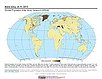
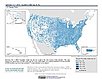
Environmental Performance Index, 2018 Release (
|
||
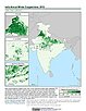
India Village-Level Geospatial Socio-Economic Data Set, v1 (1991, 2001)India Data Collection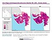
To provide data that can be used in independent spatial statistical analyses, construction of development-related indices, or in combination with remote sensing data in order to identify spatio-temporal patterns and/or changes in different demographic categories, such as male, female, urban, rural, level of education, etc. |
||
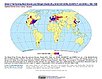
Natural Resource Protection and Child Health Indicators, 2017 Release (
|
||
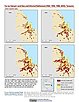
India Annual Winter Cropped Area, v1 (
|
Global Human Built-up And Settlement Extent (HBASE) Dataset From Landsat, v1 (2010)Global High Resolution Urban Data from Landsat
To provide high spatial resolution estimates of global urban extent derived from global 30m Landsat satellite data for the target year 2010 and a companion dataset to the Global Man-made Impervious Surface (GMIS) dataset. |
|
Global Man-made Impervious Surface (GMIS) Dataset From Landsat, v1 (2010)Global High Resolution Urban Data from Landsat
To provide high spatial resolution estimates of global man-made imperviousness for the target year 2010, derived from global 30m Landsat satellite data and a companion dataset to the Global Human Built-up And Settlement Extent (HBASE) dataset. |
Global Urban Heat Island (UHI) Data Set, v1 (2013)Satellite-Derived Environmental Indicators
To provide a global data set of average summer daytime maximum/nighttime minimum land surface temperatures (LSTs) for urban extents, as well as the LST difference between the urban area and the buffer. |
|
Global Summer Land Surface Temperature (LST) Grids, v1 (2013)Satellite-Derived Environmental Indicators
To provide raster representations of global summer daytime maximum and nighttime minimum surface temperature for studies related to human health and climate change. |
||
Global Gridded Geographically Based Economic Data (G-Econ), v4 (1990, 1995, 2000, 2005)Spatial Economic Data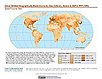
To provide global gridded Gross Domestic Product (GDP) data in both Market Exchange Rate (MER) and Purchasing Power Parity (PPP) to be used for socioeconomic, environmental, climate, and other related research. |
||
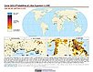
Environmental Performance Index, 2016 Release (
|
||
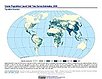
Global Amphibian Richness Grids, 2015 Release (2013)Gridded Species Distribution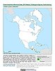
To provide information on the number of amphibian species present at a one-kilometer spatial resolution which can be used in modeling efforts, wildlife conservation planning, natural resource management, policy-making, biodiversity studies and human-environment interactions. |
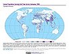
Global Mammal Richness Grids, 2015 Release (2013)Gridded Species Distribution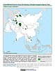
To provide information on the number of mammal species present at a one-kilometer spatial resolution which can be used in modeling efforts, wildlife conservation planning, natural resource management, policy-making, biodiversity studies and human-environment interactions. |
| 3 of 8 |