Data Sets » Format: tabularRemove Facet » Theme: HazardsRemove Facet
1 of 1
Prev | Next

Sub-global Scenarios that Extend the Global SSP Narratives: Literature Database, v1 (2014 – 2021)

Shared Socioeconomic Pathways (SSPs)

To provide a literature database tracking the use of the sub-global scenarios consisting of Shared Socioeconomic Pathways (SSPs) and Representative Concentration Pathways (RCPs) that extend the global SSP narratives and framework for climate, socioeconomic, environmental, and other related research.

INFORM Global Risk Index 2019 Mid Year, v0.3.7, (2019)

Intergovernmental Panel on Climate Change

To assess country-level vulnerability and coping capacity related to climate change based on the data set used in Chapter 8 of the Sixth Assessment Report (AR6) by the Intergovernmental Panel on Climate Change (IPCC) Working Group II (WGII).

Global High Resolution Daily Extreme Urban Heat Exposure (UHE-Daily), v1 (1983 – 2016)

Satellite-Derived Environmental Indicators

To provide a high-resolution, longitudinal global data set of extreme urban heat events and urban heat exposure.

SSPs Literature Database, v1 (2014 – 2019)

Shared Socioeconomic Pathways (SSPs)

To provide a literature database tracking the use of a global scenarios framework consisting of Shared Socioeconomic Pathways (SSPs), Representative Concentration Pathways (RCPs), and Shared Policy Assumptions (SPAs), for climate, socioeconomic, environmental, and other related research.

Global Fire Emissions Indicators, Country-Level Tabular Data, v1 (1997 – 2015)

Satellite-Derived Environmental Indicators

To provide data that can be used to calculate trace gas and aerosol emissions due to fires; monitor and assess national efforts to manage emissions.

Global Urban Heat Island (UHI) Data Set, v1 (2013)

Satellite-Derived Environmental Indicators

To provide a global data set of average summer daytime maximum/nighttime minimum land surface temperatures (LSTs) for urban extents, as well as the LST difference between the urban area and the buffer.

Population Exposure Estimates in Proximity to Nuclear Power Plants, Locations, v1 (1956 – 2012)

Energy Infrastructure

To provide a global data set of point locations and attributes describing nuclear power plants and reactors.

Population Exposure Estimates in Proximity to Nuclear Power Plants, Country-Level Aggregates, v1 (1990, 2000, 2010)

Energy Infrastructure

To provide estimates of total, urban and rural populations and land areas in proximity to nuclear power plants.

U.S. EPA National Priorities List Sites with CIESIN Modifications, v2 (2014)

Superfund Site Footprints

To provide an easily accessible, corrected EPA data set of the geo-referenced locations displayed as points for all the National Priorities List (NPL) Superfund sites in the United States, Puerto Rico, and other territories.

Complete Collection, v1.01 (1973 – 2005)

Compendium of Environmental Sustainability Indicators

To make the acquisition, comparison and analysis of sustainability indicators easier by compiling them in a single database, incorporating multiple country codes, and condensing the indicator descriptions into short methodological summaries in an accompanying data dictionary.

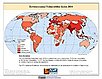
Environmental Vulnerability Index (EVI), 2004 Release (1973 – 2003)

Compendium of Environmental Sustainability Indicators

To provide insights into the processes that can negatively influence the sustainable development of countries, with particular reference to vulnerability to natural hazards.

Data Sets » Format: tabularRemove Facet » Theme: HazardsRemove Facet
1 of 1
Prev | Next