Data Sets » Theme: PovertyRemove Facet » Format: vectorRemove Facet
1 of 1
Prev | Next

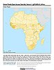
Food Insecurity Hotspots Data Set, v1 (2009 – 2019)

Food Security

To provide gridded data that identify the level of intensity and frequency of food insecurity over the 10 years between 2009 and 2019, as well as hotspot areas that have experienced consecutive food insecurity events, based on FEWS NET Food Security Data.

Dar es Salaam Land Use and Informal Settlement Data Set, v1 (1982, 1992, 1998, 2002)

Urban Spatial Data

To provide urban land use and informal settlements for the years 1982, 1992, 1998, and 2002 in Dar es Salaam, Tanzania.

Global Roads Open Access Data Set (gROADS), v1 (1980 – 2010)

Global Roads

To provide an open access, well documented global data set of roads between settlements using a consistent data model (UNSDI-T v.2) which is, to the extent possible, topologically integrated.

Dams, v1.01 (2011)

Global Reservoir and Dam (GRanD), v1

To provide a geographically explicit and reliable database of dams for the scientific community.

Reservoirs, v1.01 (2011)

Global Reservoir and Dam (GRanD), v1

To provide a geographically explicit and reliable database of reservoirs for the scientific community.

Unsatisfied Basic Needs, v1 (1998 – 2001)

Poverty Mapping

To provide high spatial resolution subnational estimates of unsatisfied basic needs for use by a wide community for interdisciplinary studies of poverty, inequality and the environment.

Small Area Estimates of Poverty and Inequality, v1 (1990 – 2002)

Poverty Mapping

To provide high spatial resolution subnational estimates of poverty and inequality for use by a wide user community for interdisciplinary studies of poverty, inequality and the environment.

Global Subnational Prevalence of Child Malnutrition, v1 (1990 – 2002)

Poverty Mapping

To provide a global subnational map of the prevalence of underweight children that can be used by a wide user community in interdisciplinary studies of health, poverty and the environment.

Poverty and Food Security Case Studies, v1 (1998 – 2002)

Poverty Mapping

To provide high spatial resolution subnational estimates of poverty and food security for use by a wide community for interdisciplinary studies of poverty, food security and the environment.

Global Subnational Infant Mortality Rates, v1 (2000)

Poverty Mapping

To provide a global subnational map of infant mortality rate estimates that can be used by a wide user community in interdisciplinary studies of health, poverty and the environment.

Data Sets » Theme: PovertyRemove Facet » Format: vectorRemove Facet
1 of 1
Prev | Next