Environmental Sustainability Indicators and Trends
Data Sets (2 of 147) View All
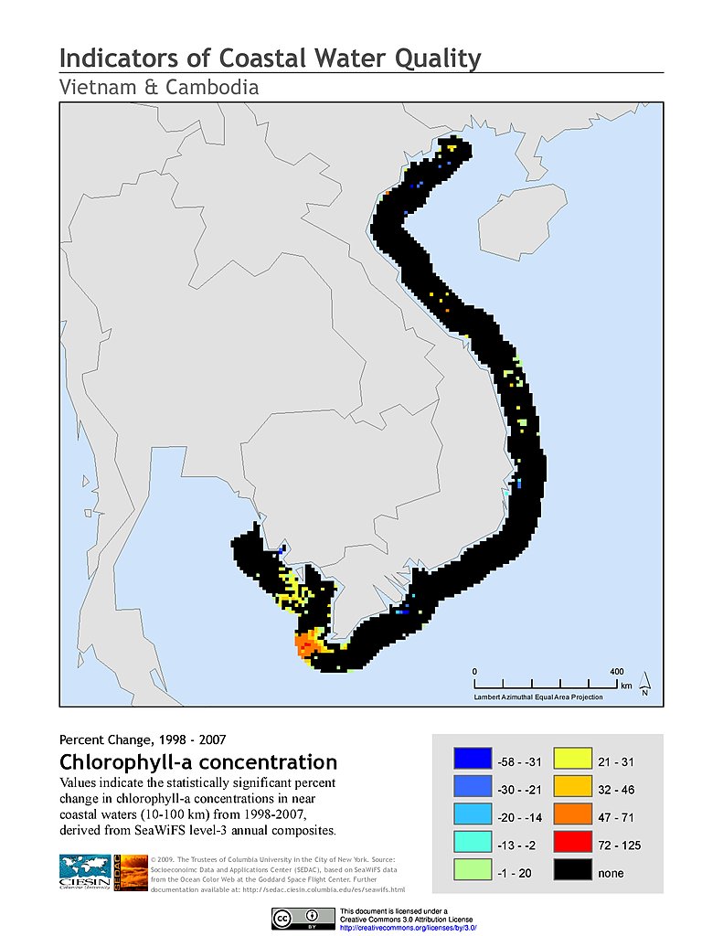
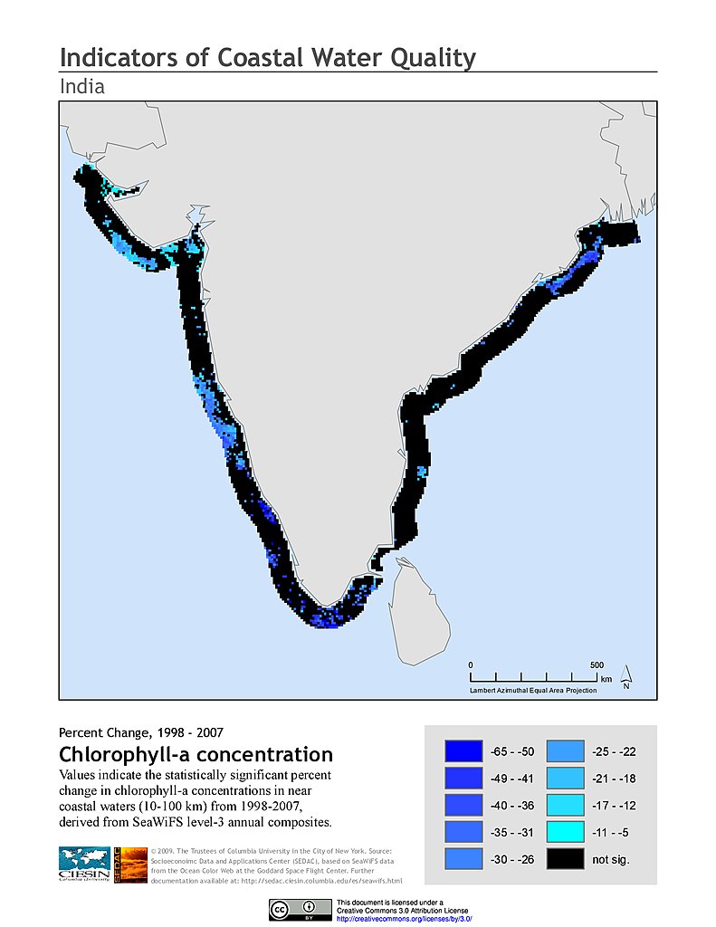
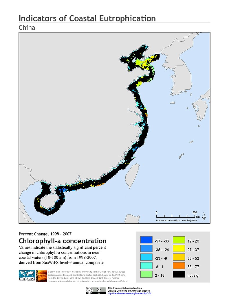
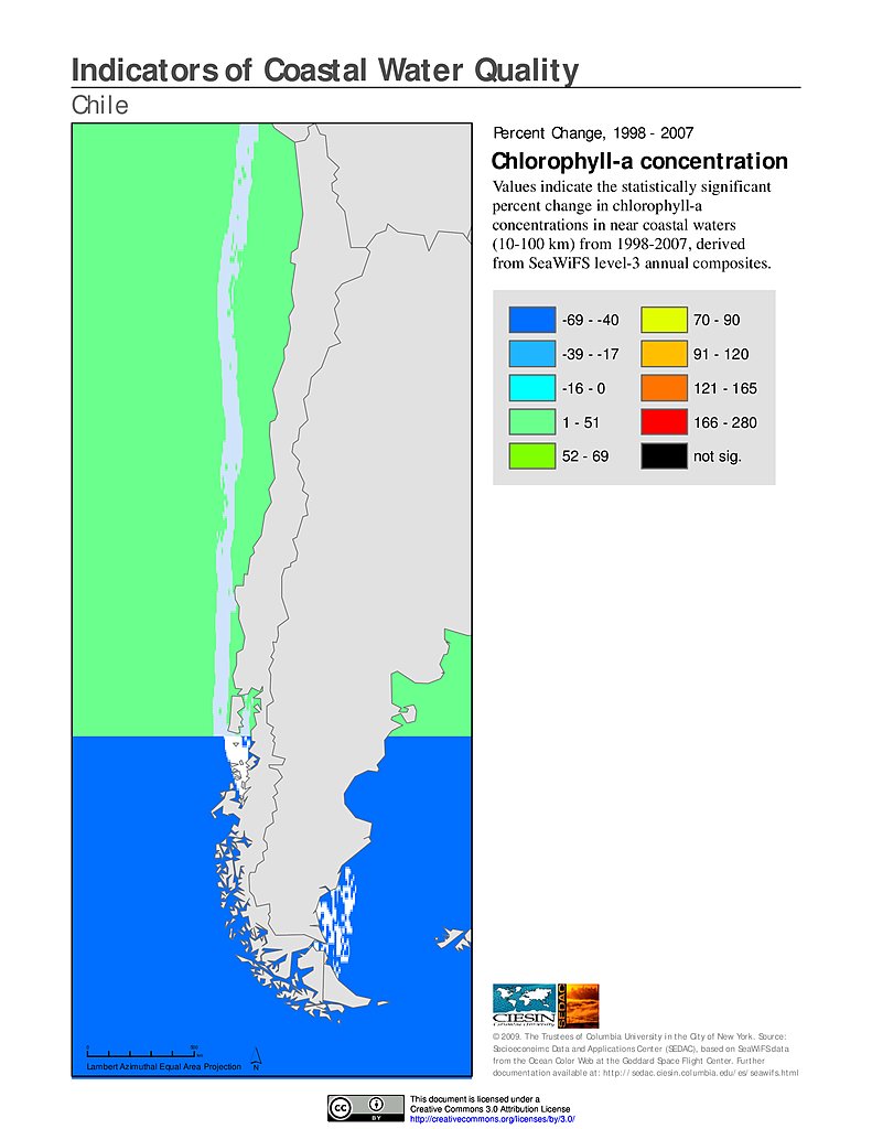
Annual Chlorophyll-a Concentration, v1 (
|
Anthropogenic Biomes of the World, v2 (1700)Anthropogenic BiomesTo provide information on anthropogenic transformation of the biosphere circa 1700 for global land use studies and research on human-environment interactions. |
Map Gallery (4 of 1403) View All
Featured Data Uses (2 of 9) View All
Scorecard on the EnvironmentNASA Earth Data Web Site Sensing Our Planet: NASA Earth Science Research Features 2008 features an article on how SEDAC data was used for the 2008 Environmental Performance Index and other environmental assessments; CIESIN’s Marc Levy is interviewed. |
Relationships Between Population Density and Burned Areas Around the GlobePLoS ONE A complex spatial relationship between population density and fire exists across the globe. This study looked at this relationship by comparing population density data from SEDAC’s Gridded Population of the World to burned area maps based largely on NASA MODIS satellite observations. In general it finds that in regions where climate or vegetation create conditions where fire is likely, people tend to suppress the fire, whereas in less fire-prone regions people tend to let the fire spread. In most regions of the world, increased population density initially leads to an increase in burned area but that relationship reverses at higher levels of population density. |