Data Sets (296)
|
1 of 15
Prev
|
Next
|
Daily 8-Hour Maximum and Annual O3 Concentrations for the Contiguous United States, 1-km Grids, v1.10 (
|
Daily and Annual PM2.5 Concentrations for the Contiguous United States, 1-km Grids, v1.10 (
|
|
Daily and Annual NO2 Concentrations for the Contiguous United States, 1-km Grids, v1.10 (
|
Delta Urban-Rural Population and Land Area Estimates, v1 (1990, 2000, 2014, 2015)Low Elevation Coastal Zone (LECZ)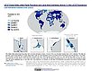
To provide country-level estimates of populations and land areas in river delta- and non-delta contexts for the years 1990, 2000, 2014, and 2015 for 246 statistical areas, focusing on greater-risk zones using the global extent of low elevation zones contiguous to the coast bounded by either 5 meters or 10 meters. |
|
U.S. Climate Risk Projections by County, v1 (
|
Annual Mean PM2.5 Components (EC, NH4, NO3, OC, SO4) 50m Urban and 1km Non-Urban Area Grids for Contiguous U.S., v1 (
|
|
Annual Mean PM2.5 Components Trace Elements (TEs) 50m Urban and 1km Non-Urban Area Grids for Contiguous U.S., v1 (
|
Groundswell Africa Spatial Population and Migration Projections at One-Eighth Degree According to SSPs and RCPs, v1 (
|
|
Annual Global High-Resolution Extreme Heat Estimates (GEHE), v1 (
|
SDG Indicator 7.1.1: Access to Electricity, 2023 Release (
|
|
SDG Indicator 11.2.1: Urban Access to Public Transport, 2023 Release (
|
SDG Indicator 9.1.1: The Rural Access Index (RAI), 2023 Release (
|
|
SDG Indicator 11.7.1: Urban Public Space, Availability and Access, 2023 Release (
|
Yale Center for Earth Observation (YCEO) Surface Urban Heat Islands, v4 (
|
|
Global Database of Light-based Geospatial Income Inequality (LGII) Measures, v1 (
|
Sub-global Scenarios that Extend the Global SSP Narratives: Literature Database, v1 (
|
|
Natural Resource Protection and Child Health Indicators, 2023 Release (
|
U.S. Social Vulnerability Index Grids, v1.01 (2000, 2010, 2014, 2016, 2018, 2020)U.S. Census Grids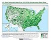
To provide a 1 km grid of the CDC Social Vulnerability Index (SVI) aligned with CIESIN's Gridded Population of the World, Version 4, Revision 11 (GPWv4.11) with a mask for water and no population. |
|
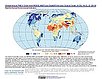
Global (GL) Annual PM2.5 Grids from MODIS, MISR and SeaWiFS Aerosol Optical Depth (AOD), v4.03 (
|
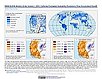
Water Security (WSIM-GLDAS) Monthly Grids, v1 (
|


|
1 of 15
Prev
|
Next
|