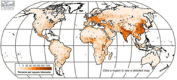
| Demographic information is often provided
on a national basis, but global environmental and other cross-disciplinary
studies usually require data that are referenced by geographic
coordinates, such as latitude and longitude, rather than by political
or administrative units. In this Gridded Population of the World
(GPW) data set, the distribution of human population is converted
from national or subnational units to a series of georeferenced
quadrilateral grids.
Developed in 1999-2000, GPW version 2, incorporates
a number improvements to the original
version of this popular dataset. |
GPW version
2 provides estimates of the population
of the world in 1990 and 1995, both population counts (raw
counts) and population densities (per square km). National
figures have been reconciled to be consistent with United
Nations population estimates for those years; unadjusted
data are also available. Both images and data are
accessible and downloadable.
Looking for LandScan?
Want to compare GPW with LandScan?
|