Socioeconomic Data and Applications Center (
sedac
)
A Data Center in NASA's Earth Observing System Data and Information System (
EOSDIS
) — Hosted by
CIESIN
at
Columbia University
Search SEDAC
Data
Data Sets
Maps
Web Pages
search
Data
· Data Sets
· Data Collections
· Featured Data Uses
· Data Citations
· Citations Database
· Data Submission
Maps
· Map Gallery
· Map Viewer
· Map Services
· Mapping Tools
Themes
· Agriculture
· Climate
· Conservation
· Governance
· Hazards
· Health
· Infrastructure
· Land Use
· Marine and Coastal
· Population
· Poverty
· Remote Sensing
· Sustainability
· Urban
· Water
Resources
· Guides
· Multimedia
· Networks
· News
· Publications
· Related Sites
· Remote Sensing
· Tools
Social Media
· Twitter
· FaceBook
· YouTube
· Flickr
· Blog Posts
· Communities
About
· About SEDAC
· User Working Group
· Privacy
· User Registration
Help
Map Gallery
(347)
Follow Us:
Twitter
Follow Us on Facebook
YouTube
Flickr
| Share:
Twitter
Facebook
Search
All Fields:
search
Theme
Agriculture
(8)
Climate
(28)
Conservation
(26)
Framework Data
(54)
Hazards
(5)
Health
(19)
Infrastructure
(5)
Land Use
(31)
Marine and Coastal
(5)
Population
(240)
Poverty
(17)
Remote Sensing
(23)
Sustainability
(199)
Urban
(172)
Water
(4)
Location
Select a Location...
albania
(11)
andorra
(5)
austria
(6)
belarus
(5)
belgium
(5)
bosnia and herzegovina
(5)
bulgaria
(11)
croatia
(5)
cyprus
(5)
czech republic
(5)
denmark
(5)
estonia
(5)
faeroe islands
(5)
finland
(5)
france
(6)
french guiana
(2)
georgia
(5)
germany
(6)
gibraltar
(5)
greece
(6)
guadeloupe
(5)
guernsey
(5)
holy see
(3)
hungary
(6)
iceland
(5)
ireland
(4)
isle of man
(5)
italy
(7)
jersey
(5)
latvia
(5)
liechtenstein
(5)
lithuania
(5)
luxembourg
(5)
malta
(5)
monaco
(5)
netherlands
(7)
norway
(5)
poland
(5)
portugal
(6)
republic of moldova
(5)
romania
(5)
russian federation
(5)
san marino
(5)
serbia
(7)
slovakia
(5)
slovenia
(5)
spain
(6)
svalbard and jan mayen islands
(5)
sweden
(5)
switzerland
(5)
the former yugoslav republic of macedonia
(5)
ukraine
(5)
united kingdom of great britain and northern ireland
(7)
go
Maps
»
Region: Europe
Remove Facet
5 of 11
Prev
|
Next
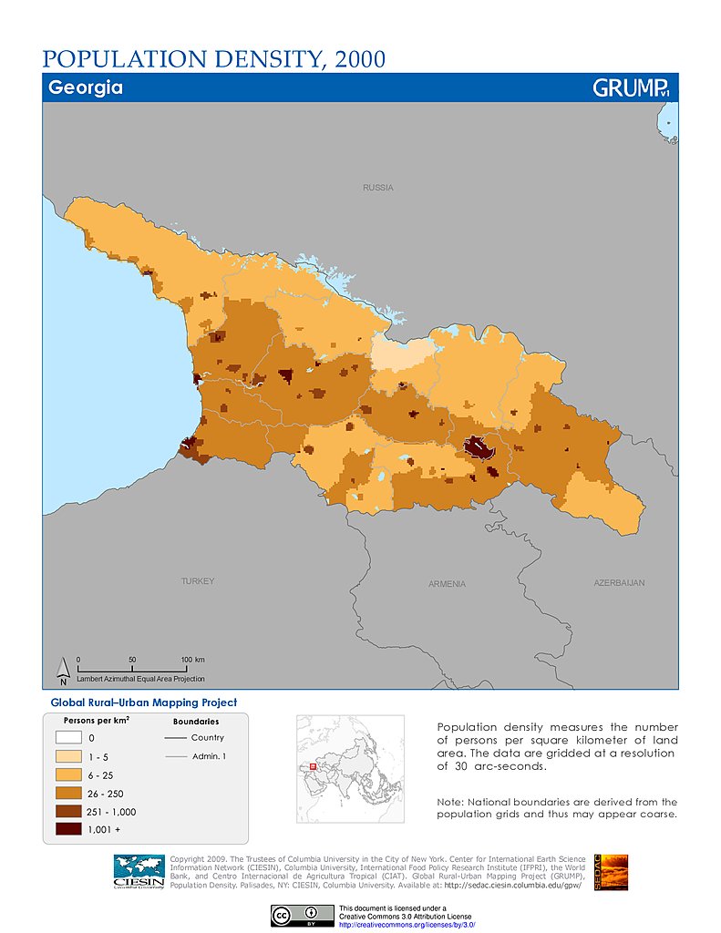
Population Density (2000): Georgia
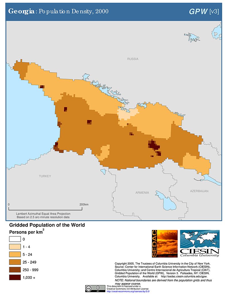
Population Density (2000): Georgia
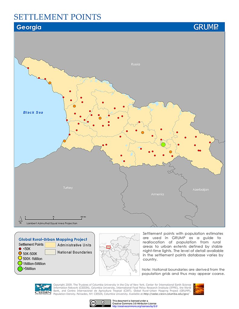
Settlement Points: Georgia
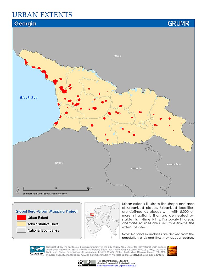
Urban Extents: Georgia
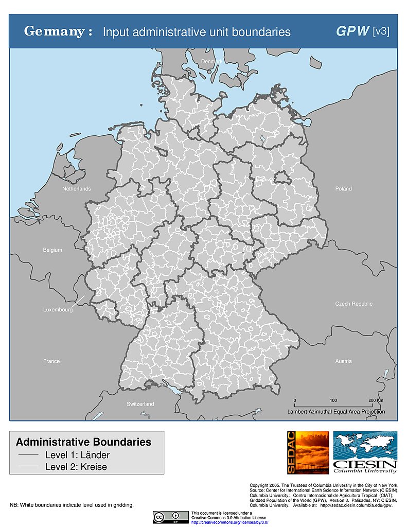
Administrative Boundaries: Germany
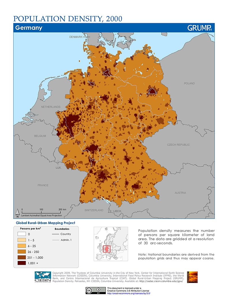
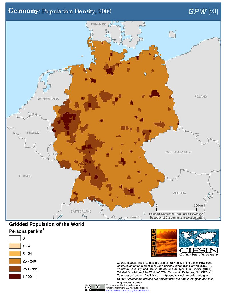
Population Density (2000): Germany
Population Density (2000): Germany
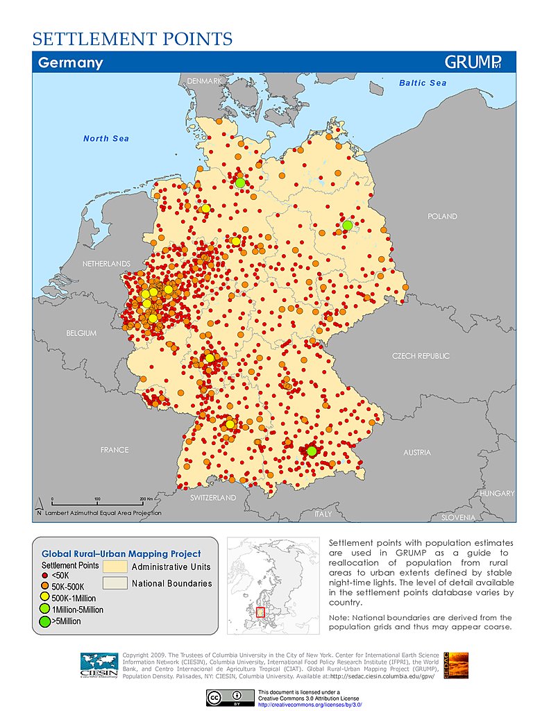
Settlement Points: Germany
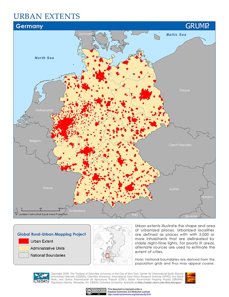
Urban Extents: Germany
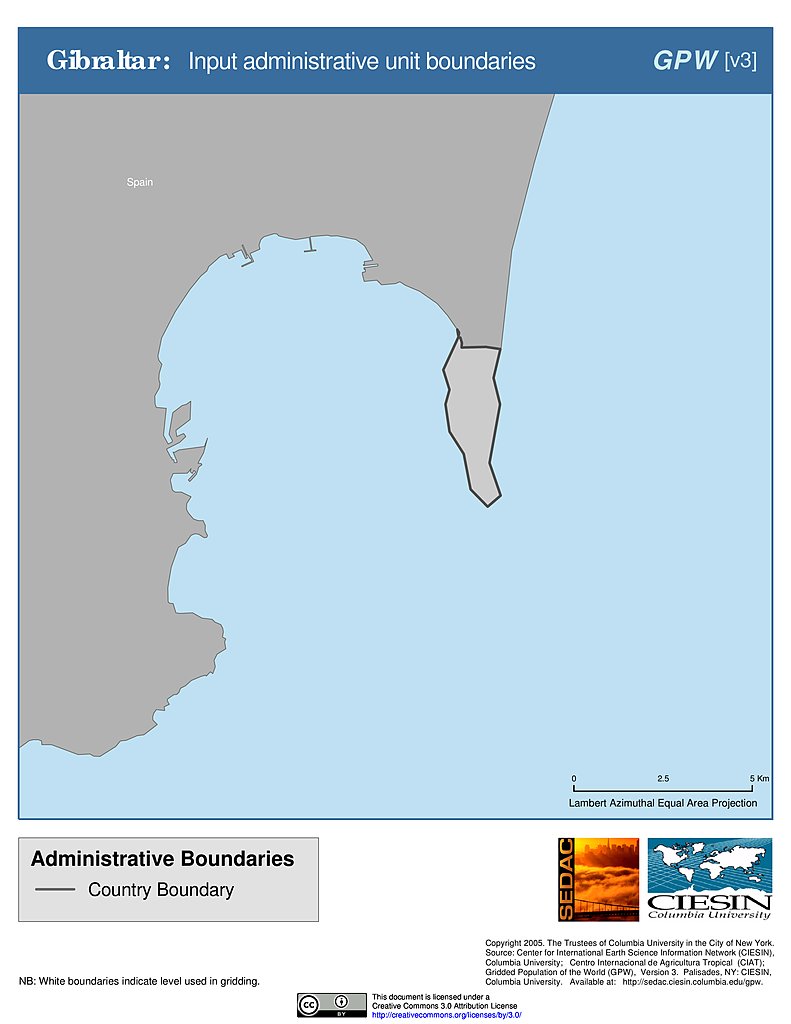
Administrative Boundaries: Gibraltar
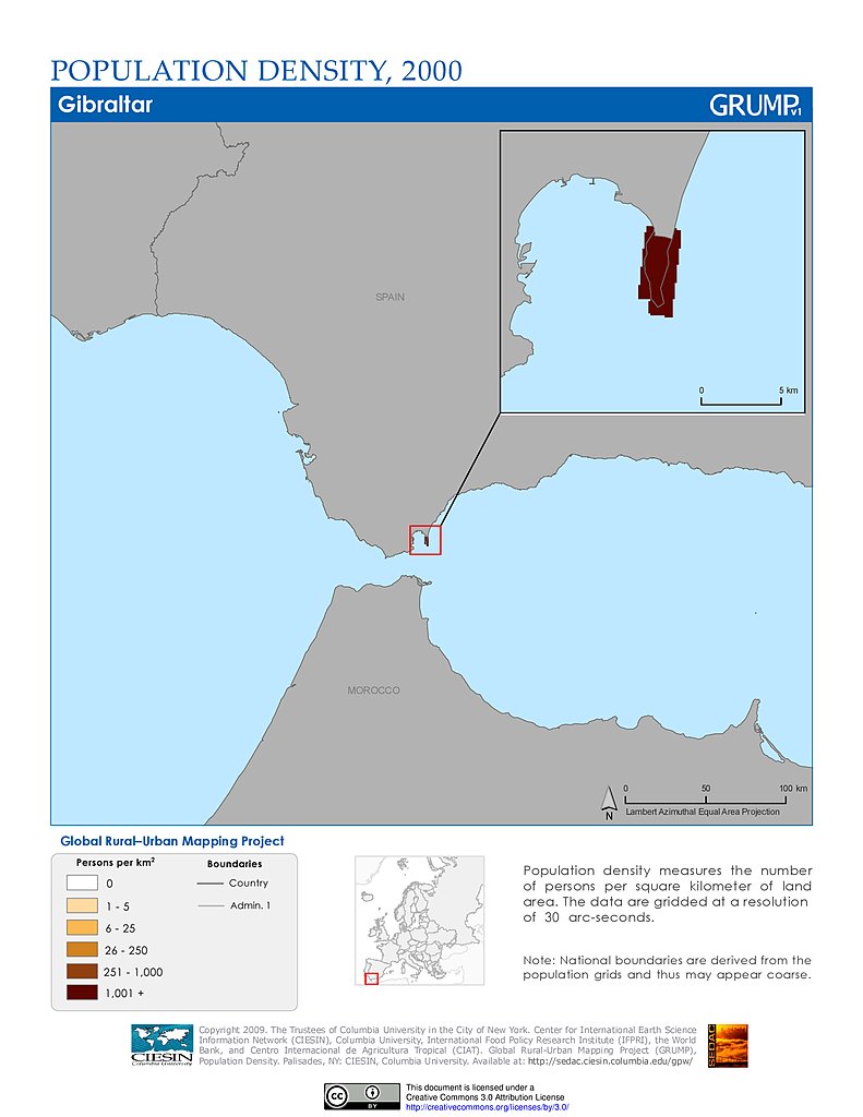
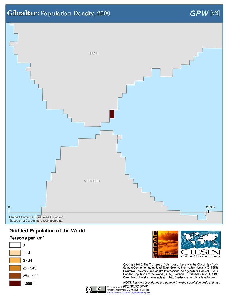
Population Density (2000): Gibraltar
Population Density (2000): Gibraltar
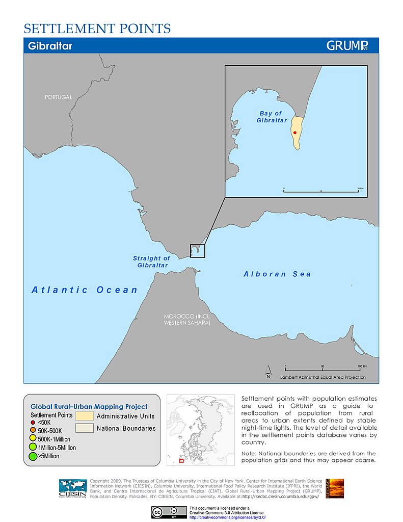
Settlement Points: Gibraltar
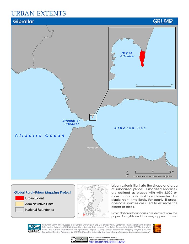
Urban Extents: Gibraltar
Amphibian Richness, 2015: Europe
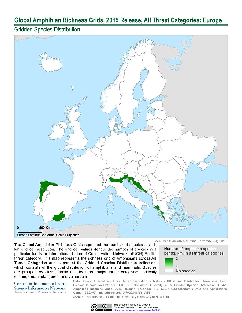
Amphibian Richness - All Threats, 2015: Europe
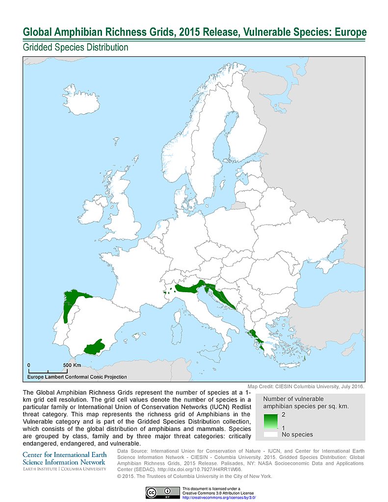
Amphibian Richness - Vulnerable, 2015: Europe
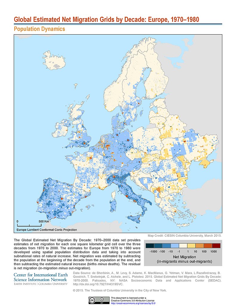
Net Migration (1970-1980): Europe
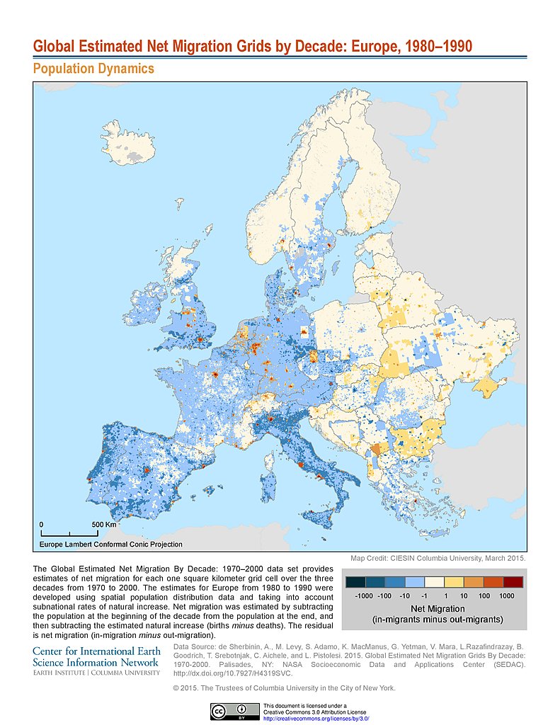
Net Migration (1980-1990): Europe
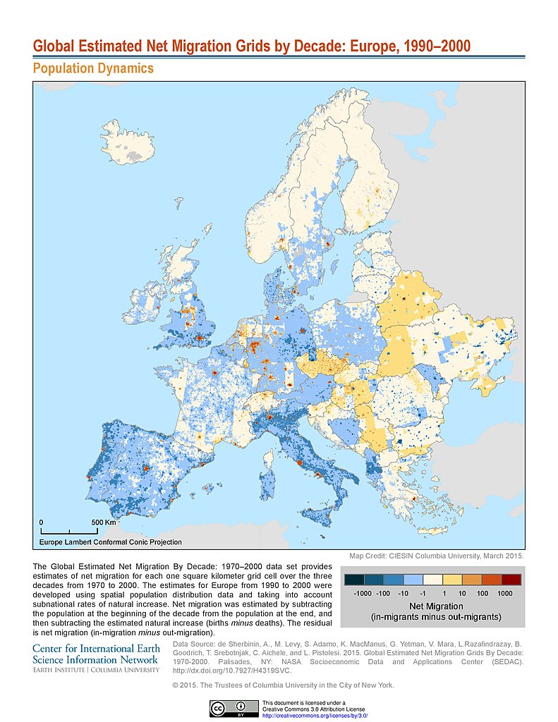
Net Migration (1990-2000): Europe
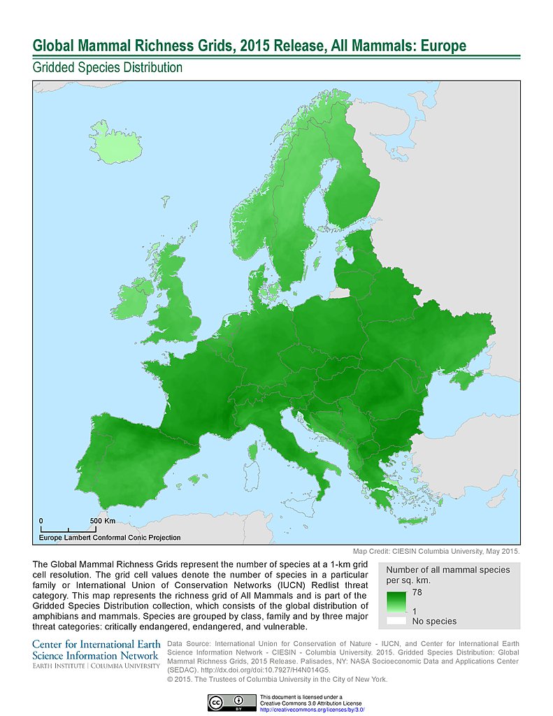
Mammal Richness, 2015: Europe
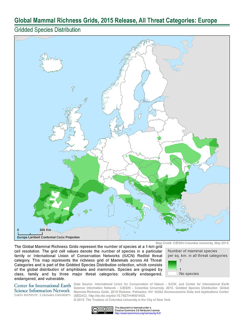
Mammal Richness - All Threats, 2015: Europe
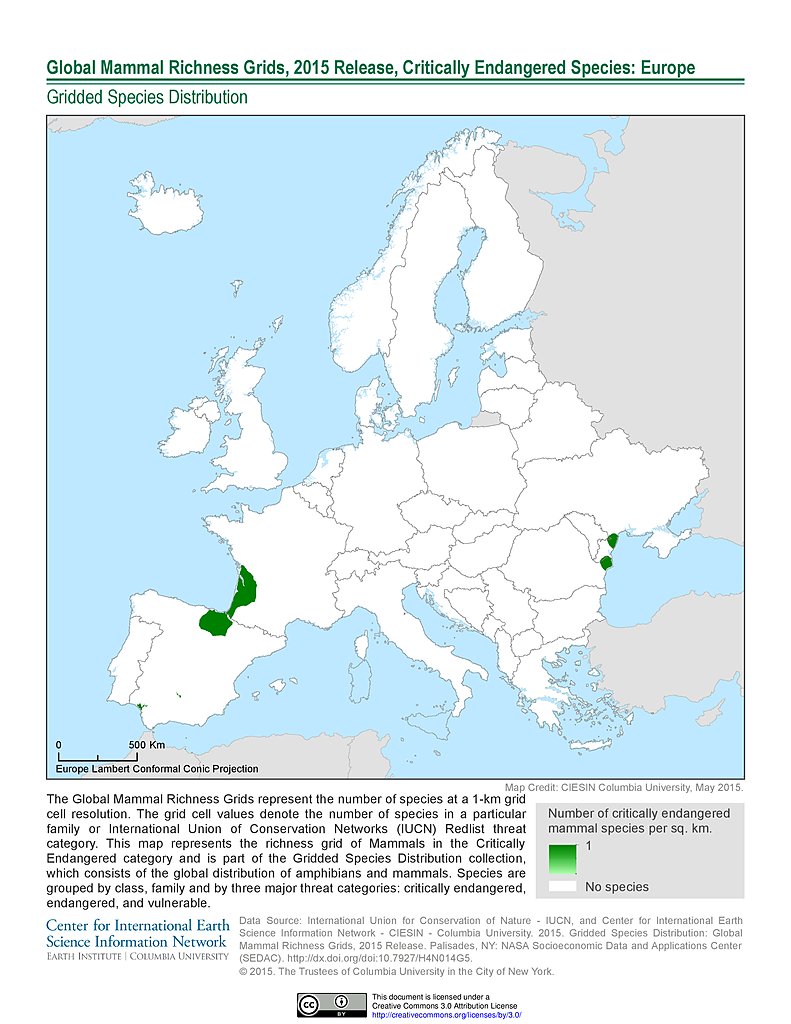
Mammal Richness - Critically Endangered, 2015: Europe
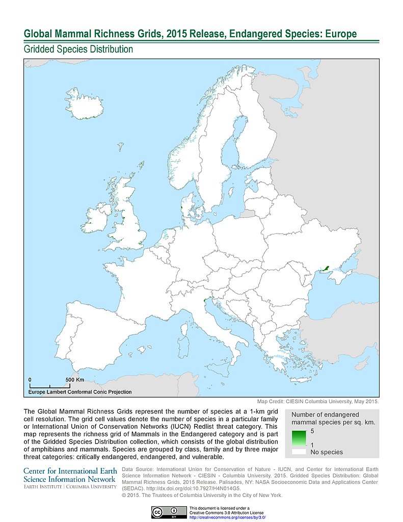
Mammal Richness - Endangered, 2015: Europe
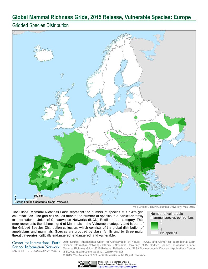
Mammal Richness - Vulnerable, 2015: Europe
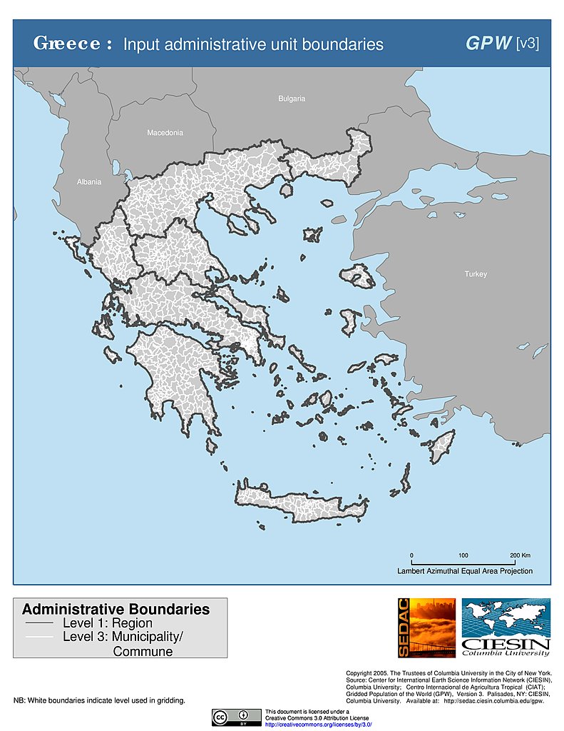
Administrative Boundaries: Greece
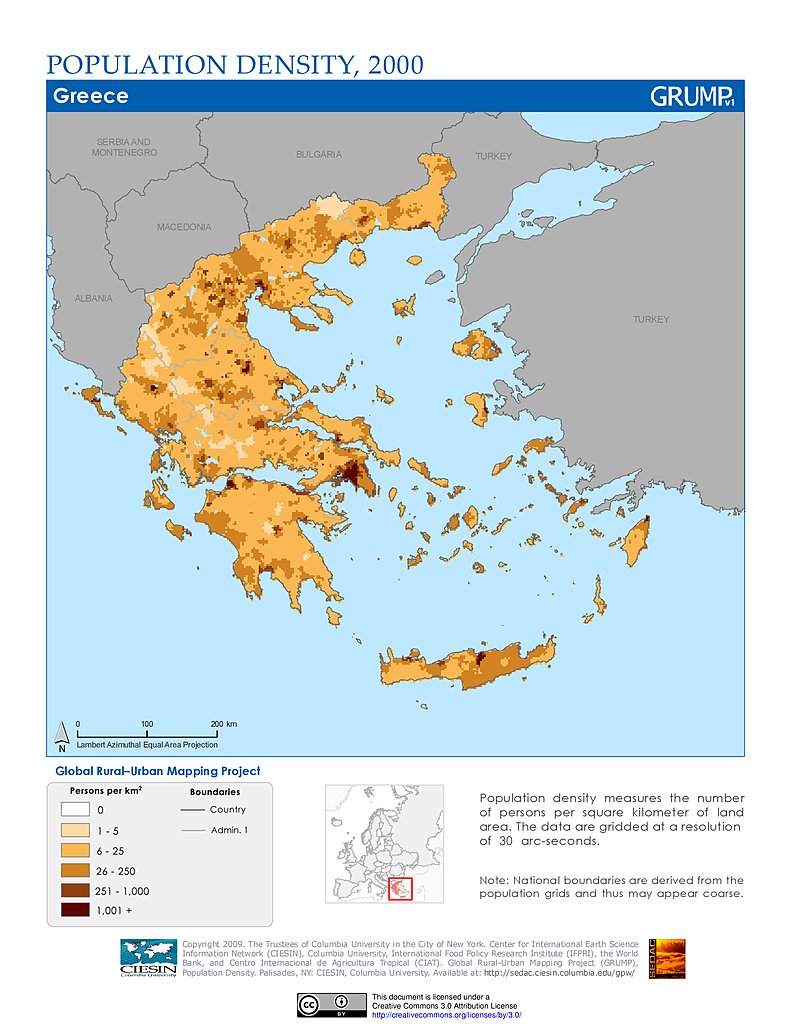
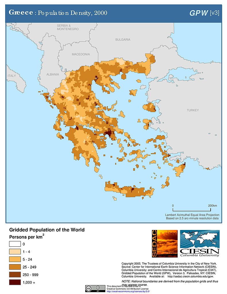
Population Density (2000): Greece
Population Density (2000): Greece
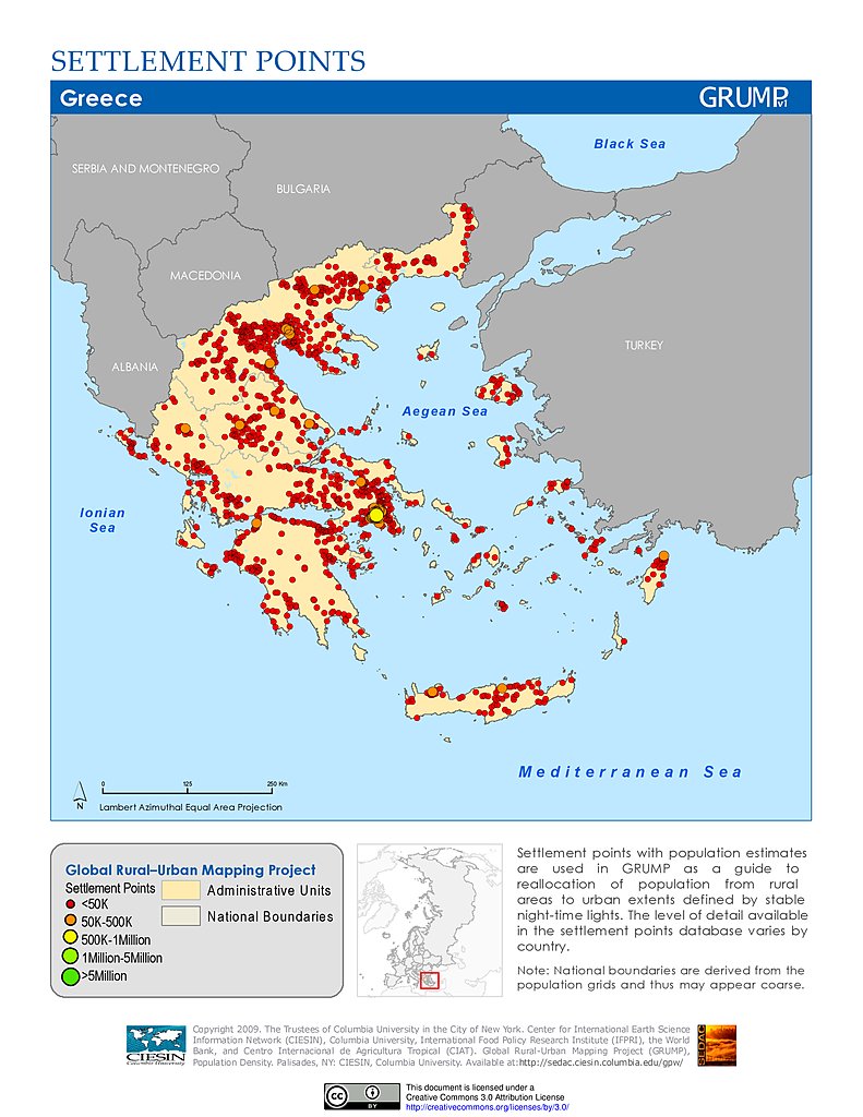
Settlement Points: Greece
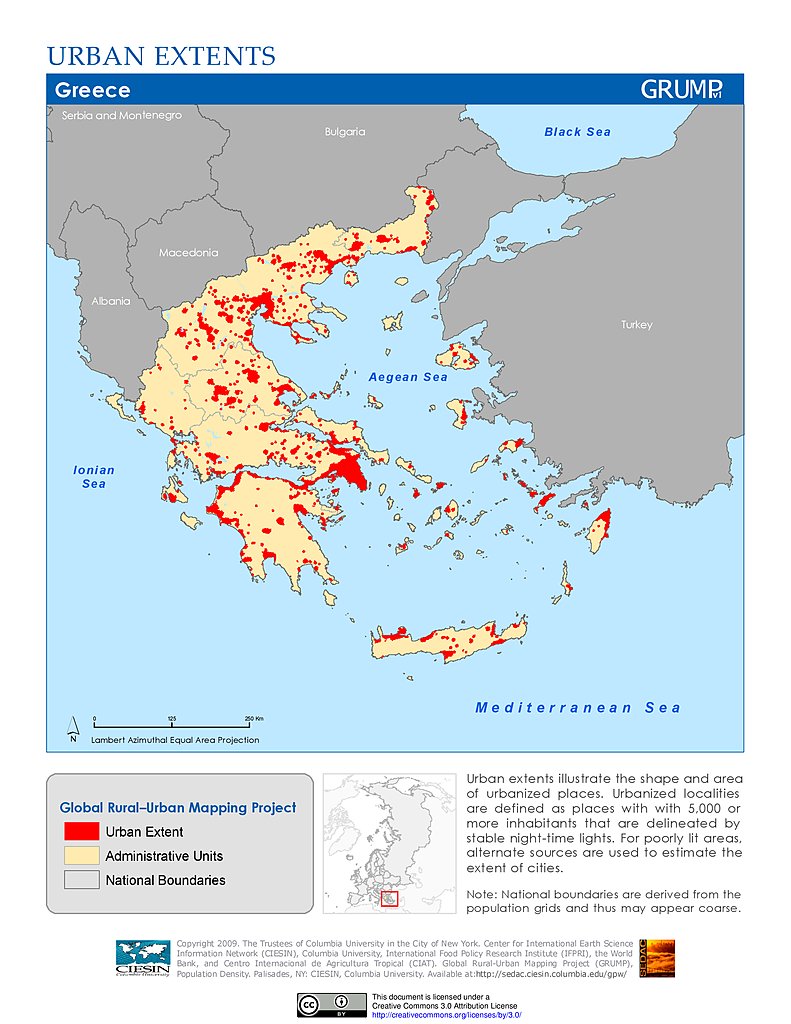
Urban Extents: Greece
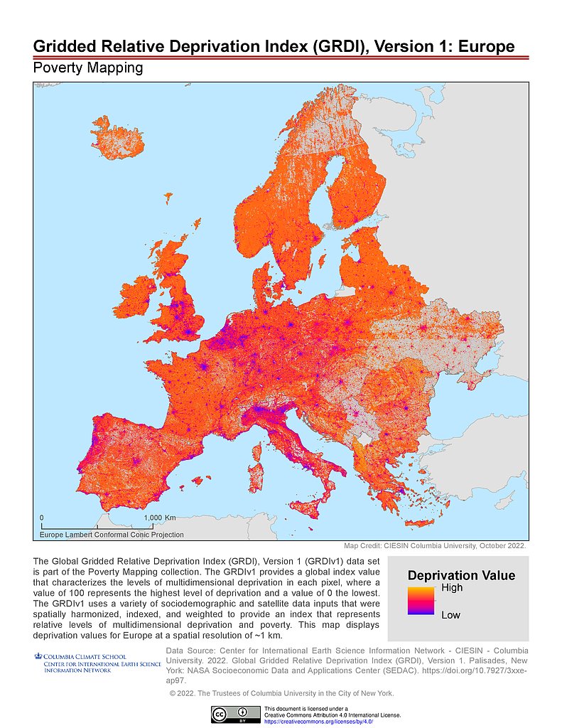
GRDIv1: Europe
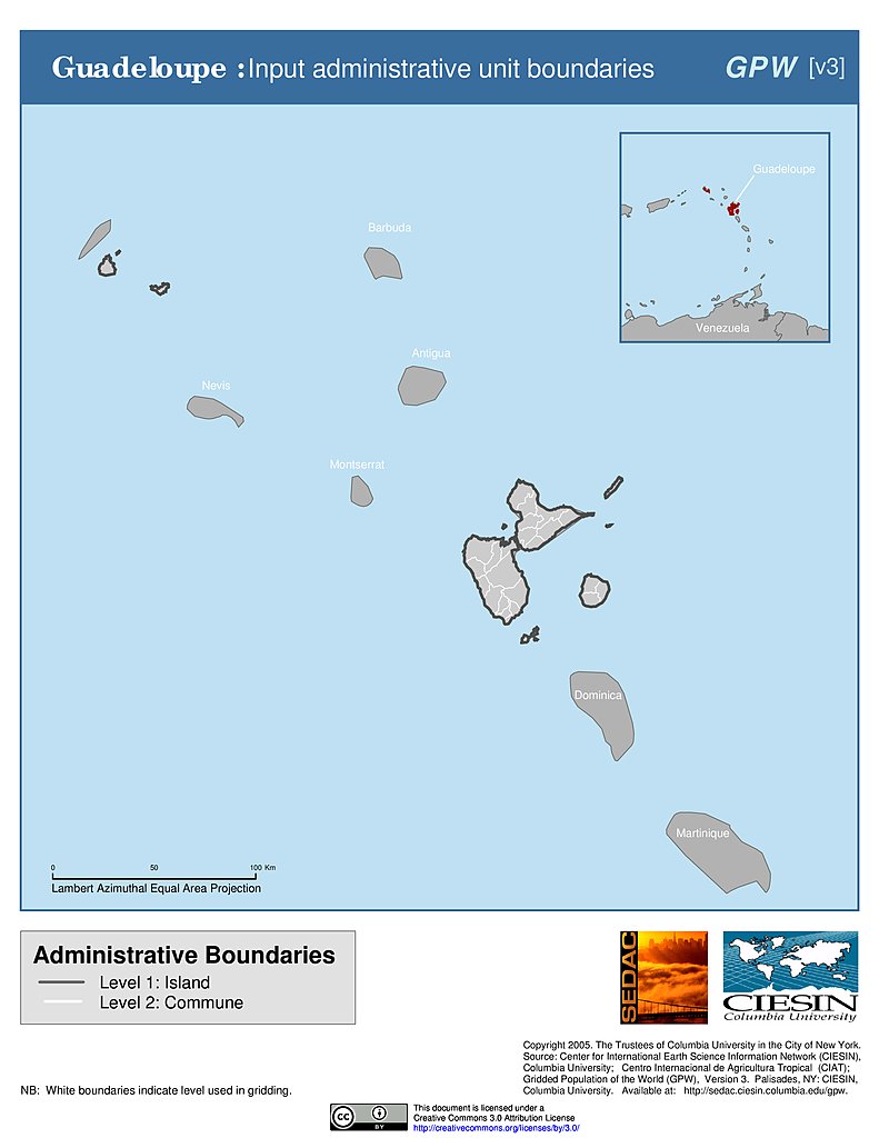
Administrative Boundaries: Guadeloupe
Maps
»
Region: Europe
Remove Facet
5 of 11
Prev
|
Next