Socioeconomic Data and Applications Center (
sedac
)
A Data Center in NASA's Earth Observing System Data and Information System (
EOSDIS
) — Hosted by
CIESIN
at
Columbia University
Search SEDAC
Data
Data Sets
Maps
Web Pages
search
Data
· Data Sets
· Data Collections
· Featured Data Uses
· Data Citations
· Citations Database
· Data Submission
Maps
· Map Gallery
· Map Viewer
· Map Services
· Mapping Tools
Themes
· Agriculture
· Climate
· Conservation
· Governance
· Hazards
· Health
· Infrastructure
· Land Use
· Marine and Coastal
· Population
· Poverty
· Remote Sensing
· Sustainability
· Urban
· Water
Resources
· Guides
· Multimedia
· Networks
· News
· Publications
· Related Sites
· Remote Sensing
· Tools
Social Media
· Twitter
· FaceBook
· YouTube
· Flickr
· Blog Posts
· Communities
About
· About SEDAC
· User Working Group
· Privacy
· User Registration
Help
Map Gallery
(410)
Follow Us:
Twitter
Follow Us on Facebook
YouTube
Flickr
| Share:
Twitter
Facebook
Search
All Fields:
search
Theme
Agriculture
(10)
Climate
(49)
Conservation
(29)
Framework Data
(37)
Hazards
(24)
Health
(67)
Infrastructure
(8)
Land Use
(51)
Marine and Coastal
(22)
Population
(252)
Poverty
(62)
Remote Sensing
(41)
Sustainability
(179)
Urban
(159)
Water
(10)
Location
Select a Location...
anguilla
(5)
antigua and barbuda
(5)
aruba
(5)
bahamas
(5)
barbados
(5)
belize
(6)
bermuda
(5)
british virgin islands
(5)
canada
(9)
cape verde
(5)
cayman islands
(5)
costa rica
(6)
cuba
(5)
dominica
(5)
dominican republic
(6)
el salvador
(6)
greenland
(5)
grenada
(5)
guatemala
(24)
haiti
(6)
honduras
(16)
jamaica
(5)
martinique
(5)
mexico
(9)
montserrat
(5)
netherlands antilles
(5)
nicaragua
(9)
panama
(16)
puerto rico
(5)
saint kitts and nevis
(5)
saint lucia
(5)
saint pierre and miquelon
(5)
saint vincent and the grenadines
(5)
turks and caicos islands
(4)
united states of america
(111)
united states virgin islands
(5)
go
Maps
»
Region: North America
Remove Facet
5 of 13
Prev
|
Next
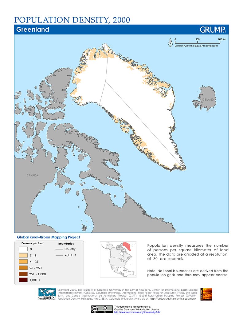
Population Density (2000): Greenland
Population Density (2000): Greenland
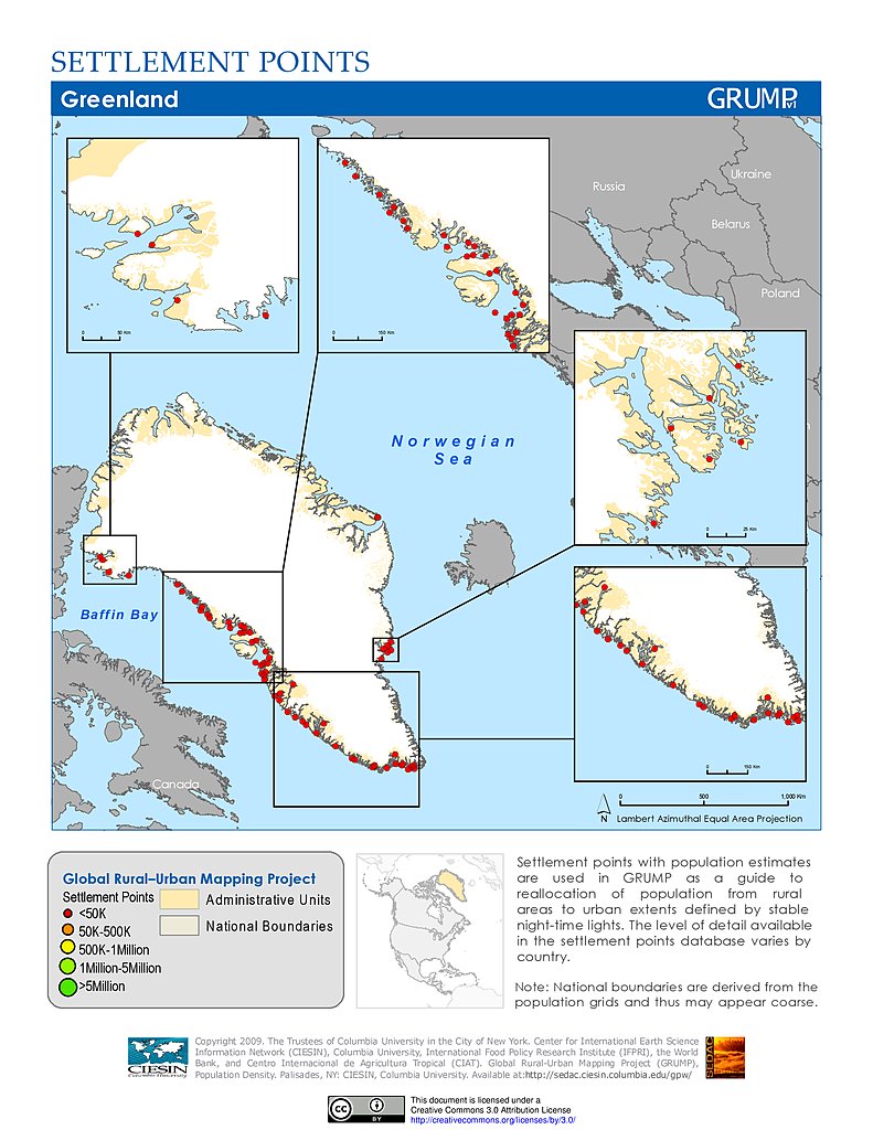
Settlement Points: Greenland
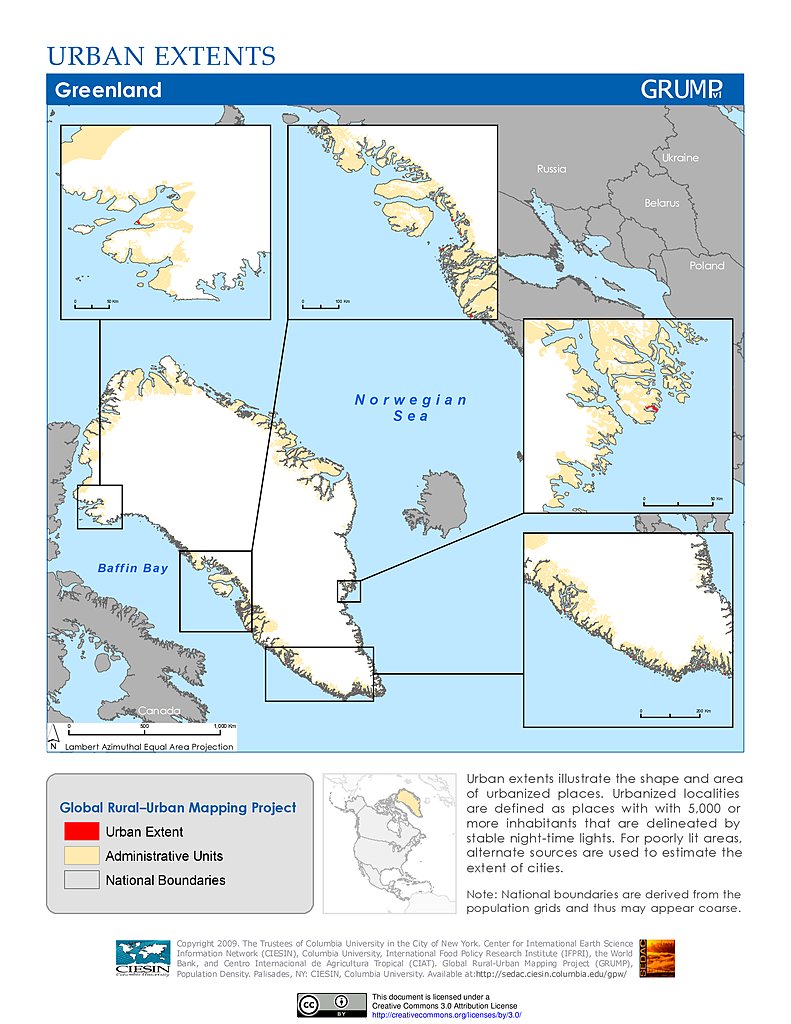
Urban Extents: Greenland
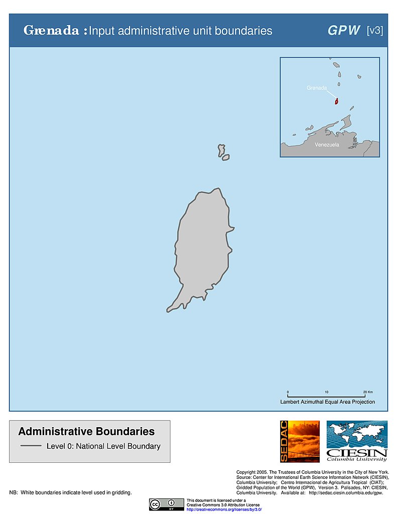
Administrative Boundaries: Grenada
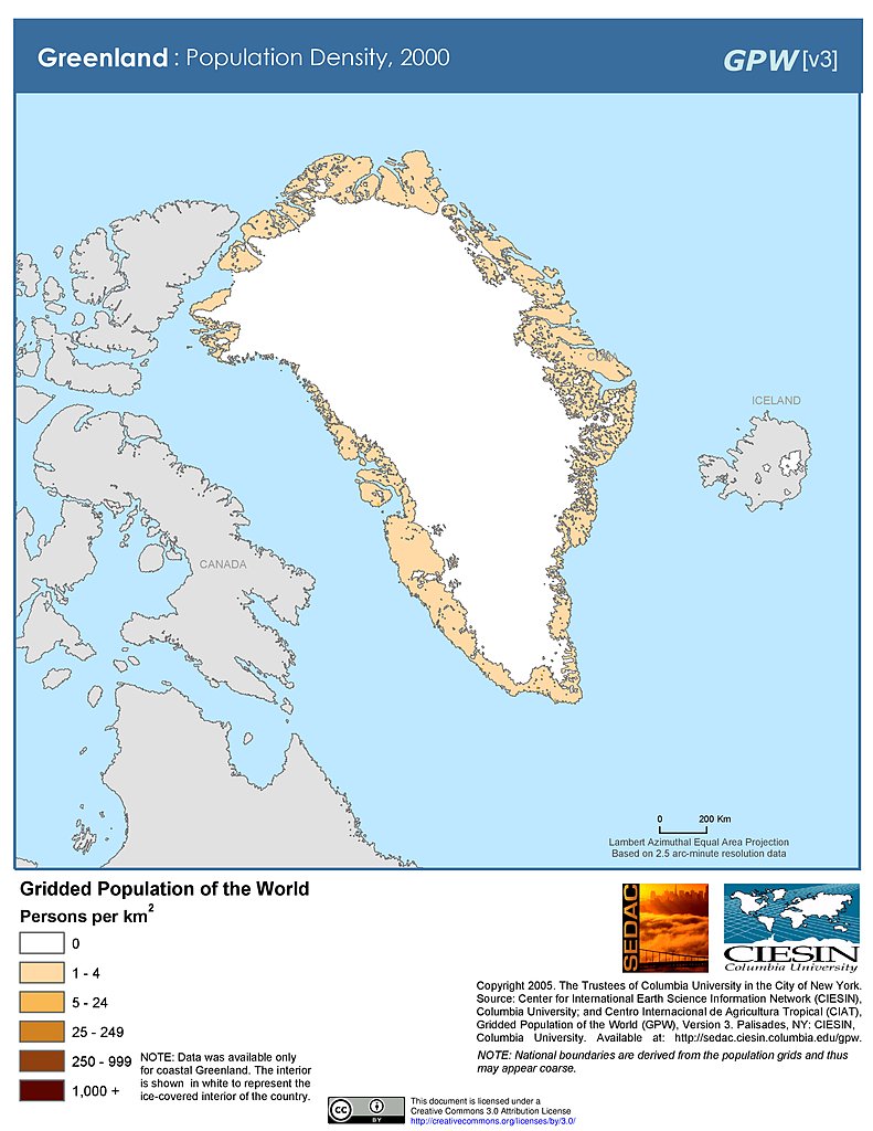
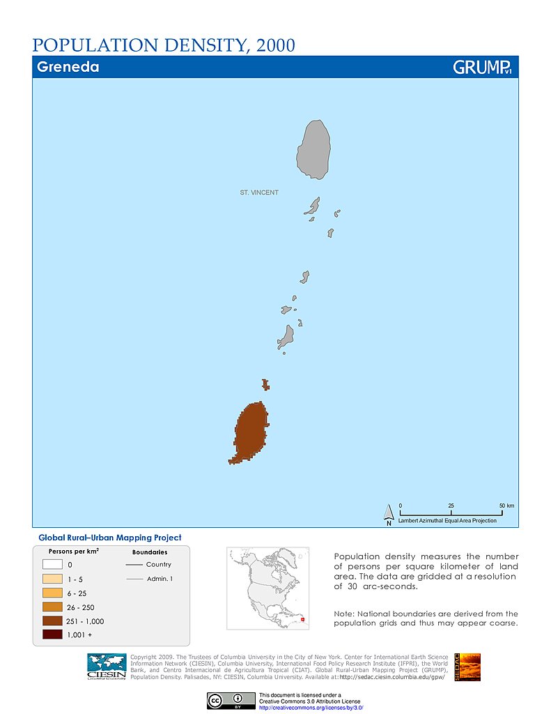
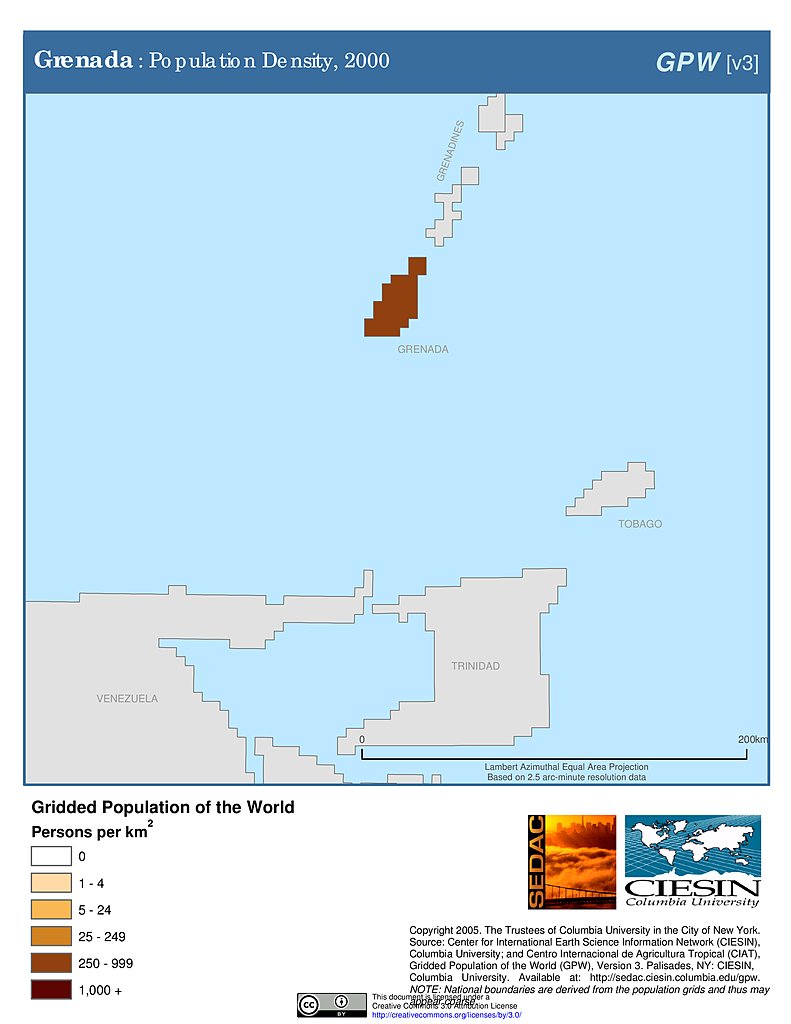
Population Density (2000): Grenada
Population Density (2000): Grenada
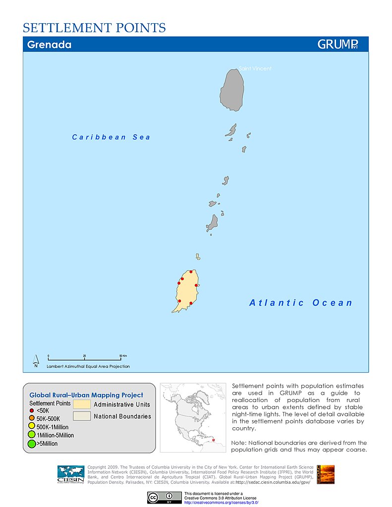
Settlement Points: Grenada
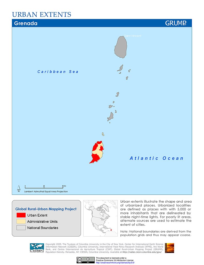
Urban Extents: Grenada
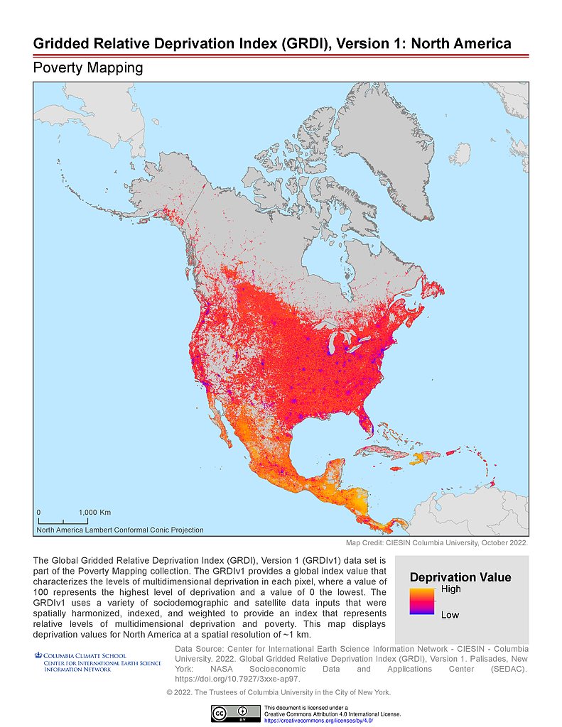
GRDIv1: North America
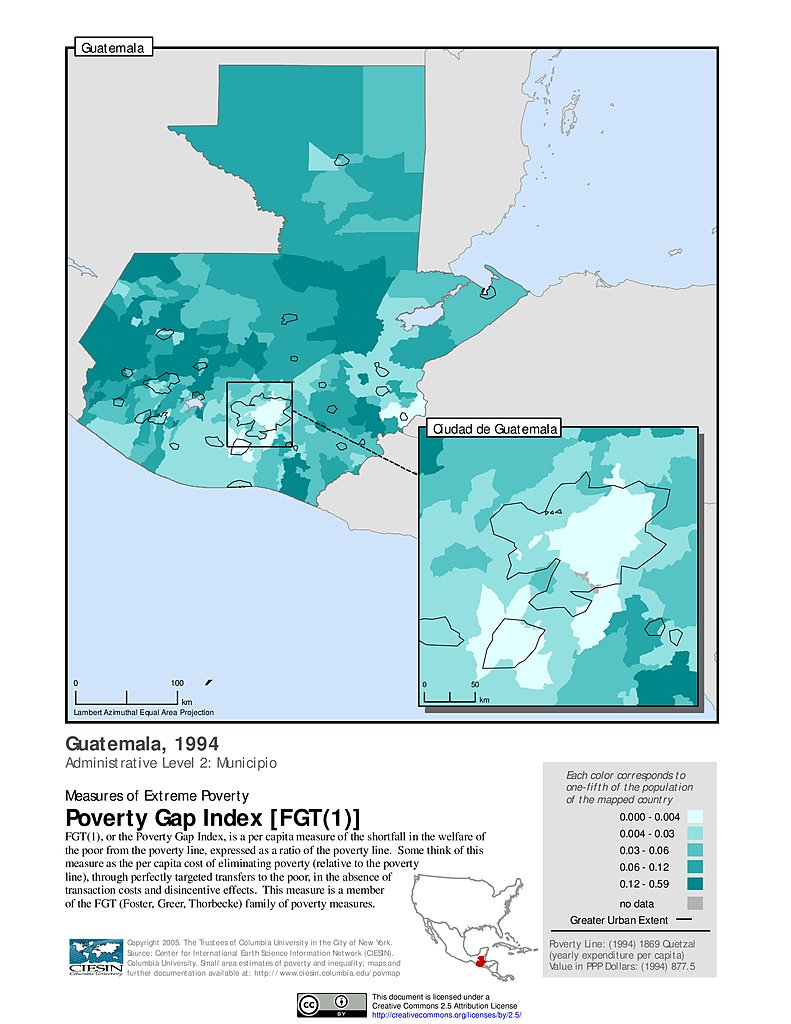
Extreme Poverty Gap Index, ADM2 (1994): Guatemala
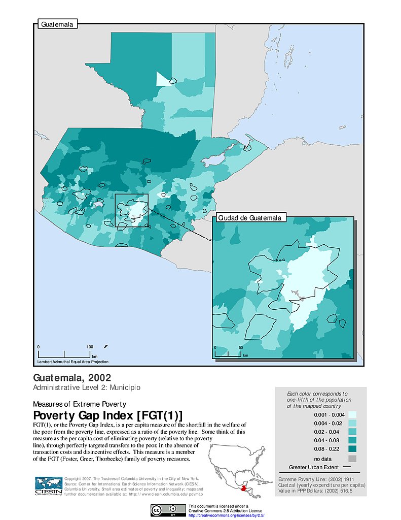
Extreme Poverty Gap Index, ADM2 (2002): Guatemala
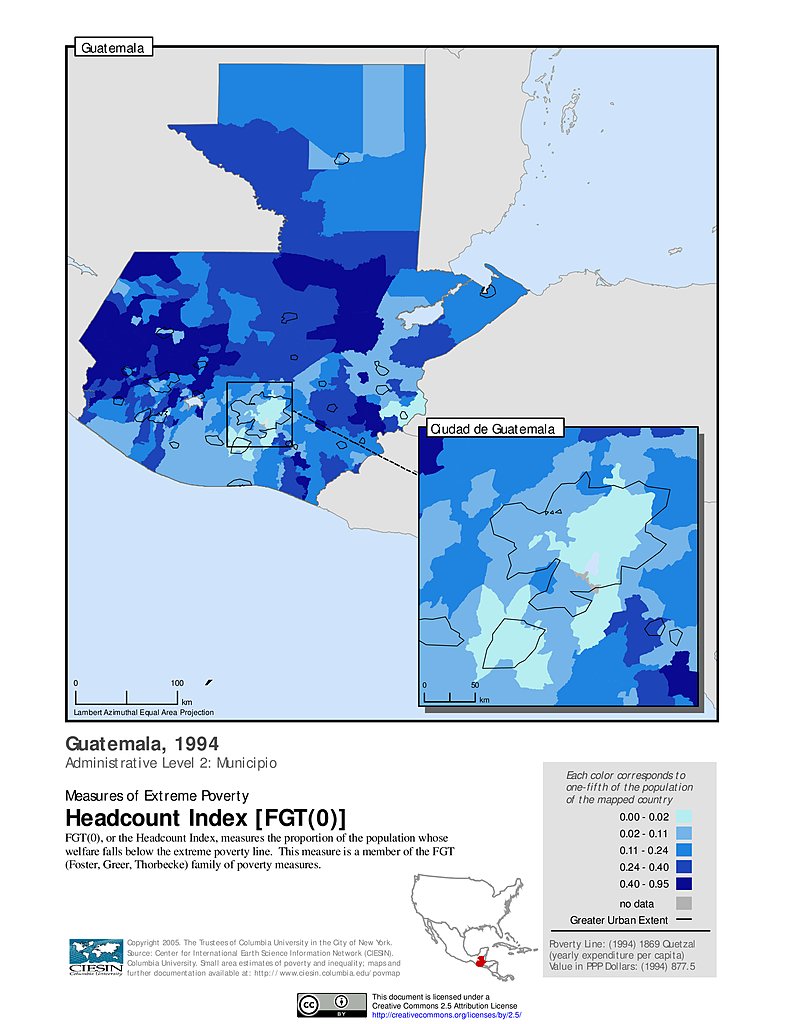
Extreme Poverty Headcount Index, ADM2 (1994): Guatemala
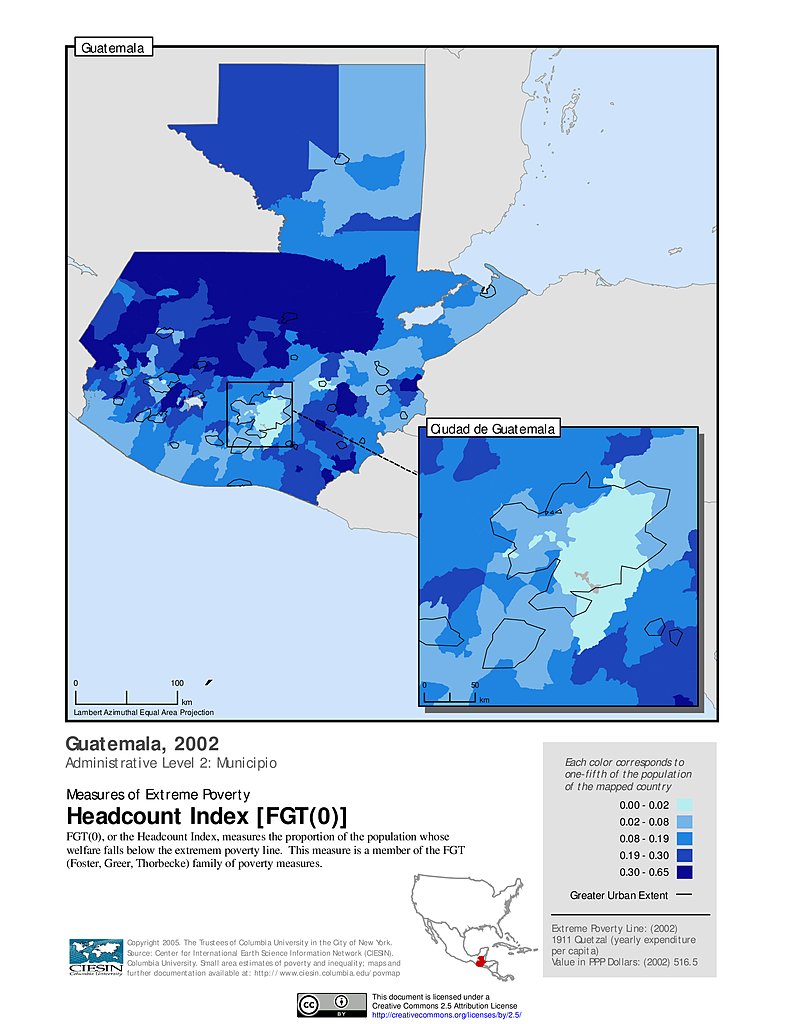
Extreme Poverty Headcount Index, ADM2 (2002): Guatemala
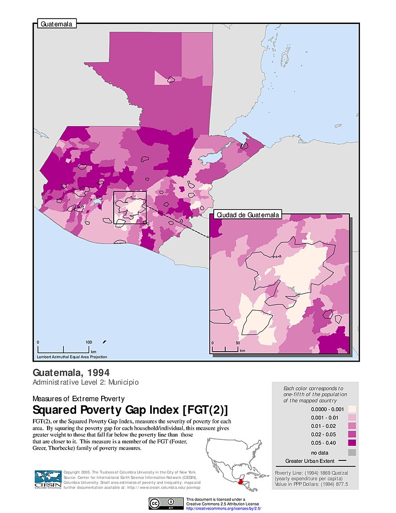
Extreme Squared Poverty Gap Index, ADM2 (1994): Guatemala
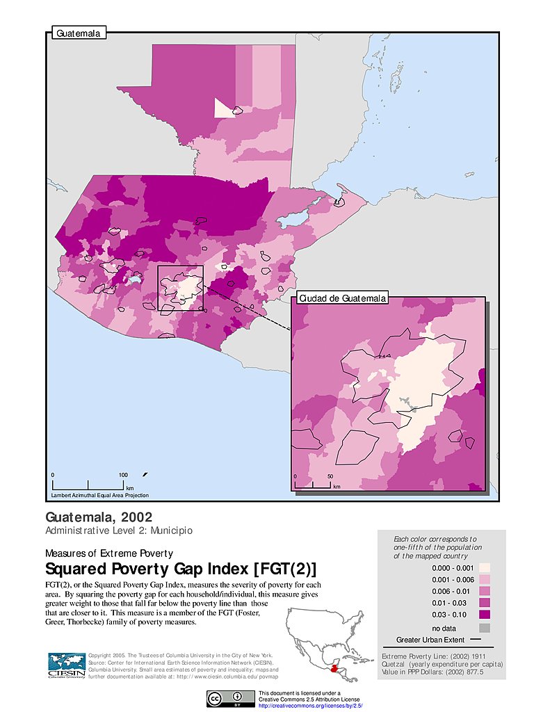
Extreme Squared Poverty Gap Index, ADM2 (2002): Guatemala
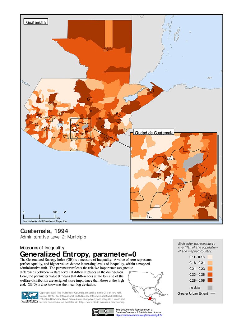
Generalized Entropy Index 0, ADM2 (1994): Guatemala
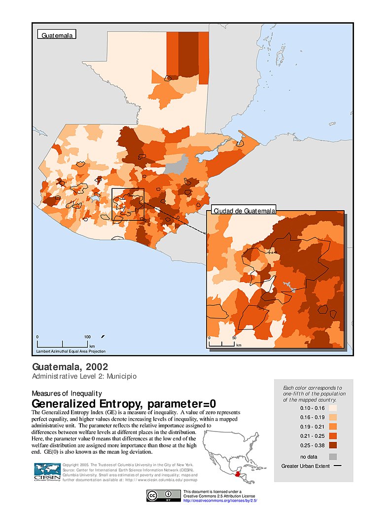
Generalized Entropy Index 0, ADM2 (2002): Guatemala
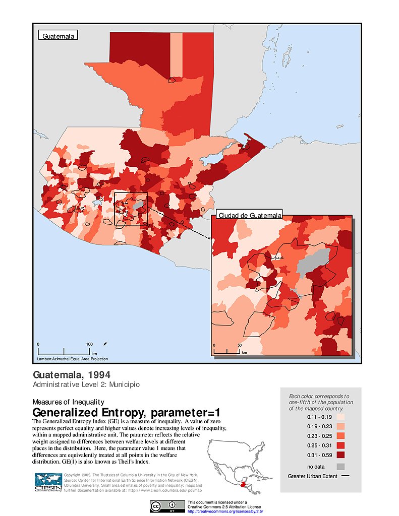
Generalized Entropy Index 1, ADM2 (1994): Guatemala
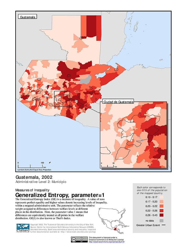
Generalized Entropy Index 1, ADM2 (2002): Guatemala
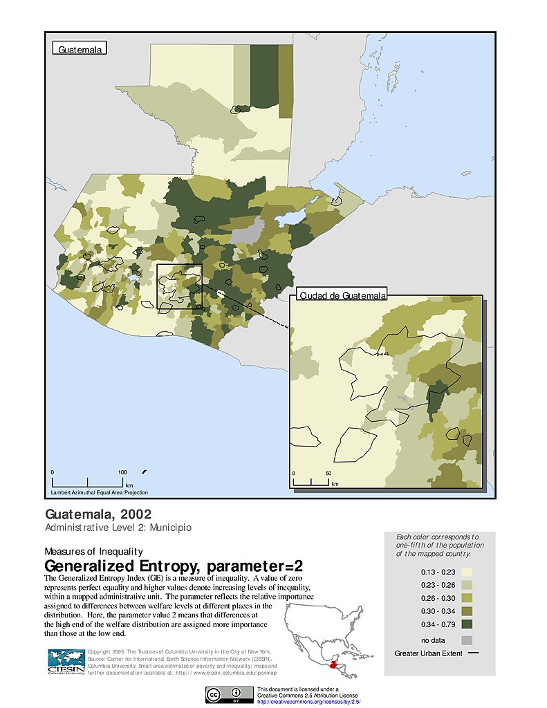
Generalized Entropy Index 2, ADM2 (1994): Guatemala
Generalized Entropy Index 2, ADM2 (2002): Guatemala
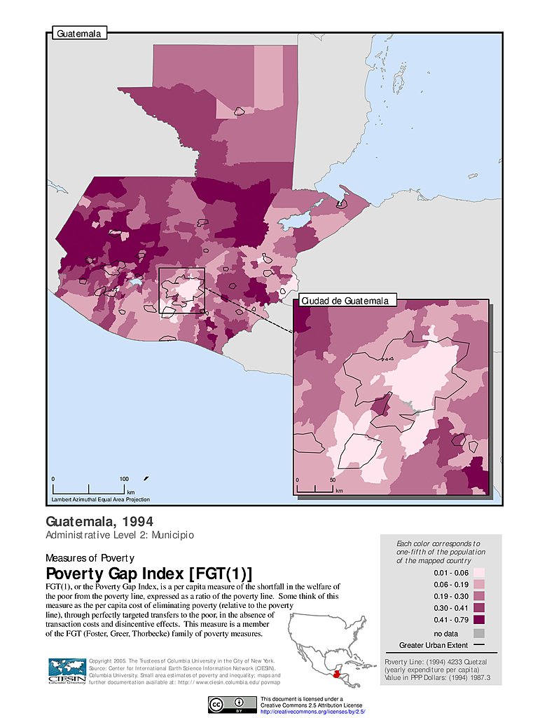
Poverty Gap Index, ADM2 (1994): Guatemala
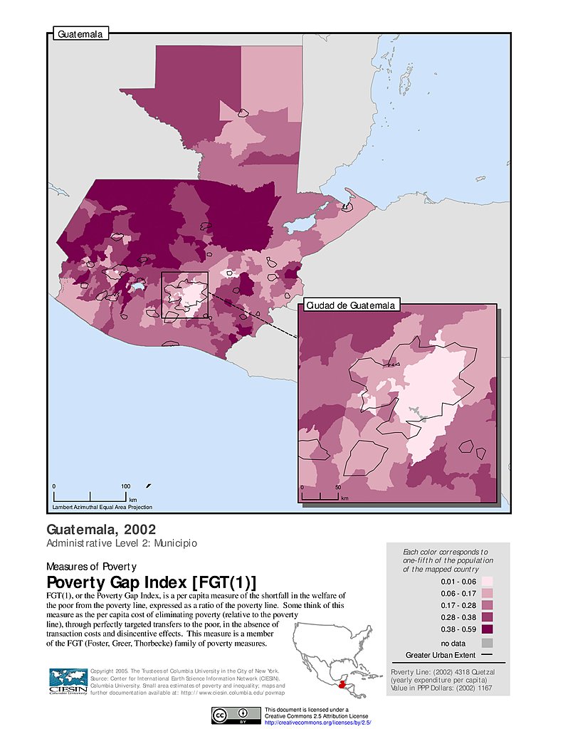
Poverty Gap Index, ADM2 (2002): Guatemala
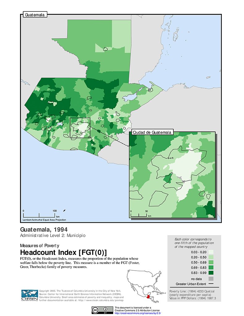
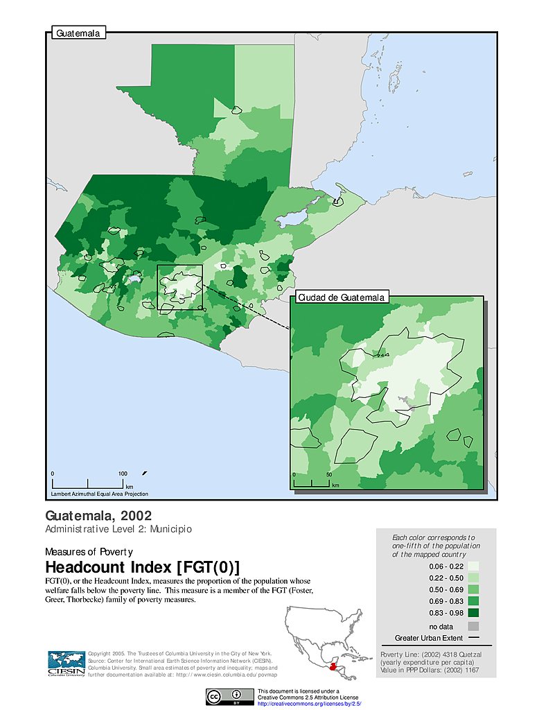
Poverty Headcount Index, ADM2 (1994): Guatemala
Poverty Headcount Index, ADM2 (2002): Guatemala
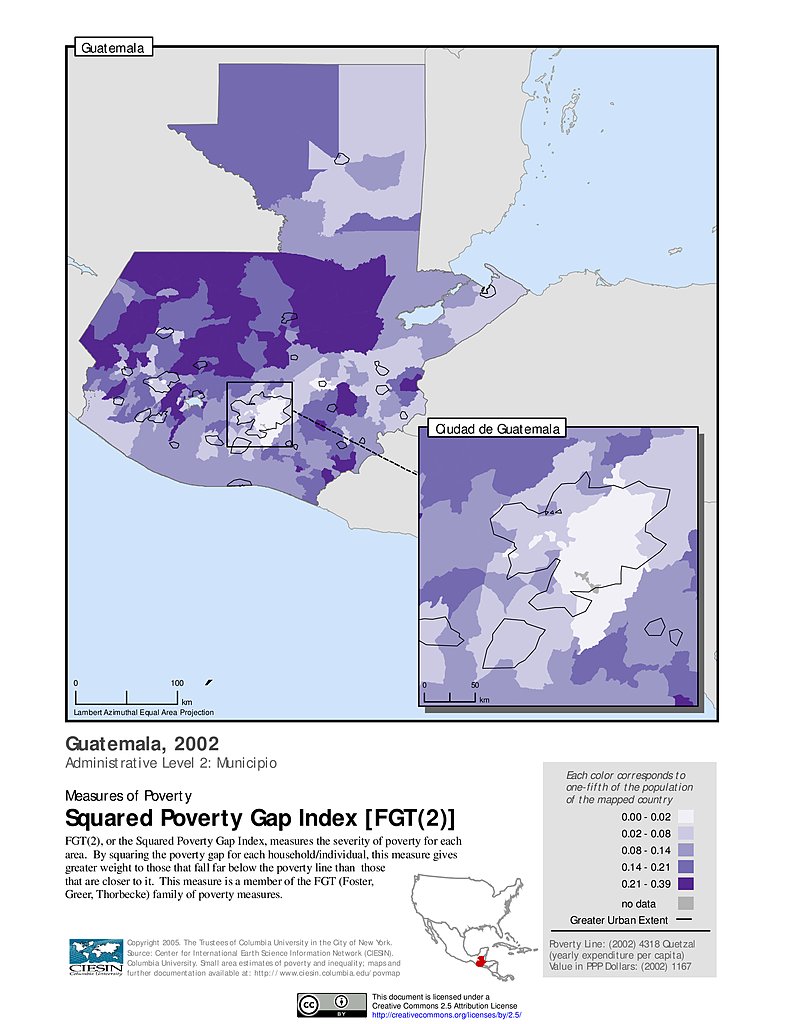
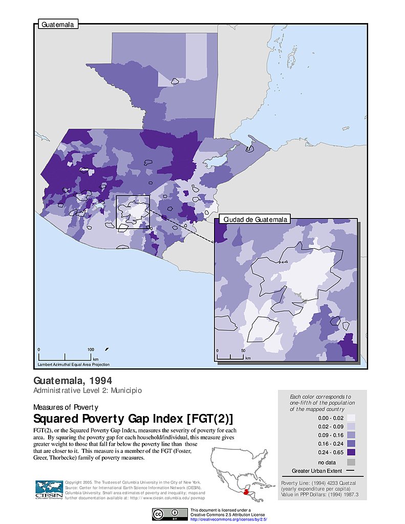
Squared Poverty Gap Index, ADM2 (2002): Guatemala
Squared Poverty Gap Index, ADM2 (1994): Guatemala
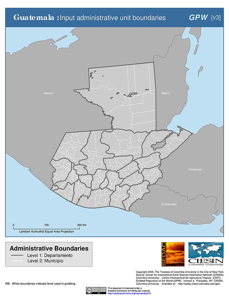
Administrative Boundaries: Guatemala
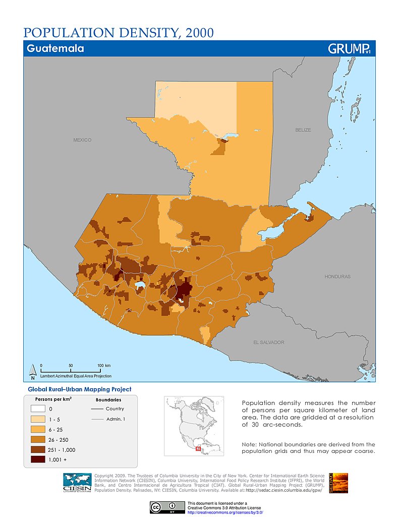
Population Density (2000): Guatemala
Population Density (2000): Guatemala
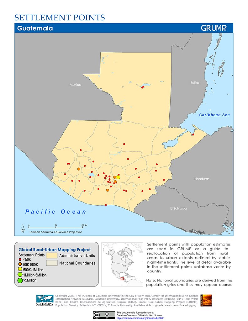
Settlement Points: Guatemala
Maps
»
Region: North America
Remove Facet
5 of 13
Prev
|
Next