Socioeconomic Data and Applications Center (
sedac
)
A Data Center in NASA's Earth Observing System Data and Information System (
EOSDIS
) — Hosted by
CIESIN
at
Columbia University
Search SEDAC
Data
Data Sets
Maps
Web Pages
search
Data
· Data Sets
· Data Collections
· Featured Data Uses
· Data Citations
· Citations Database
· Data Submission
Maps
· Map Gallery
· Map Viewer
· Map Services
· Mapping Tools
Themes
· Agriculture
· Climate
· Conservation
· Governance
· Hazards
· Health
· Infrastructure
· Land Use
· Marine and Coastal
· Population
· Poverty
· Remote Sensing
· Sustainability
· Urban
· Water
Resources
· Guides
· Multimedia
· Networks
· News
· Publications
· Related Sites
· Remote Sensing
· Tools
Social Media
· Twitter
· FaceBook
· YouTube
· Flickr
· Blog Posts
· Communities
About
· About SEDAC
· User Working Group
· Privacy
· User Registration
Help
Map Gallery
(462)
Follow Us:
Twitter
Follow Us on Facebook
YouTube
Flickr
| Share:
Twitter
Facebook
Search
All Fields:
search
Region
Africa
(53)
Asia
(45)
Europe
(19)
Global
(234)
North America
(67)
Oceania
(9)
South America
(34)
Location
Select a Location...
abu dhabi
(1)
albania
(6)
australia
(1)
bangladesh
(6)
bolivia
(6)
bulgaria
(6)
cambodia
(10)
chile
(1)
china
(5)
ecuador
(8)
guatemala
(18)
honduras
(11)
india
(1)
indonesia
(5)
kenya
(5)
madagascar
(7)
malawi
(9)
morocco
(1)
mozambique
(6)
nicaragua
(3)
panama
(11)
paraguay
(13)
south africa
(7)
uganda
(5)
united states of america
(13)
viet nam
(9)
go
Maps
»
Theme: Health
Remove Facet
5 of 15
Prev
|
Next
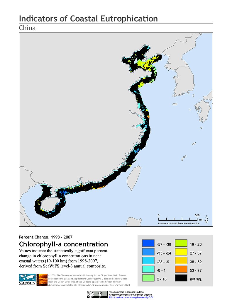
% Chlorophyll-a Concentration Change (1998-2007): China
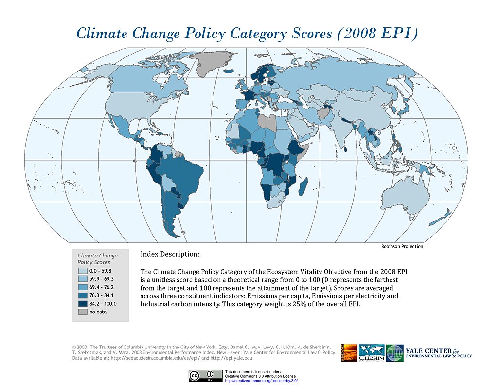
Climate Change, EPI 2008
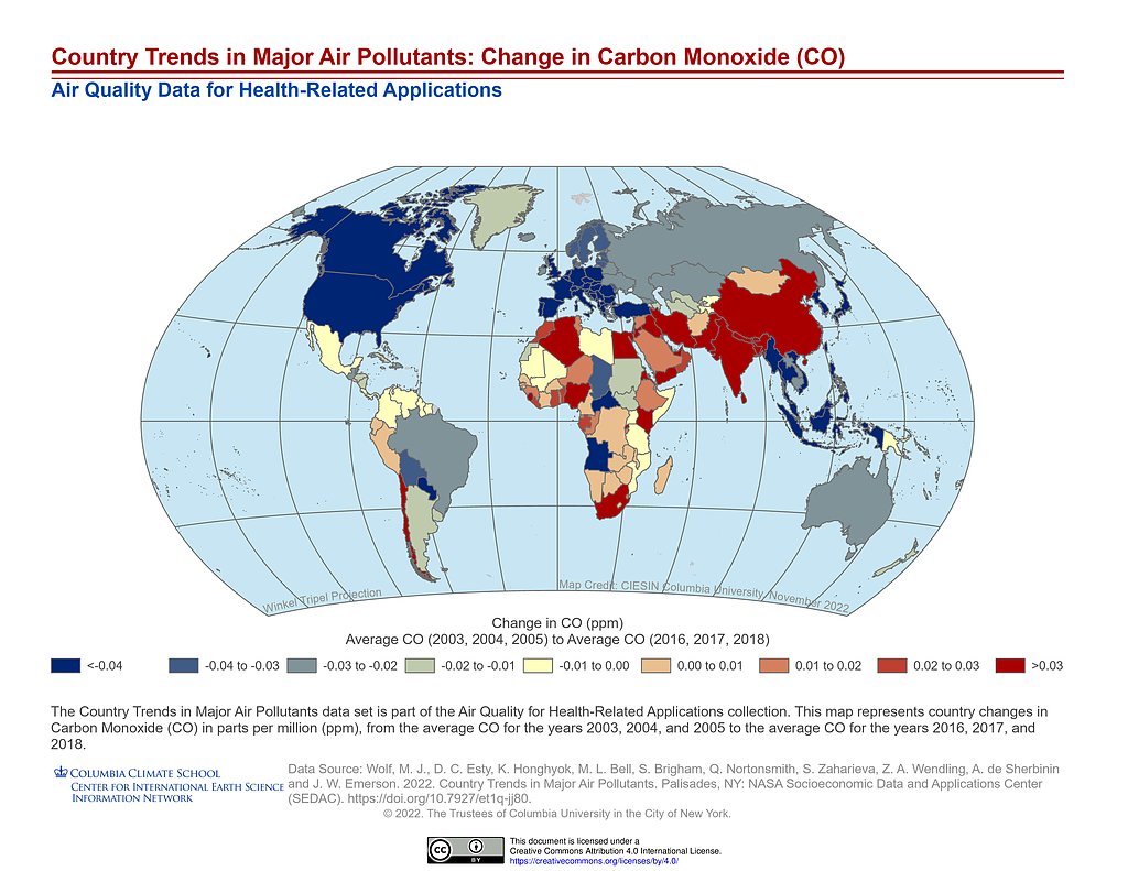
Country Trends Major Air Pollutants: CO Change
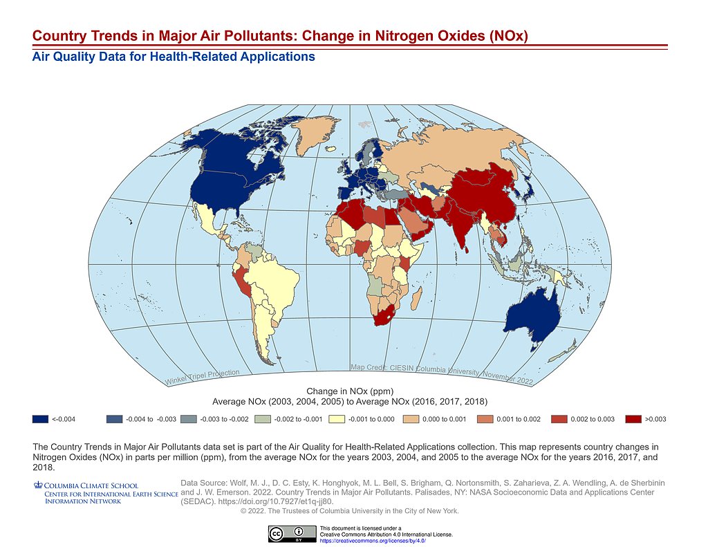
Country Trends Major Air Pollutants: NOx Change
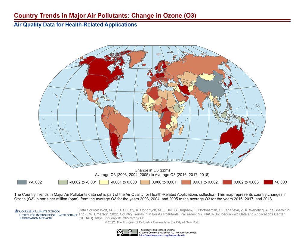
Country Trends Major Air Pollutants: O3 Change
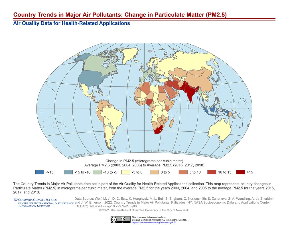
Country Trends Major Air Pollutants: PM2.5 Change
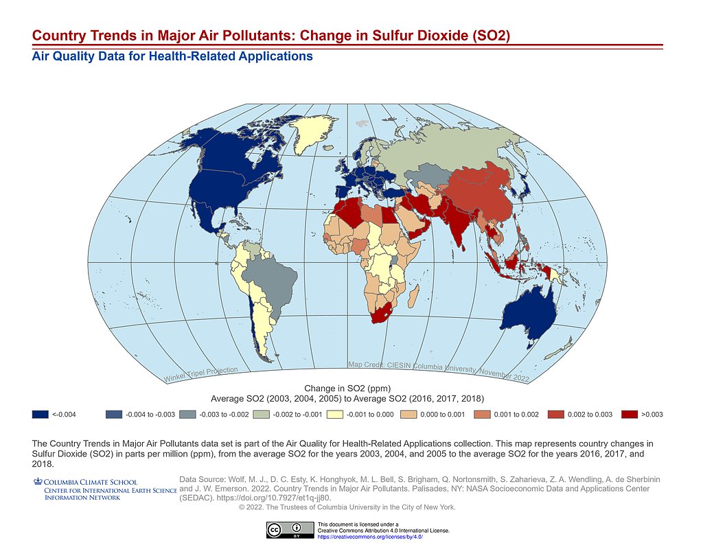
Country Trends Major Air Pollutants: SO2 Change
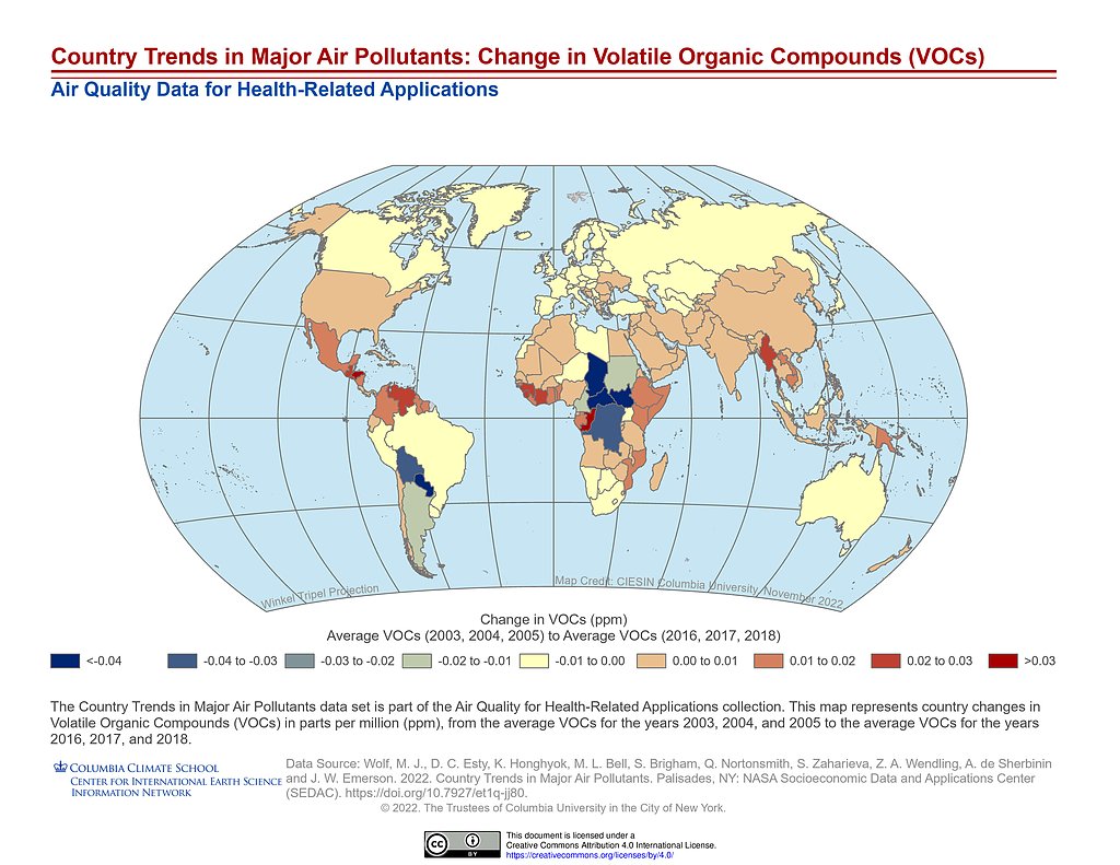
Country Trends Major Air Pollutants: VOCs Change
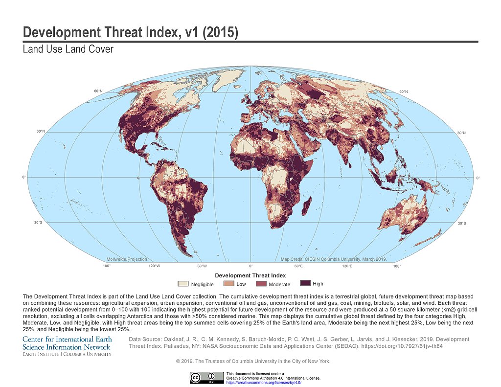
Development Threat Index (2015)
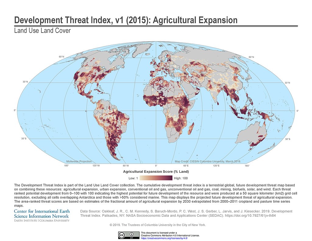
Development Threat Index (2015): Agricultural Expansion
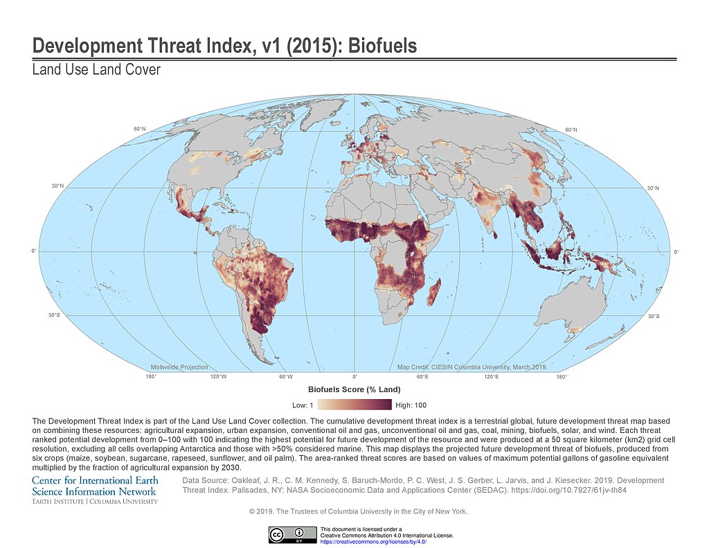
Development Threat Index (2015): Biofuels
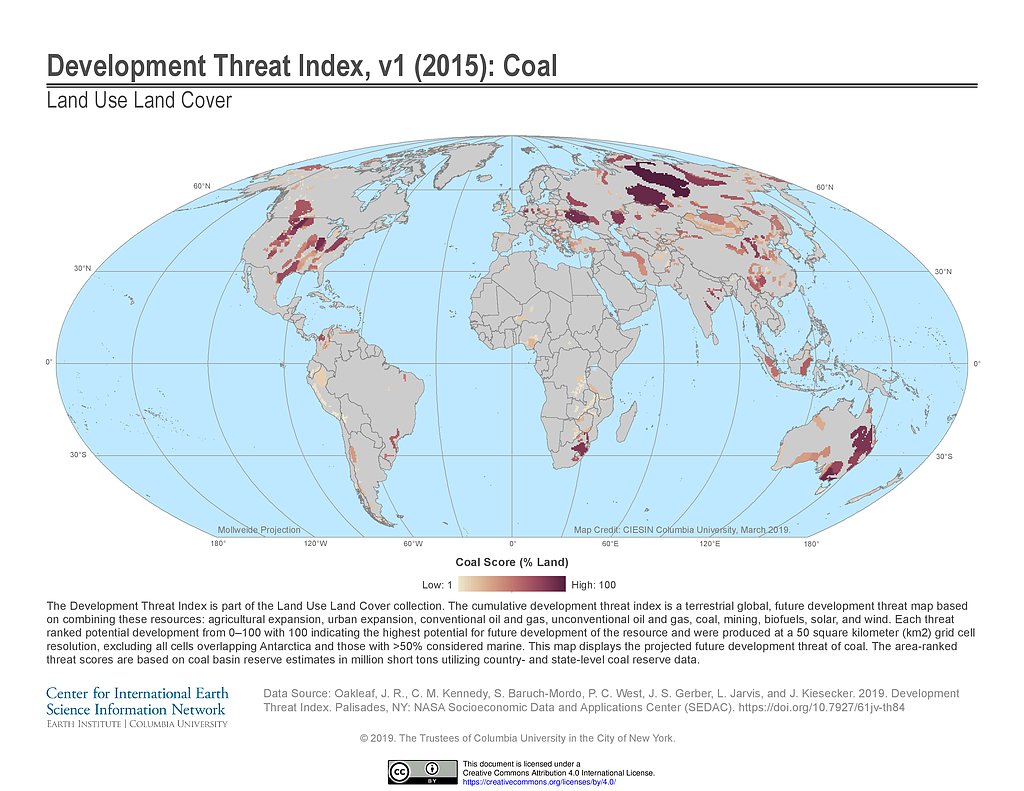
Development Threat Index (2015): Coal
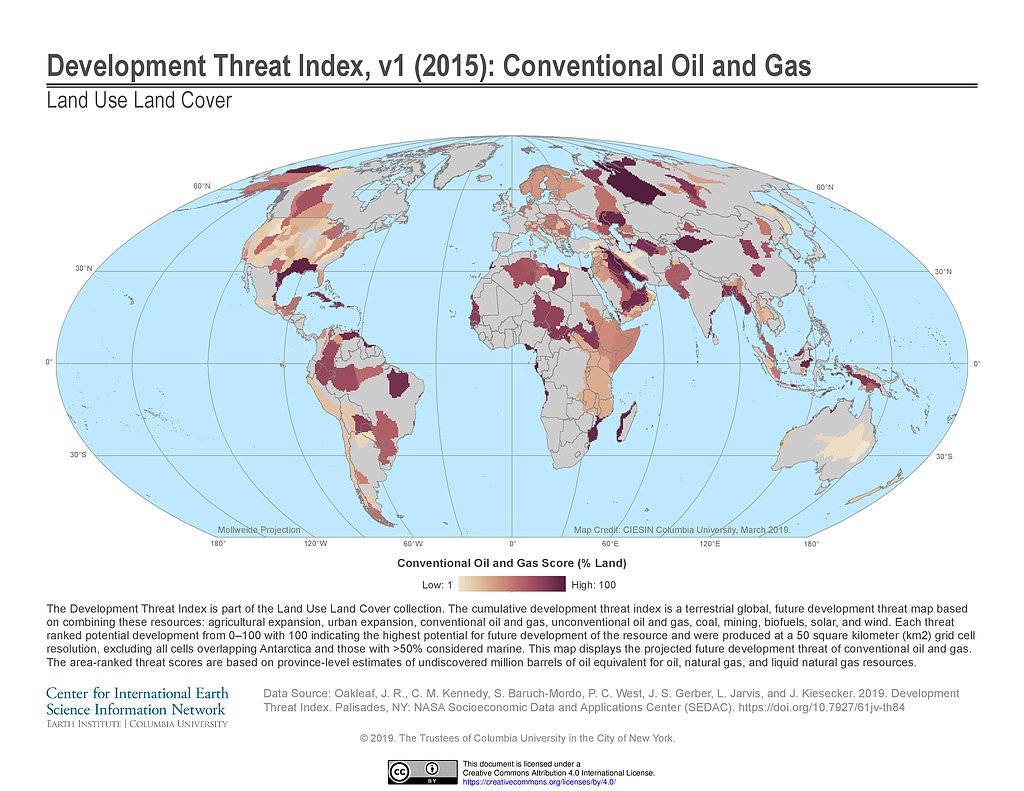
Development Threat Index (2015): Conventional Oil and Gas
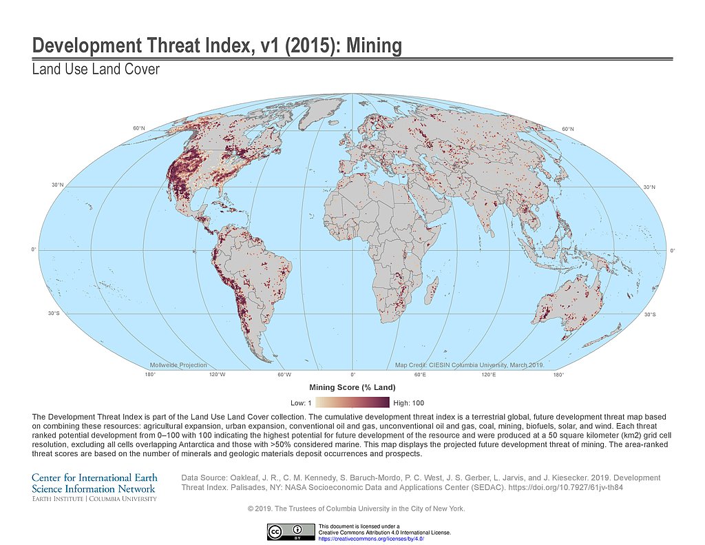
Development Threat Index (2015): Mining
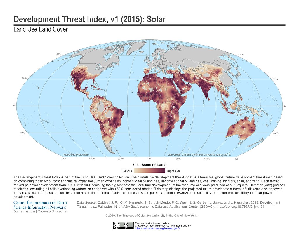
Development Threat Index (2015): Solar
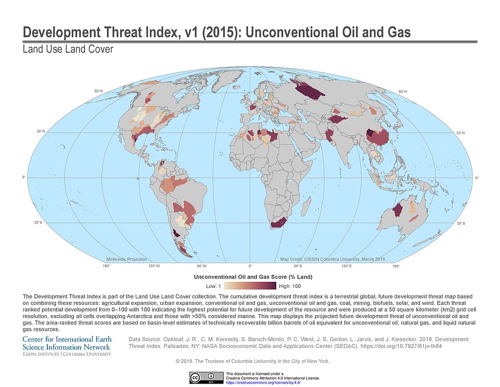
Development Threat Index (2015): Unconventional Oil and Gas
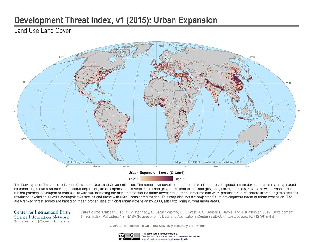
Development Threat Index (2015): Urban Expansion
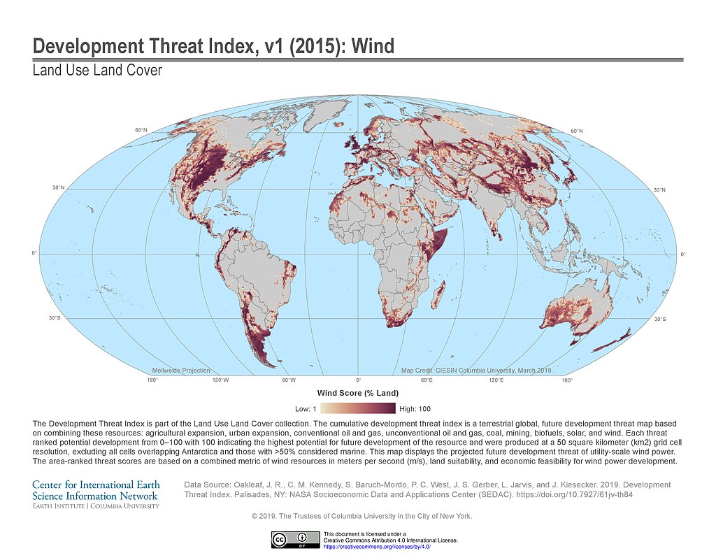
Development Threat Index (2015): Wind
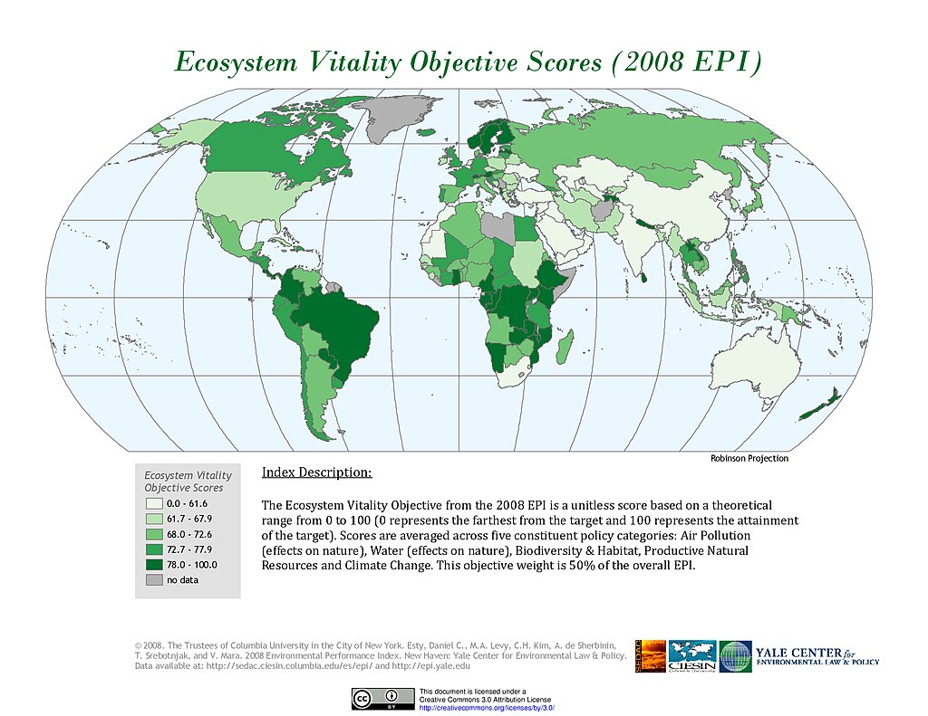
Ecosystem Vitality , EPI 2008
Generalized Entropy Index 0, ADM3: Ecuador
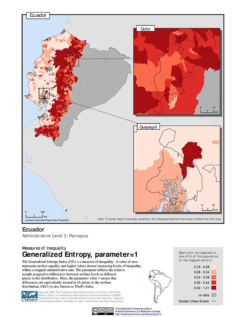
Generalized Entropy Index 1, ADM3: Ecuador
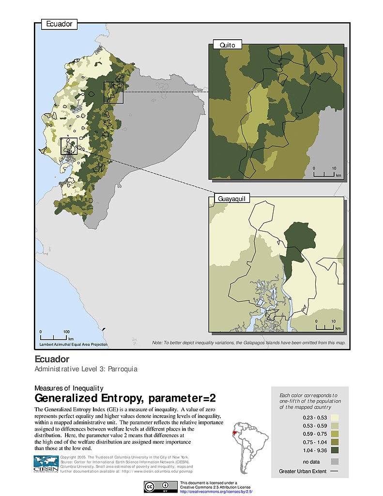
Generalized Entropy Index 2, ADM3: Ecuador
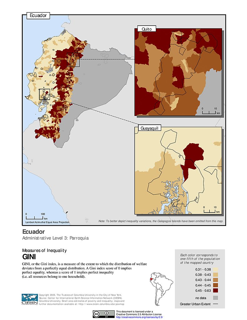
Gini Index, ADM3: Ecuador
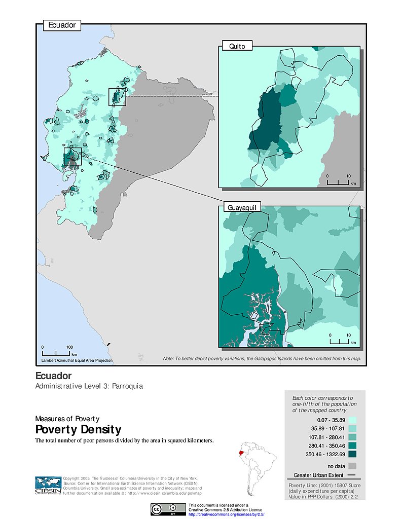
Poverty Density, ADM3: Ecuador
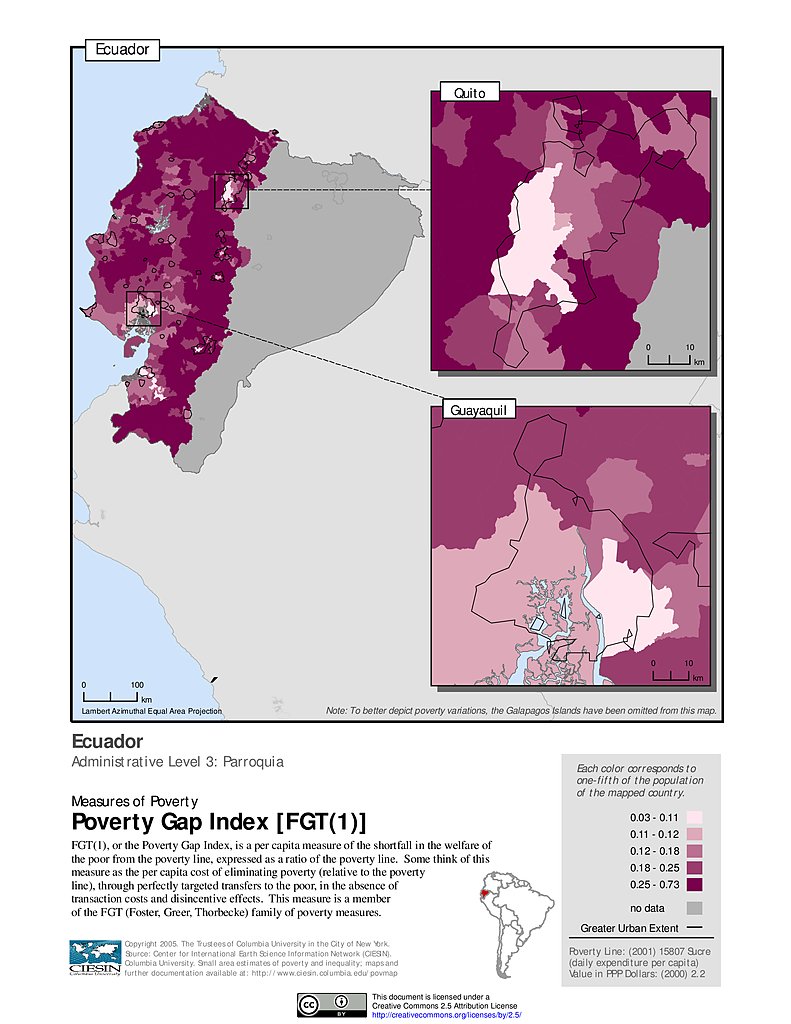
Poverty Gap Index, ADM3: Ecuador
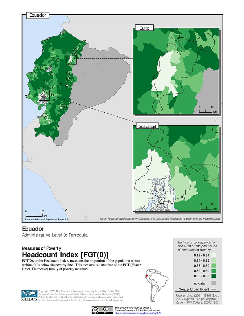
Poverty Headcount Index, ADM3: Ecuador
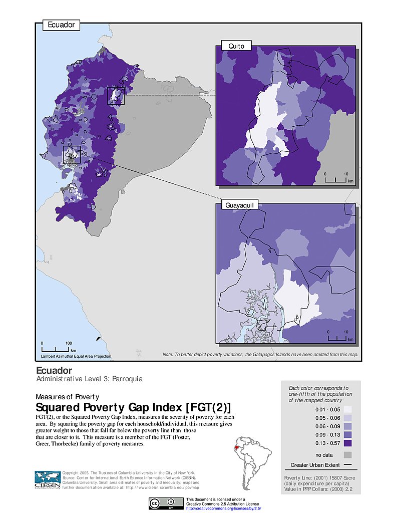
Squared Poverty Gap Index, ADM3: Ecuador
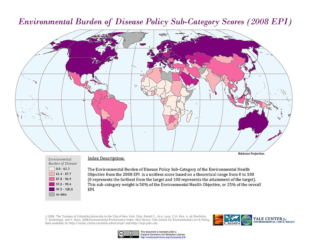
Environmental Burden of Disease, EPI 2008
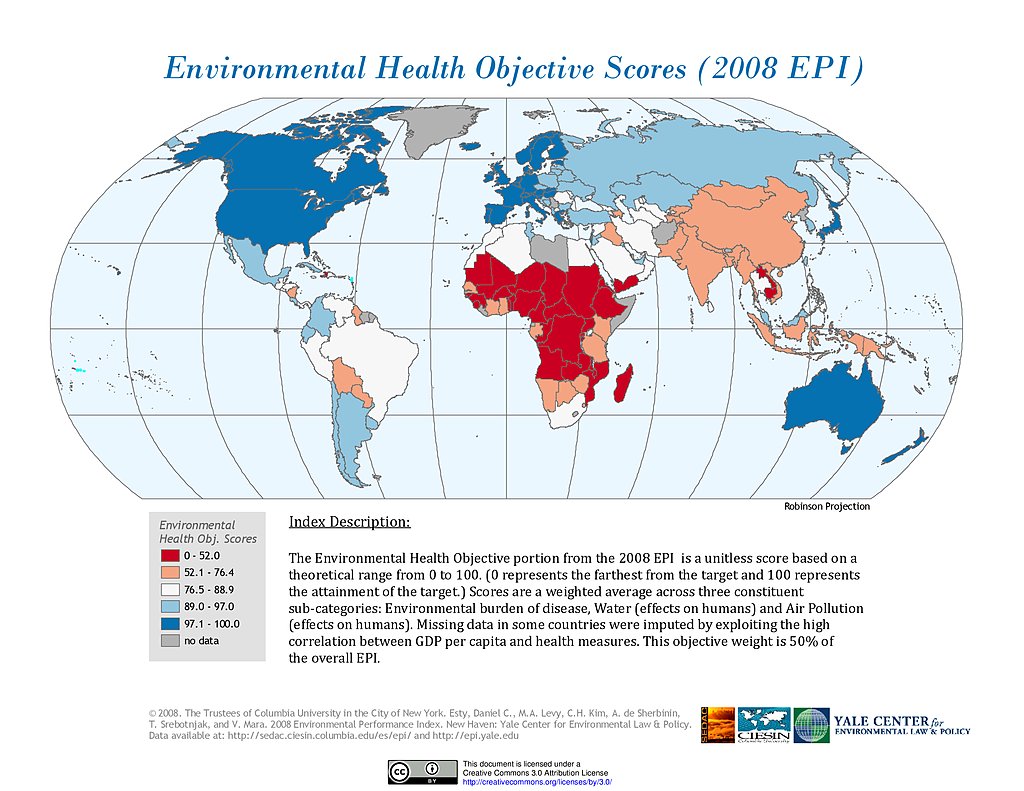
Environmental Health, EPI 2008
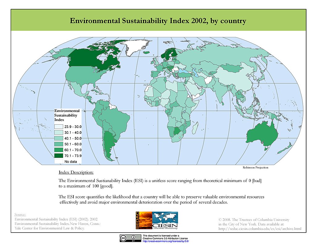
ESI 2002
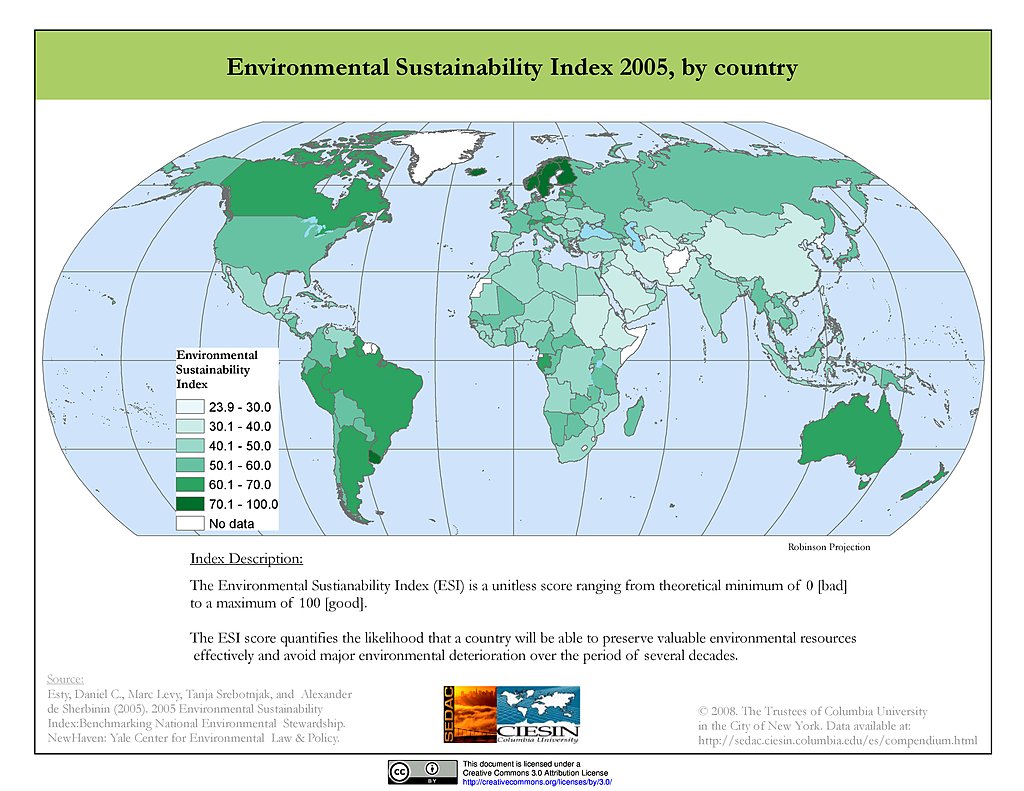
ESI 2005
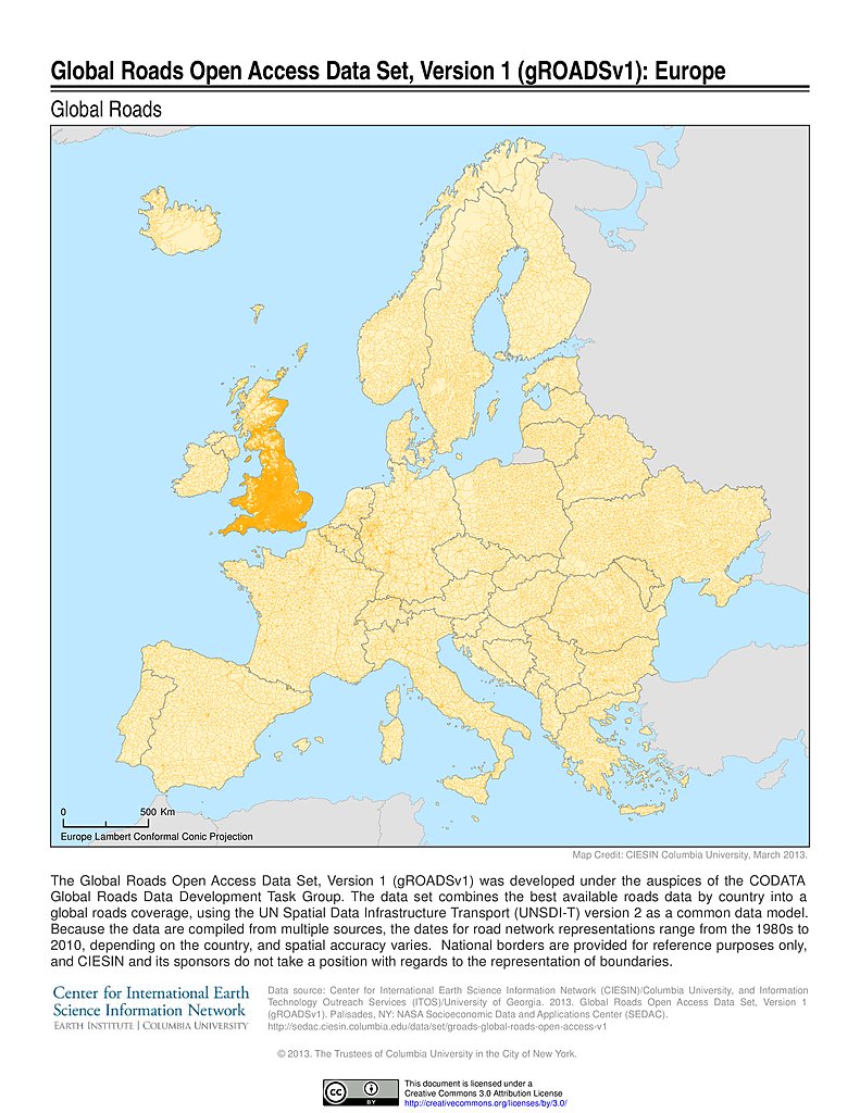
Global Roads Open Access Data Set, v1: Europe
Maps
»
Theme: Health
Remove Facet
5 of 15
Prev
|
Next