Socioeconomic Data and Applications Center (
sedac
)
A Data Center in NASA's Earth Observing System Data and Information System (
EOSDIS
) — Hosted by
CIESIN
at
Columbia University
Search SEDAC
Data
Data Sets
Maps
Web Pages
search
Data
· Data Sets
· Data Collections
· Featured Data Uses
· Data Citations
· Citations Database
· Data Submission
Maps
· Map Gallery
· Map Viewer
· Map Services
· Mapping Tools
Themes
· Agriculture
· Climate
· Conservation
· Governance
· Hazards
· Health
· Infrastructure
· Land Use
· Marine and Coastal
· Population
· Poverty
· Remote Sensing
· Sustainability
· Urban
· Water
Resources
· Guides
· Multimedia
· Networks
· News
· Publications
· Related Sites
· Remote Sensing
· Tools
Social Media
· Twitter
· FaceBook
· YouTube
· Flickr
· Blog Posts
· Communities
About
· About SEDAC
· User Working Group
· Privacy
· User Registration
Help
Map Gallery
(398)
Follow Us:
Twitter
Follow Us on Facebook
YouTube
Flickr
| Share:
Twitter
Facebook
Search
All Fields:
search
Theme
Agriculture
(11)
Climate
(32)
Conservation
(31)
Framework Data
(55)
Governance
(1)
Hazards
(7)
Health
(53)
Infrastructure
(8)
Land Use
(32)
Marine and Coastal
(8)
Population
(251)
Poverty
(52)
Remote Sensing
(24)
Sustainability
(214)
Urban
(181)
Water
(7)
Location
Select a Location...
abu dhabi
(1)
algeria
(5)
angola
(5)
benin
(5)
botswana
(5)
burkina faso
(5)
burundi
(5)
cameroon
(5)
central african republic
(5)
chad
(5)
comoros
(5)
congo
(5)
cote d'ivoire
(5)
democratic republic of the congo
(5)
djibouti
(5)
egypt
(7)
equatorial guinea
(5)
eritrea
(5)
ethiopia
(5)
gabon
(5)
gambia
(5)
ghana
(6)
guinea
(5)
guinea-bissau
(5)
kenya
(10)
lesotho
(5)
liberia
(6)
libya
(5)
madagascar
(12)
malawi
(14)
mali
(6)
mauritania
(6)
mauritius
(5)
mayotte
(5)
morocco
(3)
mozambique
(11)
namibia
(5)
niger
(5)
nigeria
(7)
reunion
(5)
rwanda
(5)
saint helena
(5)
sao tome and principe
(5)
senegal
(6)
seychelles
(5)
sierra leone
(5)
somalia
(5)
south africa
(13)
sudan
(5)
swaziland
(5)
togo
(5)
tunisia
(5)
uganda
(10)
united republic of tanzania
(6)
zambia
(5)
zimbabwe
(5)
go
Maps
»
Region: Asia
Remove Facet
»
Region: Africa
Remove Facet
1 of 13
Prev
|
Next
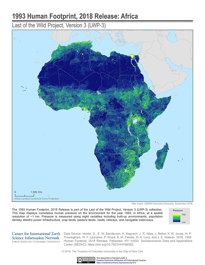
Human Footprint (1993): Africa
Human Footprint (2009): Africa
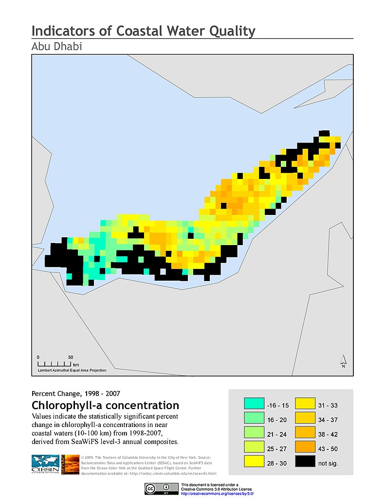
% Chlorophyll-a Concentration Change (1998-2007): Abu Dhabi
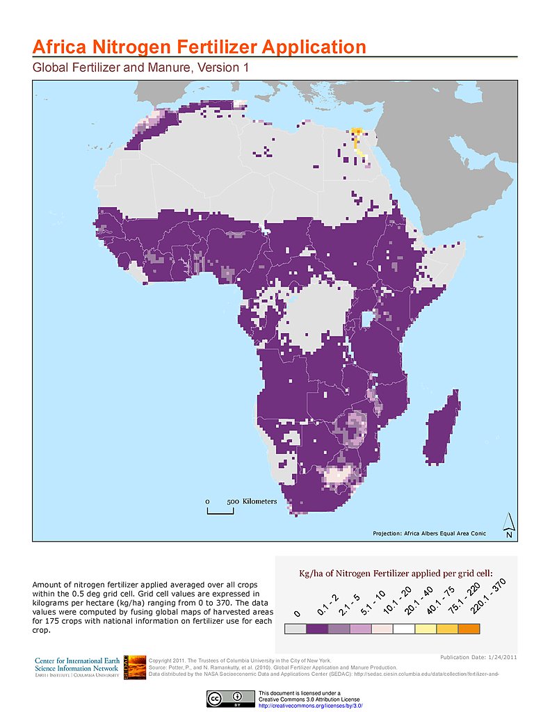
Nitrogen Fertilizer Application: Africa
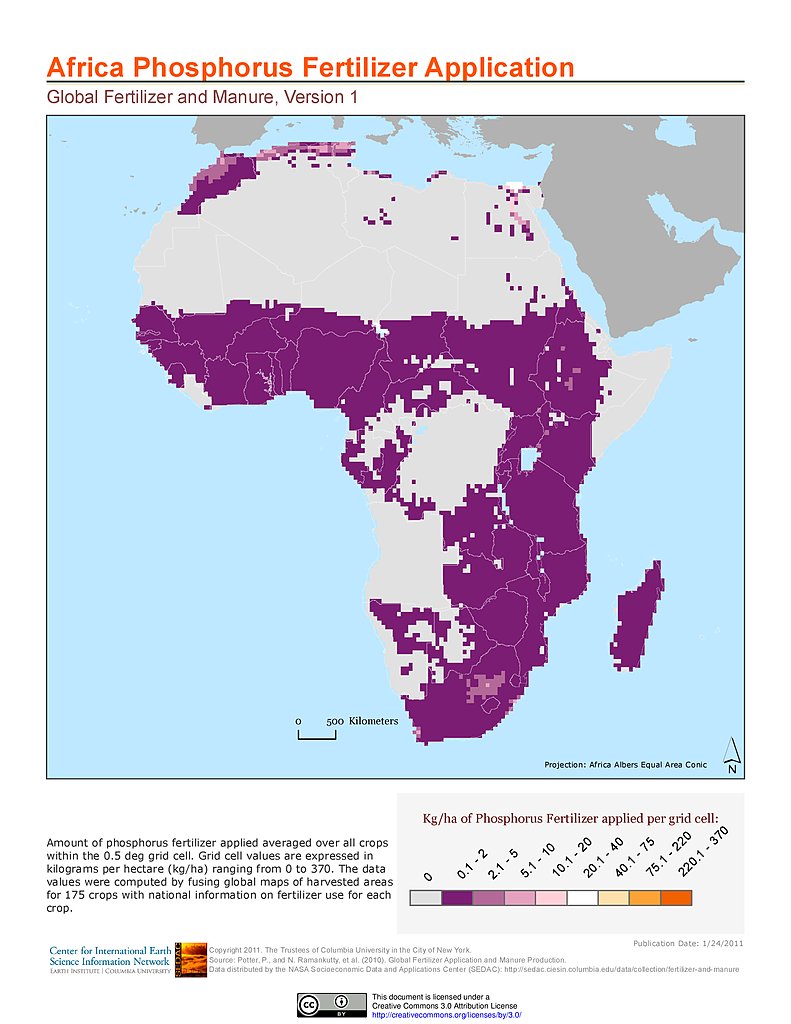
Phosphorus Fertilizer Application: Africa
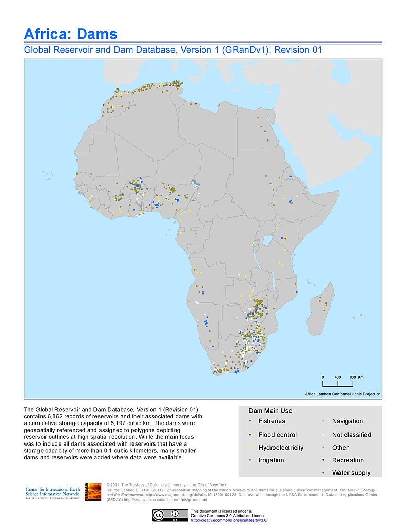
Dams, v1.01: Africa
Reservoirs, v1.01: Africa
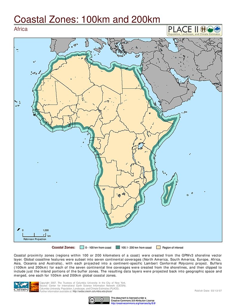
100 km & 200 km Coastal Zones: Africa
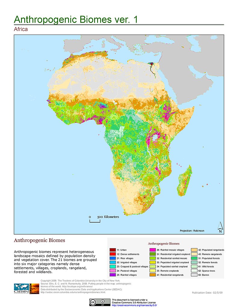
Anthropogenic Biomes, v1: Africa
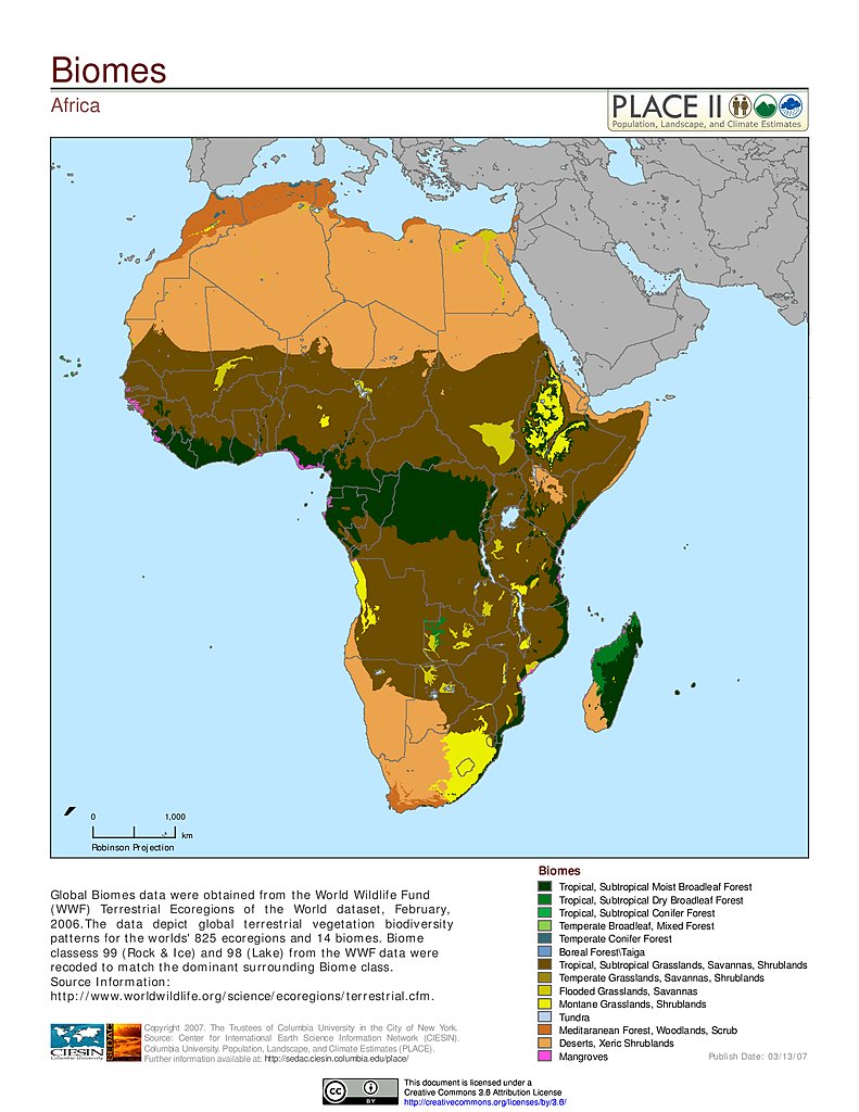
Biomes: Africa
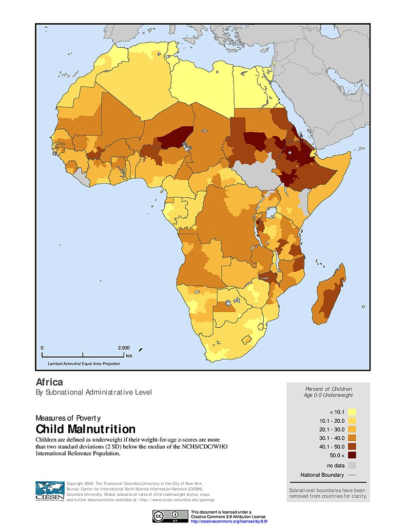
Child Malnutrition: Africa
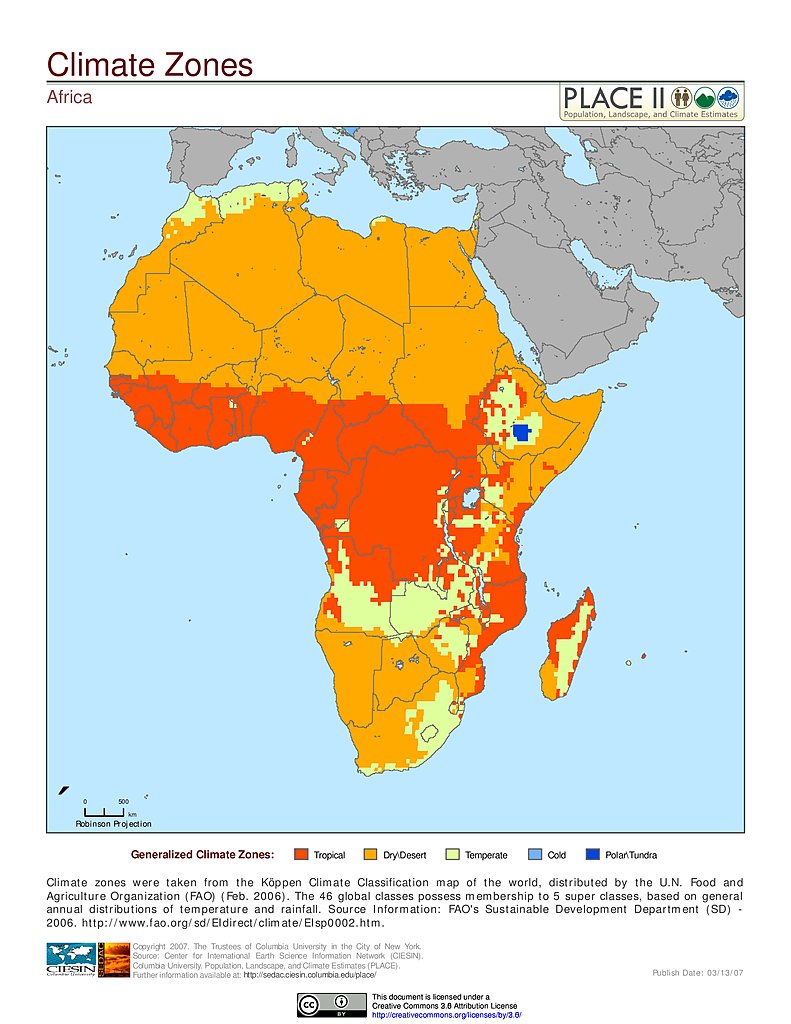
Climate Zones: Africa
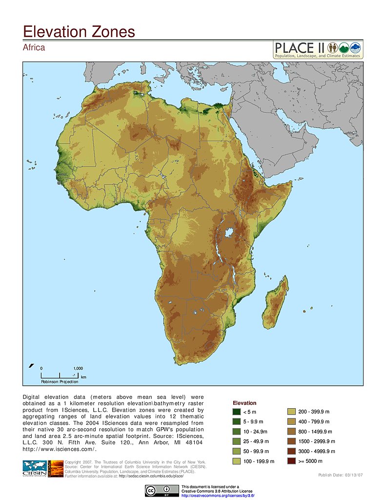
Elevation Zones: Africa
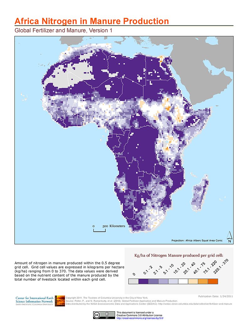
Nitrogen in Manure Production: Africa
Phosphorus in Manure Production: Africa
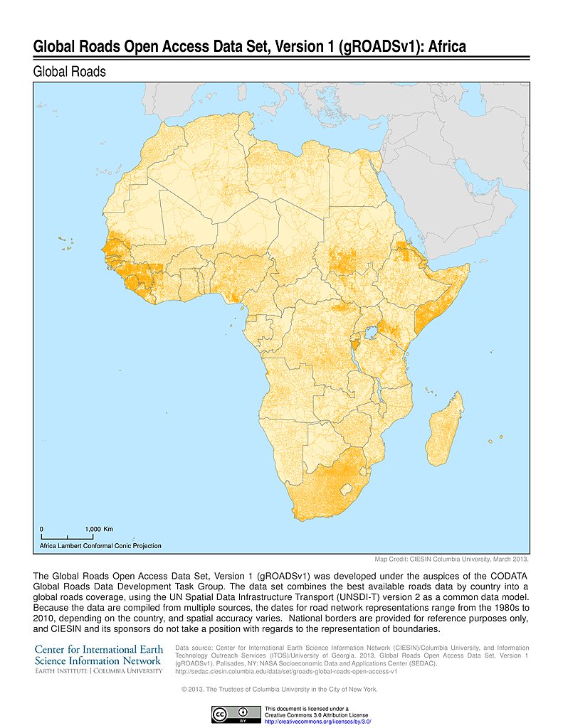
Global Roads Open Access Data Set, v1: Africa
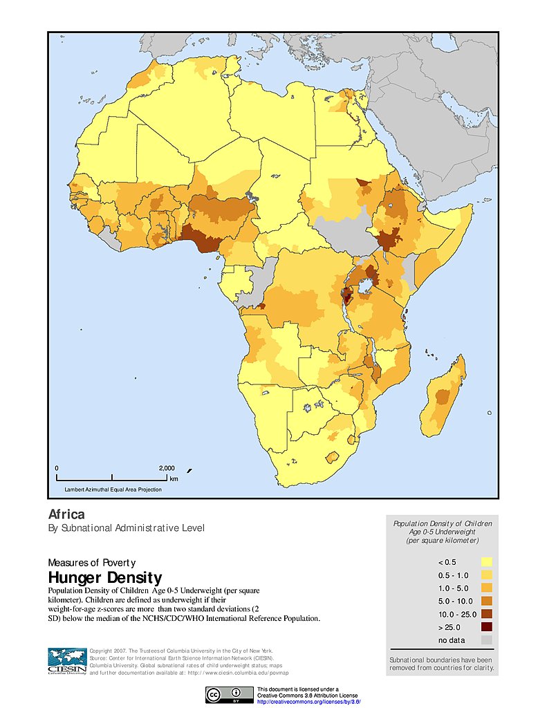
Hunger Density: Africa
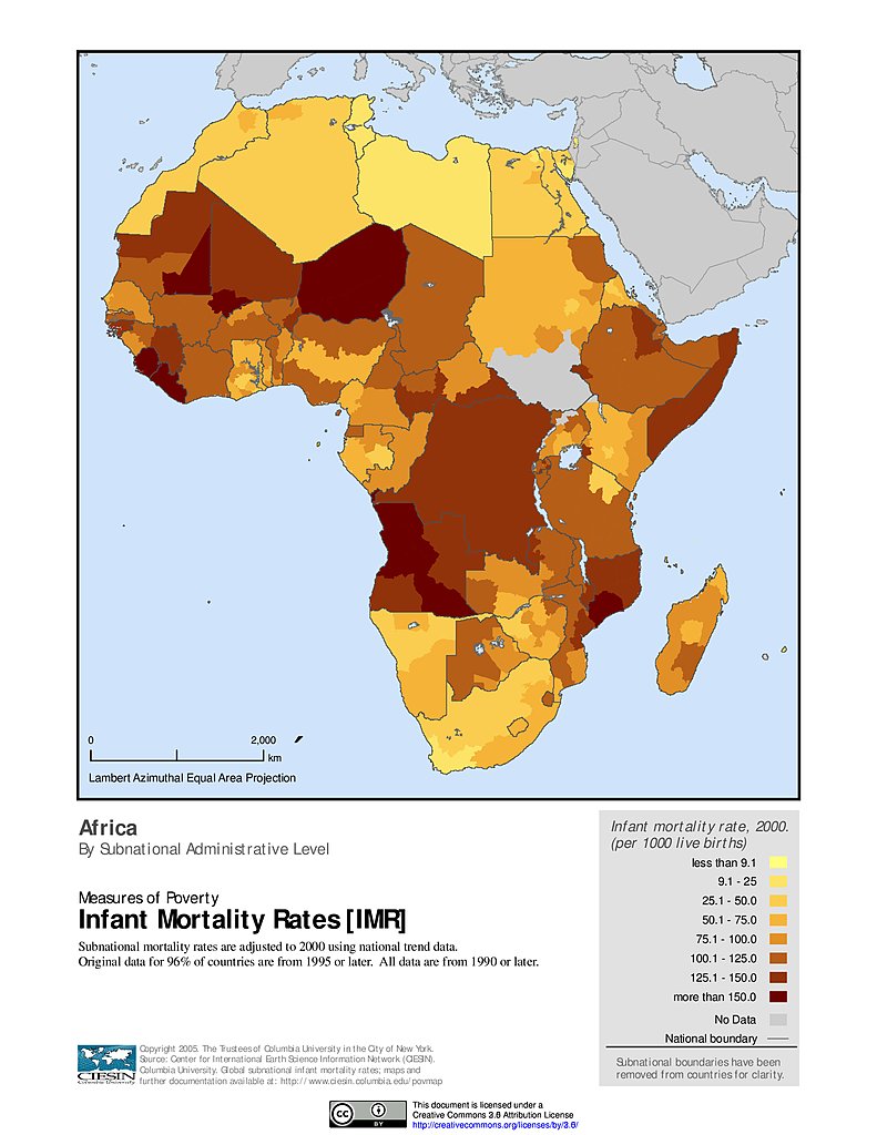
Infant Mortality Rates: Africa
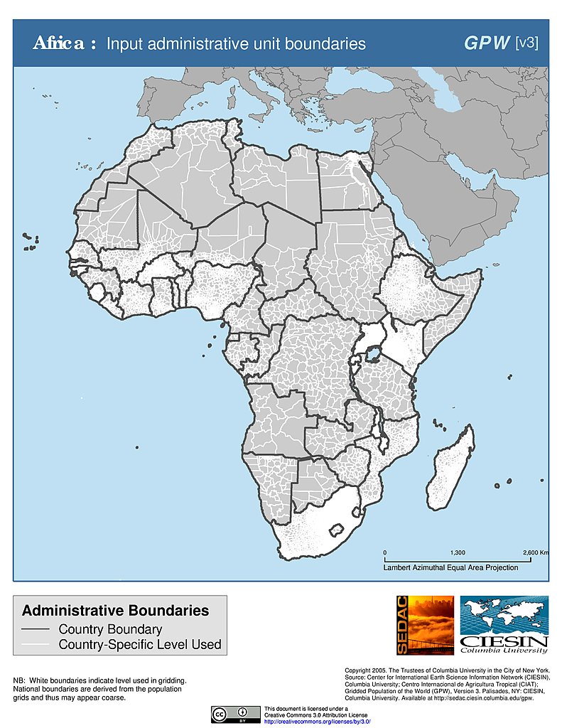
Administrative Boundaries: Africa
% Chlorophyll-a Concentration Change (1998-2007): Africa
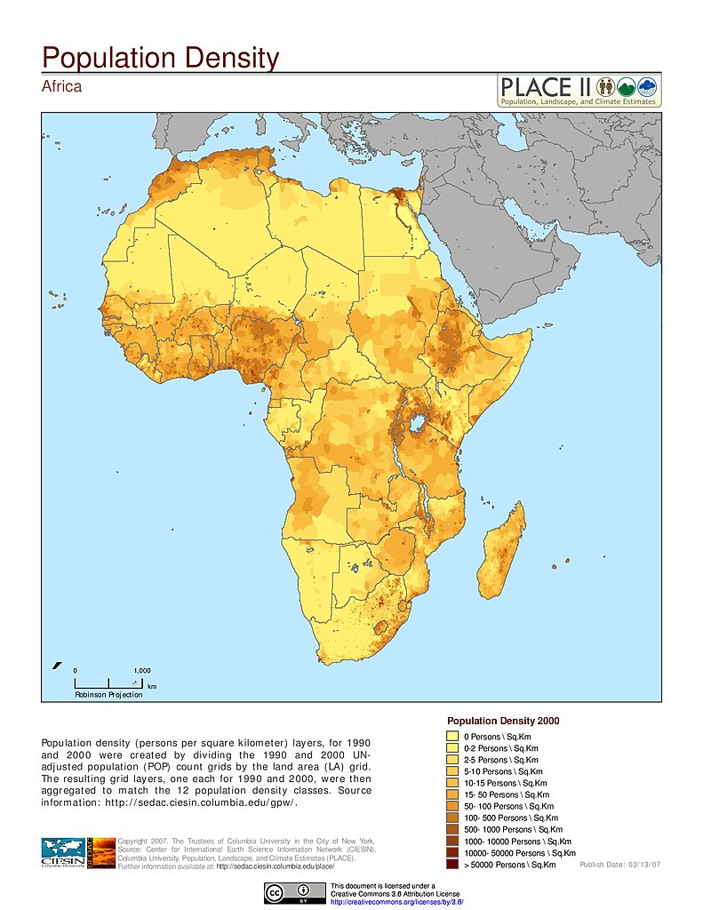
Population Density: Africa
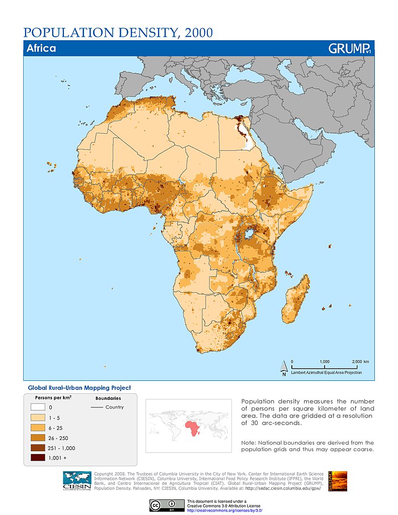
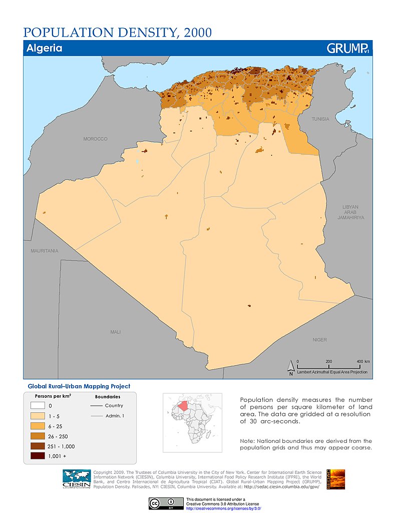
Population Density (2000): Africa
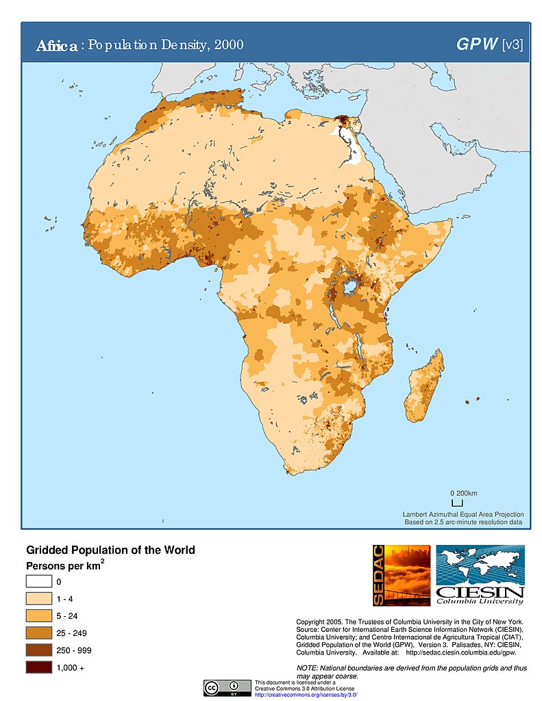
Population Density (2000): Africa
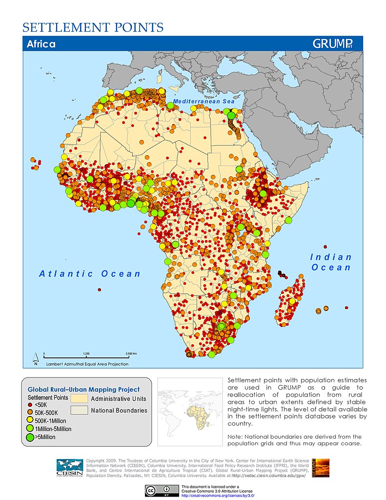
Settlement Points: Africa
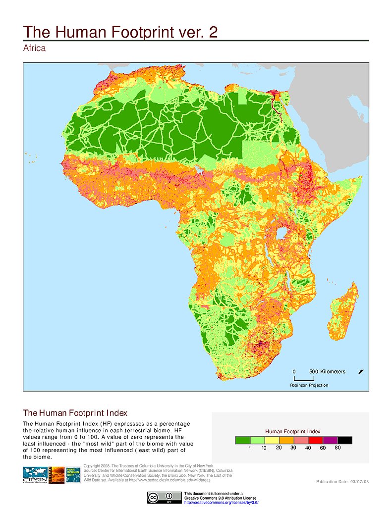
Human Footprint Index, v2: Africa
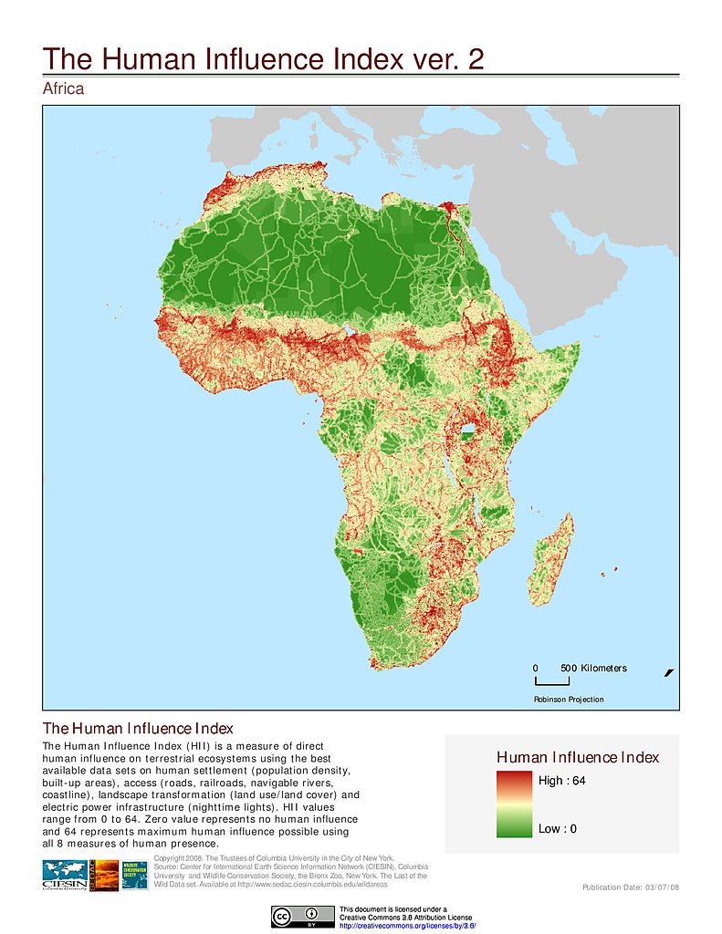
Human Influence Index, v2: Africa
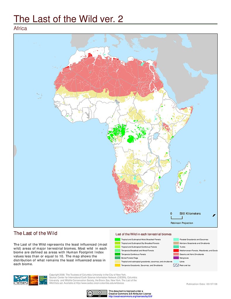
Last of the Wild, v2: Africa
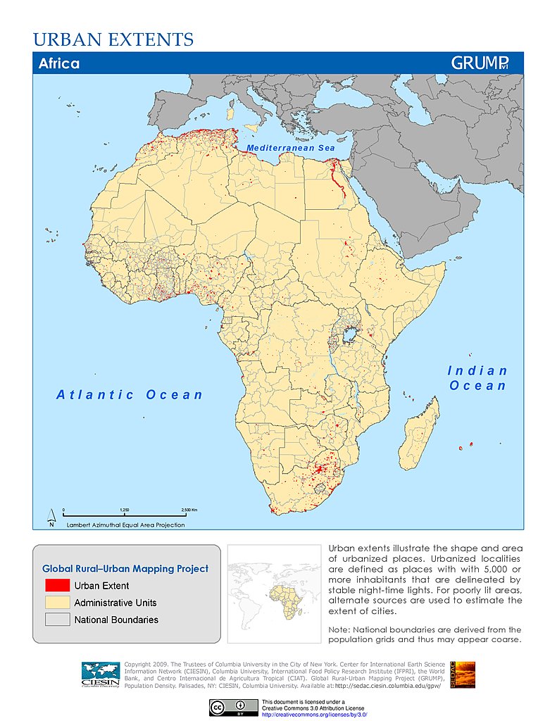
Urban Extents: Africa
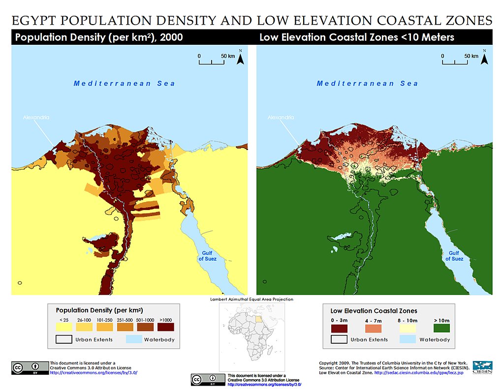
Population Density & LECZ: Alexandria, Egypt
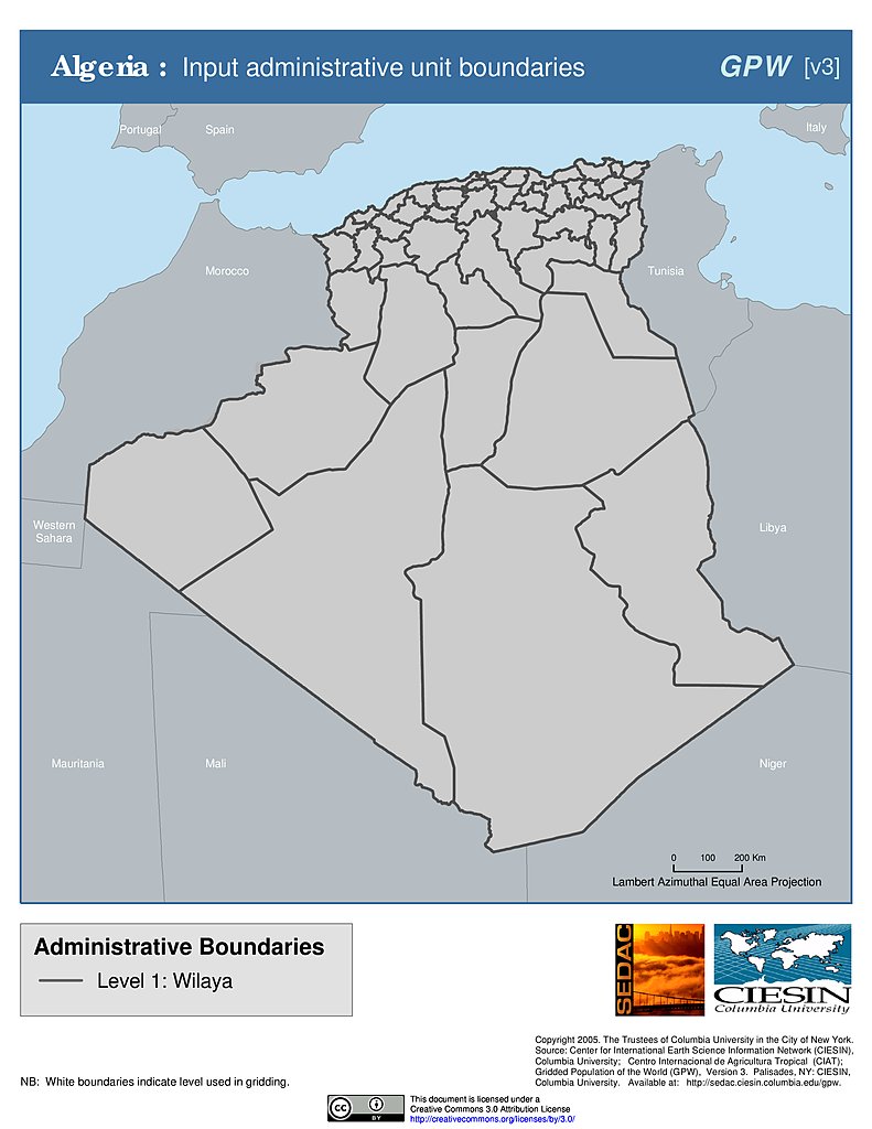
Administrative Boundaries: Algeria
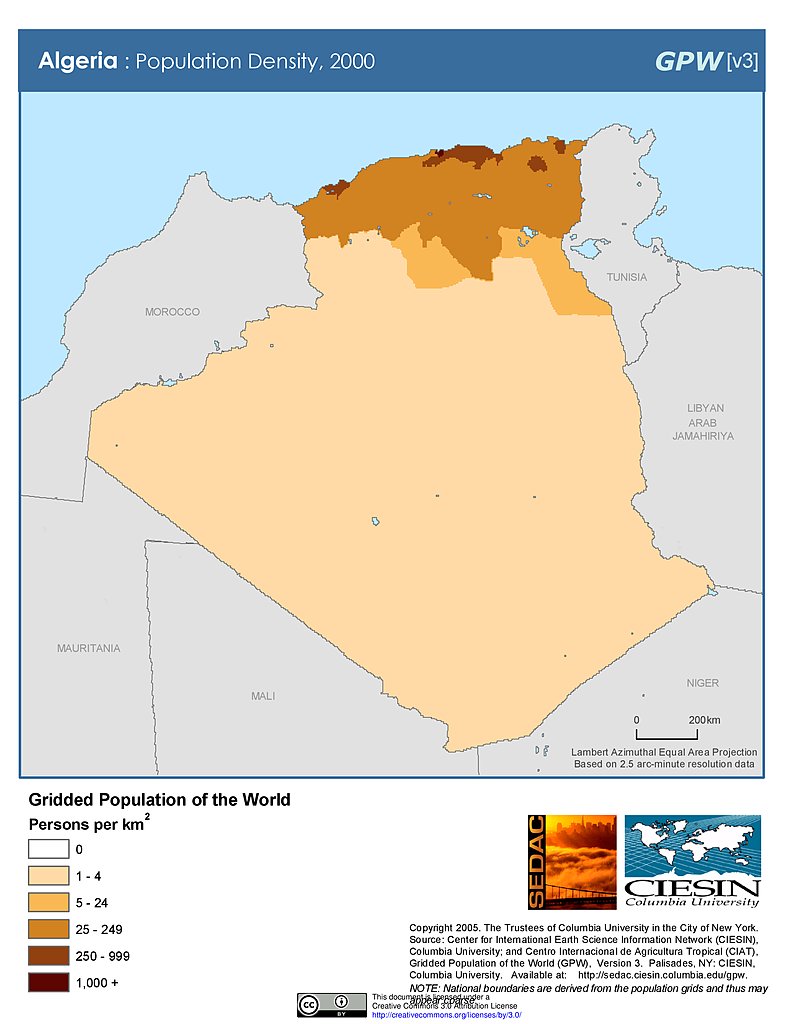
Population Density (2000): Algeria
Population Density (2000): Algeria
Maps
»
Region: Asia
Remove Facet
»
Region: Africa
Remove Facet
1 of 13
Prev
|
Next