Data Sets » Format: rasterRemove Facet » Theme: HealthRemove Facet » All Fields: environmental indicatorsRemove Facet
1 of 1
Prev | Next

Annual Global High-Resolution Extreme Heat Estimates (GEHE), v1 (1983 – 2016)

Satellite-Derived Environmental Indicators

To provide a high-resolution, longitudinal global data set of annual extreme humid-heat.

Yale Center for Earth Observation (YCEO) Surface Urban Heat Islands, v4 (2003 – 2018)

Satellite-Derived Environmental Indicators

To provide global estimates of the surface urban heat island intensity from monthly, seasonal, to annual scales for over 10,000 urban clusters developed using a simplified urban-extent algorithm.

Global (GL) Annual PM2.5 Grids from MODIS, MISR and SeaWiFS Aerosol Optical Depth (AOD), v4.03 (1998 – 2019)

Satellite-Derived Environmental Indicators

To provide an annual global surface of concentrations (micrograms per cubic meter) of all composition ground-level fine particulate matter of 2.5 micrometers or smaller (PM2.5) for large-scale health and environmental research.

Global Fire Emissions Indicators, Grids, v1 (1997 – 2015)

Satellite-Derived Environmental Indicators

To provide data that can be used to calculate trace gas and aerosol emissions, due to fires; monitor and assess national efforts to manage emissions.

Global 3-Year Running Mean Ground-Level NO2 Grids from GOME, SCIAMACHY and GOME-2, v1 (1996 – 2012)

Satellite-Derived Environmental Indicators

To provide a continuous surface of NO2 concentrations for health and environmental research.

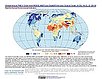
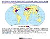
Global Summer Land Surface Temperature (LST) Grids, v1 (2013)

Satellite-Derived Environmental Indicators

To provide raster representations of global summer daytime maximum and nighttime minimum surface temperature for studies related to human health and climate change.

Annual Chlorophyll-a Concentration, v1 (1998 – 2007)

Indicators of Coastal Water Quality

To provide a gridded version of existing SeaWiFS data in GIS-compatible formats in order to determine concentrations of chlorophyll-a in the coastal water column and to facilitate the integration with other data.

Ancillary Data, v1 (1998 – 2007)

Indicators of Coastal Water Quality

To provide data that can assist in the extraction and analysis of chlorophyll-a concentration and trends from global grids.

Data Sets » Format: rasterRemove Facet » Theme: HealthRemove Facet » All Fields: environmental indicatorsRemove Facet
1 of 1
Prev | Next