Health and the Environment
| 2 of 3 |
Annual Mean PM2.5 Components (EC, NH4, NO3, OC, SO4) 50m Urban and 1km Non-Urban Area Grids for Contiguous U.S., v1 (
|
Daily 8-Hour Maximum and Annual O3 Concentrations for the Contiguous United States, 1-km Grids, v1 (
|
|
Daily and Annual NO2 Concentrations for the Contiguous United States, 1-km Grids, v1 (
|
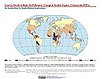
Country Trends in Major Air Pollutants, v1 (
|
|
Demographic and Health Survey Data Sets, v1 (
|
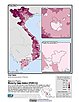
U.S. Social Vulnerability Index Grids, v1 (2000, 2010, 2014, 2016, 2018)U.S. Census Grids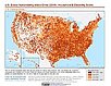
To provide a 1 km grid of the CDC Social Vulnerability Index (SVI) aligned with CIESIN's Gridded Population of the World, Version 4, Revision 11 (GPWv4.11) with a mask for water and no population. |
|
Global Fire Emissions Indicators, Grids, v1 (
|
Global Fire Emissions Indicators, Country-Level Tabular Data, v1 (
|
|
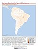
Unsatisfied Basic Needs, v1 (
|
Small Area Estimates of Poverty and Inequality, v1 (
|
|
Poverty and Food Security Case Studies, v1 (
|
INFORM Global Risk Index 2019 Mid Year, v0.3.7, (2019)Intergovernmental Panel on Climate ChangeTo assess country-level vulnerability and coping capacity related to climate change based on the data set used in Chapter 8 of the Sixth Assessment Report (AR6) by the Intergovernmental Panel on Climate Change (IPCC) Working Group II (WGII). |
|
Global Pesticide Grids (PEST-CHEMGRIDS), v1.01 (2015, 2020, 2025)Global Agricultural Inputs, v1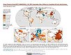
To provide a global gridded data set of commonly-used agricultural pesticides crucial to assess human and ecosystem exposure to potential toxicants for environmental modeling, assessment of agricultural chemical contamination and risk analysis, and other related research at global, regional, national, and local levels. |
Environmental Performance Index and Pilot Trend Environmental Performance Index, 2012 Release (
|
|
Environmental Performance Index, 2022 Release (
|
Environmental Performance Index, 2020 Release (
|
|
Environmental Performance Index, 2018 Release (
|
Environmental Performance Index, 2016 Release (
|
|
Environmental Performance Index, 2014 Release (
|
Environmental Performance Index, 2010 Release (
|
| 2 of 3 |