Data Sets (94)
| 2 of 5 |
Trends in Global Freshwater Availability from the Gravity Recovery and Climate Experiment (GRACE), v1 (
|
Global Fire Emissions Indicators, Grids, v1 (
|
|
Environmental Performance Index, 2018 Release (
|
||
Natural Resource Protection and Child Health Indicators, 2017 Release (
|
Global Urban Heat Island (UHI) Data Set, v1 (2013)Satellite-Derived Environmental Indicators
To provide a global data set of average summer daytime maximum/nighttime minimum land surface temperatures (LSTs) for urban extents, as well as the LST difference between the urban area and the buffer. |
|
Global Summer Land Surface Temperature (LST) Grids, v1 (2013)Satellite-Derived Environmental Indicators
To provide raster representations of global summer daytime maximum and nighttime minimum surface temperature for studies related to human health and climate change. |
Environmental Performance Index, 2016 Release (
|
|
Anthropogenic Biomes of the World, v2 (1700)Anthropogenic BiomesTo provide information on anthropogenic transformation of the biosphere circa 1700 for global land use studies and research on human-environment interactions. |
Anthropogenic Biomes of the World, v2 (1800)Anthropogenic BiomesTo provide information on anthropogenic transformation of the biosphere circa 1800 for global land use studies and research on human-environment interactions. |
|
Anthropogenic Biomes of the World, v2 (2000)Anthropogenic BiomesTo provide information on anthropogenic transformation of the biosphere circa 2000 for global land use studies and research on human-environment interactions. |
Anthropogenic Biomes of the World, v2 (1900)Anthropogenic BiomesTo provide information on anthropogenic transformation of the biosphere circa 1900 for global land use studies and research on human-environment interactions. |
|
Environmental Performance Index, 2014 Release (
|
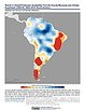
Sea Level Rise Impacts on Ramsar Wetlands of International Importance, v1 (
|
|
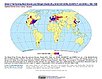
Urban-Rural Population and Land Area Estimates, v2 (1990, 2000, 2010, 2100)Low Elevation Coastal Zone (LECZ)
To provide estimates of urban and rural populations and land areas for the years 1990, 2000, and 2010; and projections to the year 2100 for 202 countries with contiguous coastal elevations in the following categories: less than or equal to 1m, 3m, 5m, 7m, 9m, 10m, 12m, or 20m; as well as national totals. |
||
Population, Landscape, And Climate Estimates (PLACE), v3 (1990, 2000, 2010)National Aggregates of Geospatial Data Collection (NAGDC)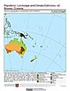
To provide tabular data to researchers without GIS capabilities who need data on population and land area by country across a range of physical characteristics. These include measures such as the number of persons living within coastal zones, the percent of a region within specific elevation strata, or the number of persons living within different climate zones. |
| 2 of 5 |