Data Sets (37)
|
1 of 2
Prev
|
Next
|
Global 1-km Downscaled Population Base Year and Projection Grids Based on the SSPs, v1.01 (
|
Global One-Eighth Degree Population Base Year and Projection Grids Based on the SSPs, v1.01 (
|
|
Global Human Modification of Terrestrial Systems, v1 (2016)Land Use and Land Cover
To provide a cumulative measure of human modification of terrestrial lands based on modeling the physical extents of 13 anthropogenic stressors and their estimated impacts using spatially-explicit global data sets. |
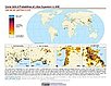
Global Development Potential Indices, v1 (2016)Land Use and Land Cover
To provide spatially-explicit data that relatively rank global land suitability referred to as Development Potential Indices (DPIs) for 13 sectors related to renewable energy, fossil fuels, mining and agriculture as an aid to conservation priority setting. |
|
Development Threat Index, v1 (2015)Land Use and Land Cover (LULC)
To provide a future development threat map based on combining these resources: agricultural expansion, urban expansion, conventional oil and gas, unconventional oil and gas, coal, mining, biofuels, solar, and wind. |
||
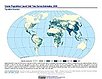
UN WPP-Adjusted Population Density, v4.11 (2000, 2005, 2010, 2015, 2020)Gridded Population of the World (GPW), v4
To provide estimates of population density for the years 2000, 2005, 2010, 2015, and 2020, based on counts consistent with national censuses and population registers with respect to relative spatial distribution, but adjusted to match United Nations country totals. |
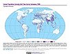
Population Density, v4.11 (2000, 2005, 2010, 2015, 2020)Gridded Population of the World (GPW), v4
To provide estimates of population density for the years 2000, 2005, 2010, 2015, and 2020, based on counts consistent with national censuses and population registers, as raster data to facilitate data integration. |
|
Basic Demographic Characteristics, v4.11 (2010)Gridded Population of the World (GPW), v4To provide estimates of population counts by age and sex for the year 2010, consistent with national censuses and population registers, as raster data to facilitate data integration. |
Population Count, v4.11 (2000, 2005, 2010, 2015, 2020)Gridded Population of the World (GPW), v4
To provide estimates of population count for the years 2000, 2005, 2010, 2015, and 2020, consistent with national censuses and population registers, as raster data to facilitate data integration. |
|
Administrative Unit Center Points with Population Estimates, v4.11 (2000, 2005, 2010, 2015, 2020)Gridded Population of the World (GPW), v4To provide a vector (point) version of the input administrative units used in GPWv4 with population estimates, densities, 2010 basic demographic characteristics, and administrative name, area, and data context for use in data integration. |
||
UN WPP-Adjusted Population Count, v4.11 (2000, 2005, 2010, 2015, 2020)Gridded Population of the World (GPW), v4
To provide estimates of population count for the years 2000, 2005, 2010, 2015, and 2020, consistent with national censuses and population registers with respect to relative spatial distribution, but adjusted to match United Nations country totals. |
||
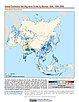
Population Exposure Estimates in Proximity to Nuclear Power Plants, Locations, v1 (
|
||
ATSDR Hazardous Waste Site Polygon Data with CIESIN Modifications, v2 (2010)Superfund Site FootprintsTo provide an easily accessible, corrected data set of polygons for hazardous waste sites in the United States which can be used to identify nearby populations and assess their potential risk. |
U.S. EPA National Priorities List Sites with CIESIN Modifications, v2 (2014)Superfund Site Footprints
To provide an easily accessible, corrected EPA data set of the geo-referenced locations displayed as points for all the National Priorities List (NPL) Superfund sites in the United States, Puerto Rico, and other territories. |
|
1 of 2
Prev
|
Next
|