Data Sets (110)
| 4 of 6 |
ATSDR Hazardous Waste Site Polygon Data, v2 (2010)Superfund Site FootprintsTo provide the ATSDR polygon data set of hazardous waste sites in the United States, Puerto Rico, and other territories which can be used to identify nearby populations and assess their potential risk. |
Environmental Performance Index, 2010 Release (
|
|
Change in Chlorophyll-a Concentration, v1 (
|
||
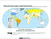
Fourth Assessment Report (AR4) Observed Climate Change Impacts, v1 (
|
||
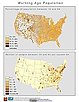
Summary File 3: Metropolitan Statistical Areas, v1 (2000)U.S. Census Grids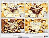
To provide gridded demographic data, including characteristics of income, education, and housing, for metropolitan statistical areas at a finer resolution than is available in the 30 arc-second grids used for the United States as a whole. |
||
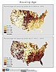
Summary File 1: Metropolitan Statistical Areas, v1 (2000)U.S. Census Grids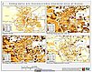
To provide gridded demographic data, including characteristics of age, race, ethnicity, and housing, for metropolitan statistical areas at a finer resolution than is available in the 30 arc-second grids used for the United States as a whole. |
||
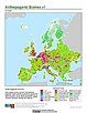
Synthetic Assessment of Global Distribution of Vulnerability to Climate Change, v1 (2005, 2050, 2100)Intergovernmental Panel on Climate Change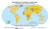
To provide geographical portraits of vulnerability designed to incorporate both exposure to climate change and national capacities to adapt. |
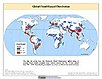
Global Flood Hazard Frequency and Distribution, v1 (
|
|
Global Landslide Mortality Risks and Distribution, v1 (2000)Natural Disaster Hotspots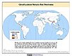
To provide a means of assessing global landslide mortality risks and distribution. |
Global Cyclone Hazard Frequency and Distribution, v1 (
|
|
Global Volcano Hazard Frequency and Distribution, v1 (
|
Global Drought Total Economic Loss Risk Deciles, v1 (2000)Natural Disaster Hotspots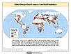
To provide a spatial surface of the total economic impacts of global drought hazard. |
|
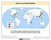
Global Volcano Proportional Economic Loss Risk Deciles, v1 (2000)Natural Disaster Hotspots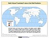
To provide a spatial surface of the proportional economic impacts of global volcano hazard. |
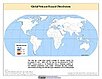
Global Earthquake Proportional Economic Loss Risk Deciles, v1 (2000)Natural Disaster Hotspots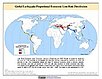
To provide a spatial surface of the proportional economic impacts of global earthquake hazard. |
|
Global Landslide Total Economic Loss Risk Deciles, v1 (2000)Natural Disaster Hotspots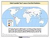
To provide a spatial surface of the total economic impacts of global landslide hazard. |
Global Earthquake Hazard Frequency and Distribution, v1 (
|
| 4 of 6 |