Data Sets (16)
|
1 of 1
Prev
|
Next
|
SDG Indicator 11.2.1: Urban Access to Public Transport, 2023 Release (
|
SDG Indicator 11.7.1: Urban Public Space, Availability and Access, 2023 Release (
|
|
Country Trends in Major Air Pollutants, v1 (
|
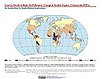
Urban Extent Polygons, v1.02 (1995)Global Rural-Urban Mapping Project (GRUMP), v1To provide a polygon representation of urban areas with city or agglomeration name and time series population estimates. |
|
Settlement Points, v1.01 (1990, 1995, 2000)Global Rural-Urban Mapping Project (GRUMP), v1To provide populated place (point) data with consistent population estimates. |
Global Human Built-up And Settlement Extent (HBASE) Dataset From Landsat, v1 (2010)Global High Resolution Urban Data from Landsat
To provide high spatial resolution estimates of global urban extent derived from global 30m Landsat satellite data for the target year 2010 and a companion dataset to the Global Man-made Impervious Surface (GMIS) dataset. |
|
Global Man-made Impervious Surface (GMIS) Dataset From Landsat, v1 (2010)Global High Resolution Urban Data from Landsat
To provide high spatial resolution estimates of global man-made imperviousness for the target year 2010, derived from global 30m Landsat satellite data and a companion dataset to the Global Human Built-up And Settlement Extent (HBASE) dataset. |
Population Count Grid, v1 (1990, 1995, 2000)Global Rural-Urban Mapping Project (GRUMP), v1To provide a time series of raster population data for ntegration with other data sets. |
|
Urban Extents Grid, v1 (1995)Global Rural-Urban Mapping Project (GRUMP), v1
To provide a raster representation of urban areas (or urban mask) for use with GRUMP population grids or other data sets. |
Land and Geographic Unit Area Grids, v1 (2000)Global Rural-Urban Mapping Project (GRUMP), v1To provide land area data for use with GRUMPv1 population and urban data as well as a quantitative measure of resolution of the input spatial units for GRUMPv1. |
|
Population Density Grid, v1 (1990, 1995, 2000)Global Rural-Urban Mapping Project (GRUMP), v1
To provide a time series of raster population density data for data integration. |
National Administrative Boundaries, v1 (2000)Global Rural-Urban Mapping Project (GRUMP), v1To permit cartographic display of countries and territories that exactly match the GRUMPv1 population surfaces |
|
Settlement Points, v1 (1990, 1995, 2000)Global Rural-Urban Mapping Project (GRUMP), v1
To provide populated place (point) data with consistent population estimates. |
Coastlines, v1 (2000)Global Rural-Urban Mapping Project (GRUMP), v1To permit cartographic display of coastlines that exactly match the GRUMPv1 population surfaces. |
|
National Identifier Grid, v1 (1995, 2000, 2010)Global Rural-Urban Mapping Project (GRUMP), v1To permit the summation of population values by country/territory and, in combination with other data layers, the summation of population values by irregular areas represented in the other data layers and country/territory. |
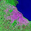
Urban Landsat: Cities from Space, v1 (
|


|
1 of 1
Prev
|
Next
|