Socioeconomic Data and Applications Center (
sedac
)
A Data Center in NASA's Earth Observing System Data and Information System (
EOSDIS
) — Hosted by
CIESIN
at
Columbia University
Search SEDAC
Data
Data Sets
Maps
Web Pages
search
Data
· Data Sets
· Data Collections
· Featured Data Uses
· Data Citations
· Citations Database
· Data Submission
Maps
· Map Gallery
· Map Viewer
· Map Services
· Mapping Tools
Themes
· Agriculture
· Climate
· Conservation
· Governance
· Hazards
· Health
· Infrastructure
· Land Use
· Marine and Coastal
· Population
· Poverty
· Remote Sensing
· Sustainability
· Urban
· Water
Resources
· Guides
· Multimedia
· Networks
· News
· Publications
· Related Sites
· Remote Sensing
· Tools
Social Media
· Twitter
· FaceBook
· YouTube
· Flickr
· Blog Posts
· Communities
About
· About SEDAC
· User Working Group
· Privacy
· User Registration
Help
Map Gallery
(398)
Follow Us:
Twitter
Follow Us on Facebook
YouTube
Flickr
| Share:
Twitter
Facebook
Search
All Fields:
search
Maps
»
Theme: Sustainability
Remove Facet
»
Region: Global
Remove Facet
4 of 13
Prev
|
Next
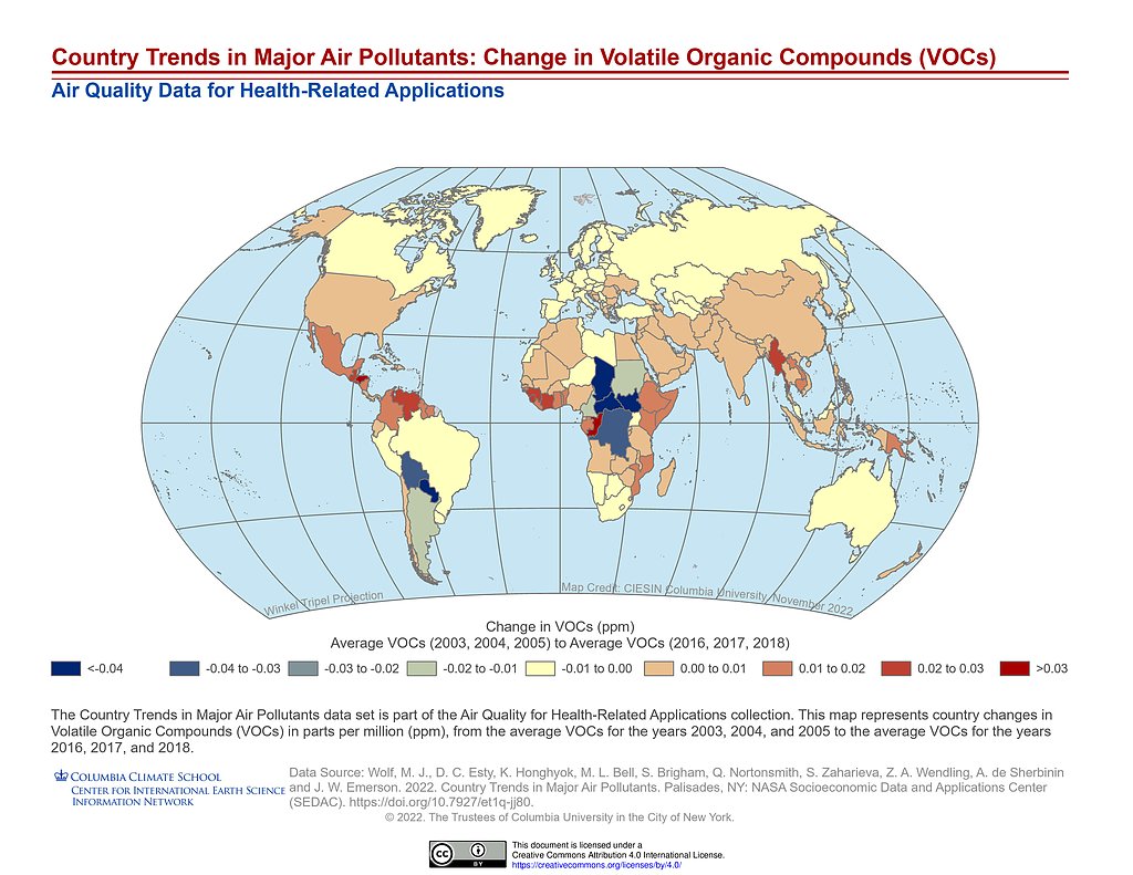
Country Trends Major Air Pollutants: VOCs Change
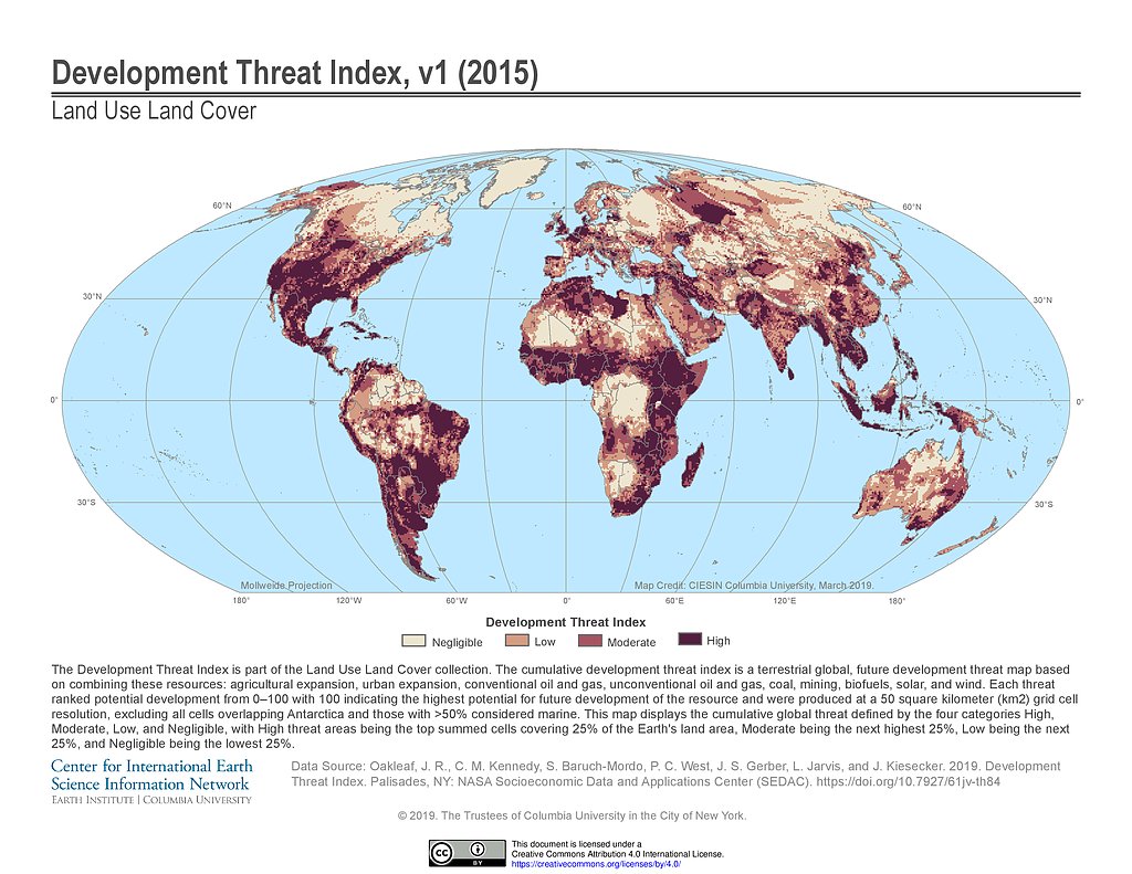
Development Threat Index (2015)
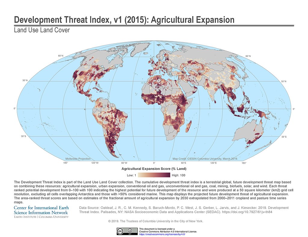
Development Threat Index (2015): Agricultural Expansion
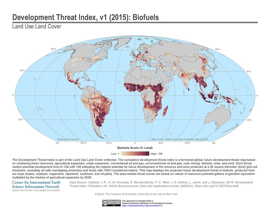
Development Threat Index (2015): Biofuels
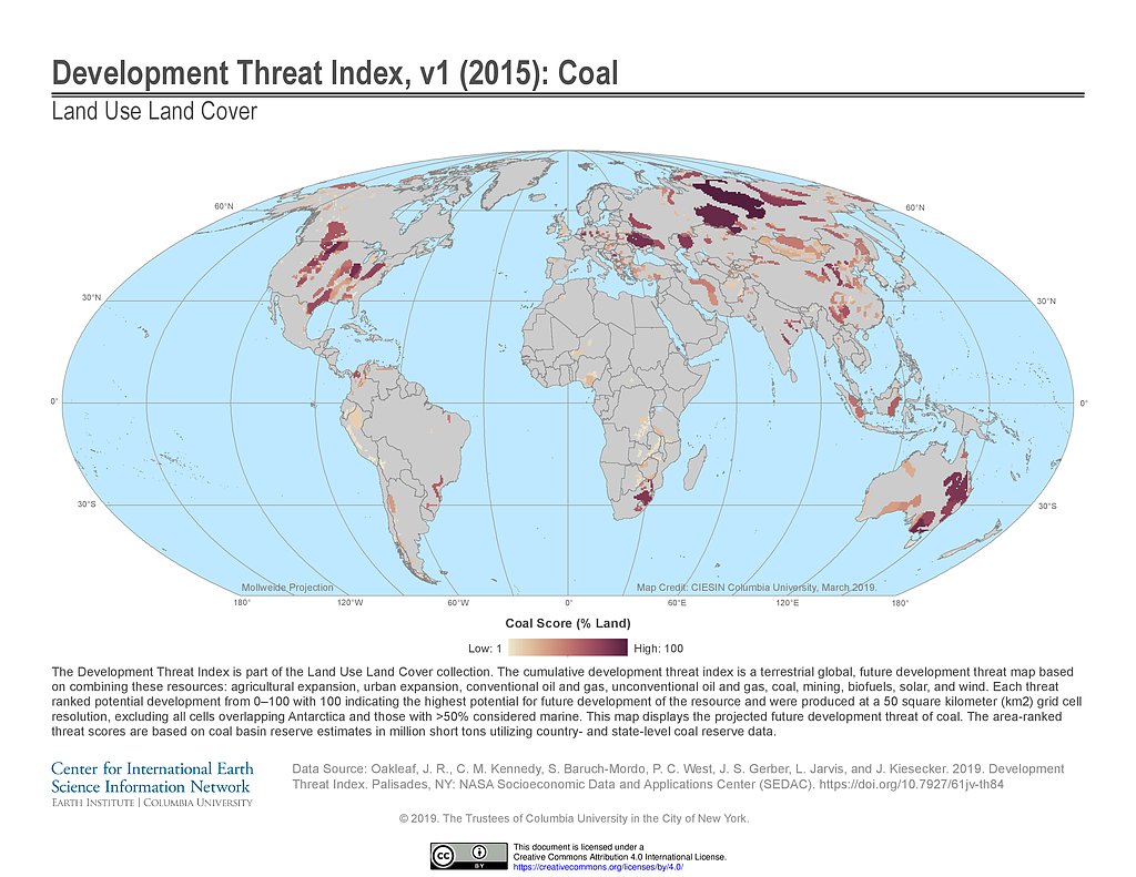
Development Threat Index (2015): Coal
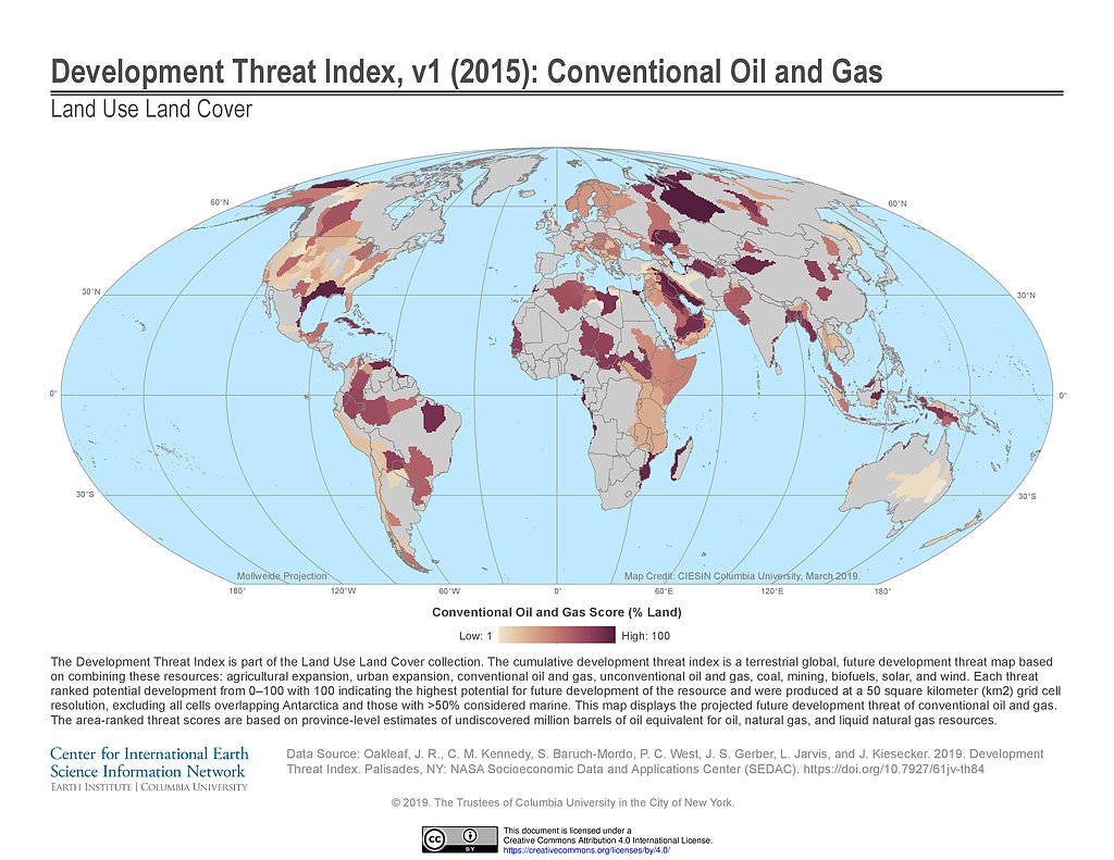
Development Threat Index (2015): Conventional Oil and Gas
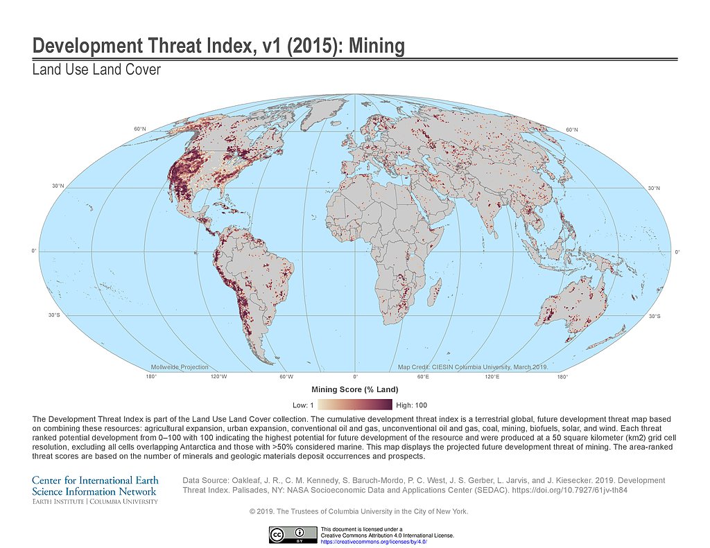
Development Threat Index (2015): Mining
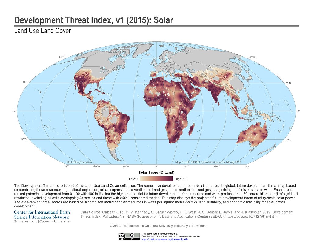
Development Threat Index (2015): Solar
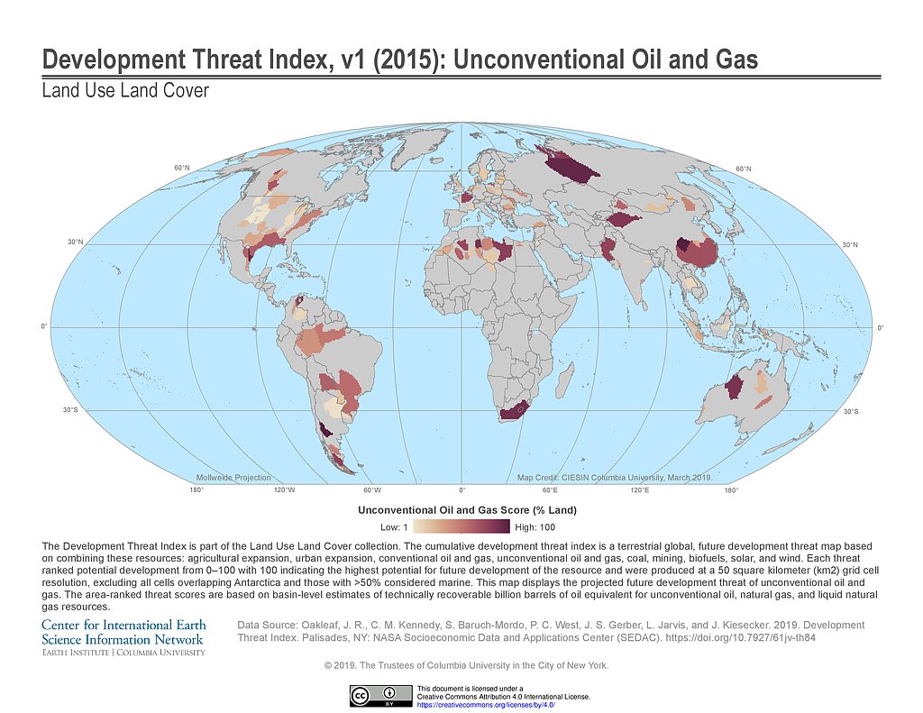
Development Threat Index (2015): Unconventional Oil and Gas
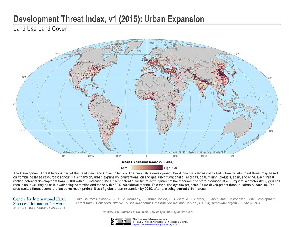
Development Threat Index (2015): Urban Expansion
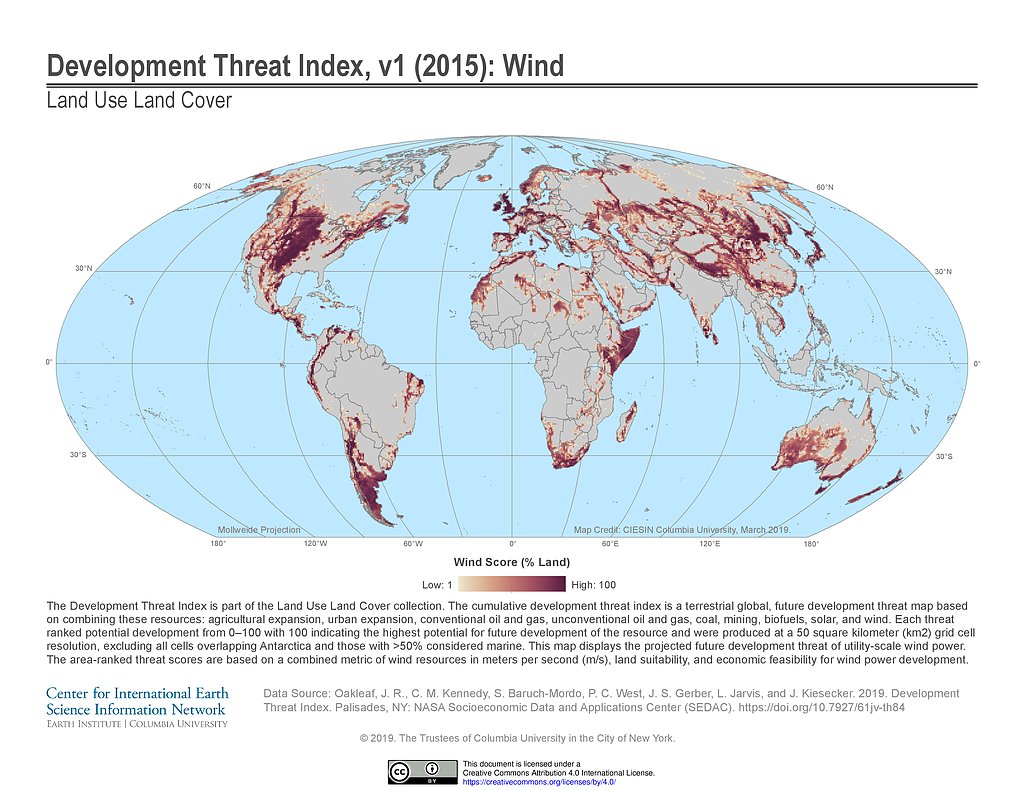
Development Threat Index (2015): Wind
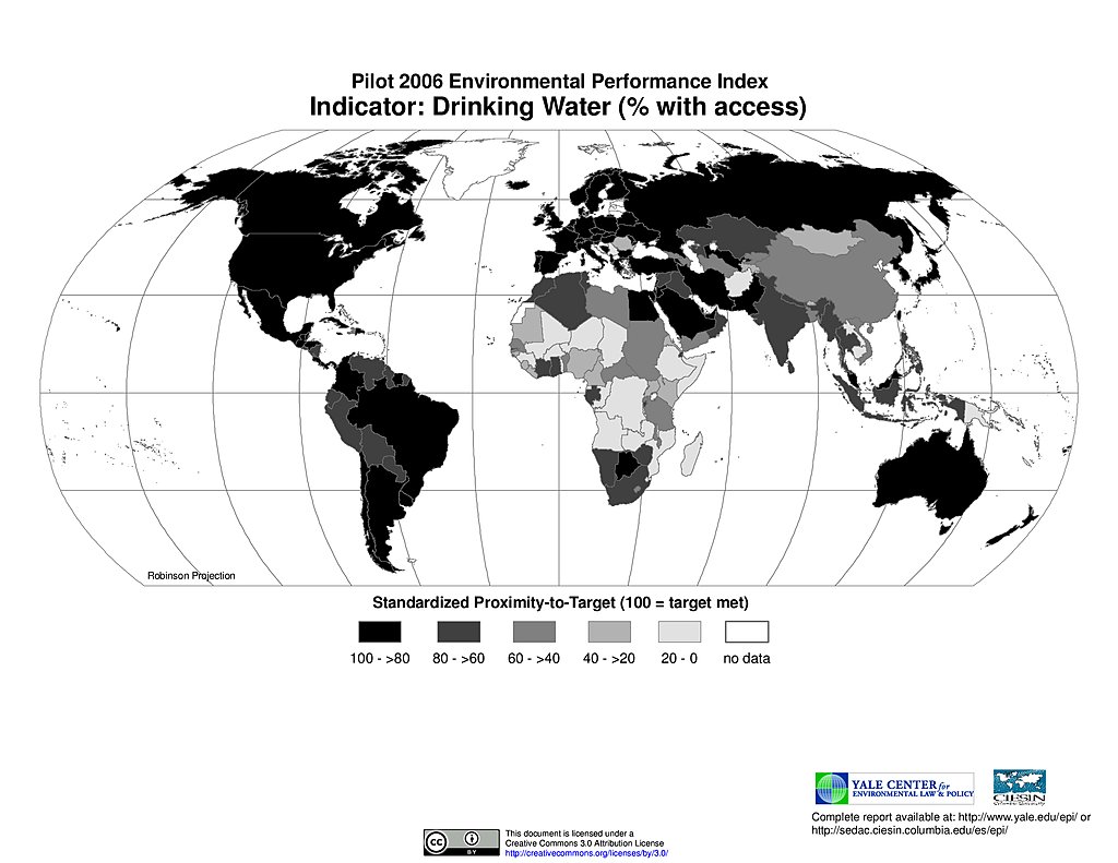
Drinking Water, Pilot EPI 2006
Ecoregion Protection, Pilot EPI 2006
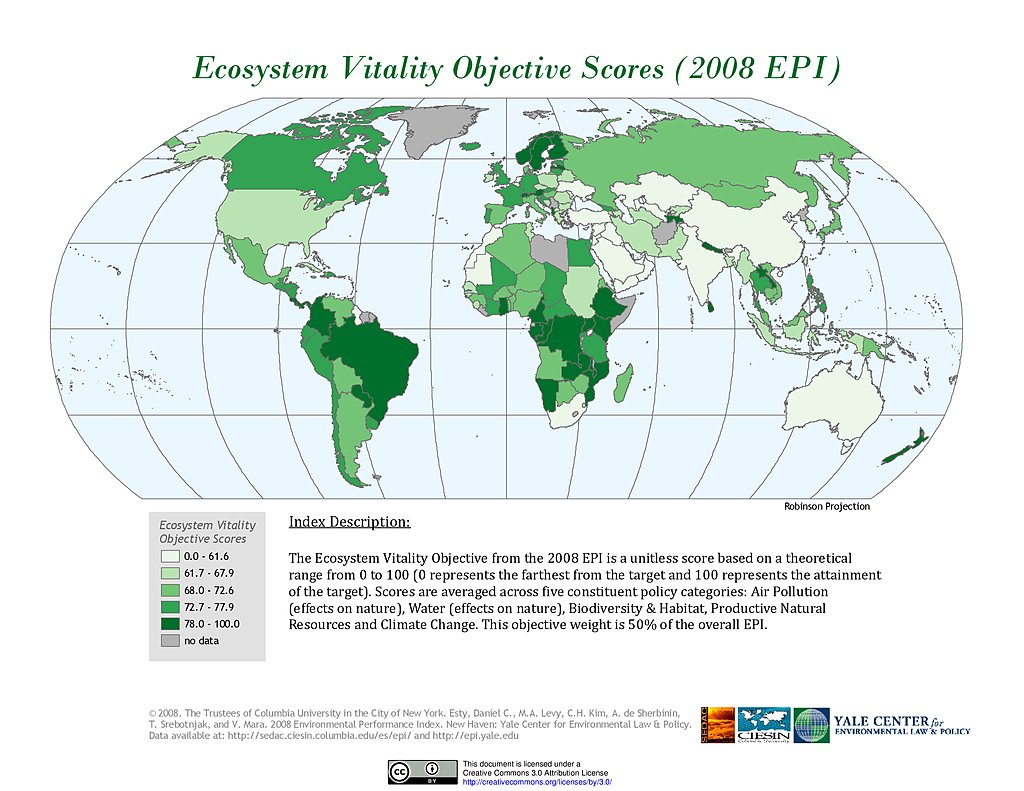
Ecosystem Vitality , EPI 2008
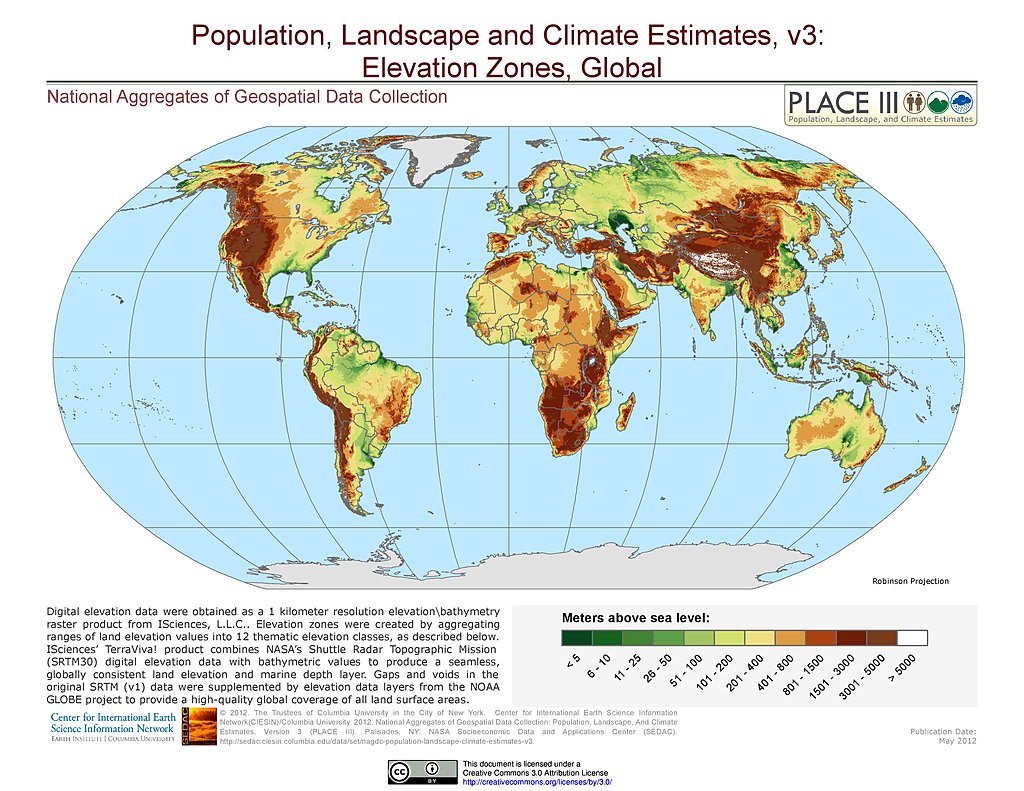
Elevation Zones
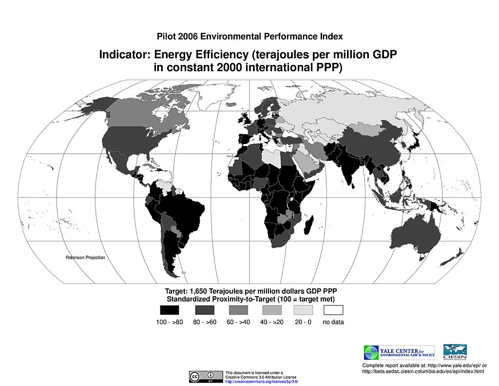
Energy Efficiency, Pilot EPI 2006
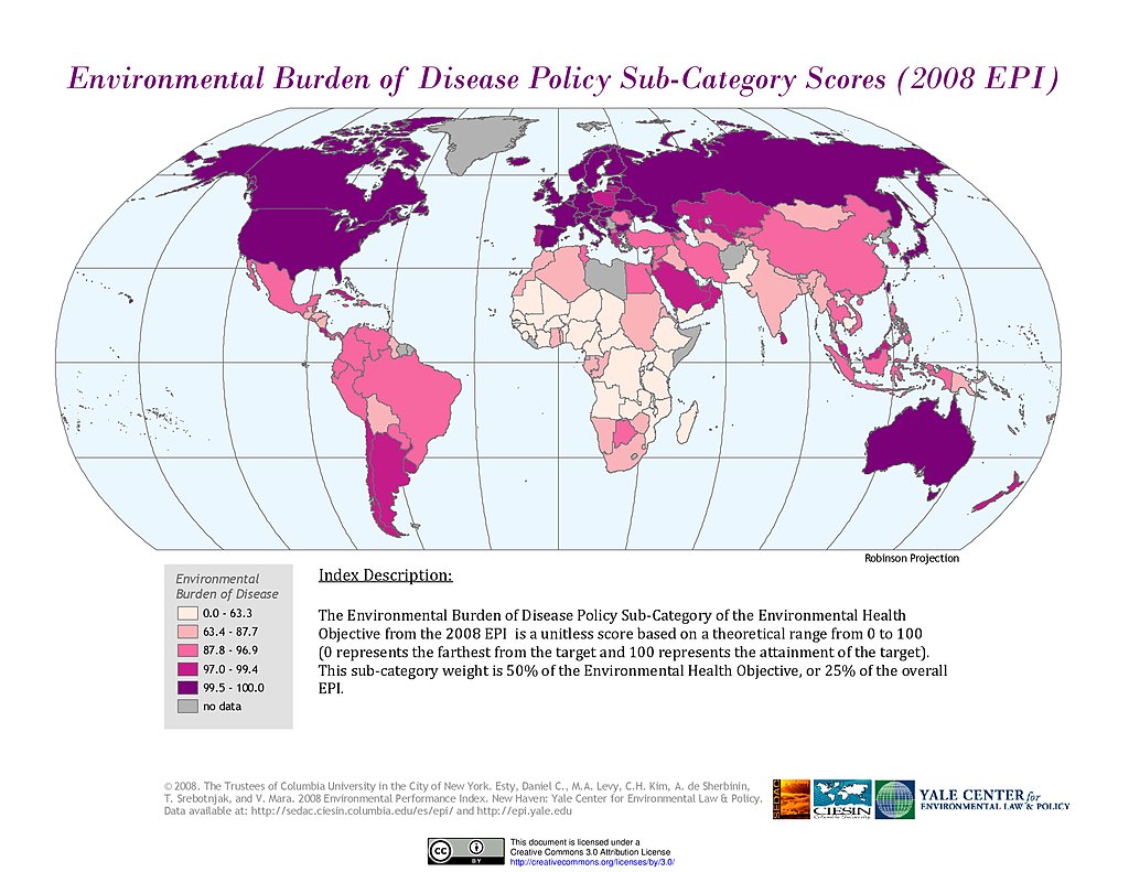
Environmental Burden of Disease, EPI 2008
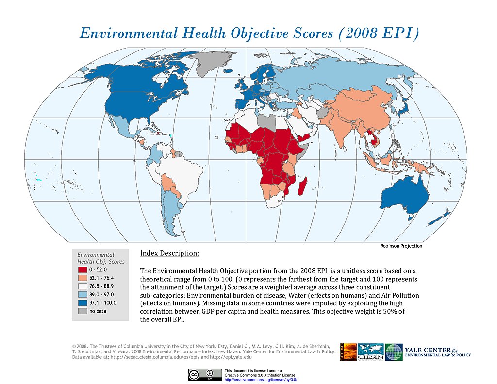
Environmental Health, EPI 2008
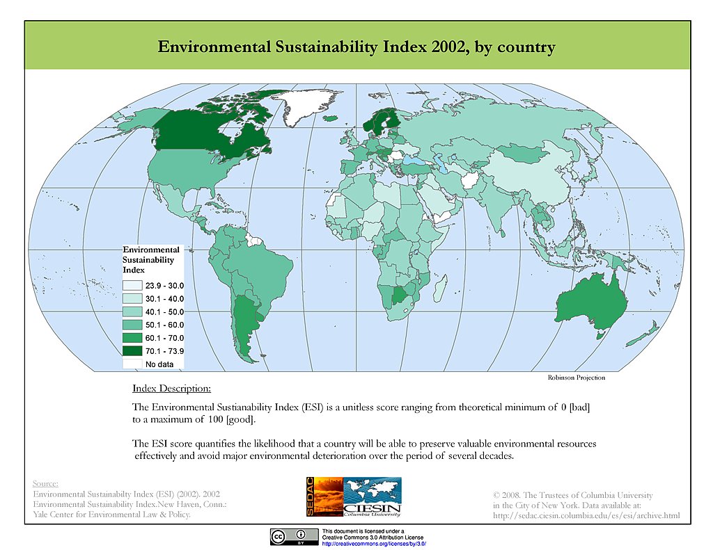
ESI 2002
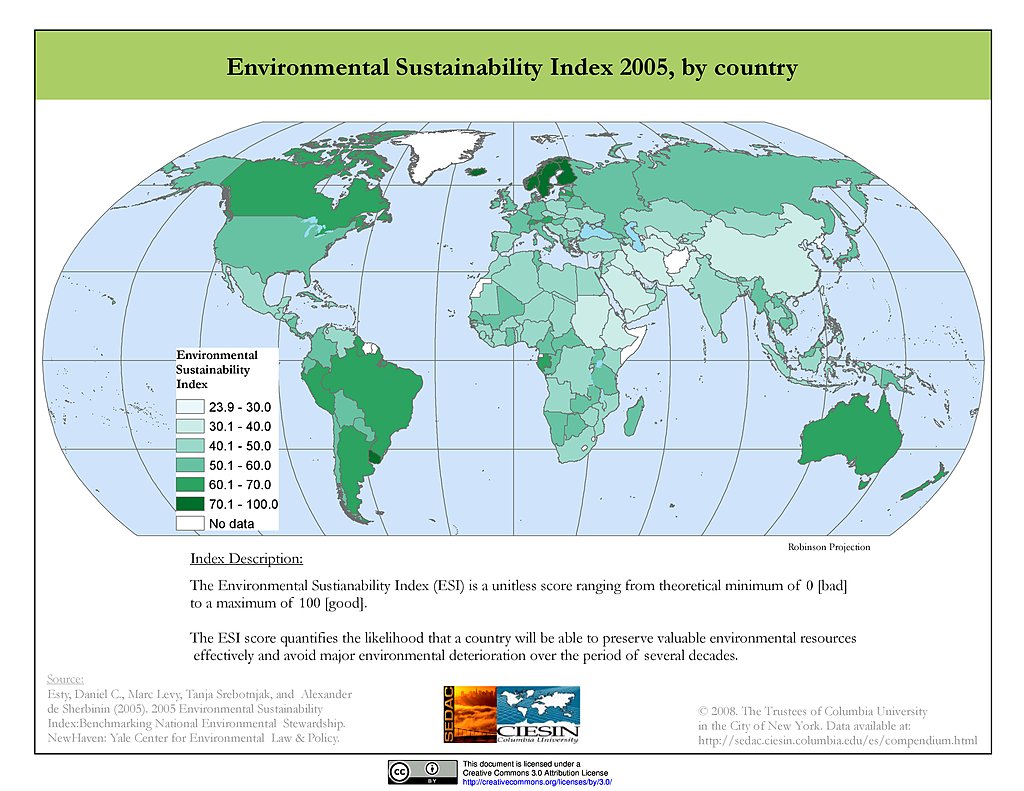
ESI 2005
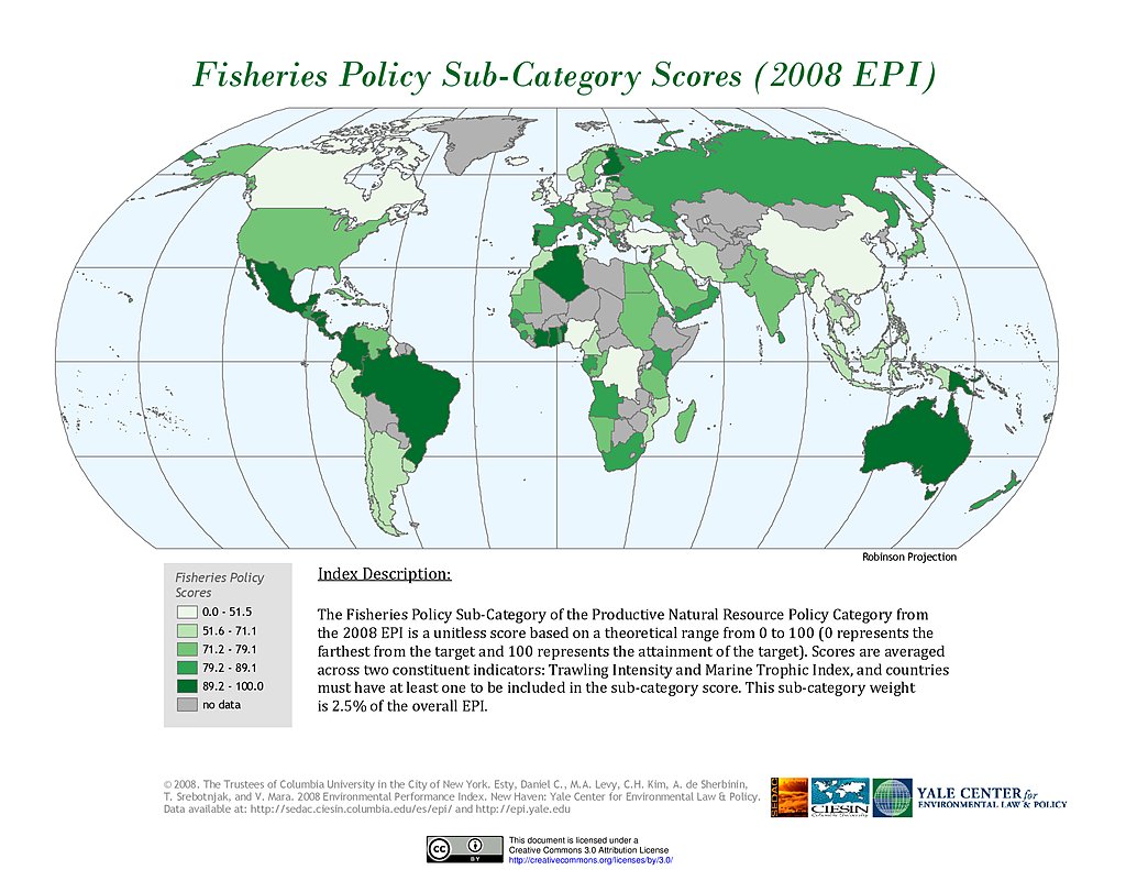
Fisheries, EPI 2008
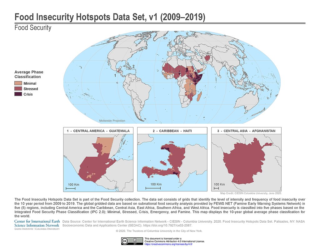
Food Insecurity Hotspots (2009-2019)
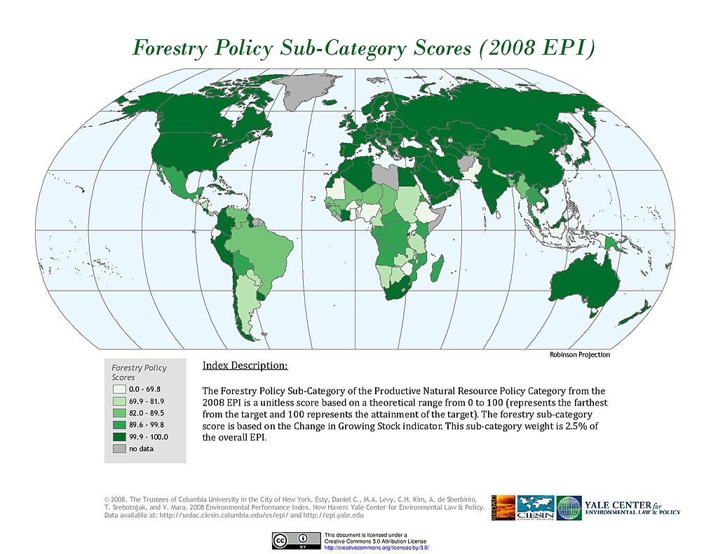
Forestry, EPI 2008
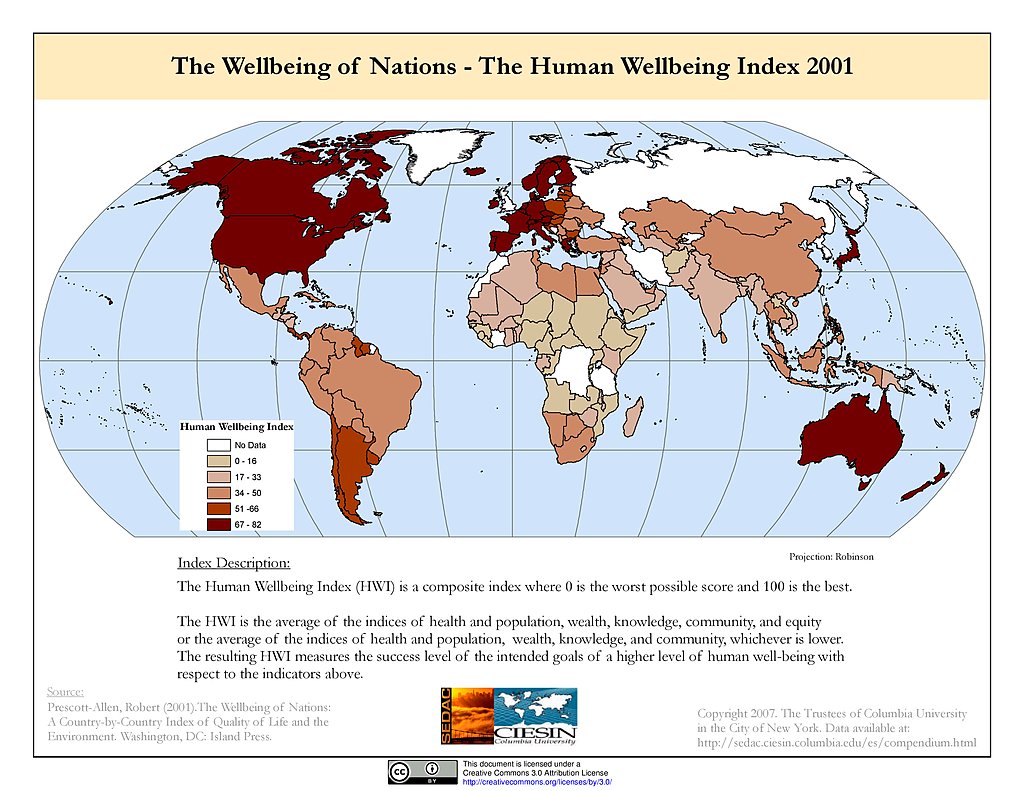
Human Wellbeing Index (2001)
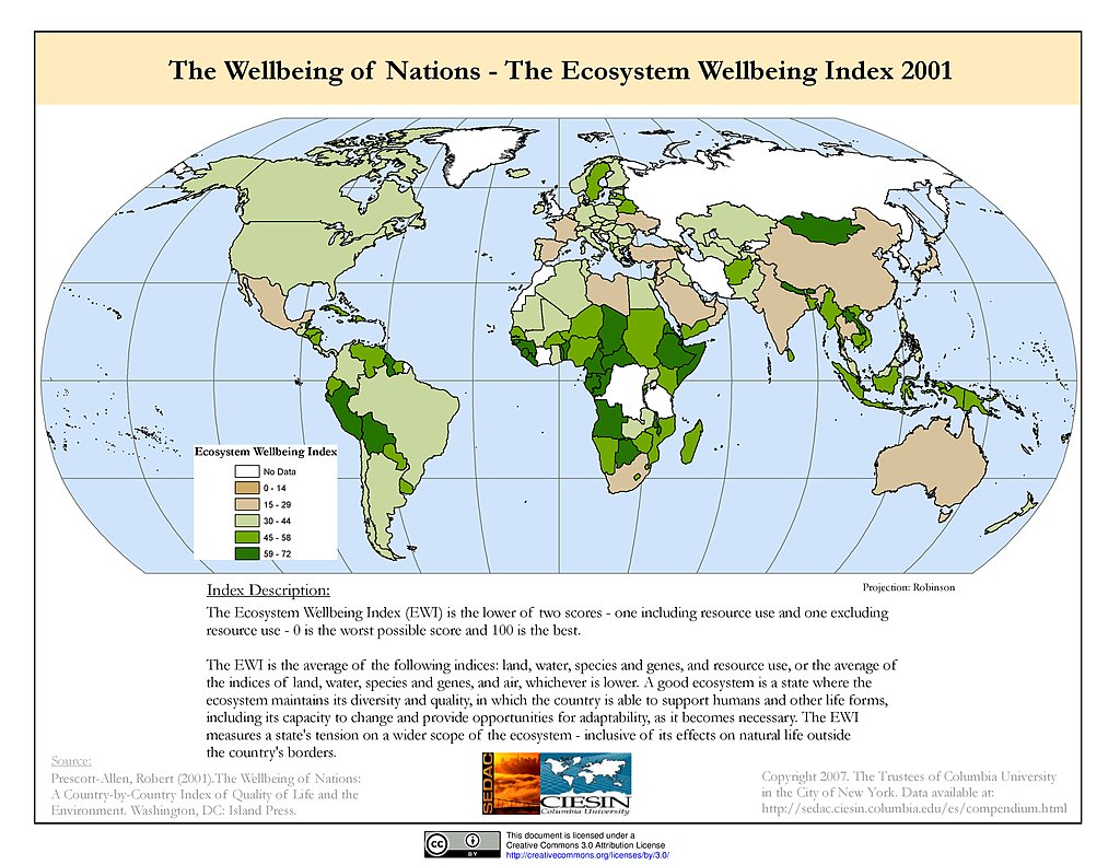
Ecosystem Wellbeing Index (2001)
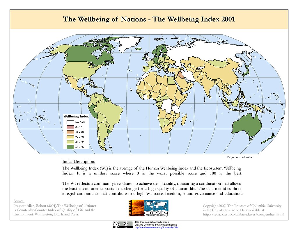
Wellbeing Index (2001)
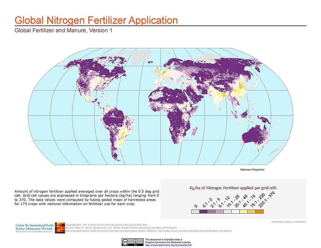
Nitrogen Fertilizer Application
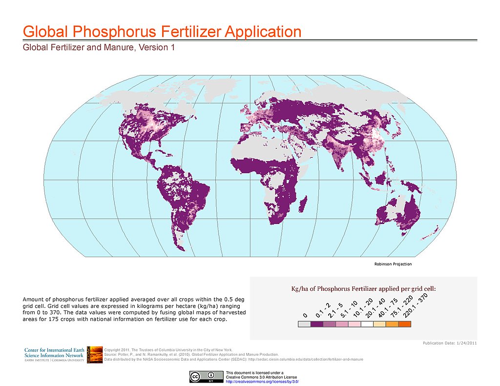
Phosphorus Fertilizer Application
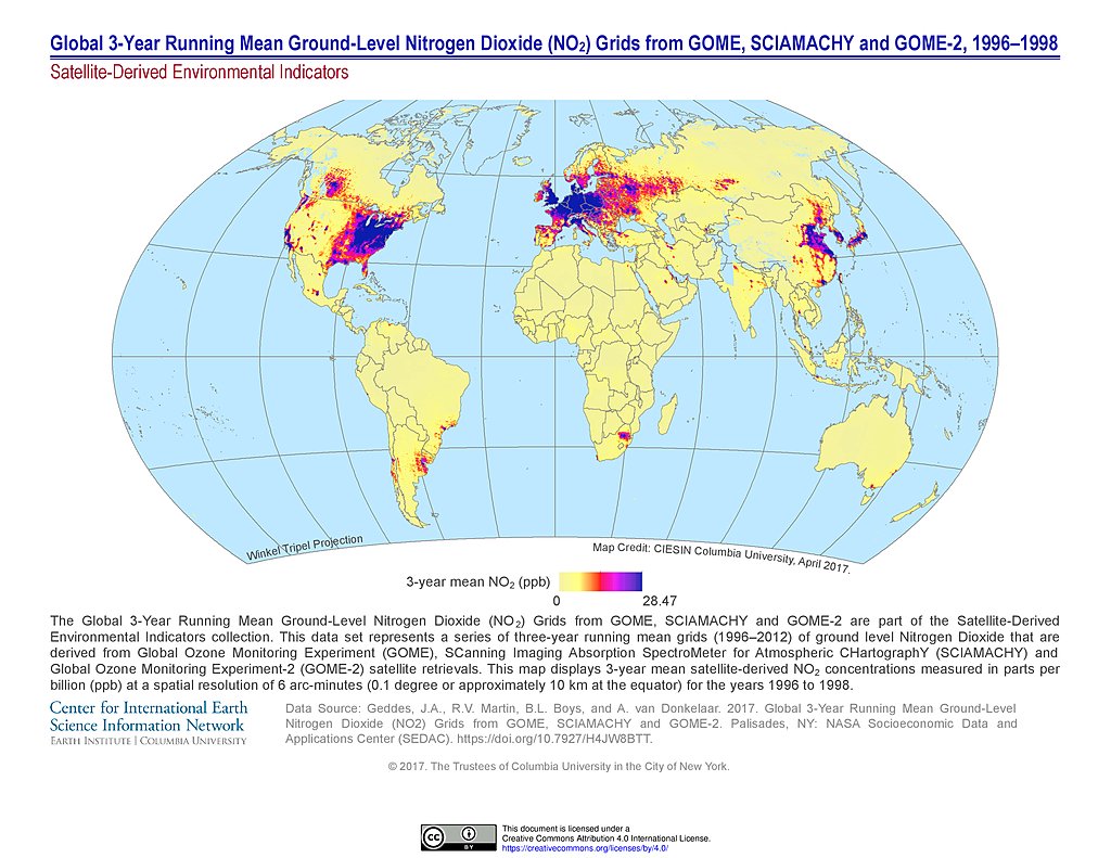
NO2 Grids (1996-1998)
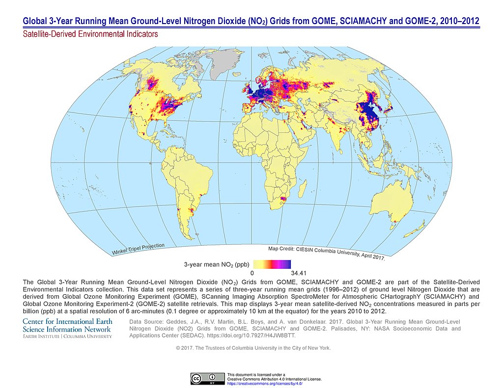
NO2 Grids (2010-2012)
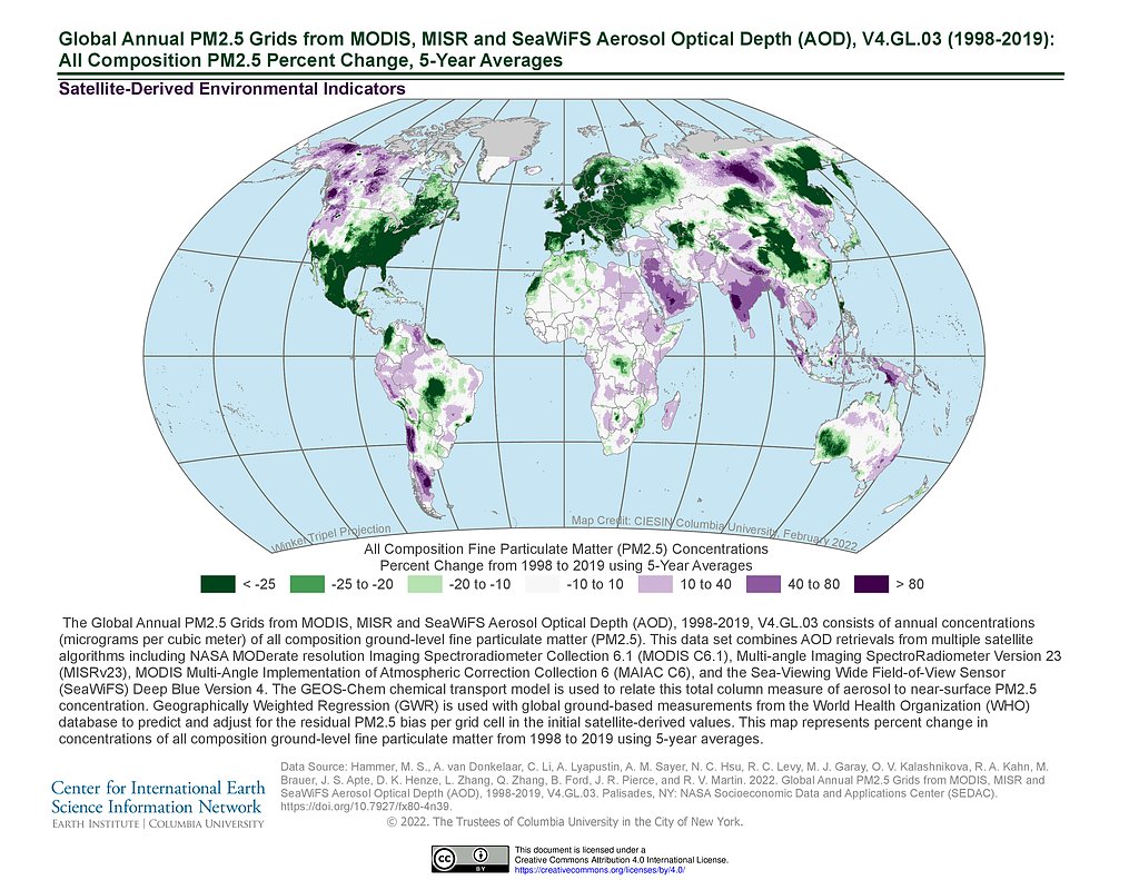
PM 2.5 Grids V4.GL.03 (1998-2019): % Change
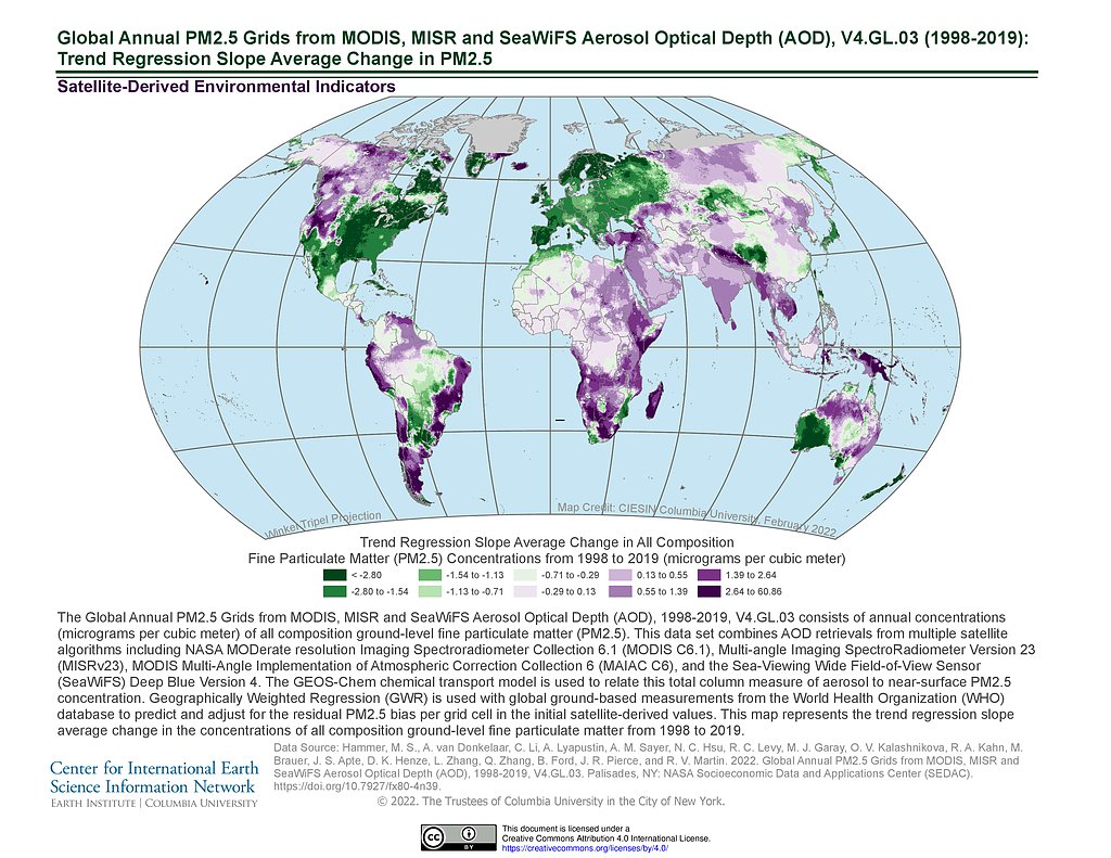
PM 2.5 Grids V4.GL.03 (1998-2019): Trend Avg Change
Maps
»
Theme: Sustainability
Remove Facet
»
Region: Global
Remove Facet
4 of 13
Prev
|
Next