Socioeconomic Data and Applications Center (
sedac
)
A Data Center in NASA's Earth Observing System Data and Information System (
EOSDIS
) — Hosted by
CIESIN
at
Columbia University
Search SEDAC
Data
Data Sets
Maps
Web Pages
search
Data
· Data Sets
· Data Collections
· Featured Data Uses
· Data Citations
· Citations Database
· Data Submission
Maps
· Map Gallery
· Map Viewer
· Map Services
· Mapping Tools
Themes
· Agriculture
· Climate
· Conservation
· Governance
· Hazards
· Health
· Infrastructure
· Land Use
· Marine and Coastal
· Population
· Poverty
· Remote Sensing
· Sustainability
· Urban
· Water
Resources
· Guides
· Multimedia
· Networks
· News
· Publications
· Related Sites
· Remote Sensing
· Tools
Social Media
· Twitter
· FaceBook
· YouTube
· Flickr
· Blog Posts
· Communities
About
· About SEDAC
· User Working Group
· Privacy
· User Registration
Help
Map Gallery
(398)
Follow Us:
Twitter
Follow Us on Facebook
YouTube
Flickr
| Share:
Twitter
Facebook
Search
All Fields:
search
Maps
»
Theme: Sustainability
Remove Facet
»
Region: Global
Remove Facet
5 of 13
Prev
|
Next
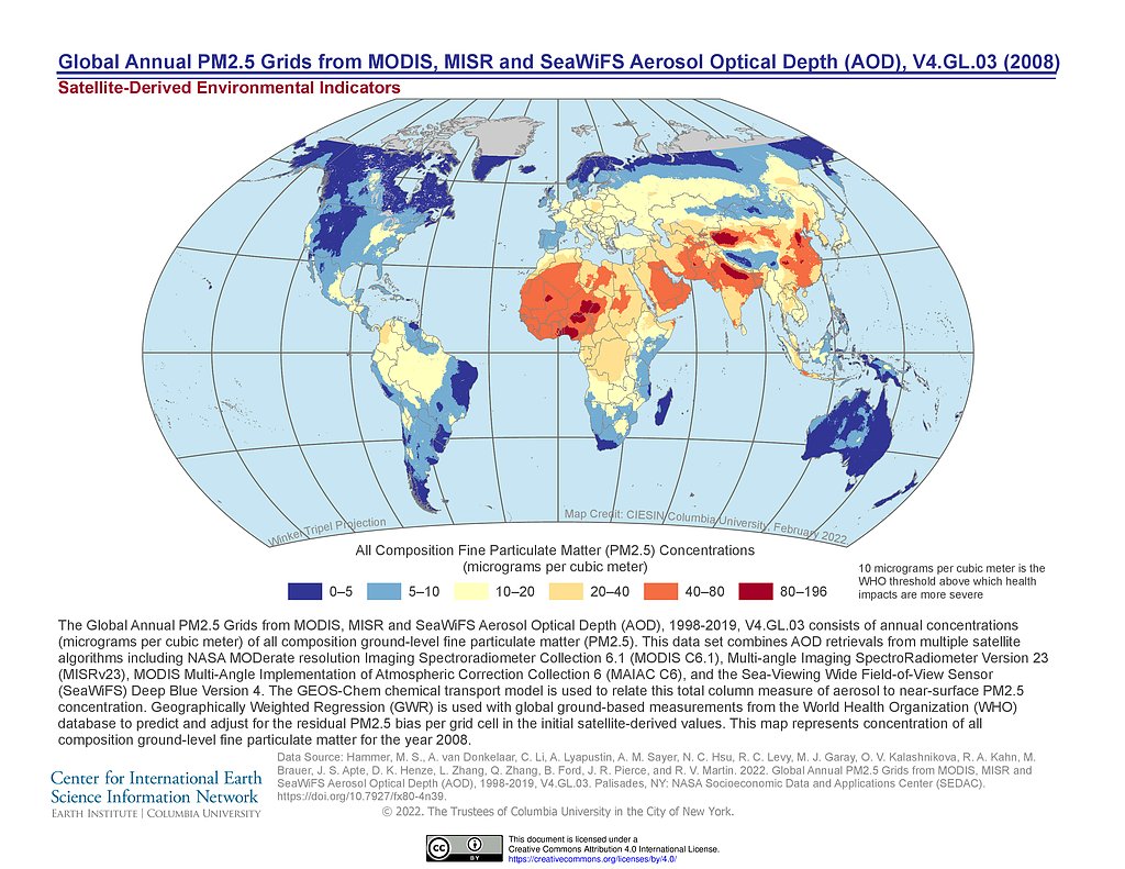
PM 2.5 Grids V4.GL.03 (2008)
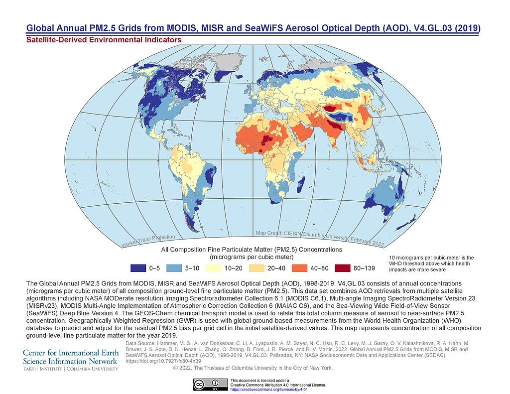
PM 2.5 Grids V4.GL.03 (2019)
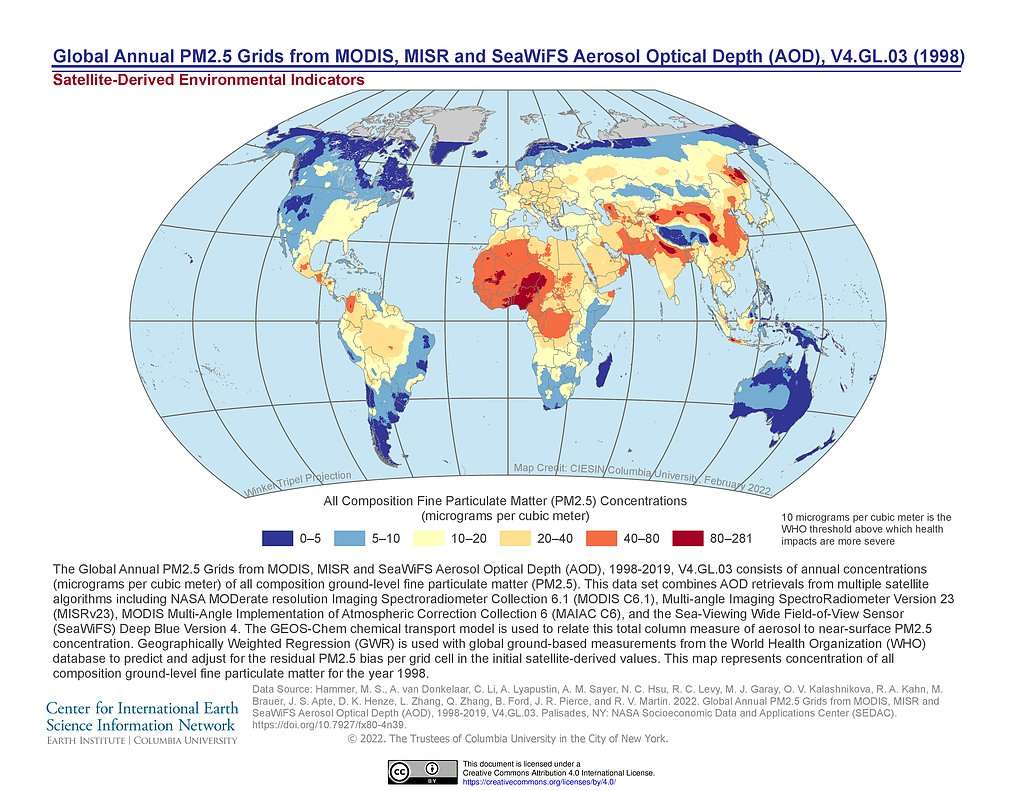
PM 2.5 Grids V4.GL.03 (1998)
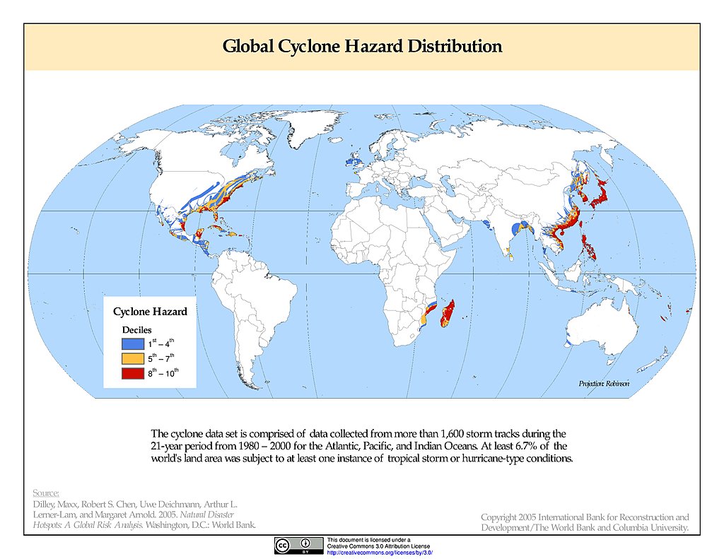
Cyclone Hazard Frequency & Distribution
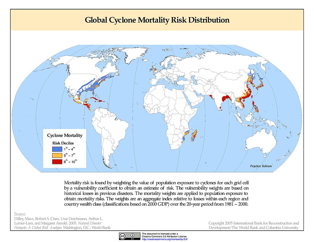
Cyclone Mortality Risks & Distribution
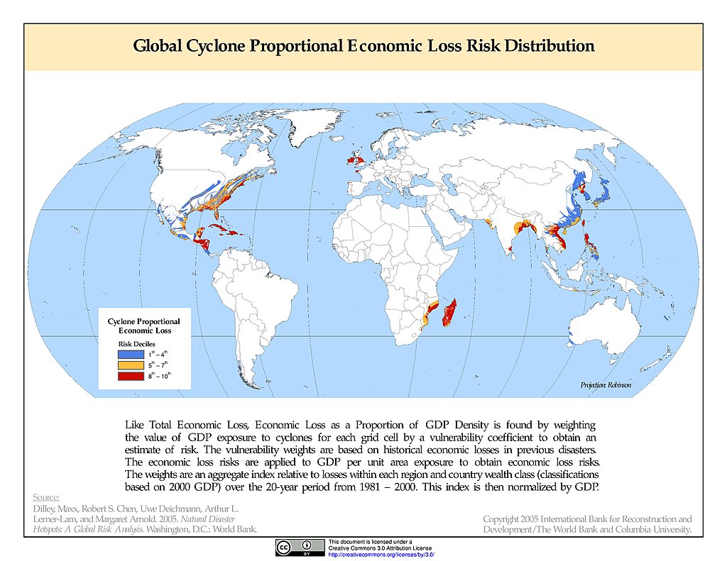
Cyclone Proportional Economic Loss Risk Deciles
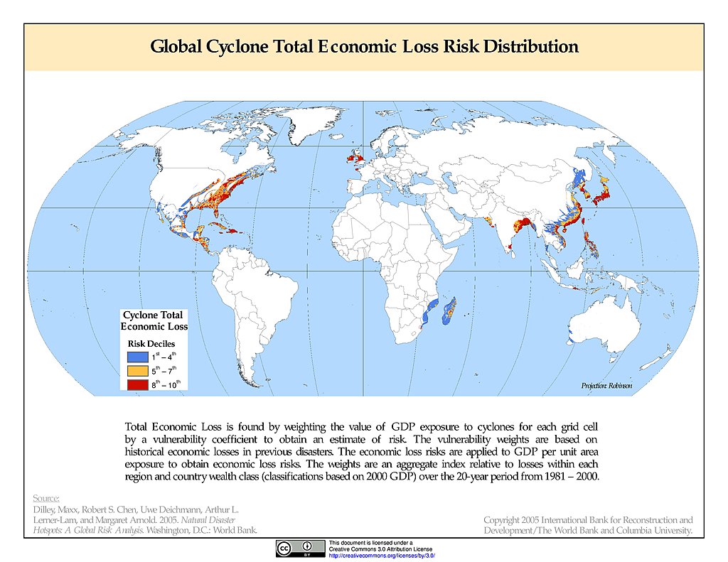
Cyclone Total Economic Loss Risk Deciles
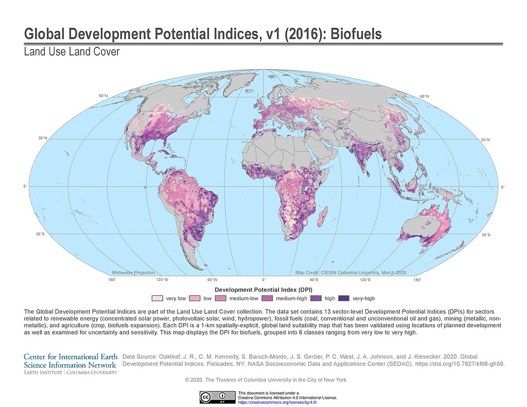
Development Potential Indices (2016): Biofuels
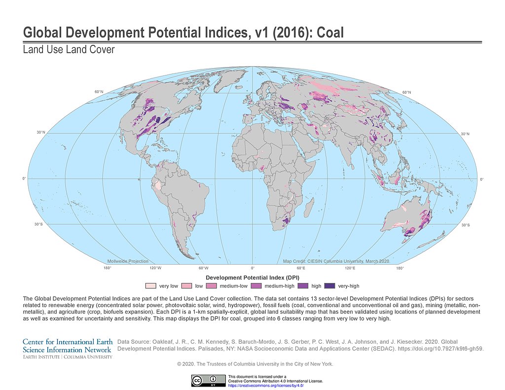
Development Potential Indices (2016): Coal
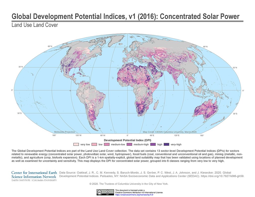
Development Potential Indices (2016): Concentrated Solar Power
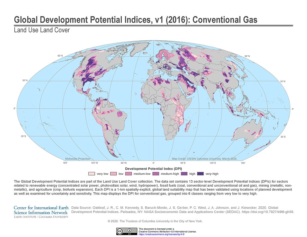
Development Potential Indices (2016): Conventional Gas
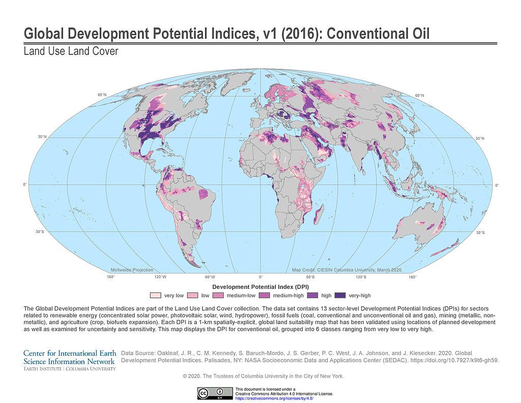
Development Potential Indices (2016): Conventional Oil
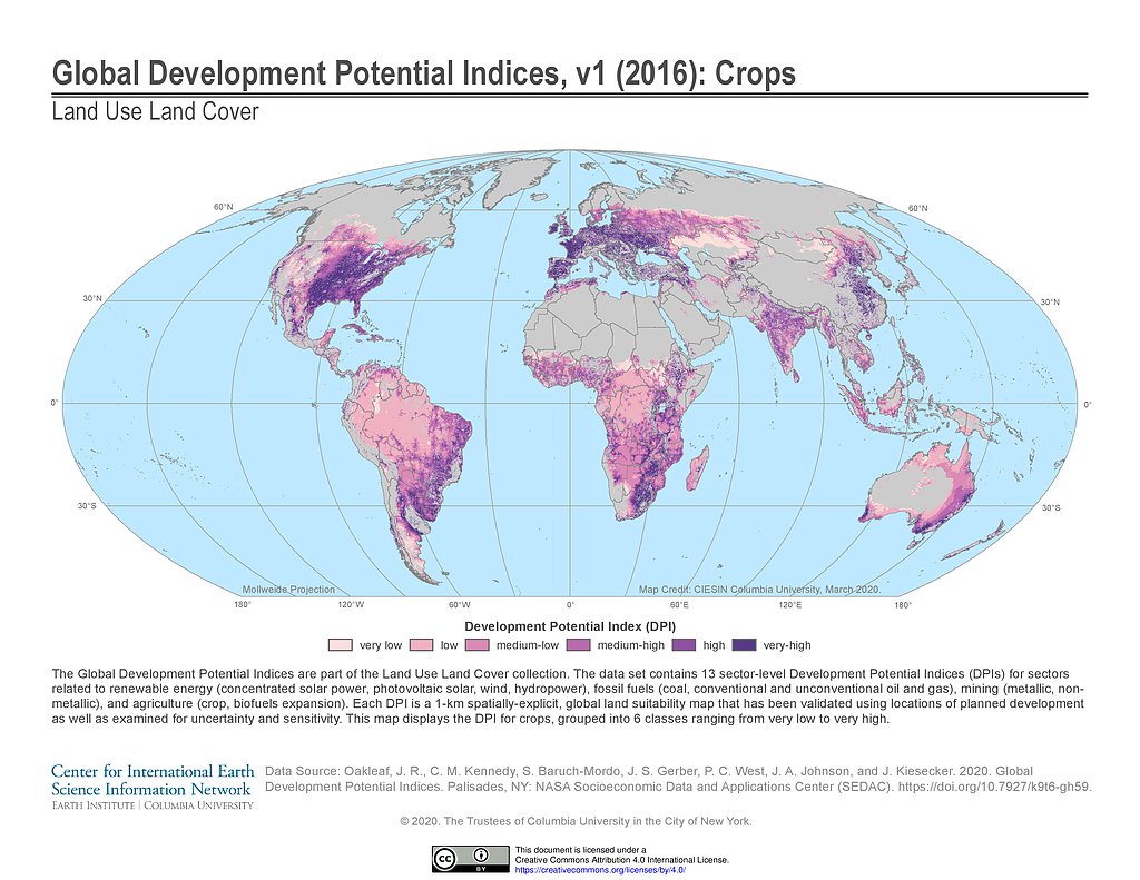
Development Potential Indices (2016): Crops
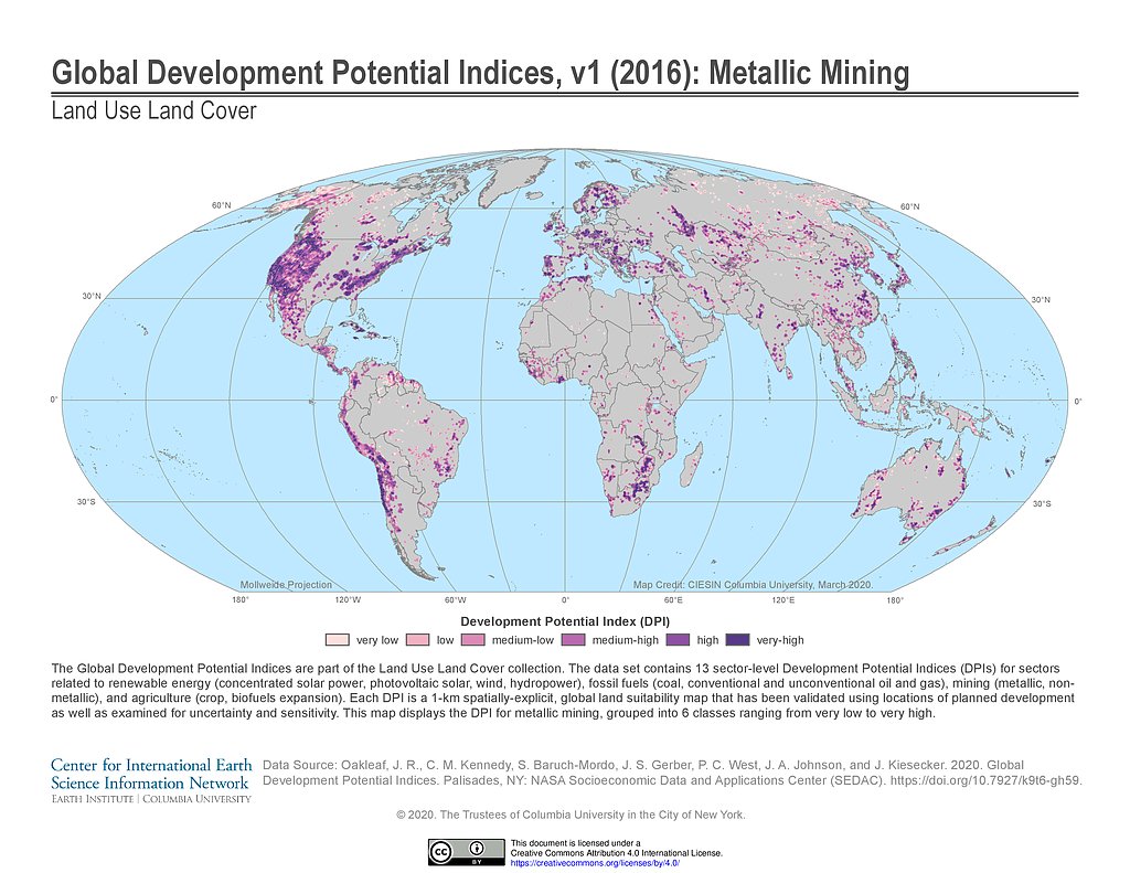
Development Potential Indices (2016): Metallic Mining
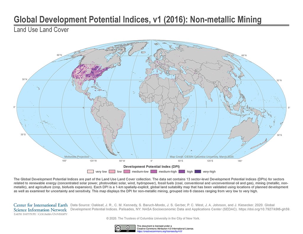
Development Potential Indices (2016): Non-metallic Mining
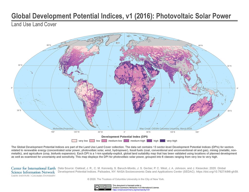
Development Potential Indices (2016): Photovoltaic Solar Power
Development Potential Indices (2016): Unconventional Gas
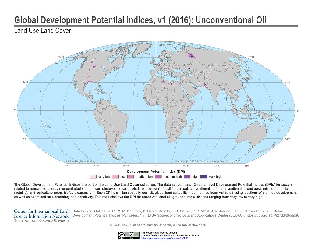
Development Potential Indices (2016): Unconventional Oil
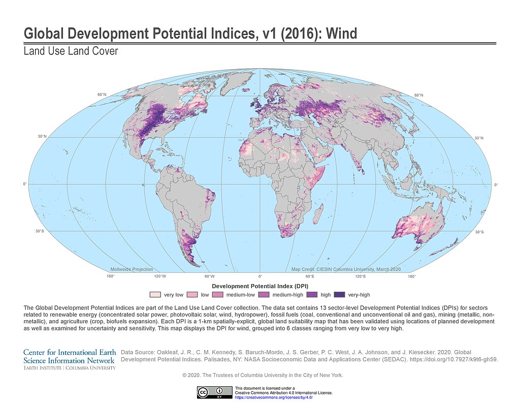
Development Potential Indices (2016): Wind
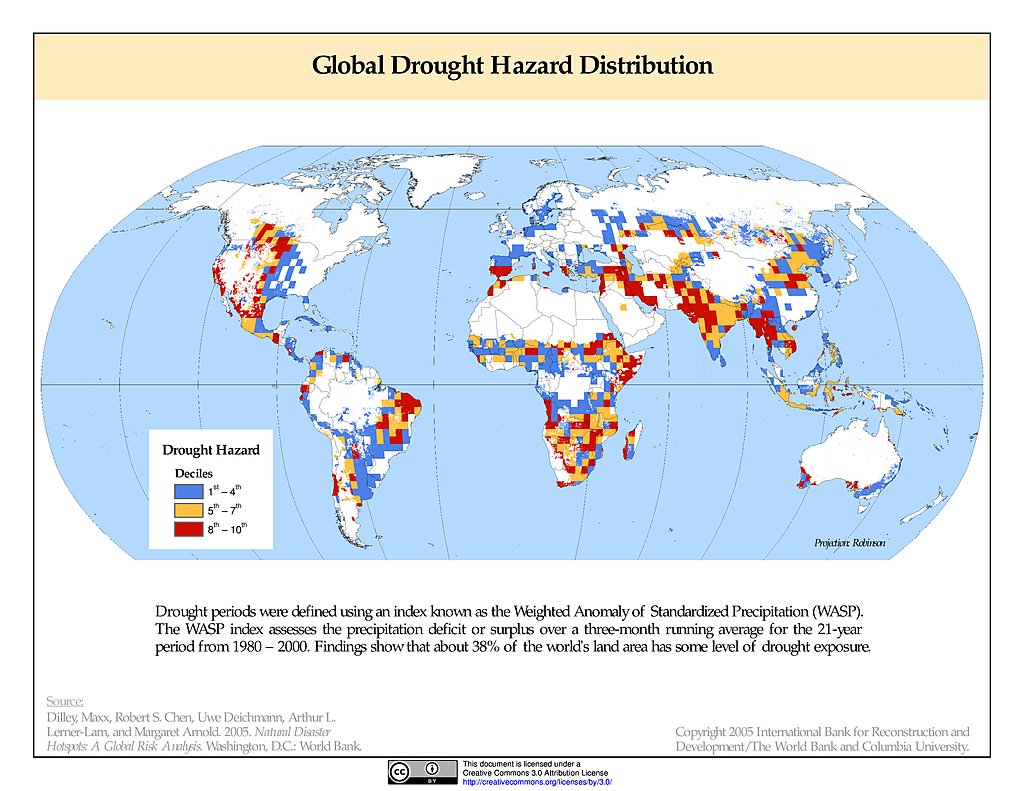
Drought Hazard Frequency & Distribution
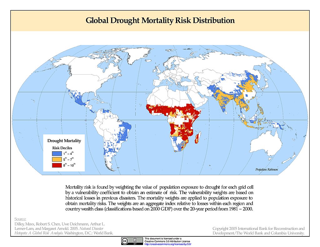
Drought Mortality Risks & Distribution
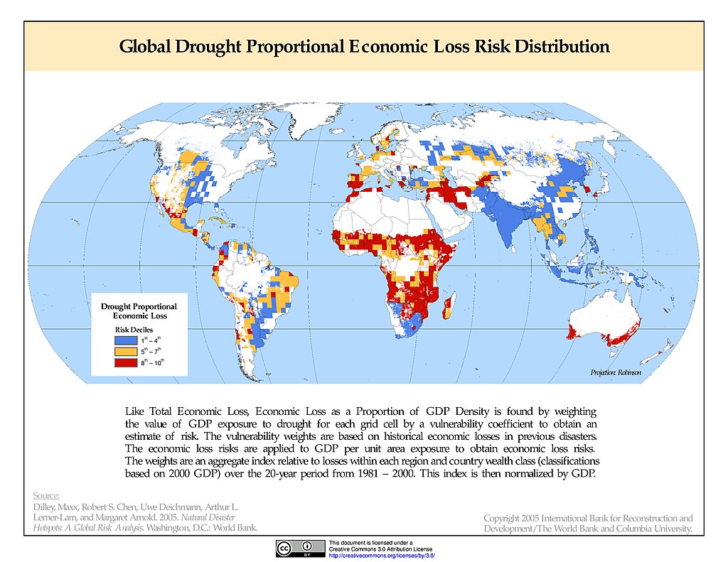
Drought Proportional Economic Loss Risk Deciles
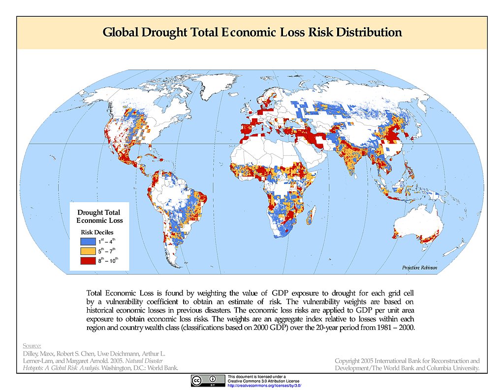
Drought Total Economic Loss Risk Deciles
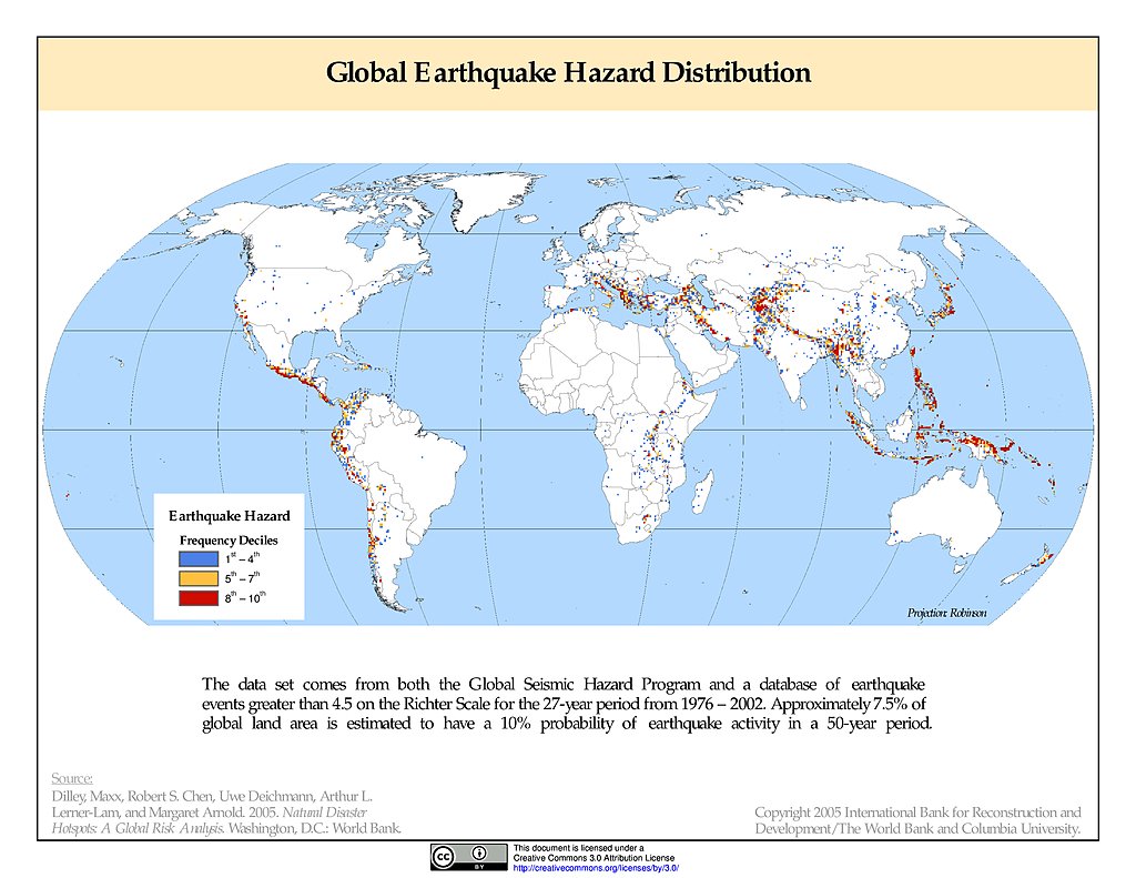
Earthquake Hazard Frequency & Distribution
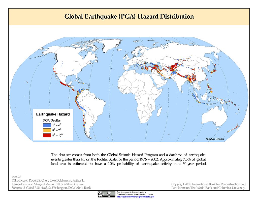
Earthquake Hazard Distribution - PGA
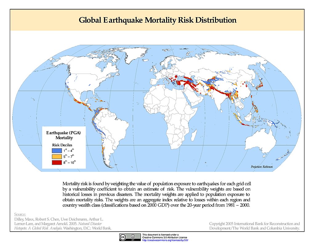
Earthquake Mortality Risks & Distribution
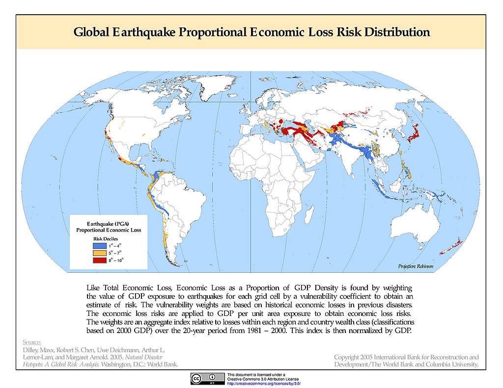
Earthquake Proportional Economic Loss Risk Deciles
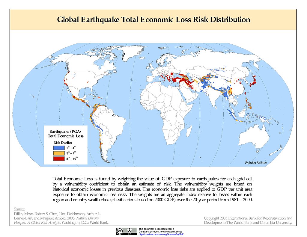
Earthquake Total Economic Loss Risk Deciles
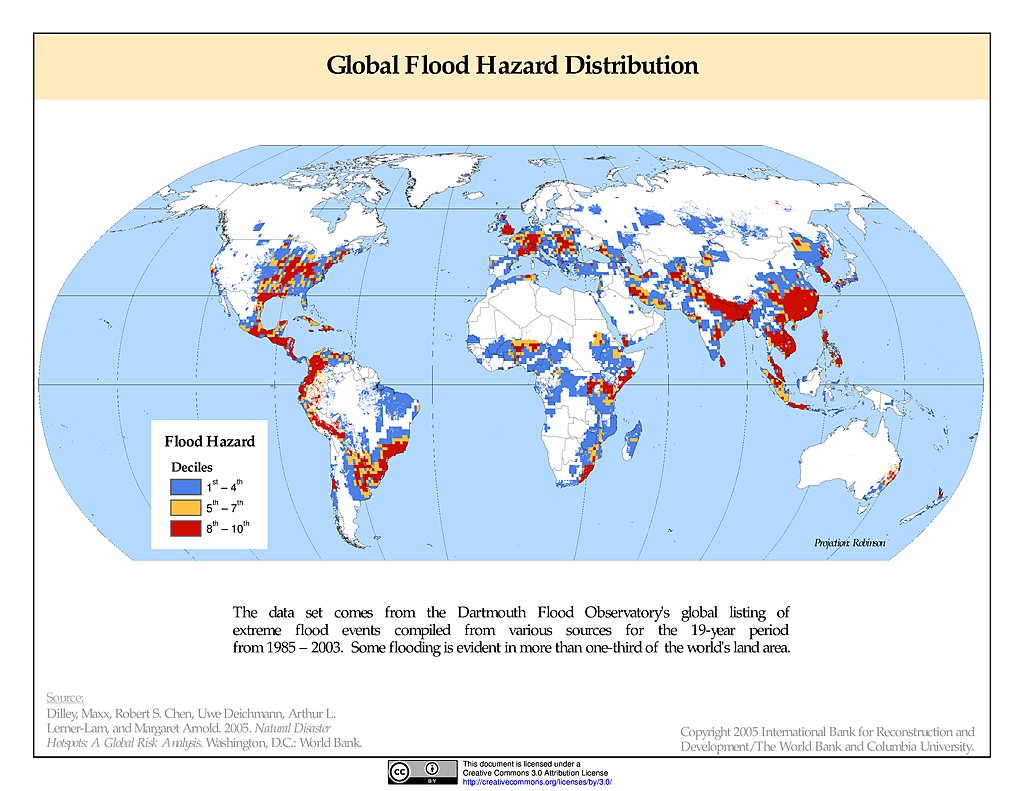
Flood Hazard Frequency & Distribution
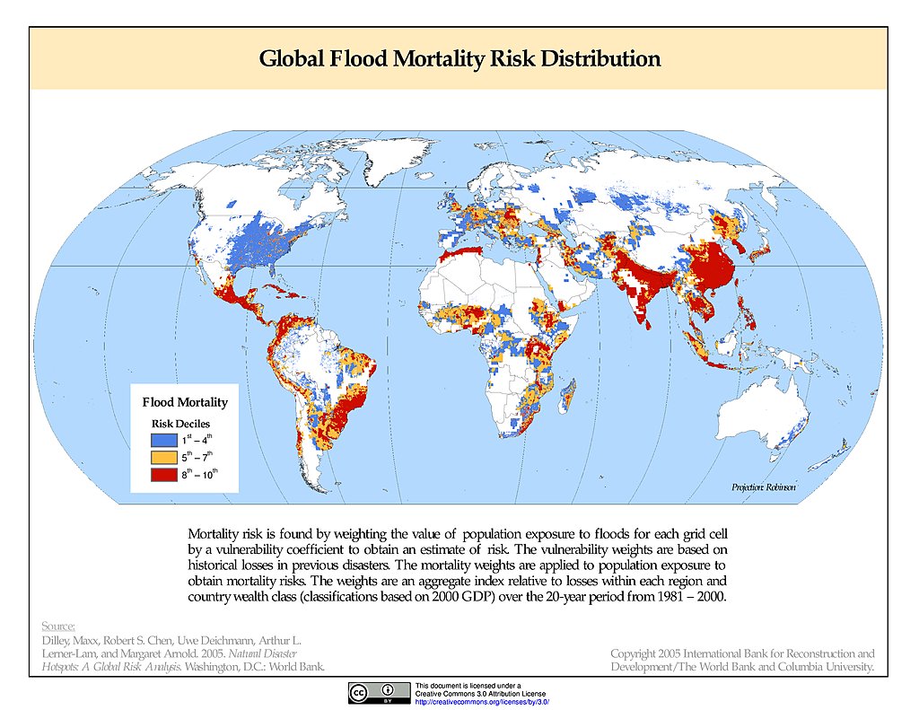
Flood Mortality Risks & Distribution
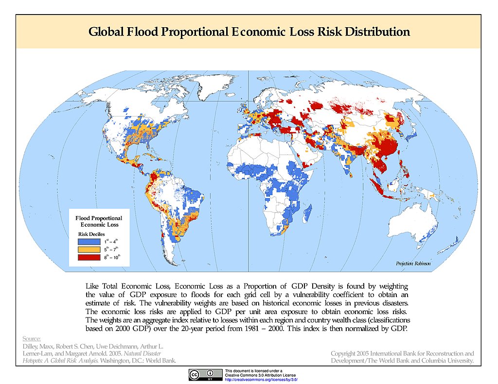
Flood Proportional Economic Loss Risk Deciles
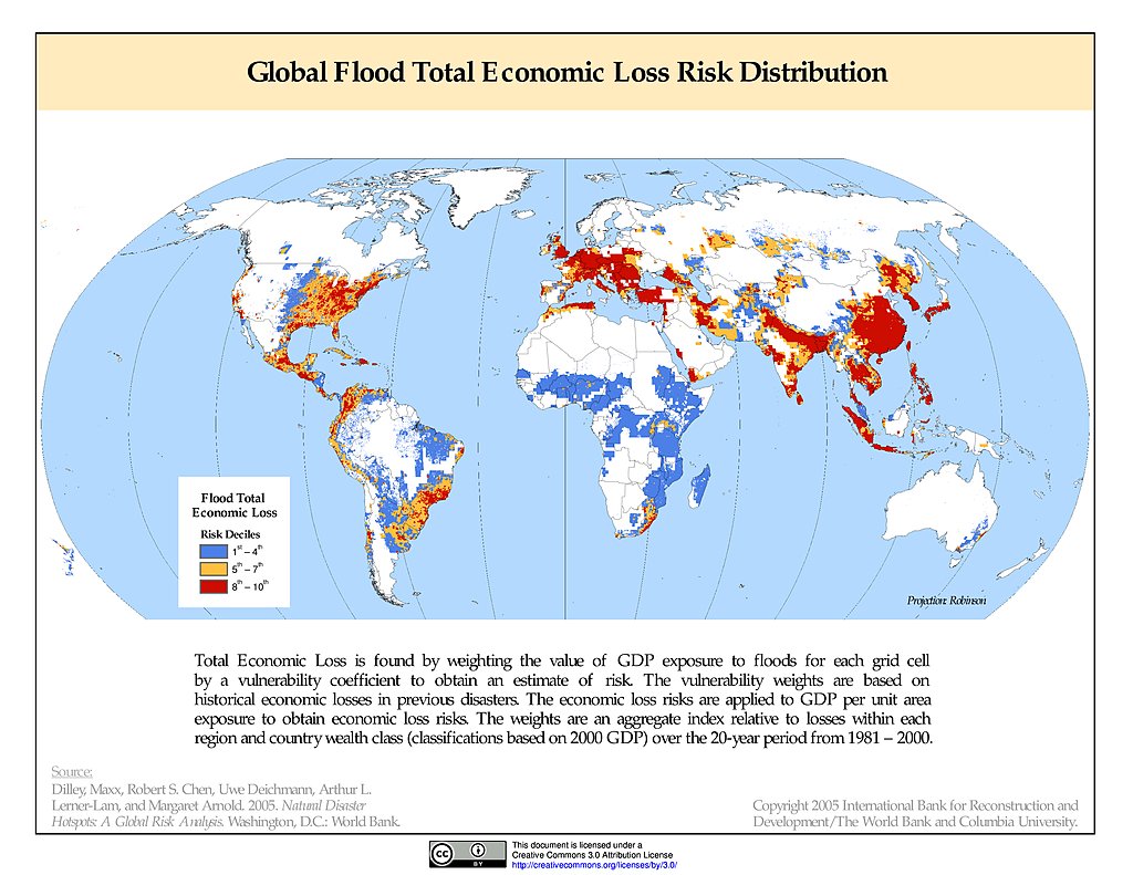
Flood Total Economic Loss Risk Deciles
Maps
»
Theme: Sustainability
Remove Facet
»
Region: Global
Remove Facet
5 of 13
Prev
|
Next