Data Sets » Theme: Remote SensingRemove Facet » All Fields: environmental indicatorsRemove Facet
1 of 1
Prev | Next

Annual Global High-Resolution Extreme Heat Estimates (GEHE), v1 (1983 – 2016)

Satellite-Derived Environmental Indicators

To provide a high-resolution, longitudinal global data set of annual extreme humid-heat.

Yale Center for Earth Observation (YCEO) Surface Urban Heat Islands, v4 (2003 – 2018)

Satellite-Derived Environmental Indicators

To provide global estimates of the surface urban heat island intensity from monthly, seasonal, to annual scales for over 10,000 urban clusters developed using a simplified urban-extent algorithm.

Global (GL) Annual PM2.5 Grids from MODIS, MISR and SeaWiFS Aerosol Optical Depth (AOD), v4.03 (1998 – 2019)

Satellite-Derived Environmental Indicators

To provide an annual global surface of concentrations (micrograms per cubic meter) of all composition ground-level fine particulate matter of 2.5 micrometers or smaller (PM2.5) for large-scale health and environmental research.

Country Trends in Major Air Pollutants, v1 (2003 – 2018)

Air Quality Data for Health-Related Applications

To provide a framework of public-health-focused air quality indicators that quantifies country trends in exposure to major air pollutants.

Annual PM2.5 Concentrations for Countries and Urban Areas, v1 (1998 – 2016)

Satellite-Derived Environmental Indicators

To provide an annual global surface of concentrations (micrograms per cubic meter) of mineral dust and sea-salt filtered fine particulate matter of 2.5 micrometers or smaller (PM2.5) in countries and urban areas for large-scale health and environmental research

Global High Resolution Daily Extreme Urban Heat Exposure (UHE-Daily), v1 (1983 – 2016)

Satellite-Derived Environmental Indicators

To provide a high-resolution, longitudinal global data set of extreme urban heat events and urban heat exposure.

VIIRS Plus DMSP Change in Lights (VIIRS+DMSP dLIGHT), v1 (1992, 2002, 2013)

Satellite-Derived Environmental Indicators

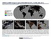
To visualize changes in brightness and extent of global nighttime lights networks over two decades with improved radiometric accuracy and finer spatial resolution.

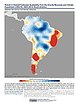
Trends in Global Freshwater Availability from the Gravity Recovery and Climate Experiment (GRACE), v1 (2002 – 2016)

Satellite-Derived Environmental Indicators

To provide data on changes in freshwater availability in order to better understand impacts on regional food supplies, human and ecosystem health, energy generation, and social unrest.

Global Fire Emissions Indicators, Grids, v1 (1997 – 2015)

Satellite-Derived Environmental Indicators

To provide data that can be used to calculate trace gas and aerosol emissions, due to fires; monitor and assess national efforts to manage emissions.

Global Fire Emissions Indicators, Country-Level Tabular Data, v1 (1997 – 2015)

Satellite-Derived Environmental Indicators

To provide data that can be used to calculate trace gas and aerosol emissions due to fires; monitor and assess national efforts to manage emissions.

Global 3-Year Running Mean Ground-Level NO2 Grids from GOME, SCIAMACHY and GOME-2, v1 (1996 – 2012)

Satellite-Derived Environmental Indicators

To provide a continuous surface of NO2 concentrations for health and environmental research.

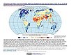
Global Urban Heat Island (UHI) Data Set, v1 (2013)

Satellite-Derived Environmental Indicators

To provide a global data set of average summer daytime maximum/nighttime minimum land surface temperatures (LSTs) for urban extents, as well as the LST difference between the urban area and the buffer.

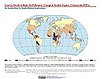
Global Summer Land Surface Temperature (LST) Grids, v1 (2013)

Satellite-Derived Environmental Indicators

To provide raster representations of global summer daytime maximum and nighttime minimum surface temperature for studies related to human health and climate change.

Annual Chlorophyll-a Concentration, v1 (1998 – 2007)

Indicators of Coastal Water Quality

To provide a gridded version of existing SeaWiFS data in GIS-compatible formats in order to determine concentrations of chlorophyll-a in the coastal water column and to facilitate the integration with other data.

Change in Chlorophyll-a Concentration, v1 (1998 – 2007)

Indicators of Coastal Water Quality

To provide tabular data on the trends of chlorophyll-a concentration on a pixel by pixel basis for identifying areas with improving, declining, and stable coastal water quality that can provide guidance for decision making in the context of coastal management.

Ancillary Data, v1 (1998 – 2007)

Indicators of Coastal Water Quality

To provide data that can assist in the extraction and analysis of chlorophyll-a concentration and trends from global grids.

Data Sets » Theme: Remote SensingRemove Facet » All Fields: environmental indicatorsRemove Facet
1 of 1
Prev | Next