Climate Impacts, Vulnerability, and Adaptation
|
1 of 5
Prev
|
Next
|
Global Urban Heat Island (UHI) Data Set, v1 (2013)Satellite-Derived Environmental Indicators
To provide a global data set of average summer daytime maximum/nighttime minimum land surface temperatures (LSTs) for urban extents, as well as the LST difference between the urban area and the buffer. |
Global High Resolution Daily Extreme Urban Heat Exposure (UHE-Daily), v1 (
|
|
Global Summer Land Surface Temperature (LST) Grids, v1 (2013)Satellite-Derived Environmental Indicators
To provide raster representations of global summer daytime maximum and nighttime minimum surface temperature for studies related to human health and climate change. |
Global Human Modification of Terrestrial Systems, v1 (2016)Land Use and Land Cover
To provide a cumulative measure of human modification of terrestrial lands based on modeling the physical extents of 13 anthropogenic stressors and their estimated impacts using spatially-explicit global data sets. |
|
Global Development Potential Indices, v1 (2016)Land Use and Land Cover
To provide spatially-explicit data that relatively rank global land suitability referred to as Development Potential Indices (DPIs) for 13 sectors related to renewable energy, fossil fuels, mining and agriculture as an aid to conservation priority setting. |
MA Climate and Land Cover, v1 (
|
|
SSPs Literature Database, v1 (
|
Subset of JRC Map of Accessibility, v1 (
|
|
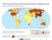
Urban-Rural Population and Land Area Estimates, v3 (1990, 2000, 2015)Low Elevation Coastal Zone (LECZ)
To provide estimates of urban and rural populations and land areas for the years 1990, 2000, 2015 for 234 countries and statistical areas with contiguous coastal elevations of less than or equal to 5m above sea level, 5-10m above sea level, and national totals using multiple updated data sources for comparative analysis. |
Sea Level Rise Impacts on Ramsar Wetlands of International Importance, v1 (
|
|
Urban-Rural Population and Land Area Estimates, v2 (1990, 2000, 2010, 2100)Low Elevation Coastal Zone (LECZ)
To provide estimates of urban and rural populations and land areas for the years 1990, 2000, and 2010; and projections to the year 2100 for 202 countries with contiguous coastal elevations in the following categories: less than or equal to 1m, 3m, 5m, 7m, 9m, 10m, 12m, or 20m; as well as national totals. |
Urban-Rural Population Estimates, v1 (1990, 1995, 2000)Low Elevation Coastal Zone (LECZ)
To provide estimates of urban and rural populations and land areas in the low elevation coastal zone. |
|
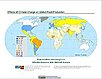
Synthetic Assessment of Global Distribution of Vulnerability to Climate Change, v1 (2005, 2050, 2100)Intergovernmental Panel on Climate Change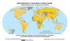
To provide geographical portraits of vulnerability designed to incorporate both exposure to climate change and national capacities to adapt. |
Fifth Assessment Report (AR5) Observed Climate Change Impacts, v2.01 (
|
|
Fourth Assessment Report (AR4) Observed Climate Change Impacts, v1 (
|
National and Regional Data Set by Source Category, v2.86 (
|
|
Groundswell Spatial Population and Migration Projections at One-Eighth Degree According to SSPs and RCPs, v1 (
|
||
U.S. Climate Risk Projections by County, v1 (
|
Groundswell Africa Spatial Population and Migration Projections at One-Eighth Degree According to SSPs and RCPs, v1 (
|


|
1 of 5
Prev
|
Next
|