World summary --- Sudan |
Summary information |
| Names | |
| ISO3-Code |
SDN
|
| Continent |
Africa
|
| Country Name |
Sudan
|
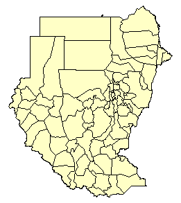
| Administrative | |
| Admin Level Used |
2
|
| Level1 Type |
State
|
| Level2 Type |
Muhafazat
|
| Number of Units |
85
|
| Population Estimates | |
| Ref. Year First |
1983
|
| Ref. Year Last |
1993
|
| Pop '90 (estimated) ('000) |
23,904
|
| Pop '95 (estimated) ('000) |
27,875
|
| Pop '90 (UN) ('000) |
24,062
|
| Pop '95 (UN) ('000) |
26,617
|
| Difference '90 |
0.7%
|
| Difference '95 |
-4.7%
|
| Spatial Estimates | |
| Area (sq km) |
2,505,810
|
| Resolution (km) |
172
|
| PopPerUnit ('000) |
313
|
| Resources | |
| Web Site 1 | |
Data sourcesThis database was initially produced for the UNEP/GRID-WRI-NCGIA
Africa Population Database. The 1980 and 1990 estimates produced for this database were used to produce the P95E estimate. Pop data sources:
4) and 5) list figures for 1973 by region. Boundaries changed significantly between the three censuses, so data had to be aggregated or split to match the available boundary data set. The boundaries match the 1983 census although some of the unit names are different in the coverage and the census publications. P90 is based on the intercensal 83-93 growth rate for the districts (third level units) where available. Else they are based on region level growth rates for the areas not enumerated. For these, only 1993 estimates were available. Since matching of the 1956 and 73 units was very difficult due to numerous boundary changes at the lower levels, P80 is based on regional level growth rates 73-83, and P60 and P70 are based on region level growth rates for 56-73. |
||||||||
|
||||||||