SEDAC
SEDAC Home
Remote Sensing and Environmental Treaties:

Building More Effective Linkages

Image Gallery of Remote Sensing Instruments of Relevance to Environmental Treaties

By Karen Kline (Remote Sensing Research Unit, Department of Geography, University of California-Santa Barbara)
Click on thumbnails to enlarge and get more details.

ASTER
ASTER (Advanced Spaceborne Thermal Emission and Reflection Radiometer)
AVHRR
AVHRR (Advanced Very High Resolution Radiometer)
CERES
CERES (Clouds and the Earth’s Radiant Energy System)
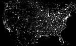
DMSP/OLS
DMSP/OLS
(Defense Meteorological Satellite Program/Operational Linescan System)
ETM+
ETM+
(Enhanced Thematic Mapper Plus)
IKONOS
IKONOS
IRS
IRS
(Indian Remote Sensing Satellite)
MISR
MISR
(Multi-Angle Imaging Spectroradiometer)
MODIS
MODIS
(Moderate-Resolution Imaging Spectroradiometer)
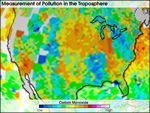
MOPITT
MOPITT
(Measurements of Pollution in the Troposphere)
Quickbird
QuickBird
SAR
SAR
(Synthetic Aperture Radar)
SPOT
SPOT
(Système Probatoire de la Observation de la Terre)
     
CIESIN Home Page

Need help or information? Contact SEDAC User Services
About SEDAC  Acknowledgments

NASA Home Page SEDAC logo

Copyright © 1997-.
The Trustees of Columbia University in the City of New York.

Privacy Policy and Important Notices

This site is for review only.
Use data and services at your own risk.