Data Sets (7)
|
1 of 1
Prev
|
Next
|
SDG Indicator 7.1.1: Access to Electricity, 2023 Release (
|
Country Trends in Major Air Pollutants, v1 (
|
|
Global Fire Emissions Indicators, Country-Level Tabular Data, v1 (
|
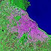
Global Human Built-up And Settlement Extent (HBASE) Dataset From Landsat, v1 (2010)Global High Resolution Urban Data from Landsat
To provide high spatial resolution estimates of global urban extent derived from global 30m Landsat satellite data for the target year 2010 and a companion dataset to the Global Man-made Impervious Surface (GMIS) dataset. |
|
Global Man-made Impervious Surface (GMIS) Dataset From Landsat, v1 (2010)Global High Resolution Urban Data from Landsat
To provide high spatial resolution estimates of global man-made imperviousness for the target year 2010, derived from global 30m Landsat satellite data and a companion dataset to the Global Human Built-up And Settlement Extent (HBASE) dataset. |
Change in Chlorophyll-a Concentration, v1 (
|
|
Urban Landsat: Cities from Space, v1 (
|

|
1 of 1
Prev
|
Next
|