|
|
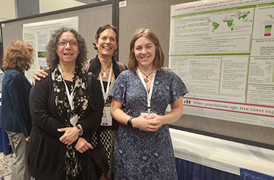
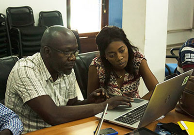
Photo Credit: Anne-Laure White, GRID3 |
As face-to-face educational activities have been curtailed or even suspended due to the pandemic, CIESIN continues to be active on diverse educational fronts, in online and hybrid venues ranging from academic settings to video series to workshops and Webinars, in addition to ongoing development of online training and curriculum resources. CIESIN staff regularly teach popular courses at graduate and undergraduate level, in a variety of departments, programs, and schools across Columbia University, including Columbia and Barnard Colleges, the Ecology, Evolution, and Environmental Biology (E3B) Department, the Mailman School of Public Health, the School of International and Public Affairs (SIPA), and the School of Professional Studies (SPS).
For the past Fall-Winter term, some CIESIN staff taught classes in “hyflex” mode (designated campus classroom, with online participation by students and faculty as needed)—for example, “Environmental Sustainability Indicators,” by associate director of Science Applications, Alex de Sherbinin, and “Data Analysis & Visualization in Sustainability,” by associate director for Geospatial Applications Greg Yetman. Both classes are in the Sustainability Management Program of the SPS. Supporting Yetman was postdoctoral research scientist Carolynne Hultquist, who taught the same class in the fall. Also this past semester, in online mode, GIS developer Kytt MacManus taught “Spatial Analysis for Sustainable Development,” and senior geographic information specialist Linda Pistolesi taught “GIS for Sustainable Development,” both for Columbia College. For E3B, research scientist Susana Adamo was instructor for “Human Populations and Sustainable Development.”
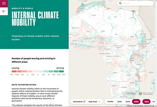
CIESIN is also part of a major new initiative of the new Columbia Climate School. Led by Alex de Sherbinin and Kamal Amakrane, a United Nations diplomat and adjunct professor at SIPA, the Climate Mobility Network is one of nine new “Earth Networks” to facilitate interdisciplinary collaboration across Columbia University in the themes of climate, sustainability and the future of the planet. During its initial three-year phase, the Climate Mobility Network plans to develop a trans-disciplinary course, teaching aids, and tools to help build curriculum and pedagogy on climate mobility. The Network will also work on policy research and modeling in support of operational agencies, building on ongoing work with the World Bank, United Nations Development Programme, the Platform for Disaster Displacement, UNHCR-The UN Refugee Agency, and the International Organization of Migration, as well as the Columbia Global Centers Committee on Forced Migration.
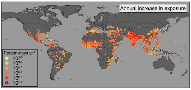
Online educational activities included an educational Webinar series for a non-technical audience, with modules to date on population modelling, mapping settlements, and mapping subnational boundaries, produced by the Georeferenced Infrastructure and Data for Development (GRID3) program. In a separate effort, several online training modules in English and Spanish were co-developed by Susana Adamo, with Professor Landy Sanchez of the Center for Demographic, Urban, and Environmental Studies at El Colegio de Mexico (COLMEX), released by the Population-Environment Research Network (PERN) and supported by the International Union for the Scientific Study of Population (IUSSP) through a grant from the William and Flora Hewlett Foundation. Focused on the fundamentals of spatial data integration and geared towards demographers and other population researchers, the video-based tutorials draw on pre-packaged data and open source geographic information system (GIS) and Web-based tools. This past year, CIESIN senior geographic information specialist Dara Mendeloff participated in Earth Institute Live (EI Live), an online series for K–12 students and educators. Coordinated by the Education and Outreach Office of the Lamont Doherty Earth Observatory (LDEO), live video lessons were led by experts in a broad variety of scientific disciplines across the EI. In one session, Mendeloff gave an introduction to geographic information systems (GIS); in another, she highlighted select data science tools used in climate research. She also took part in a professional development event for K–12 educators, sponsored by the EI, which focused on teaching climate change in the classroom.