NASA Website Socioeconomic Data and Applications Center (sedac)
A Data Center in NASA's Earth Observing System Data and Information System (EOSDIS) — Hosted by CIESIN at Columbia University
Data
  • Data Sets
  • Maps
  • Web Pages
  • home
  • Data
    • · Data Sets
    • · Data Collections
    • · Featured Data Uses
    • · Data Citations
    • · Citations Database
    • · Data Submission
  • Maps
    • · Map Gallery
    • · Map Viewer
    • · Map Services
    • · Mapping Tools
  • Themes
    • · Agriculture
    • · Climate
    • · Conservation
    • · Governance
    • · Hazards
    • · Health
    • · Infrastructure
    • · Land Use
    • · Marine and Coastal
    • · Population
    • · Poverty
    • · Remote Sensing
    • · Sustainability
    • · Urban
    • · Water
  • Resources
    • · Guides
    • · Multimedia
    • · Networks
    • · News
    • · Publications
    • · Related Sites
    • · Remote Sensing
    • · Tools
  • Social Media
    • · Twitter
    • · FaceBook
    • · YouTube
    • · Flickr
    • · Blog Posts
    • · Communities
  • About
    • · About SEDAC
    • · User Working Group
    • · Privacy
    • · User Registration
  • Help
 

Environmental Governance and International Treaties

Follow Us: Twitter Follow Us on Facebook YouTube Flickr   |   Share: Twitter Facebook
  • Theme Home
  • Data Sets
  • Map Gallery
  • Map Services
  • Featured Data Uses
  • Resources
    • Multimedia
    • Networks
    • News
    • Related Sites
    • Remote Sensing

Data Sets (2 of 22) View All

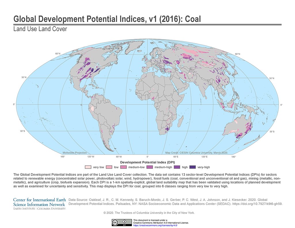
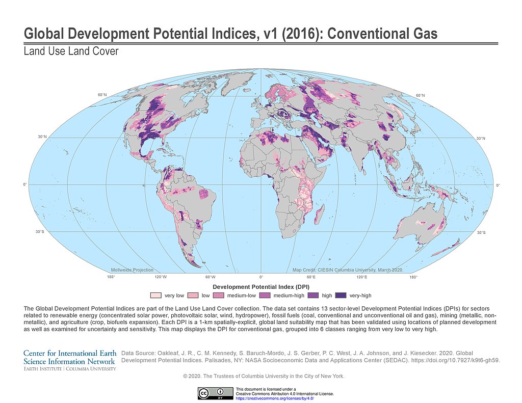
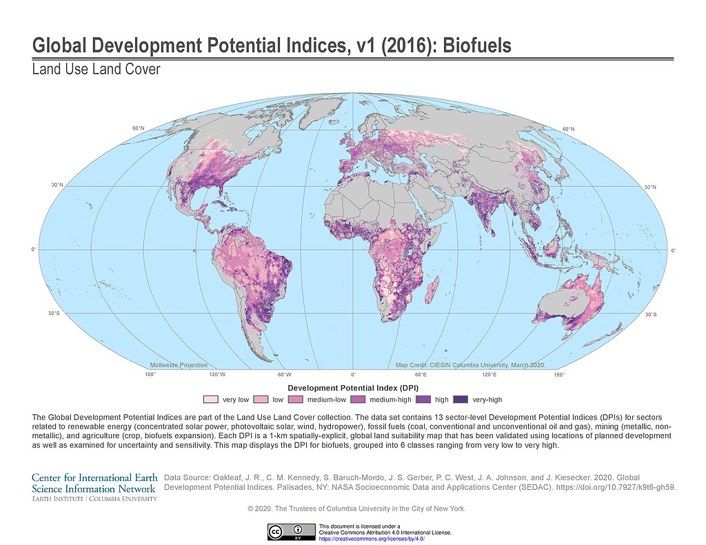
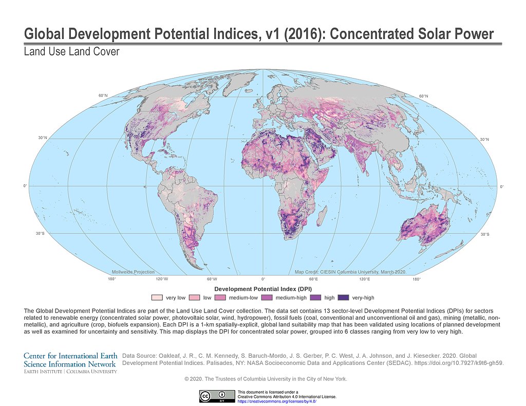
Global Development Potential Indices, v1 (2016)

Land Use and Land Cover

  • Overview
  • Download
  • Documents
  • (12) Maps

To provide spatially-explicit data that relatively rank global land suitability referred to as Development Potential Indices (DPIs) for 13 sectors related to renewable energy, fossil fuels, mining and agriculture as an aid to conservation priority setting.

Global Human Modification of Terrestrial Systems, v1 (2016)

Land Use and Land Cover

  • Overview
  • Download
  • Documents
  • (1) Maps
  • (1) WMS

To provide a cumulative measure of human modification of terrestrial lands based on modeling the physical extents of 13 anthropogenic stressors and their estimated impacts using spatially-explicit global data sets.

Map Gallery (4 of 167) View All

Development Potential Indices (2016): Coal

Map: Development Potential Indices (2016): Coal
Hi-Resolution: PDF | PNG

Development Potential Indices (2016): Conventional Gas

Map: Development Potential Indices (2016): Conventional Gas
Hi-Resolution: PDF | PNG

Development Potential Indices (2016): Biofuels

Map: Development Potential Indices (2016): Biofuels
Hi-Resolution: PDF | PNG

Development Potential Indices (2016): Concentrated Solar Power

Map: Development Potential Indices (2016): Concentrated Solar Power
Hi-Resolution: PDF | PNG

Featured Data Uses (2 of 2)

Transboundary River Basins: Status and Trends

United Nations Environment Programme

For a new report assessing the environmental and socioeconomic conditions in 286 of the world’s transboundary river basins, SEDAC data were used in the calculation of several indicators: economic dependence on water resources, societal wellbeing levels, and the risk of climate-related hazards. The report is an outcome of the Transboundary Waters Assessment Programme, coordinated by the UNEP-DHI (Danish Hydrological Institute) Center on Waste and Environment in execution with international partners, for the Global Environmental Facility, with the aim of creating a baseline assessment of all transboundary water resources on Earth.

Scorecard on the Environment

NASA Earth Data Web Site

Sensing Our Planet: NASA Earth Science Research Features 2008 features an article on how SEDAC data was used for the 2008 Environmental Performance Index and other environmental assessments; CIESIN’s Marc Levy is interviewed.

Home | Data | Data Uses | Data Citations | Maps | Map Services

News | Tools | Guides | Publications | Blog Posts

About | Help | Privacy | User Registration

Copyright © 1997–2023. The Trustees of Columbia University in the City of New York.

WDS ICSU