NASA Website Socioeconomic Data and Applications Center (sedac)
A Data Center in NASA's Earth Observing System Data and Information System (EOSDIS) — Hosted by CIESIN at Columbia University
Data
  • Data Sets
  • Maps
  • Web Pages
  • home
  • Data
    • · Data Sets
    • · Data Collections
    • · Featured Data Uses
    • · Data Citations
    • · Citations Database
    • · Data Submission
  • Maps
    • · Map Gallery
    • · Map Viewer
    • · Map Services
    • · Mapping Tools
  • Themes
    • · Agriculture
    • · Climate
    • · Conservation
    • · Governance
    • · Hazards
    • · Health
    • · Infrastructure
    • · Land Use
    • · Marine and Coastal
    • · Population
    • · Poverty
    • · Remote Sensing
    • · Sustainability
    • · Urban
    • · Water
  • Resources
    • · Guides
    • · Multimedia
    • · Networks
    • · News
    • · Publications
    • · Related Sites
    • · Remote Sensing
    • · Tools
  • Social Media
    • · Twitter
    • · FaceBook
    • · YouTube
    • · Flickr
    • · Blog Posts
    • · Communities
  • About
    • · About SEDAC
    • · User Working Group
    • · Privacy
    • · User Registration
  • Help
 

Land Use and Land Cover Change

Follow Us: Twitter Follow Us on Facebook YouTube Flickr   |   Share: Twitter Facebook
  • Theme Home
  • Data Sets
  • Map Gallery
  • Map Services
  • Featured Data Uses
  • Resources
    • Guides
    • Multimedia
    • Networks
    • Related Sites
    • Remote Sensing
    • Tools

Data Sets (2 of 53) View All

Anthropogenic Biomes of the World, v2 (1700)

Anthropogenic Biomes

  • Overview
  • Download
  • Documents
  • (1) WMS

To provide information on anthropogenic transformation of the biosphere circa 1700 for global land use studies and research on human-environment interactions.

Anthropogenic Biomes of the World, v2 (1800)

Anthropogenic Biomes

  • Overview
  • Download
  • Documents
  • (1) WMS

To provide information on anthropogenic transformation of the biosphere circa 1800 for global land use studies and research on human-environment interactions.

Map Gallery (4 of 309) View All

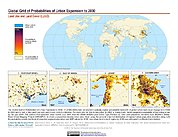
Probabilities of Urban Expansion (2000-2030)

Map: Probabilities of Urban Expansion (2000-2030)
Hi-Resolution: PDF | PNG

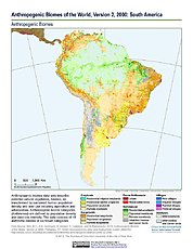
Anthropogenic Biomes, v2 (2000): South America

Map: Anthropogenic Biomes, v2 (2000): South America
Hi-Resolution: PDF | PNG

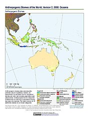
Anthropogenic Biomes, v2 (2000): Oceania

Map: Anthropogenic Biomes, v2 (2000): Oceania
Hi-Resolution: PDF | PNG

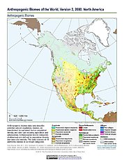
Anthropogenic Biomes, v2 (2000): North America

Map: Anthropogenic Biomes, v2 (2000): North America
Hi-Resolution: PDF | PNG

Featured Data Uses (2 of 9) View All

Mapping Population and Geographic Data

The New Security Beat

In this blog for the Center Environmental and Security Program (ECSP), CIESIN deputy director Marc Levy talks with ECSP director Geoff Dabelko about using the Gridded Population of the World (GPW) data product to aid in combining population and geographic data.

Africa Human Footprint Map

National Geographic

A map of SEDAC′s the Human Footprint illustrates the extent to which Africa′s land area is influenced by humans.

Home | Data | Data Uses | Data Citations | Maps | Map Services

News | Tools | Guides | Publications | Blog Posts

About | Help | Privacy | User Registration

Copyright © 1997–2023. The Trustees of Columbia University in the City of New York.

WDS ICSU