Enables direct comparison of different population data sets based on different data sources and methodologies. The tool incorporates a four-panel display of six different data sets: the Gridded Population of the World (GPWv4.10) 2015 count developed by SEDAC; Landscan 2015 developed by Oak Ridge National Laboratory; WorldPop Estimates 2014 from the WorldPop project; Global Human Settlement Population Grid 2015 (GHS-POP) developed by the European Commission’s Joint Research Centre and CIESIN; the Esri World Population Estimate 2016 (WPE); and the High Resolution Settlement Layer (HRSL) developed by the Facebook Connectivity Lab and CIESIN. A single-panel mode provides metadata and enables side-by-side comparison of population estimates. Developed under the auspices of the POPGRID Data Collaborative.
Mapping Tools
SEDAC has developed a variety of mapping tools, both web-based and stand-alone, to visualize, query, and analyze various map layers that are created from its geospatial data holdings. This page provides a list of all SEDAC mapping tools. In addition, tools developed by other projects that integrate SEDAC map layers and demonstrate interoperability with SEDAC map services are also included.
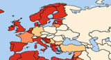
Global COVID-19 Viewer: Population Estimates by Age Group and Sex

The SEDAC Global COVID-19 Viewer allows users to visualize spatially-explicit trends in COVID-19 infection and mortality rates, including daily updated global data of COVID-19 cases and deaths at a glance in relationship to population density, and several risk factors. A map displays the national prevalence (case) and death rates for the previous seven day, and users can easily zoom in to access subnational data for selected countries (e.g., the US, Brazil, and many countries in Europe). Prevalence and mortality rates summarize the pandemic’s impacts since its beginning. Click on a country to access the pop-up Trends Chart which shows daily and 7-day averages of cases and deaths for a range of select time scales, from 1-month to 6-month and beyond.
Population Estimation Service

Web-based service that lets users of a wide variety of map clients and tools quickly obtain estimates of the number of people residing in a user-defined geographic region, without having to download and analyze large amounts of spatial data. The latest update to the PES and the Population Estimator mapping tool lets users visualize changes in total population over multiple decades (2000, 2005, 2010, 2015, and a projection to the year 2020) together with basic demographic characteristics (age and sex) for the year 2010. A new feature of the tool is a “population pyramid” for the year 2010, with estimated population counts by five-year age groups for males and females. See Tutorial.
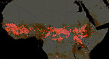
GMIS and HBASE Data Visualization and Access Tool
The Data Visualization and Access Tool lets users view and download the GMIS and HBASE data sets by country, tile, shapefile, rectangle or polygon. Data are available at 30m, 250m, and 1km resolutions in either geographic or UTM projection. Introduction and Brief Tutorial
SEDAC Hazards Mapper
The SEDAC Hazards Mapper enables users to visualize data and map layers related to Socioeconomic, Infrastructure, Natural Disasters, and Environment and analyze potential impacts and exposure. The web app mashups layers from various sources including SEDAC, NASA LANCE, NASA GIBS, USGS, NOAA, ESRI, and others.
Hazards and Population Mapper (HazPop)
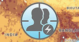
The Hazards and Population Mapper (HazPop) is a free mobile application that enables users to easily display recent natural hazard data in relationship to population, major infrastructure, and satellite imagery. Users can visualize the location of active fires over the past 48 hours, earthquake alerts over the past seven days, and yesterday′s air pollution data measured from space, and can estimate the total population in proximity to the user′s current location or to a recent hazard event or other point of interest. HazPop is designed for use by disaster risk managers, humanitarian response organizations, public health professionals, journalists, and others needing a quick assessment of the population potentially exposed to a major hazard event or developing emergency. HazPop is available for IOS and Android versions. Please note, it is not intended to support in-depth risk assessment or estimation of actual disaster losses.
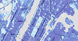
SEDAC Map Viewer
A Web mapping tool that enables visualization of all SEDAC map layers, the SEDAC Map Viewer organizes the map layers into approximately 15 interdisciplinary topics (themes) that users can select. Users may also zoom into a region of interest using a selection list, in addition to typical pan and zoom options. This updated version of the SEDAC Map Viewer implements an innovative four-window map view to make it easier to compare data layers from SEDAC’s diverse data holdings. The viewer is developed using the Open Layers JavaScript library and uses the SEDAC Web Map Services (WMS) published in GeoServer.
NASA Worldview
This tool developed by NASA's EOSDIS allows you to interactively browse global satellite imagery within hours of it being acquired. Users can overlay and visualize a subset of SEDAC map layers in conjunction with satellite images - for example, the NASA MODIS imagery showing active fires, integrated with the SEDAC GRUMP population density layer.