Data Sets » Theme: GovernanceRemove Facet » Format: vectorRemove Facet
1 of 1
Prev | Next

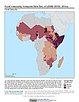
Food Insecurity Hotspots Data Set, v1 (2009 – 2019)

Food Security

To provide gridded data that identify the level of intensity and frequency of food insecurity over the 10 years between 2009 and 2019, as well as hotspot areas that have experienced consecutive food insecurity events, based on FEWS NET Food Security Data.

Point and Gridded Locations of Fatalities, v1 (2008 – 2013)

West Africa Coastal Vulnerability Mapping

To measure human security and sensitivity of populations to climate stressors in the coastal zone of West Africa.