Socioeconomic Data and Applications Center (
sedac
)
A Data Center in NASA's Earth Observing System Data and Information System (
EOSDIS
) — Hosted by
CIESIN
at
Columbia University
Search SEDAC
Data
Data Sets
Maps
Web Pages
search
Data
· Data Sets
· Data Collections
· Featured Data Uses
· Data Citations
· Citations Database
· Data Submission
Maps
· Map Gallery
· Map Viewer
· Map Services
· Mapping Tools
Themes
· Agriculture
· Climate
· Conservation
· Governance
· Hazards
· Health
· Infrastructure
· Land Use
· Marine and Coastal
· Population
· Poverty
· Remote Sensing
· Sustainability
· Urban
· Water
Resources
· Guides
· Multimedia
· Networks
· News
· Publications
· Related Sites
· Remote Sensing
· Tools
Social Media
· Twitter
· FaceBook
· YouTube
· Flickr
· Blog Posts
· Communities
About
· About SEDAC
· User Working Group
· Privacy
· User Registration
Help
Map Gallery
(555)
Follow Us:
Twitter
Follow Us on Facebook
YouTube
Flickr
| Share:
Twitter
Facebook
Search
All Fields:
search
Theme
Agriculture
(229)
Climate
(344)
Conservation
(157)
Framework Data
(1)
Governance
(166)
Hazards
(63)
Health
(234)
Infrastructure
(49)
Land Use
(86)
Marine and Coastal
(93)
Population
(147)
Poverty
(32)
remote sensing
(6)
Remote Sensing
(58)
Sustainability
(399)
Urban
(81)
Water
(95)
Maps
»
Region: Global
Remove Facet
10 of 18
Prev
|
Next
Last of the Wild, v2
Human Footprint Index, v2
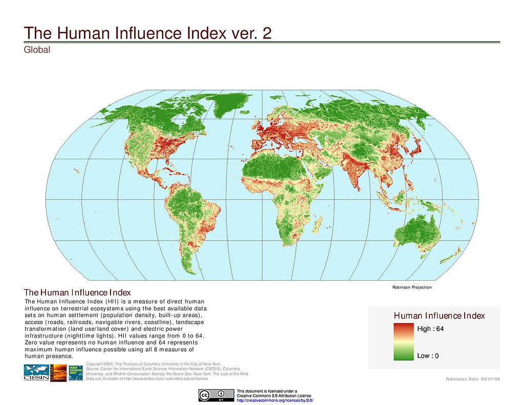
Human Influence Index, v2
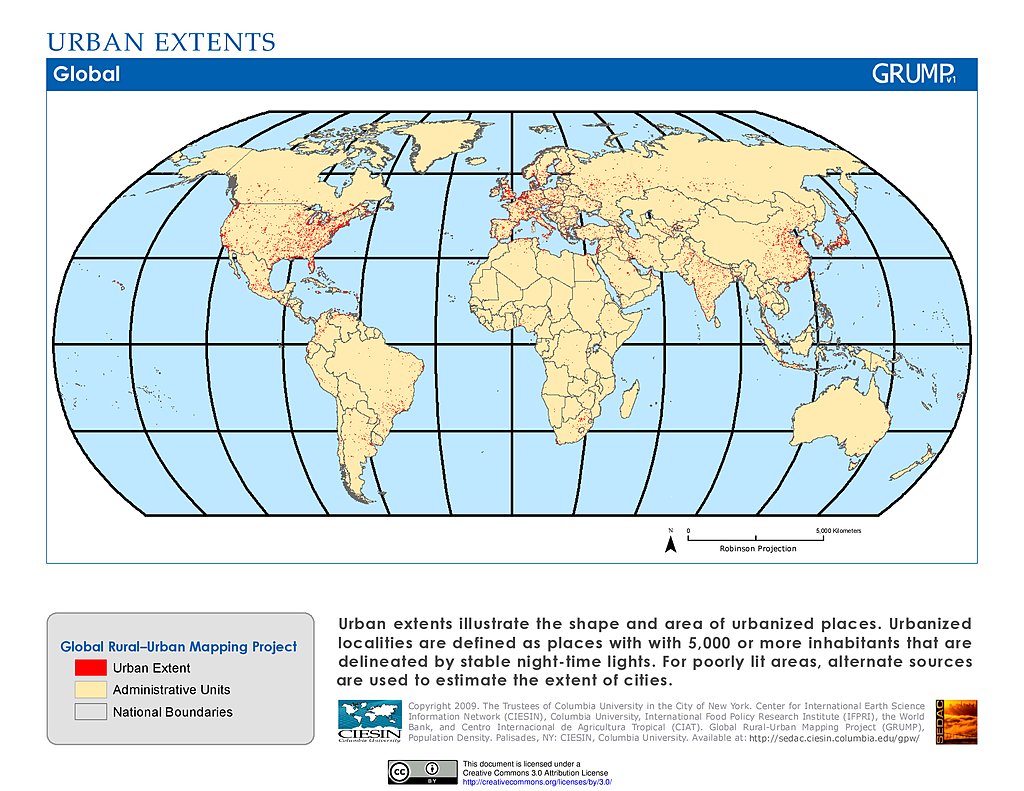
Urban Extents
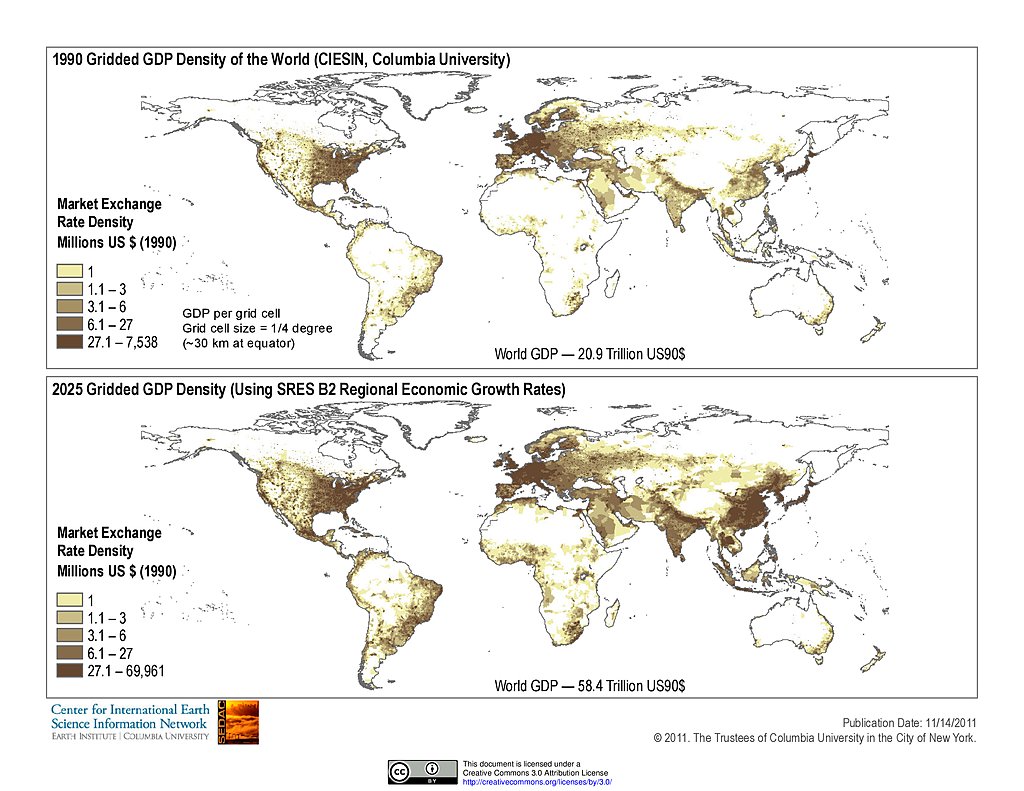
Gridded GDP Density (1990, 2025)
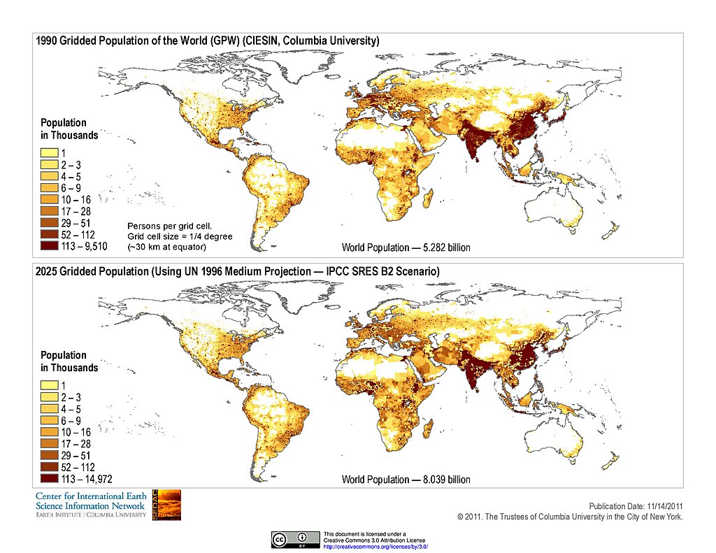
Gridded Population (1990, 2025)
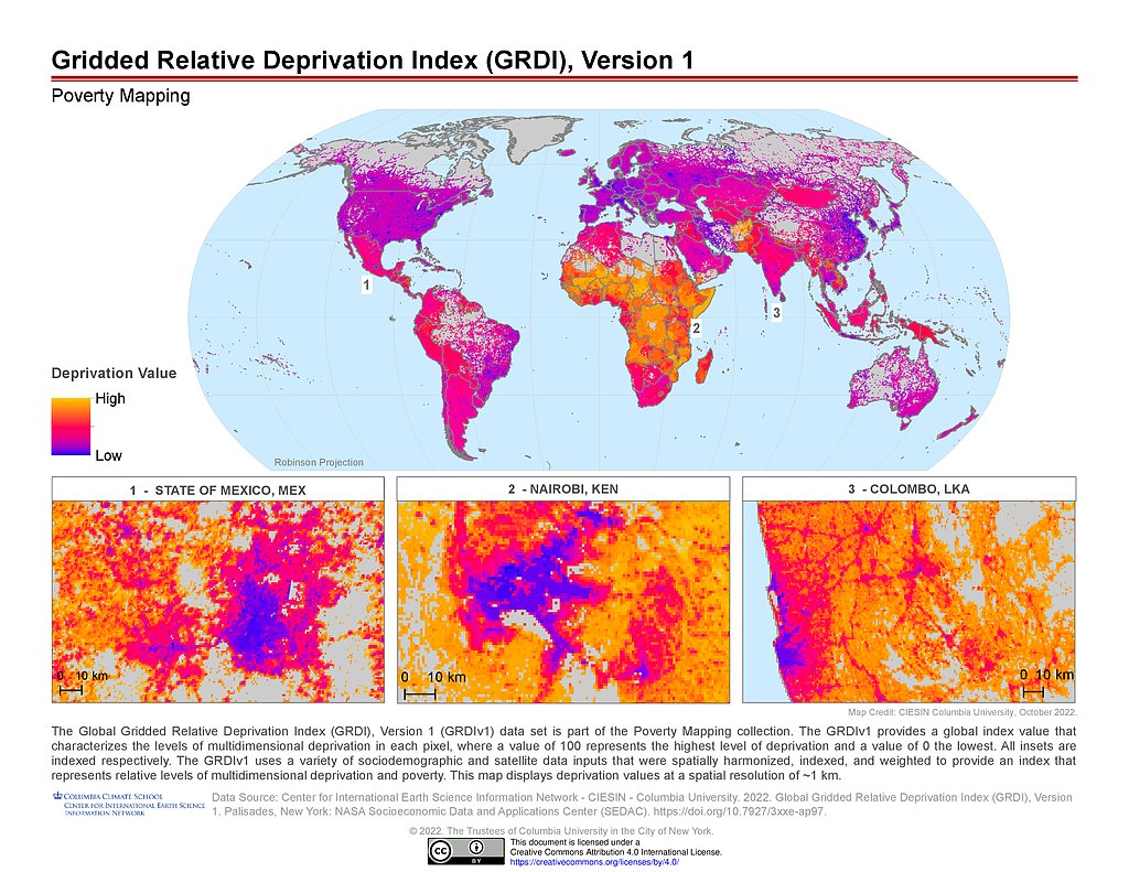
GRDIv1
GUPPDv1: Africa Population Growth
GUPPDv1: Europe Population Growth
GUPPDv1: Population Growth
GUPPDv1: SMOD Class 22 Polygons
GUPPDv1: SMOD Class 23 Polygons
GUPPDv1: SMOD Class 30 Polygons
GUPPDv1: SMOD Class Polygons
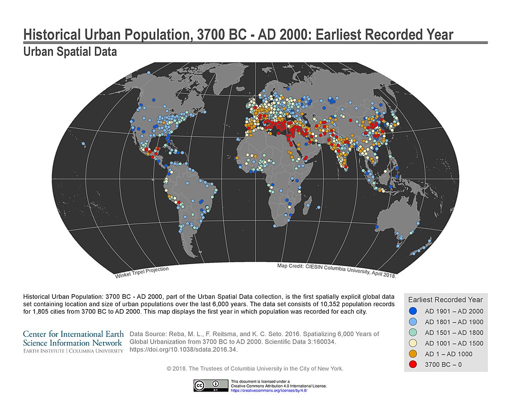
Historical Urban Population (3700BC - AD2000): Earliest Year
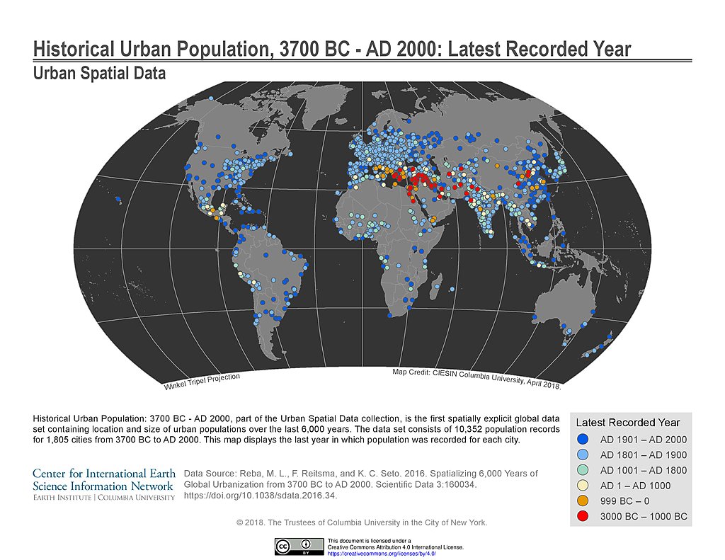
Historical Urban Population (3700BC - AD2000): Latest Year
Historical Urban Population (3700BC - AD2000): Records
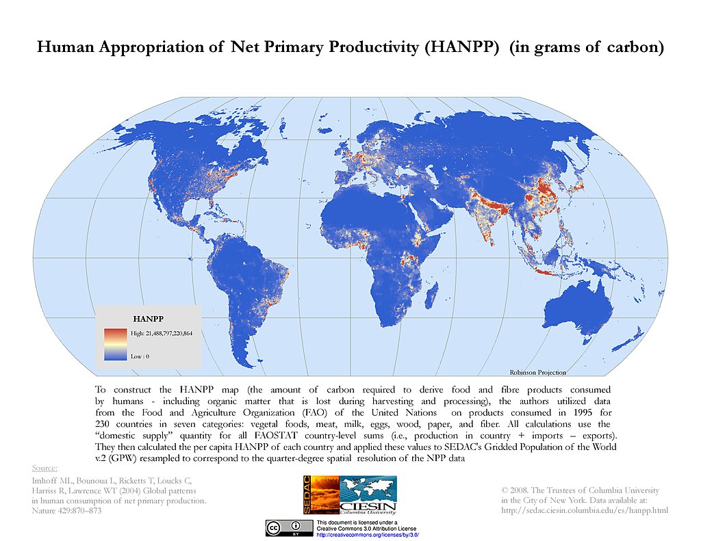
Human Appropriation of Net Primary Productivity
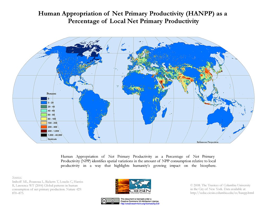
HANPP as % of Local Net Primary Productivity
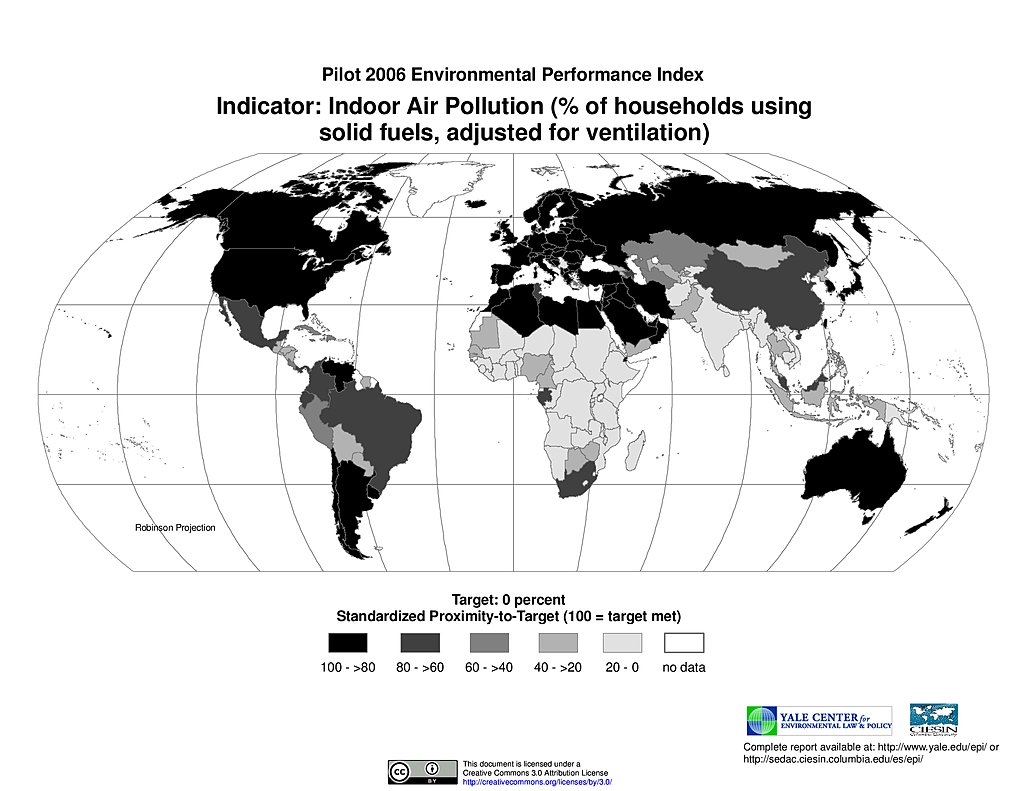
Indoor Air Pollution, Pilot EPI 2006
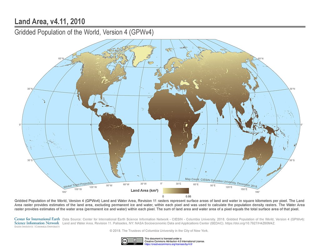
GPWv4 Rev11: Land Area (2010)
LECZ Delta v1: 10m Populations MERIT-DEM
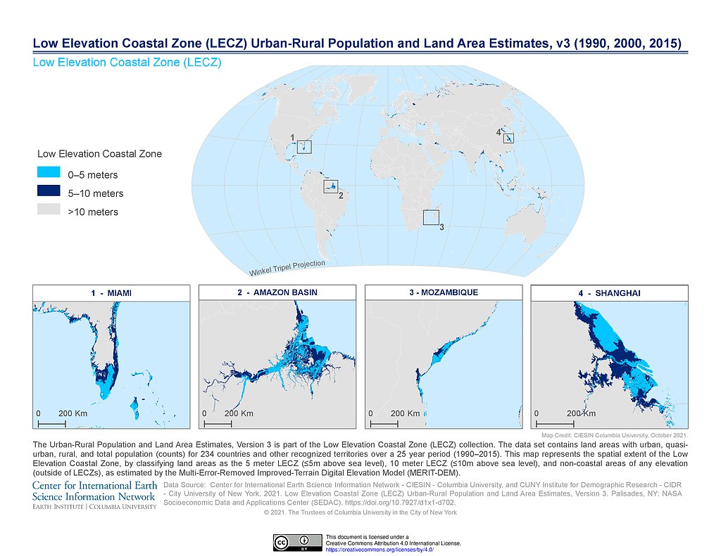
LECZv3: 5m, 10m, >10m MERIT-DEM
GPWv4 Rev11: National Identifier Grid (2010)
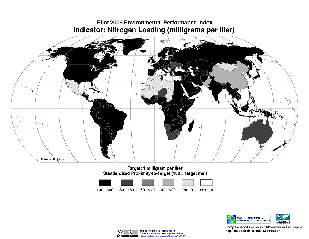
Nitrogen Loading, Pilot EPI 2006
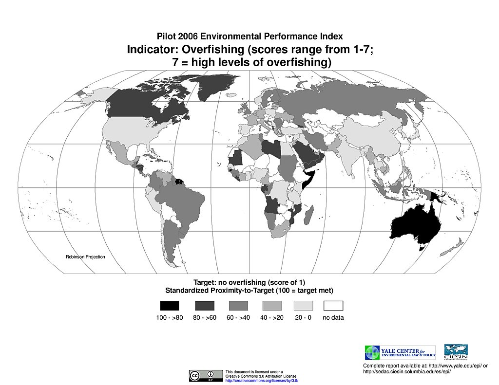
Overfishing, Pilot EPI 2006
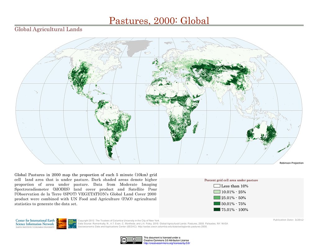
Pastures (2000)
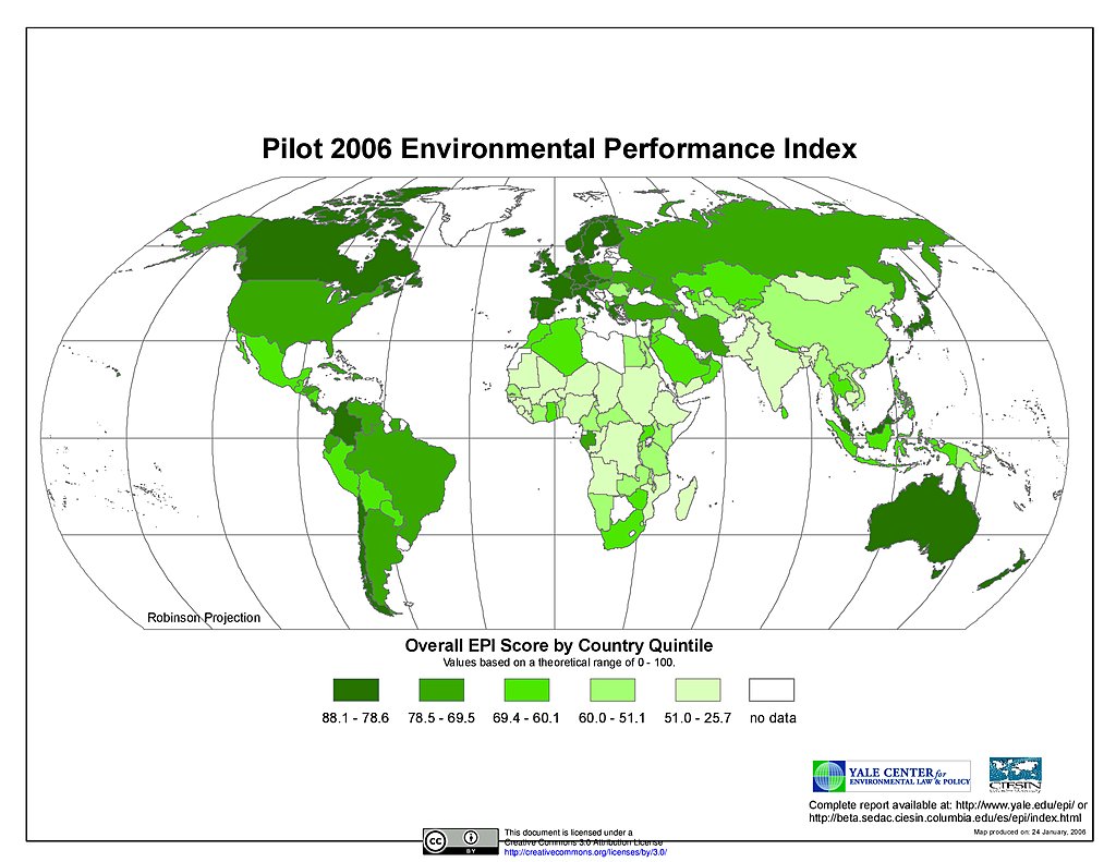
Pilot EPI 2006
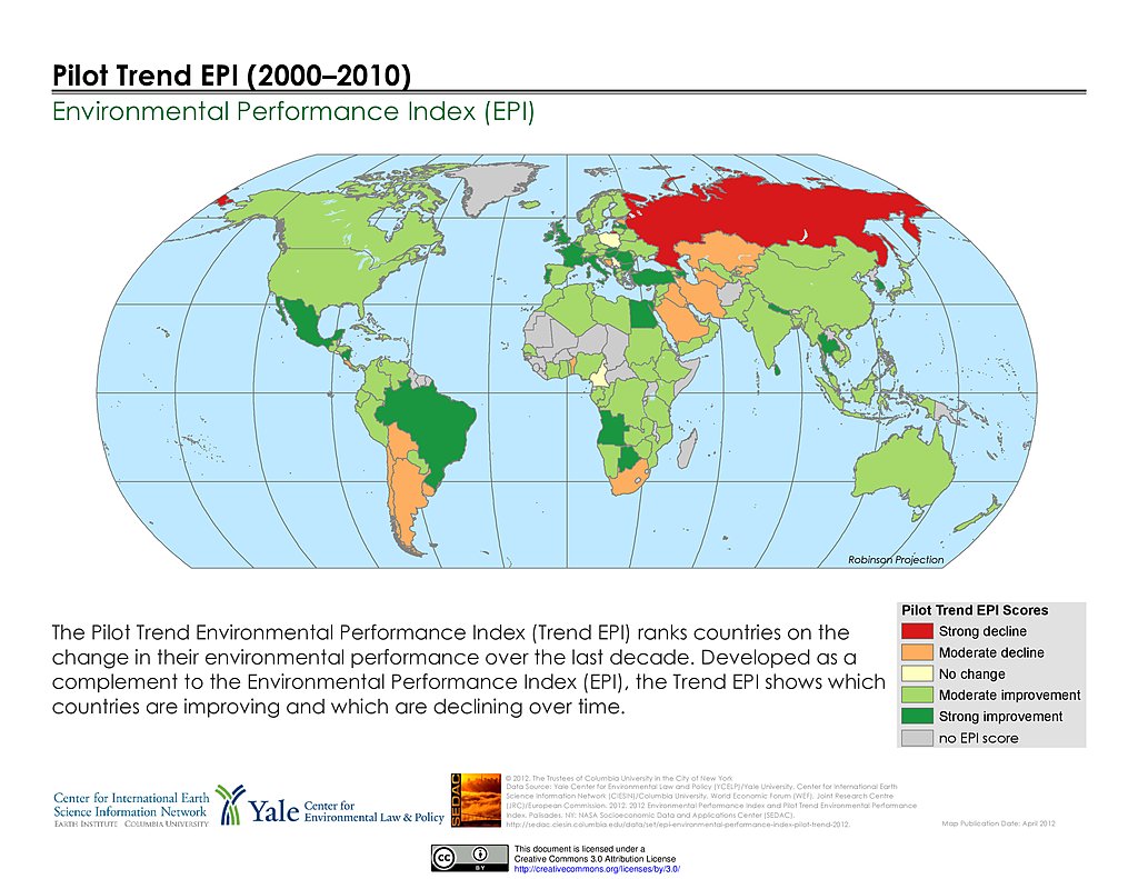
Pilot Trend EPI (2000-2010)
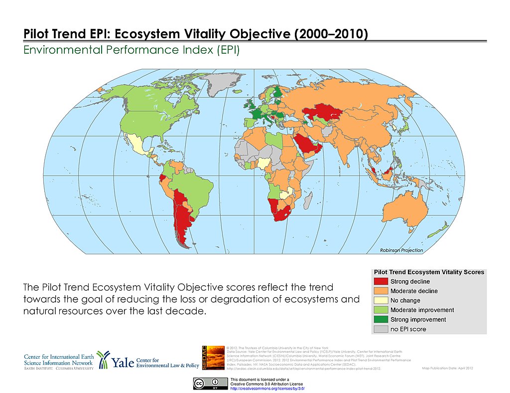
Ecosystem Vitality, Pilot Trend EPI (2000-2010)
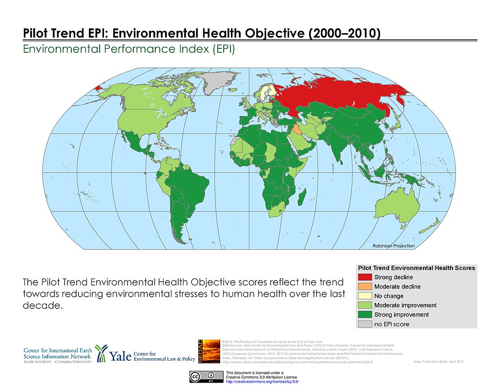
Environmental Health, Pilot Trend EPI (2000-2010)
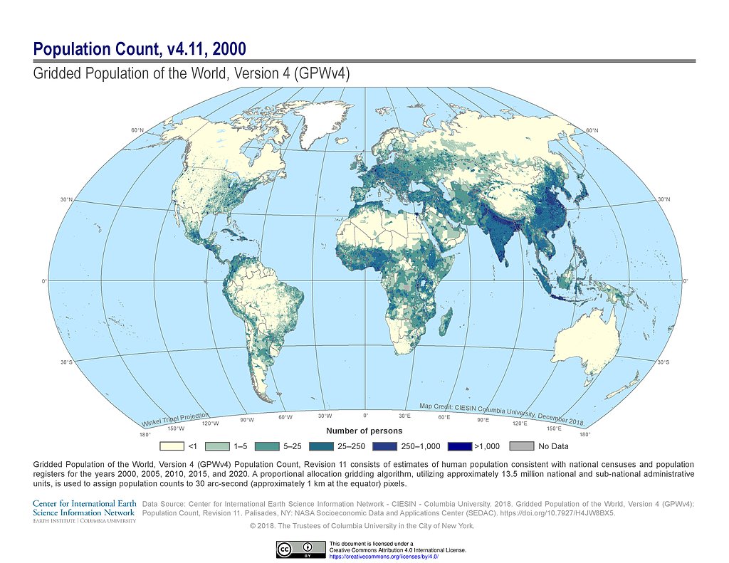
GPWv4 Rev11: Population Count (2000)
Maps
»
Region: Global
Remove Facet
10 of 18
Prev
|
Next