Socioeconomic Data and Applications Center (
sedac
)
A Data Center in NASA's Earth Observing System Data and Information System (
EOSDIS
) — Hosted by
CIESIN
at
Columbia University
Search SEDAC
Data
Data Sets
Maps
Web Pages
search
Data
· Data Sets
· Data Collections
· Featured Data Uses
· Data Citations
· Citations Database
· Data Submission
Maps
· Map Gallery
· Map Viewer
· Map Services
· Mapping Tools
Themes
· Agriculture
· Climate
· Conservation
· Governance
· Hazards
· Health
· Infrastructure
· Land Use
· Marine and Coastal
· Population
· Poverty
· Remote Sensing
· Sustainability
· Urban
· Water
Resources
· Guides
· Multimedia
· Networks
· News
· Publications
· Related Sites
· Remote Sensing
· Tools
Social Media
· Twitter
· FaceBook
· YouTube
· Flickr
· Blog Posts
· Communities
About
· About SEDAC
· User Working Group
· Privacy
· User Registration
Help
Map Gallery
(613)
Follow Us:
Twitter
Follow Us on Facebook
YouTube
Flickr
| Share:
Twitter
Facebook
Search
All Fields:
search
Theme
Agriculture
(18)
Climate
(73)
Conservation
(58)
Framework Data
(67)
Hazards
(29)
Health
(76)
Infrastructure
(13)
Land Use
(78)
Marine and Coastal
(25)
Population
(384)
Poverty
(68)
Remote Sensing
(61)
Sustainability
(298)
Urban
(250)
Water
(14)
Location
Select a Location...
american samoa
(5)
anguilla
(5)
antigua and barbuda
(5)
aruba
(5)
australia
(11)
bahamas
(5)
barbados
(5)
belize
(6)
bermuda
(5)
british virgin islands
(5)
canada
(9)
cape verde
(5)
cayman islands
(5)
cook islands
(5)
costa rica
(6)
cuba
(5)
dominica
(5)
dominican republic
(6)
el salvador
(6)
fiji
(5)
french polynesia
(5)
greenland
(5)
grenada
(5)
guam
(6)
guatemala
(24)
haiti
(6)
holy see
(1)
honduras
(16)
jamaica
(5)
kiribati
(5)
marshall islands
(7)
martinique
(5)
mexico
(9)
micronesia (federated states of)
(5)
montserrat
(5)
morocco
(1)
nauru
(5)
netherlands antilles
(5)
new caledonia
(5)
new zealand
(5)
nicaragua
(9)
niue
(5)
norfolk island
(4)
northern mariana islands
(5)
palau
(7)
panama
(16)
papua new guinea
(5)
pitcairn
(5)
puerto rico
(5)
saint kitts and nevis
(5)
saint lucia
(5)
saint pierre and miquelon
(5)
saint vincent and the grenadines
(5)
samoa
(5)
solomon islands
(5)
tokelau
(5)
tonga
(5)
trinidad and tobago
(5)
turks and caicos islands
(4)
tuvalu
(5)
united states of america
(111)
united states virgin islands
(5)
vanuatu
(5)
wallis and futuna islands
(5)
go
Maps
»
Region: n
Remove Facet
12 of 20
Prev
|
Next
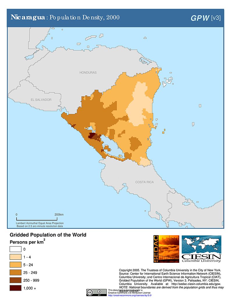
Population Density (2000): Nicaragua
Settlement Points: Nicaragua
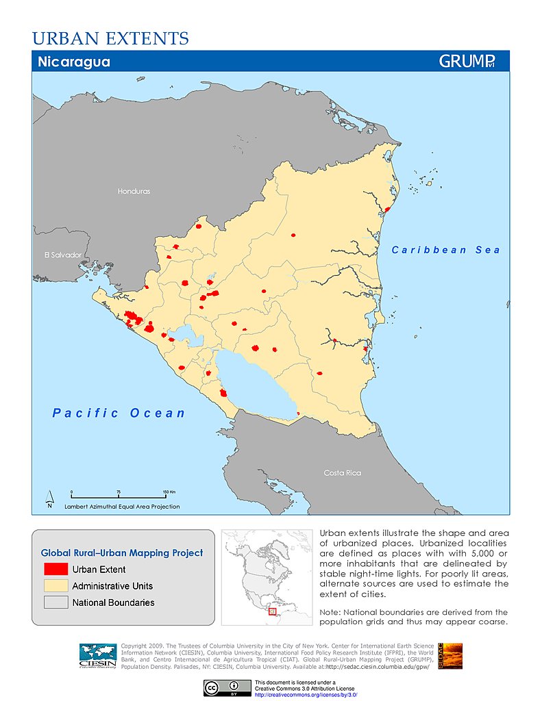
Urban Extents: Nicaragua
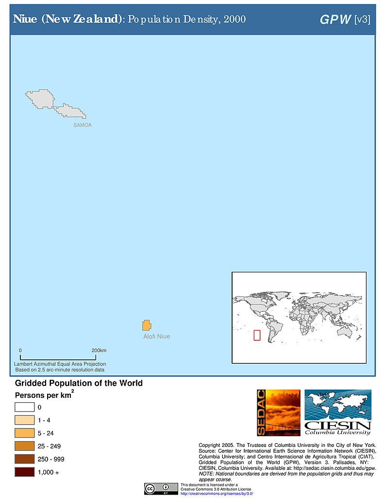
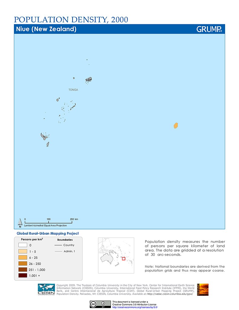
Population Density (2000): Niue
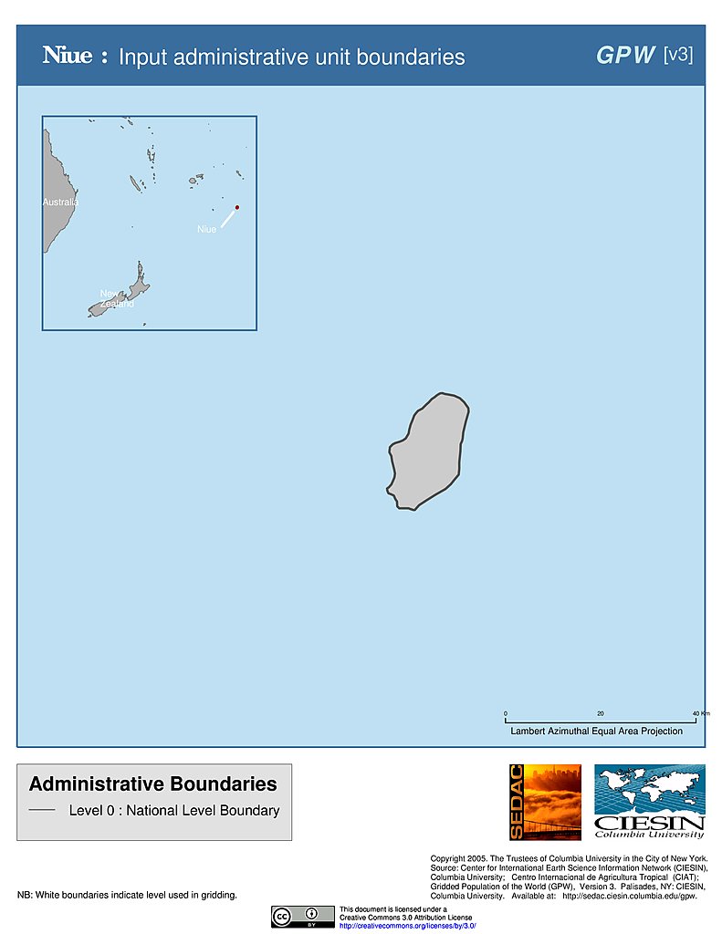
Administrative Boundaries: Niue
Population Density (2000): Niue
Settlement Points: Niue
Urban Extents: Niue
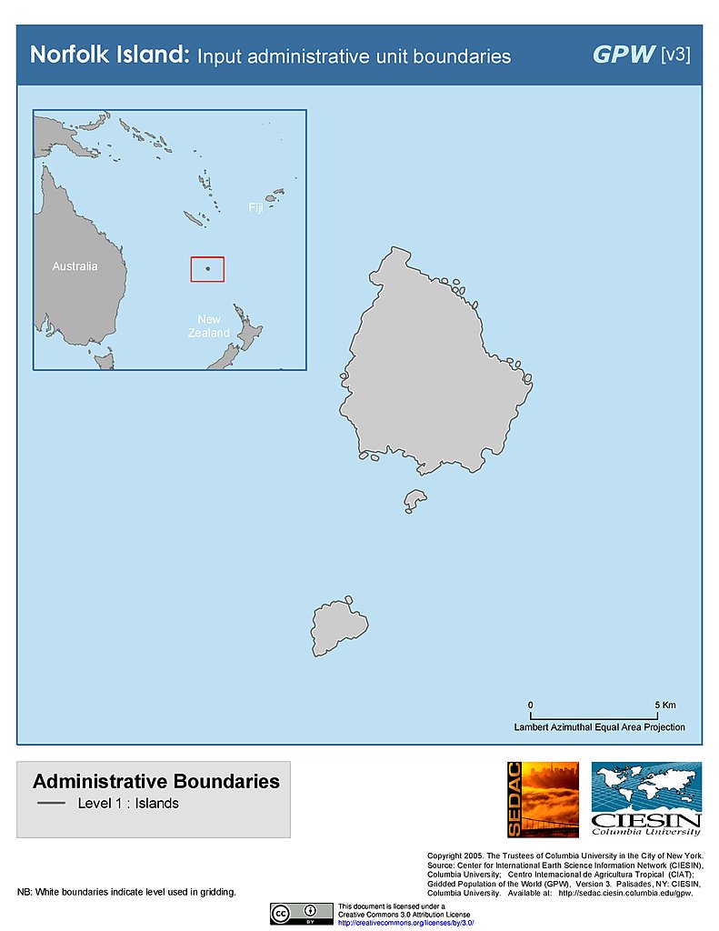
Administrative Boundaries: Norfolk Island
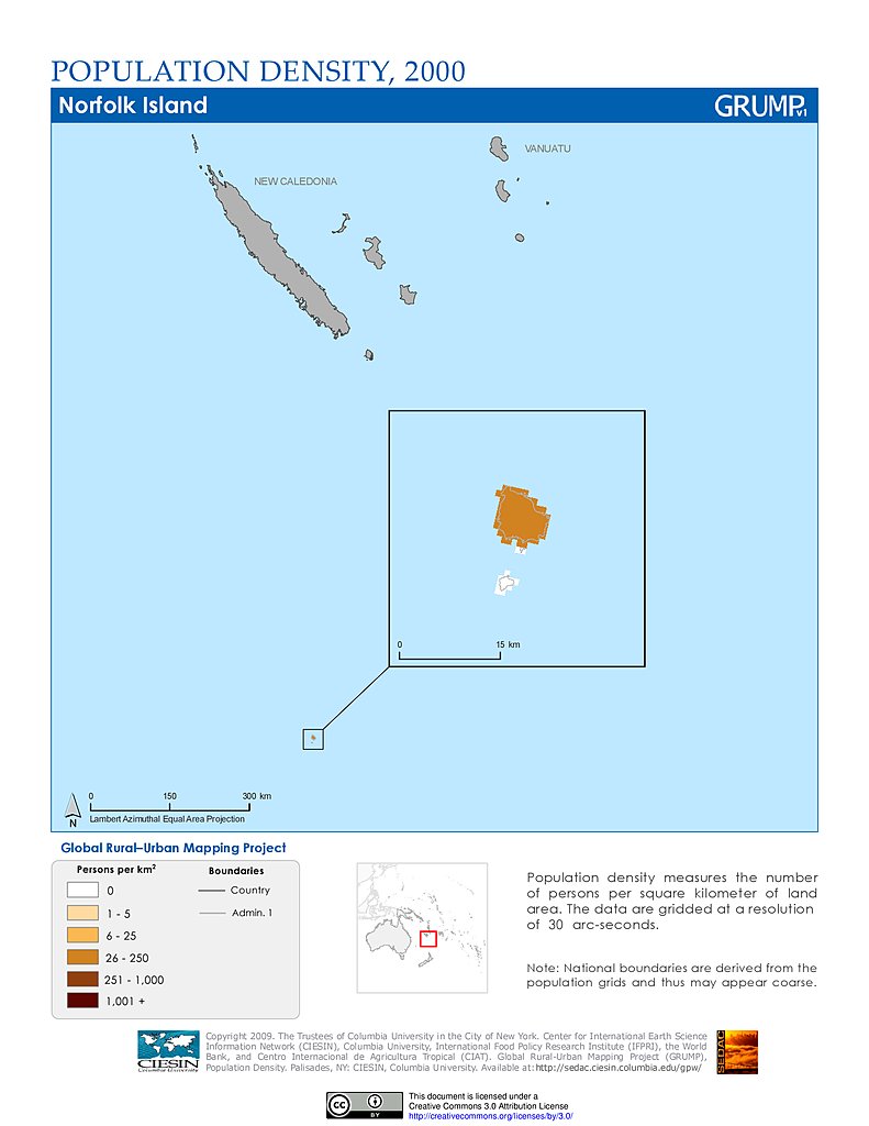
Population Density (2000): Norfolk Island
Settlement Points: Norfolk Island
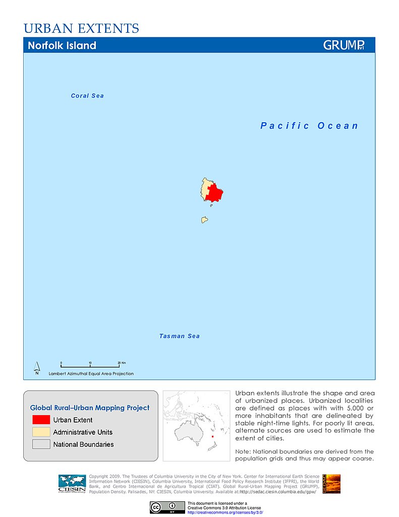
Urban Extents: Norfolk Island
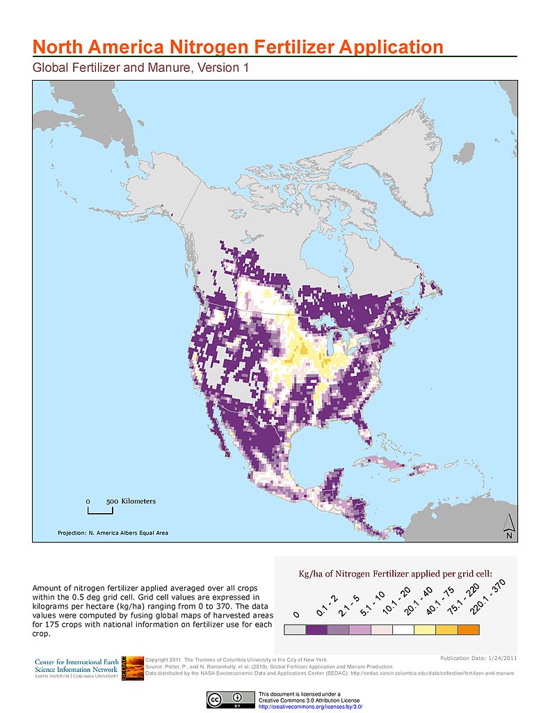
Nitrogen Fertilizer Application: North America
Phosphorus Fertilizer Application: North America
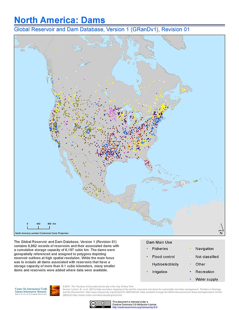
Dams, v1.01: North America
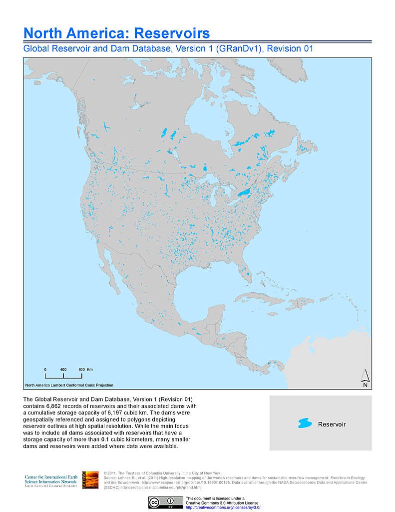
Reservoirs, v1.01: North America
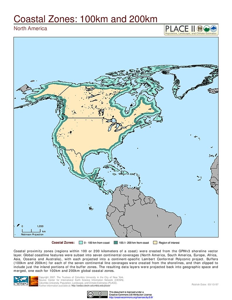
100 km & 200 km Coastal Zones: North America
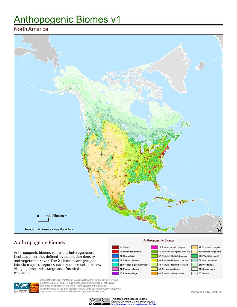
Anthropogenic Biomes, v1: North America
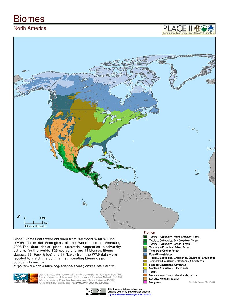
Biomes: North America
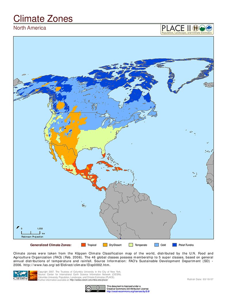
Climate Zones: North America
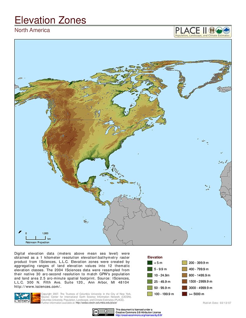
Elevation Zones: North America
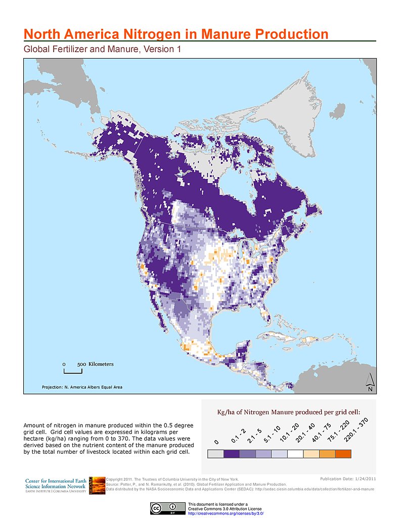
Nitrogen in Manure Production: North America
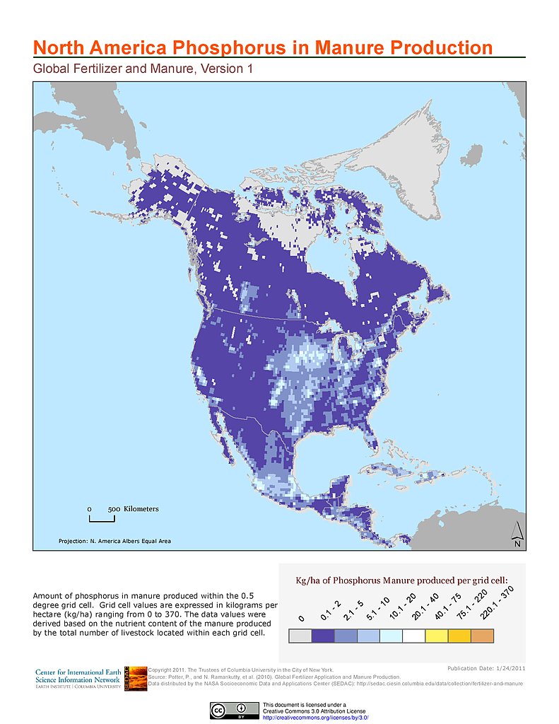
Phosphorus in Manure Production: North America
Global Roads Open Access Data Set, v1: North America
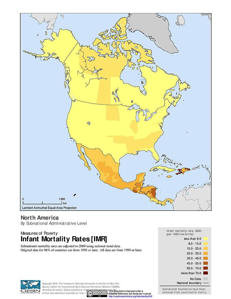
Infant Mortality Rates: North America
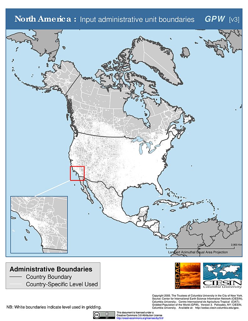
Administrative Boundaries: North America
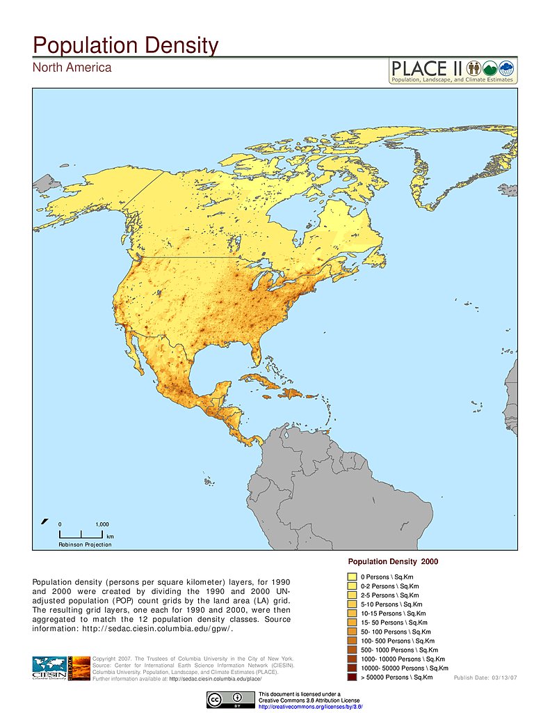
Population Density: North America
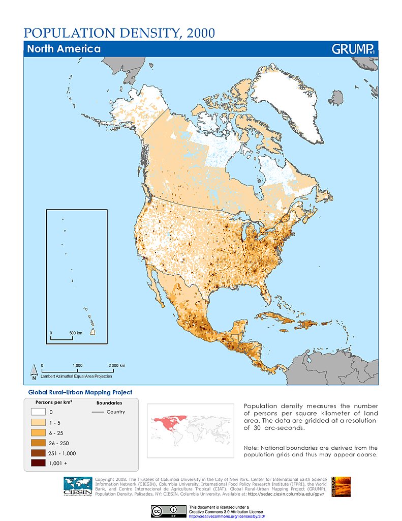
Population Density (2000): North America
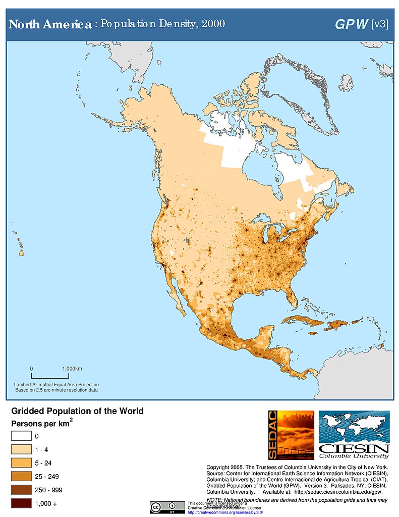
Population Density (2000): North America
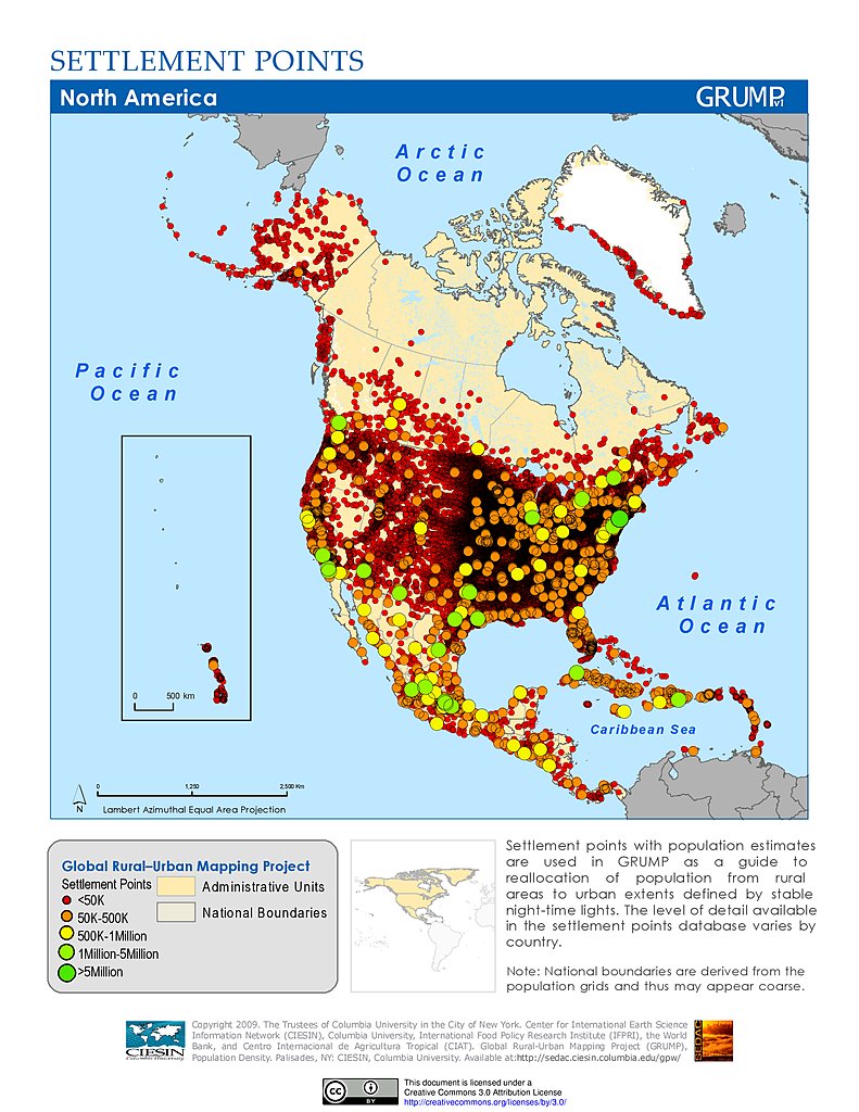
Settlement Points: North America
Human Footprint Index, v2: North America
Human Influence Index, v2: North America
Maps
»
Region: n
Remove Facet
12 of 20
Prev
|
Next