Socioeconomic Data and Applications Center (
sedac
)
A Data Center in NASA's Earth Observing System Data and Information System (
EOSDIS
) — Hosted by
CIESIN
at
Columbia University
Search SEDAC
Data
Data Sets
Maps
Web Pages
search
Data
· Data Sets
· Data Collections
· Featured Data Uses
· Data Citations
· Citations Database
· Data Submission
Maps
· Map Gallery
· Map Viewer
· Map Services
· Mapping Tools
Themes
· Agriculture
· Climate
· Conservation
· Governance
· Hazards
· Health
· Infrastructure
· Land Use
· Marine and Coastal
· Population
· Poverty
· Remote Sensing
· Sustainability
· Urban
· Water
Resources
· Guides
· Multimedia
· Networks
· News
· Publications
· Related Sites
· Remote Sensing
· Tools
Social Media
· Twitter
· FaceBook
· YouTube
· Flickr
· Blog Posts
· Communities
About
· About SEDAC
· User Working Group
· Privacy
· User Registration
Help
Map Gallery
(531)
Follow Us:
Twitter
Follow Us on Facebook
YouTube
Flickr
| Share:
Twitter
Facebook
Search
All Fields:
search
Theme
Agriculture
(13)
Climate
(49)
Conservation
(33)
Framework Data
(48)
Governance
(2)
Hazards
(7)
Health
(171)
Infrastructure
(9)
Land Use
(55)
Marine and Coastal
(17)
Population
(254)
Poverty
(170)
Remote Sensing
(48)
Sustainability
(213)
Urban
(181)
Water
(10)
Region
Africa
(43)
Asia
(395)
Europe
(13)
Global
(2)
North America
(48)
Oceania
(2)
South America
(28)
Location
Select a Location...
afghanistan
(6)
albania
(6)
armenia
(5)
azerbaijan
(5)
bahrain
(5)
bangladesh
(13)
bhutan
(5)
bolivia
(6)
brunei darussalam
(5)
bulgaria
(6)
cambodia
(15)
china
(28)
democratic people's republic of korea
(6)
ecuador
(8)
guatemala
(18)
honduras
(11)
hong kong special administrative region
(6)
india
(20)
indonesia
(11)
iran (islamic republic of)
(6)
iraq
(5)
israel
(6)
japan
(7)
jordan
(6)
kazakhstan
(5)
kenya
(5)
kuwait
(5)
kyrgyzstan
(5)
lao people's democratic republic
(5)
lebanon
(6)
macao special administrative region
(5)
madagascar
(7)
malawi
(9)
malaysia
(5)
maldives
(5)
mongolia
(5)
morocco
(1)
mozambique
(6)
myanmar
(5)
nepal
(6)
nicaragua
(3)
occupied palestinian territory
(5)
oman
(5)
pakistan
(4)
panama
(11)
paraguay
(13)
philippines
(5)
qatar
(5)
republic of korea
(5)
russian federation
(1)
saudi arabia
(5)
singapore
(6)
south africa
(7)
sri lanka
(5)
syrian arab republic
(6)
taiwan
(6)
tajikistan
(5)
thailand
(6)
timor-leste
(5)
turkey
(5)
turkmenistan
(5)
uganda
(5)
united arab emirates
(5)
united states of america
(4)
uzbekistan
(5)
viet nam
(17)
yemen
(5)
go
Maps
»
All Fields: Asia
Remove Facet
14 of 17
Prev
|
Next
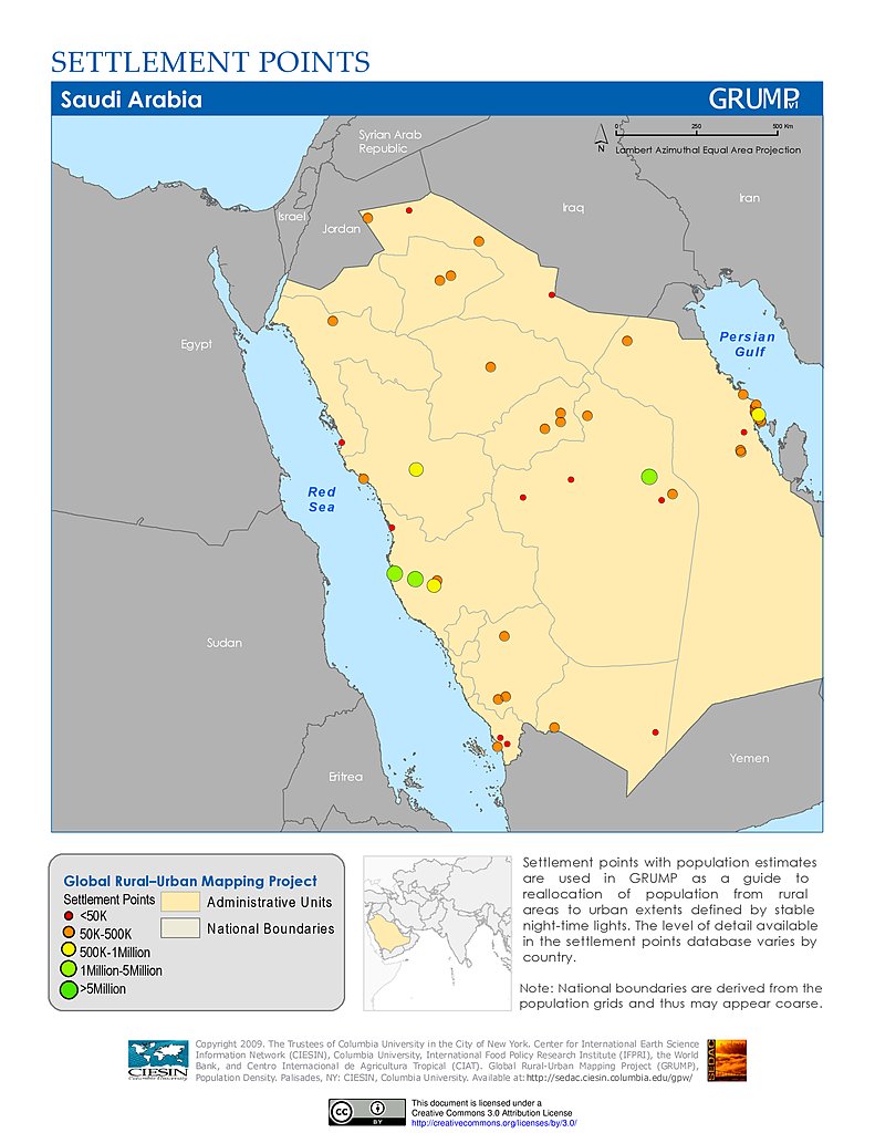
Settlement Points: Saudi Arabia
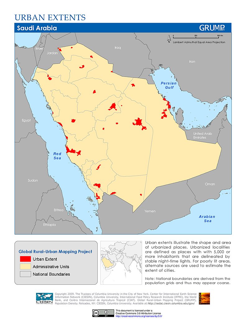
Urban Extents: Saudi Arabia
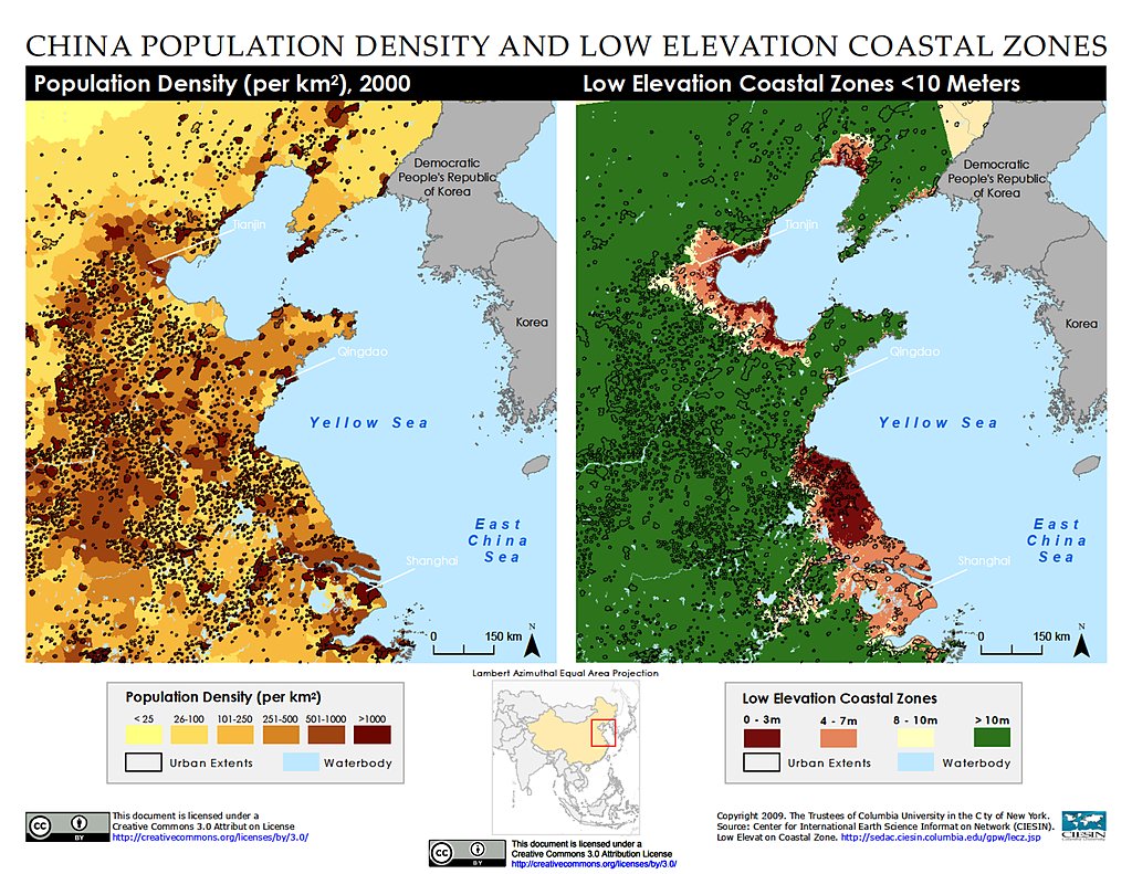
Population Density & LECZ: Shanghai, China
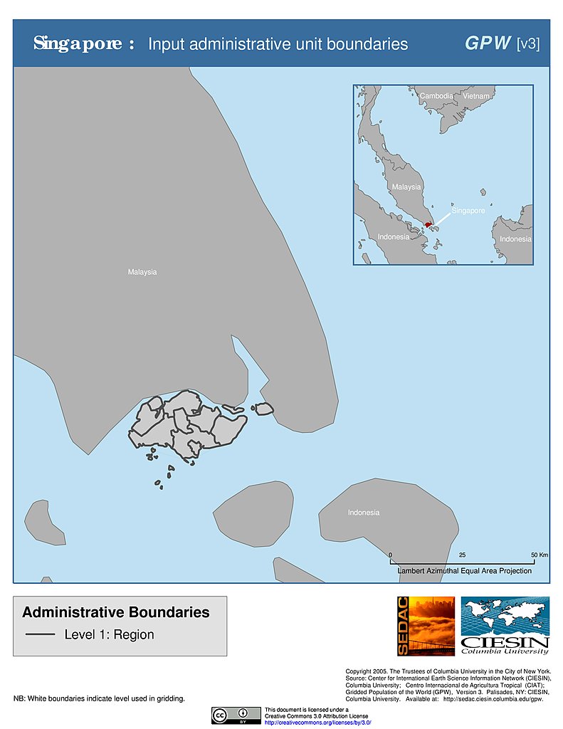
Administrative Boundaries: Singapore
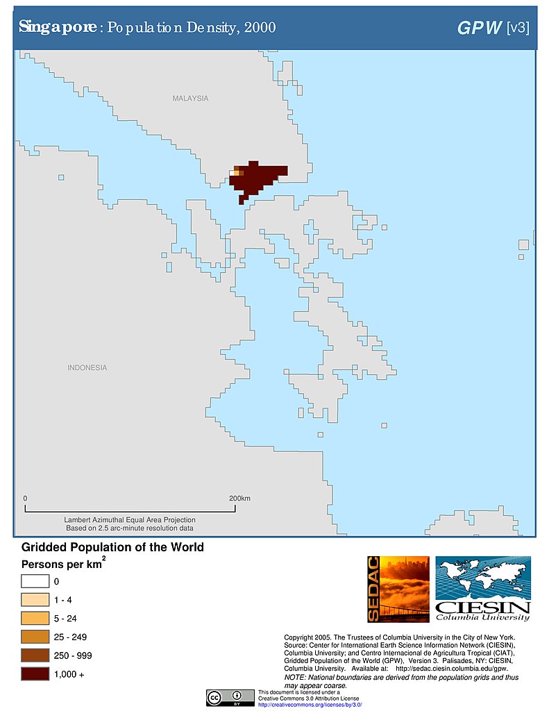
Population Density (2000): Singapore
Population Density (2000): Singapore
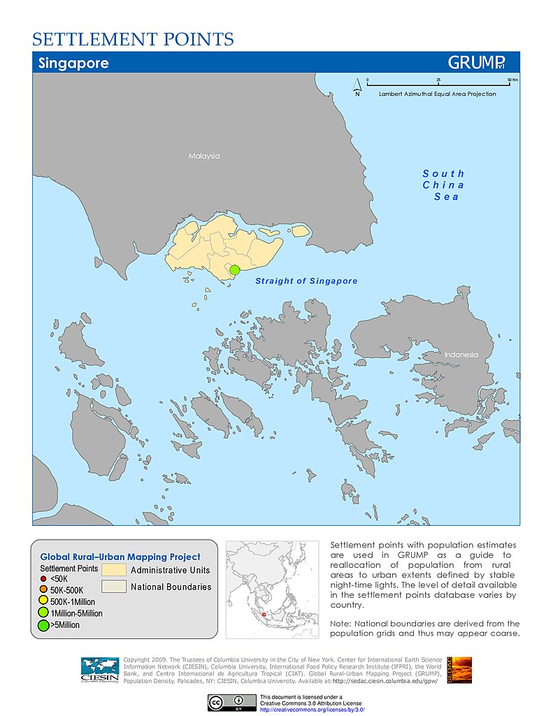
Settlement Points: Singapore
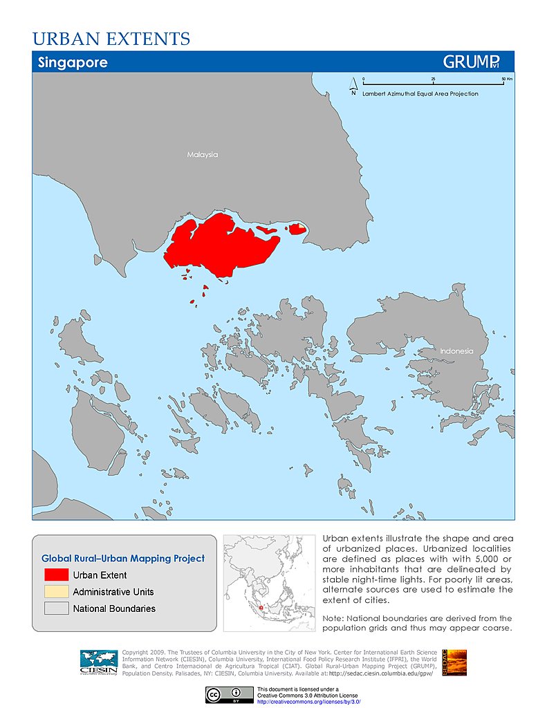
Urban Extents: Singapore
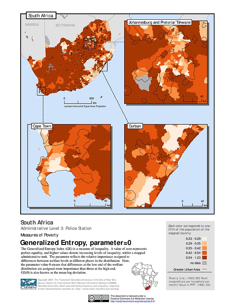
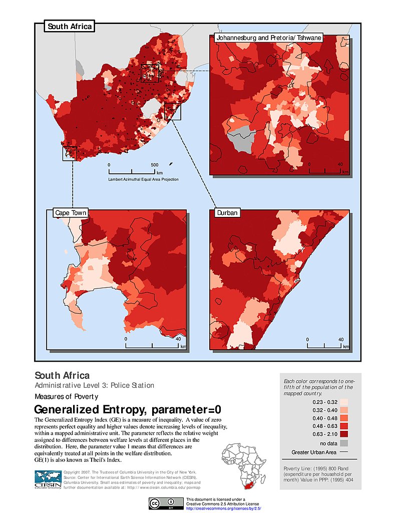
Generalized Entropy Index 0, ADM3: South Africa
Generalized Entropy Index 1, ADM3: South Africa
Generalized Entropy Index 2, ADM3: South Africa
Poverty Density, ADM3: South Africa
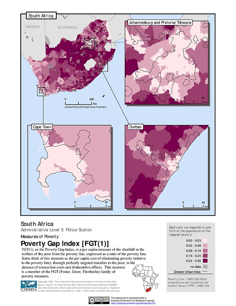
Poverty Gap Index, ADM3: South Africa
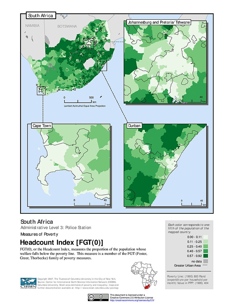
Poverty Headcount Index, ADM3: South Africa
Squared Poverty Gap Index, ADM3: South Africa
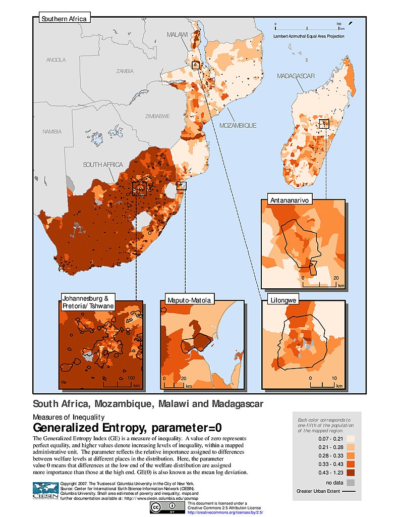
Generalized Entropy Index 0: ZAF, MOZ, MWI, MDG
Generalized Entropy Index 1: ZAF, MOZ, MWI, MDG
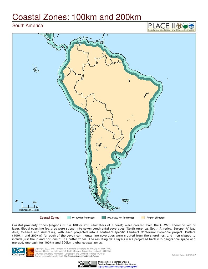
100 km & 200 km Coastal Zones: South America
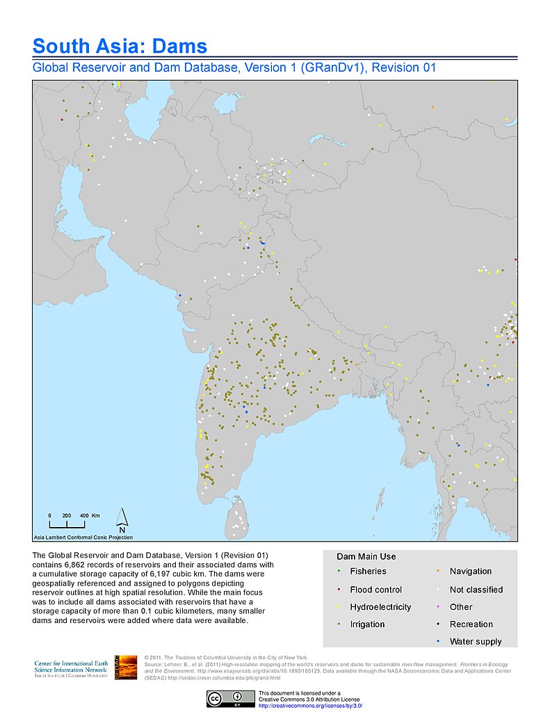
Dams, v1.01: South Asia
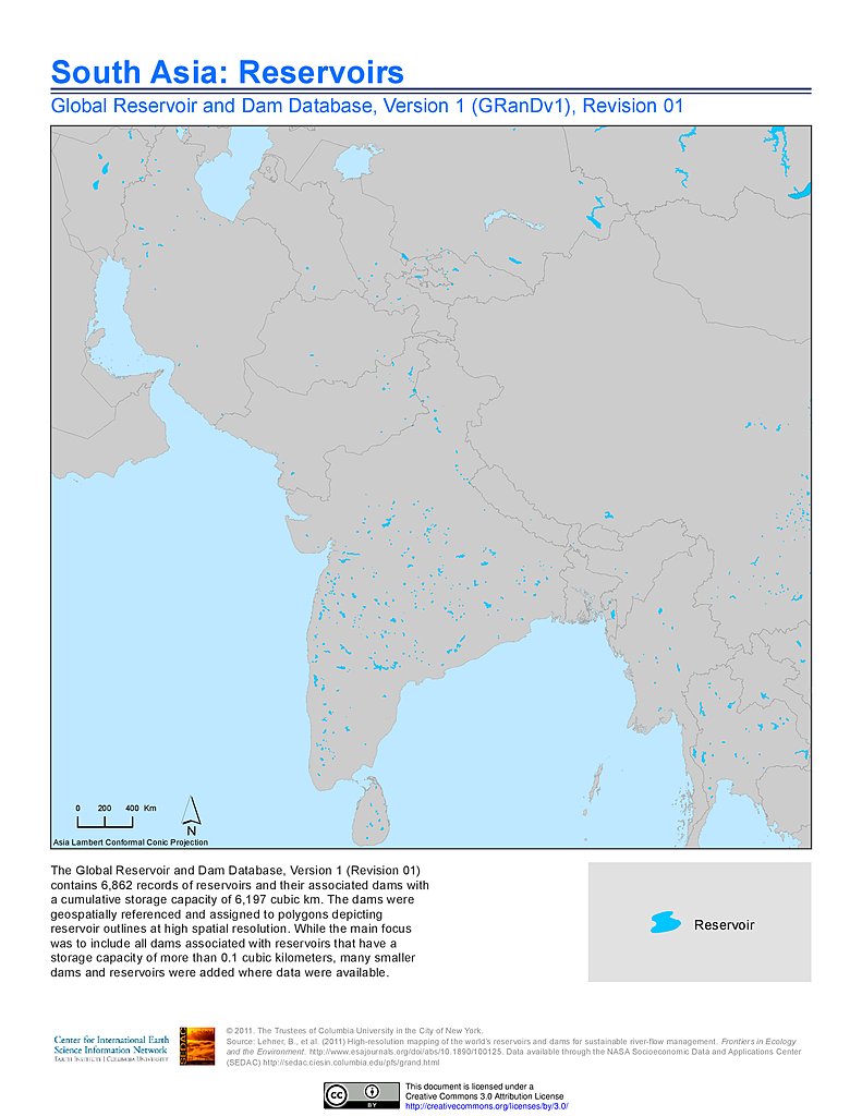
Reservoirs, v1.01: South Asia
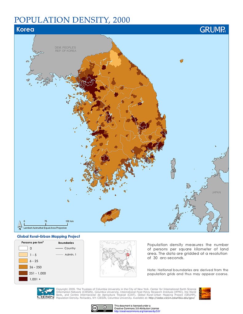
Population Density (2000): South Korea
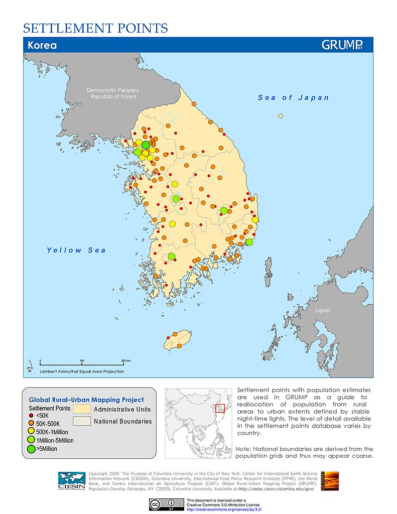
Settlement Points: South Korea
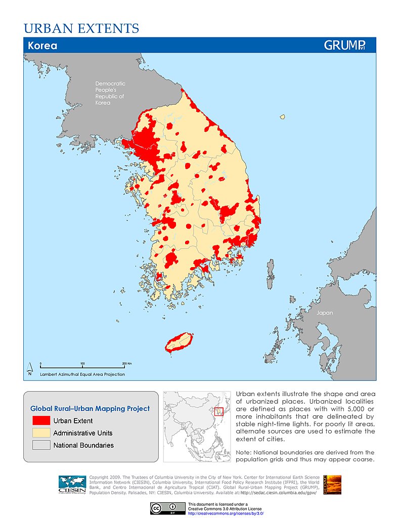
Urban Extents: South Korea
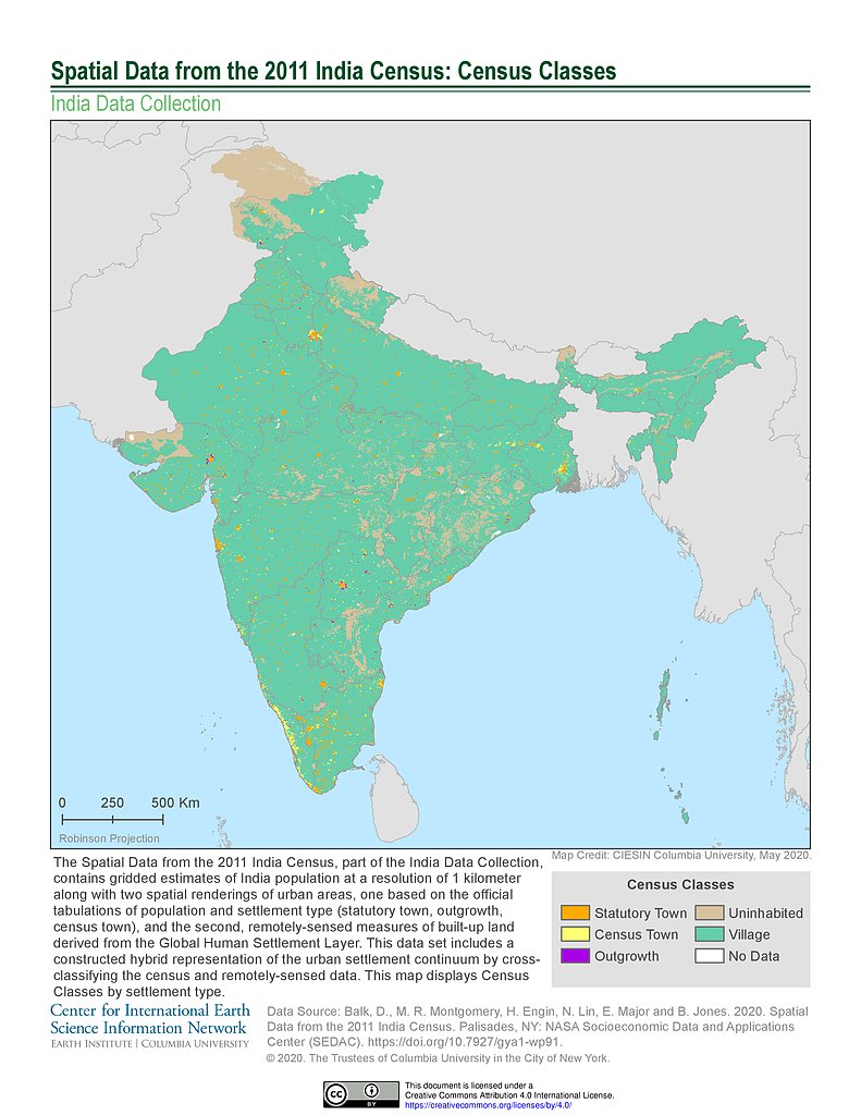
India Census (2011): Census Classes
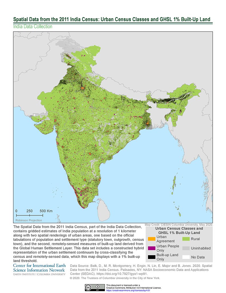
India Census (2011): Urban Census Classes & GHSL 1% Built-Up Land
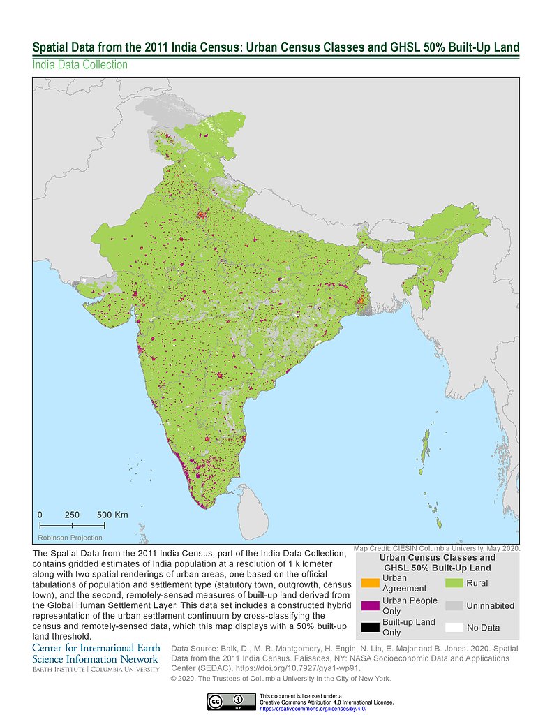
India Census (2011): Urban Census Classes & GHSL 50% Built-Up Land
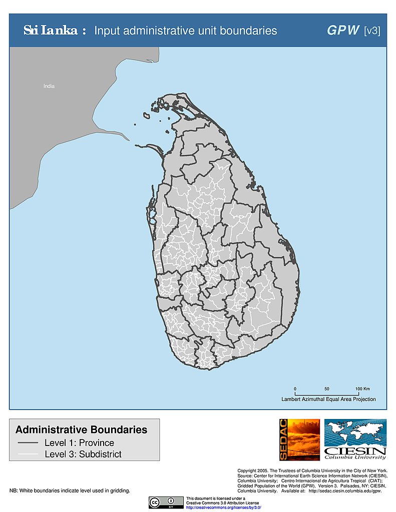
Administrative Boundaries: Sri Lanka
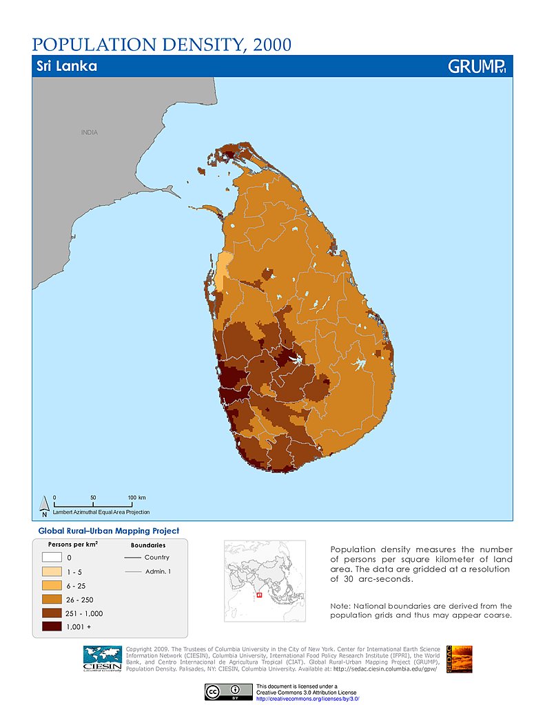
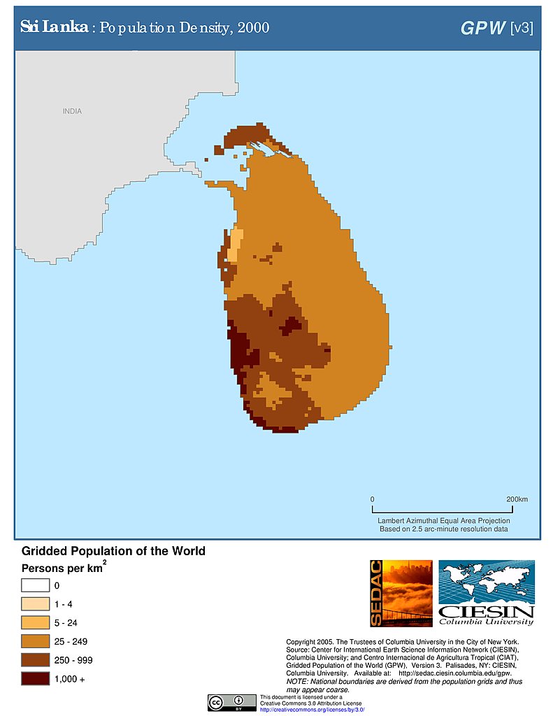
Population Density (2000): Sri Lanka
Population Density (2000): Sri Lanka
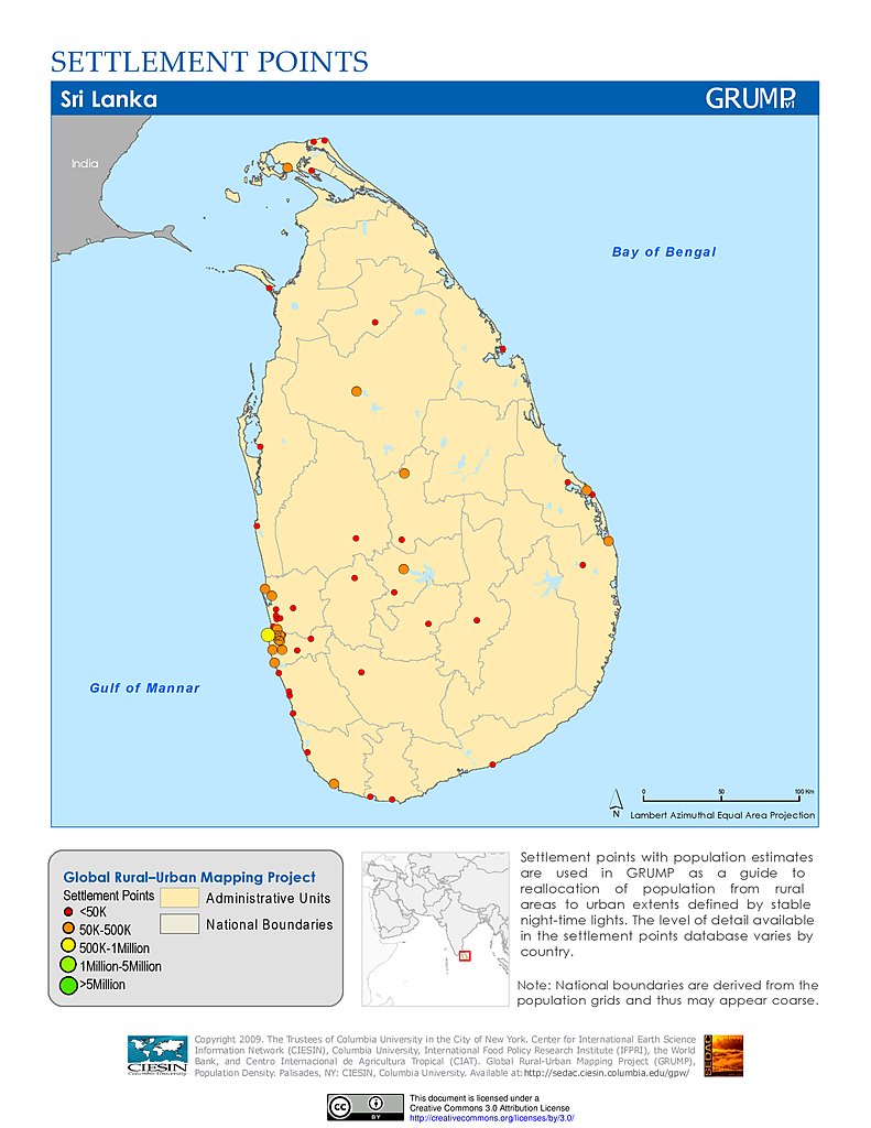
Settlement Points: Sri Lanka
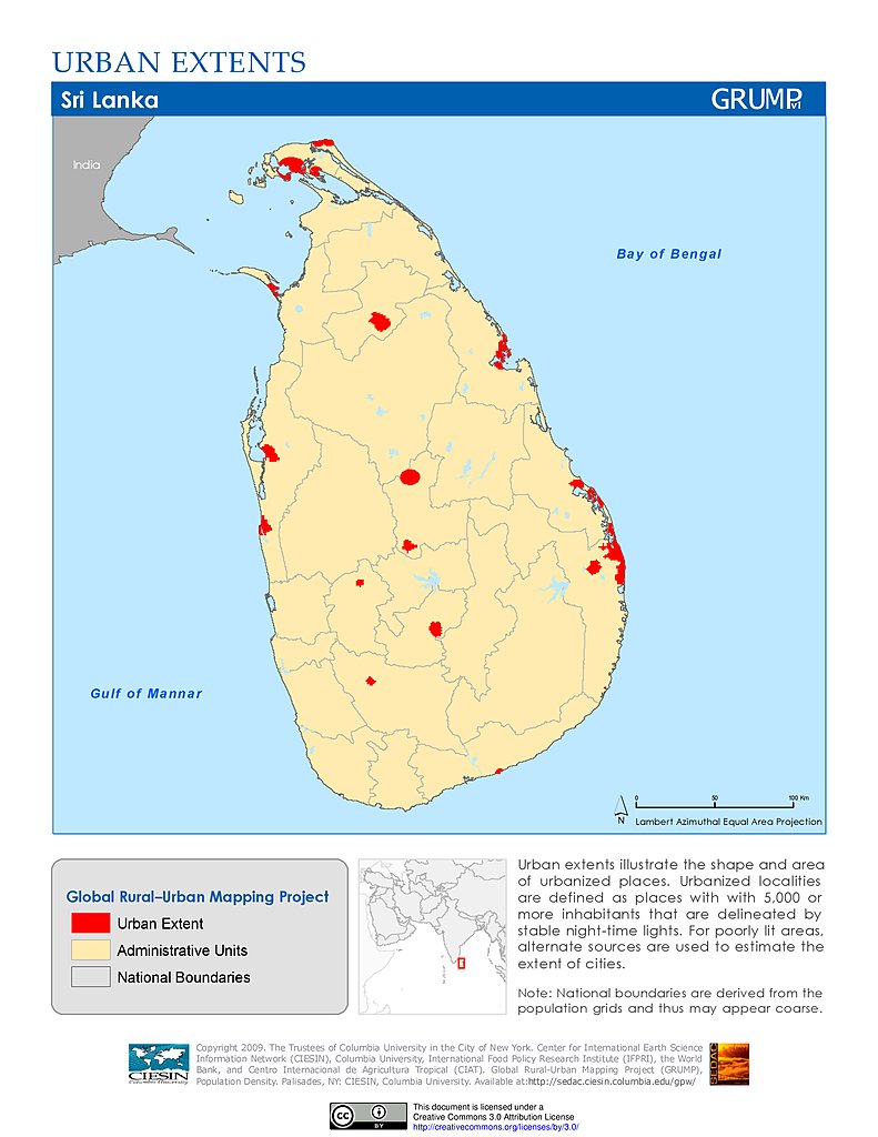
Urban Extents: Sri Lanka
SF1 2010, Asian Alone (%): USA
Maps
»
All Fields: Asia
Remove Facet
14 of 17
Prev
|
Next