Socioeconomic Data and Applications Center (
sedac
)
A Data Center in NASA's Earth Observing System Data and Information System (
EOSDIS
) — Hosted by
CIESIN
at
Columbia University
Search SEDAC
Data
Data Sets
Maps
Web Pages
search
Data
· Data Sets
· Data Collections
· Featured Data Uses
· Data Citations
· Citations Database
· Data Submission
Maps
· Map Gallery
· Map Viewer
· Map Services
· Mapping Tools
Themes
· Agriculture
· Climate
· Conservation
· Governance
· Hazards
· Health
· Infrastructure
· Land Use
· Marine and Coastal
· Population
· Poverty
· Remote Sensing
· Sustainability
· Urban
· Water
Resources
· Guides
· Multimedia
· Networks
· News
· Publications
· Related Sites
· Remote Sensing
· Tools
Social Media
· Twitter
· FaceBook
· YouTube
· Flickr
· Blog Posts
· Communities
About
· About SEDAC
· User Working Group
· Privacy
· User Registration
Help
Map Gallery
(547)
Follow Us:
Twitter
Follow Us on Facebook
YouTube
Flickr
| Share:
Twitter
Facebook
Search
All Fields:
search
Region
Africa
(32)
Asia
(41)
Europe
(28)
Global
(344)
North America
(49)
Oceania
(24)
South America
(29)
Location
Select a Location...
australia
(1)
bangladesh
(2)
belize
(1)
bolivia
(1)
china
(3)
egypt
(1)
germany
(1)
guam
(1)
india
(1)
indonesia
(1)
iran (islamic republic of)
(1)
italy
(1)
liberia
(1)
mauritania
(1)
netherlands
(2)
nigeria
(1)
thailand
(1)
united kingdom of great britain and northern ireland
(1)
united states of america
(24)
uruguay
(1)
venezuela (bolivarian republic of)
(1)
viet nam
(2)
go
Maps
»
Theme: Climate
Remove Facet
17 of 18
Prev
|
Next
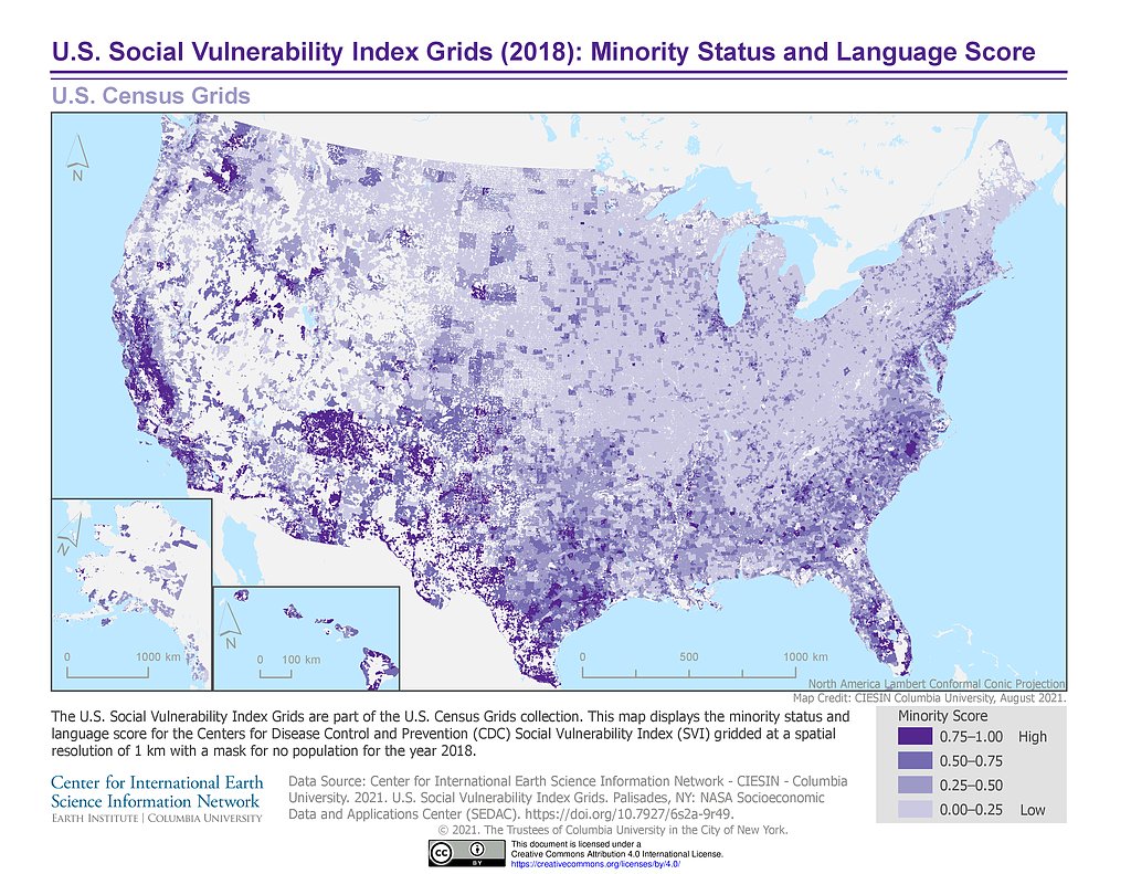
U.S. SVI (2018): Minority Status & Language Score
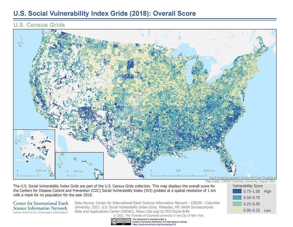
U.S. SVI (2018): Overall Score
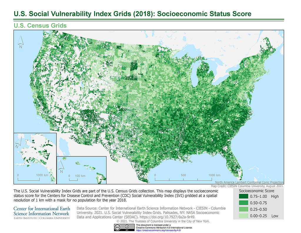
U.S. SVI (2018): Socioeconomic Status Score
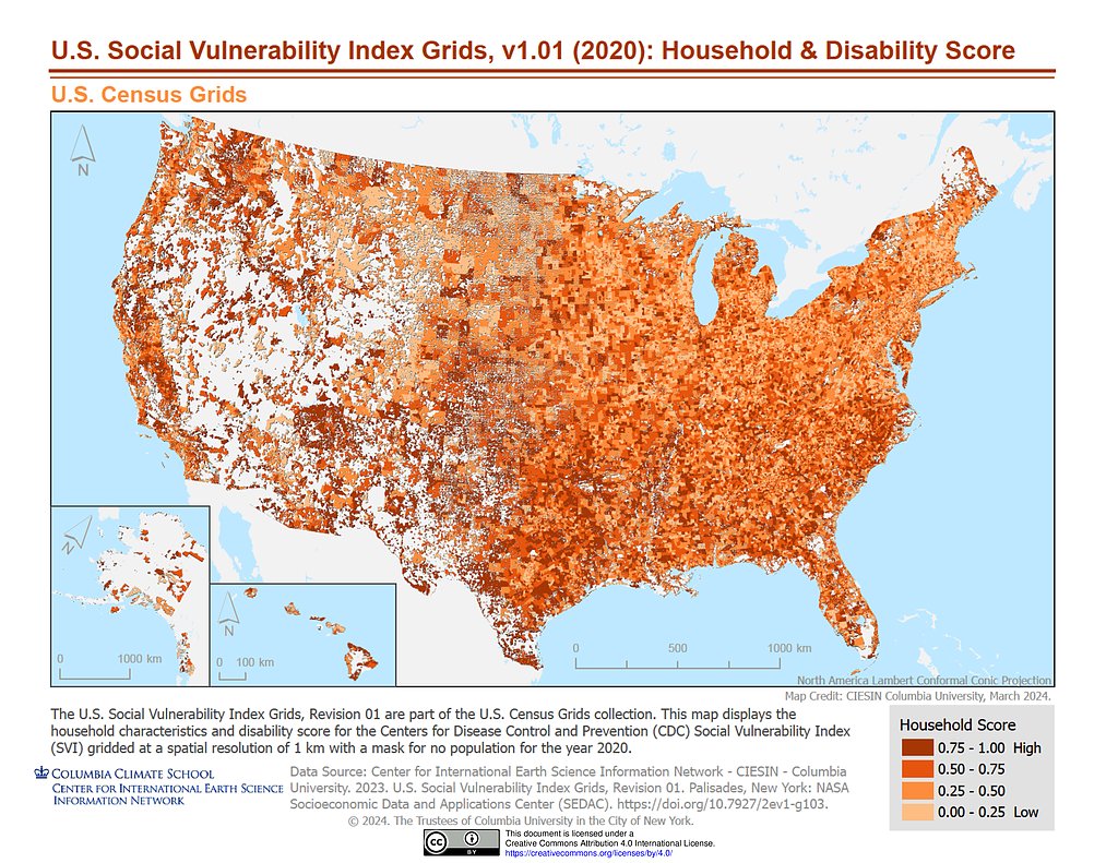
U.S. SVI, v1.01 (2020): Household & Disability Score
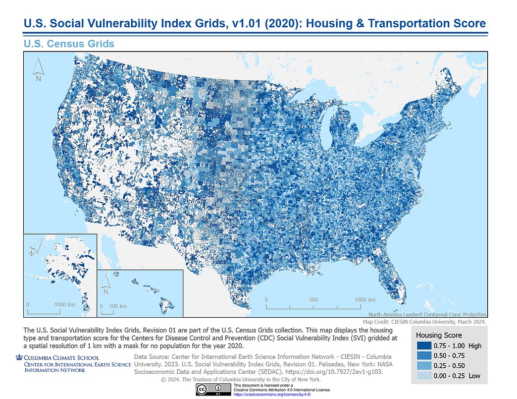
U.S. SVI, v1.01 (2020): Housing & Transportation Score
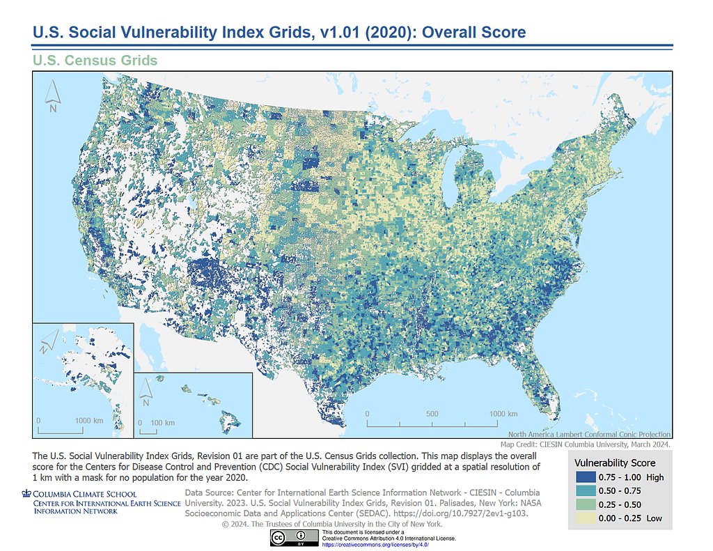
U.S. SVI, v1.01 (2020): Overall Score
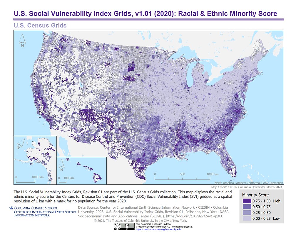
U.S. SVI, v1.01 (2020): Racial & Ethnic Minority Score
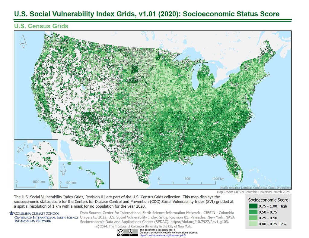
U.S. SVI, v1.01 (2020): Socioeconomic Status Score
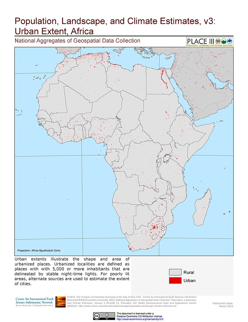
Urban Extents: Africa
Urban Extents: Asia
Urban Extents: Europe
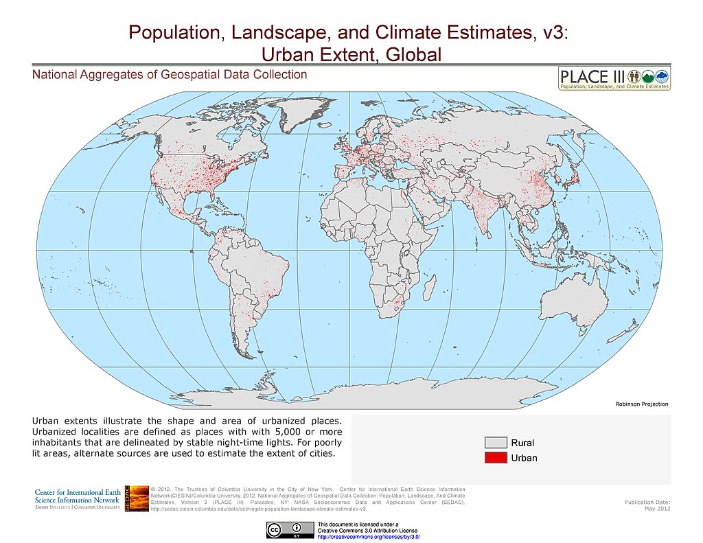
Urban Extents
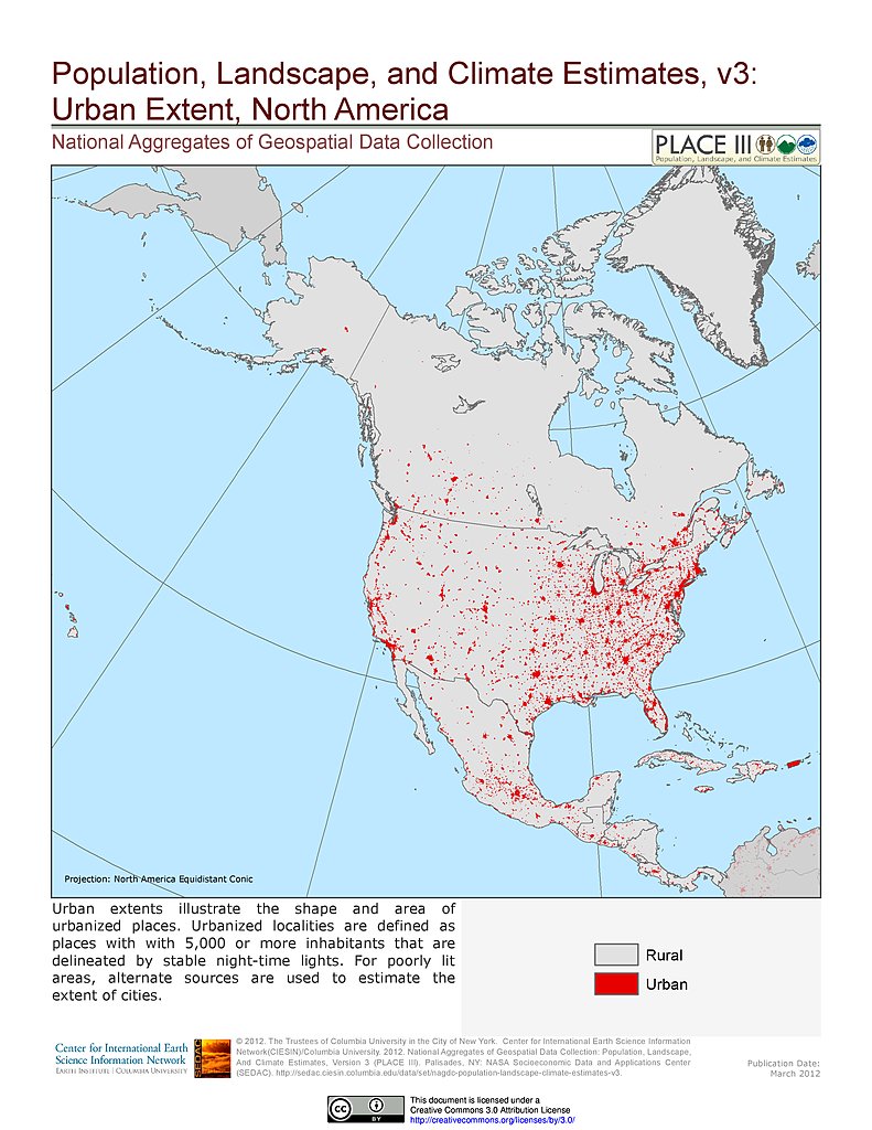
Urban Extents: North America
Urban Extents: Oceania
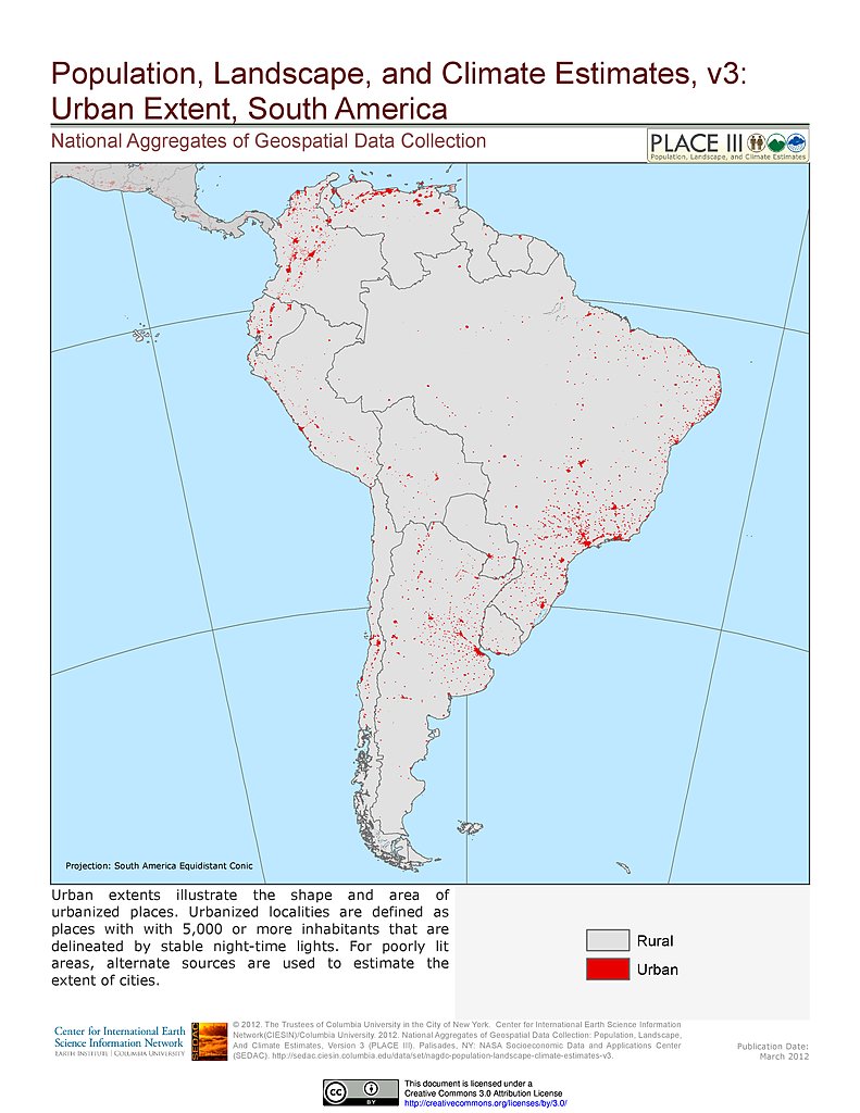
Urban Extents: South America
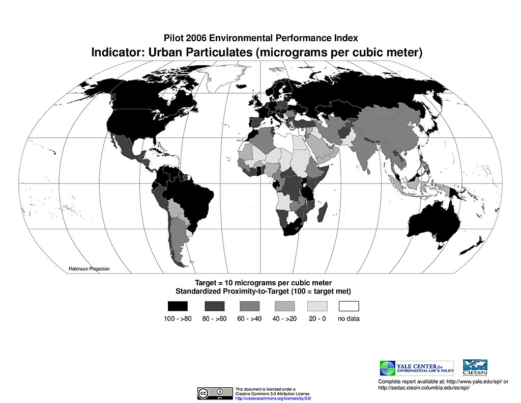
Urban Particulates, Pilot EPI 2006
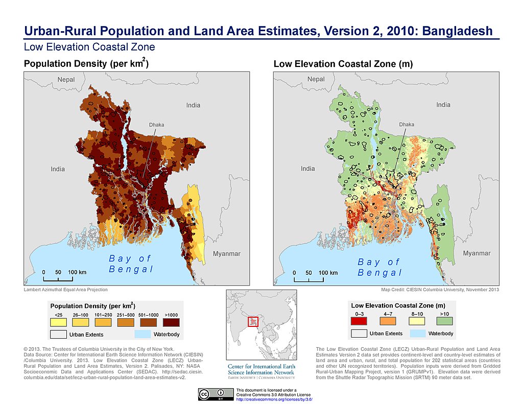
Population & Land Area Estimates (2010): Bangladesh
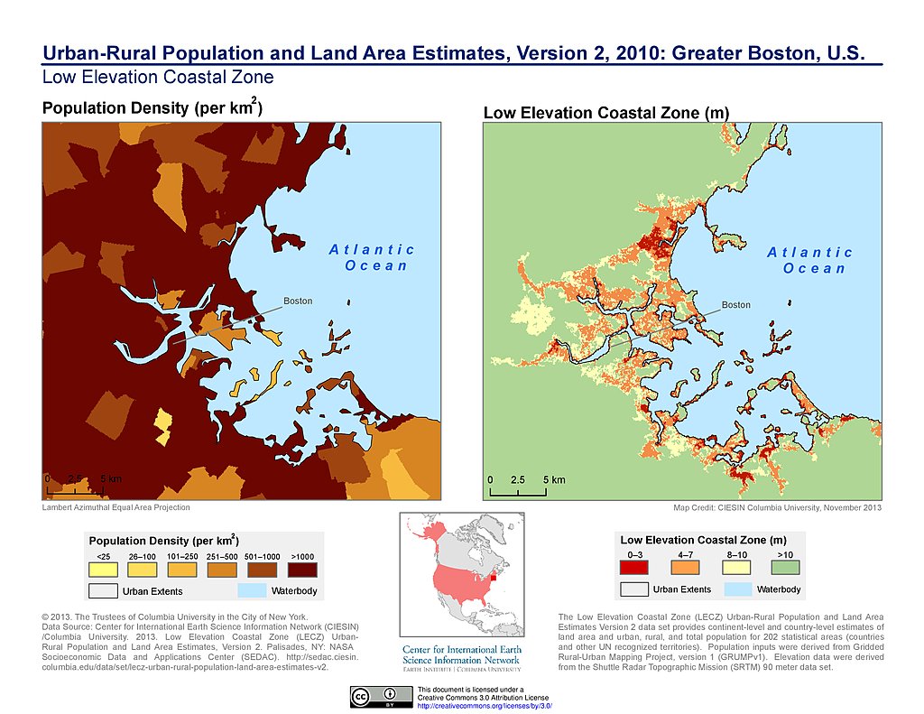
Population & Land Area Estimates (2010): Greater Boston
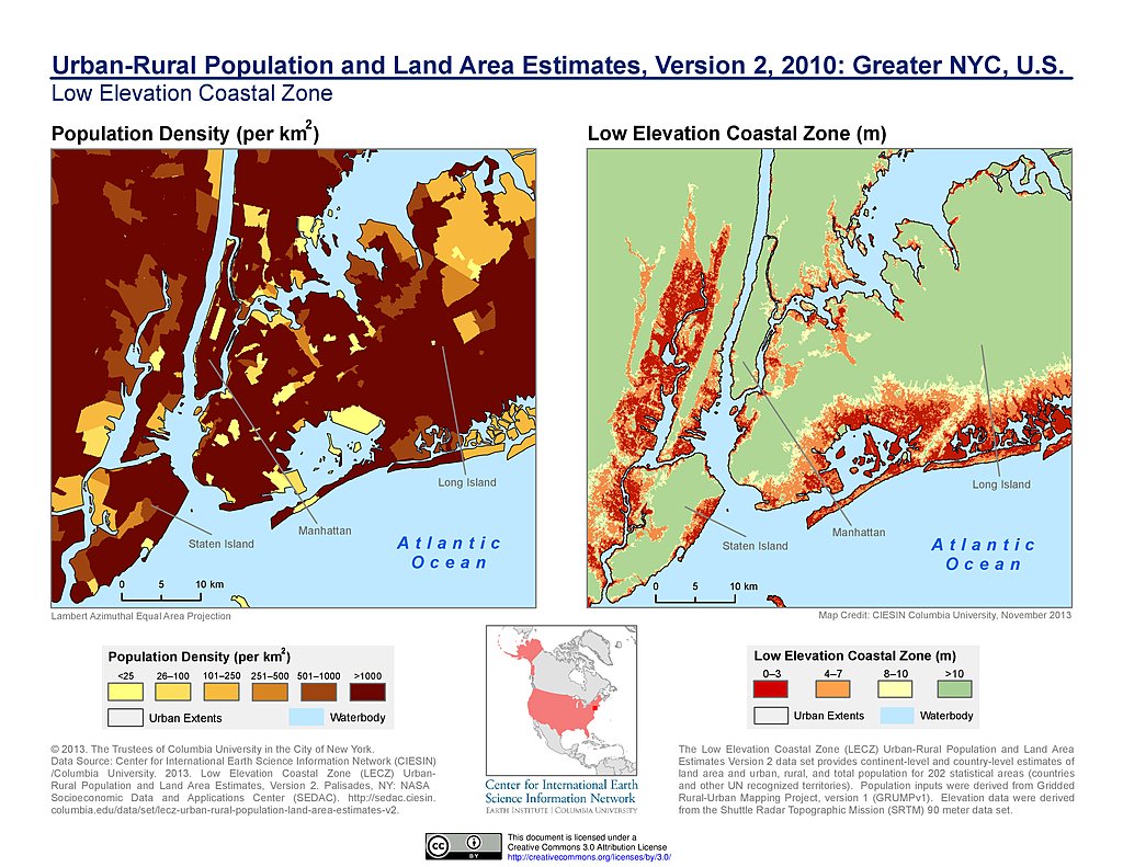
Population & Land Area Estimates (2010): Greater NYC
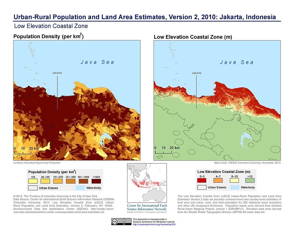
Population & Land Area Estimates (2010): Jakarta, Indonesia
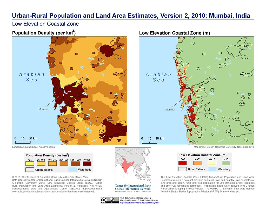
Population & Land Area Estimates (2010): Mumbai, India
Population & Land Area Estimates (2010): Netherlands
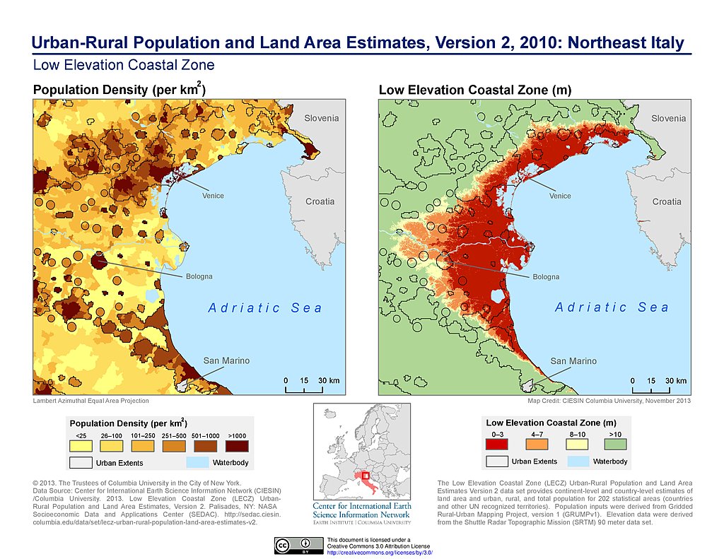
Population & Land Area Estimates (2010): Northeast Italy
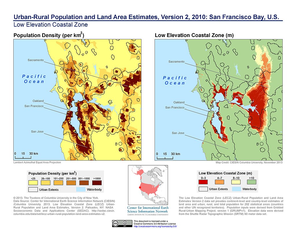
Population & Land Area Estimates (2010): San Francisco Bay
Population & Land Area Estimates (2010): Shanghai, China
Population & Land Area Estimates (2010): Ho Chi Minh, Vietnam
Population & Land Area Estimates (2010): Tianjin, China
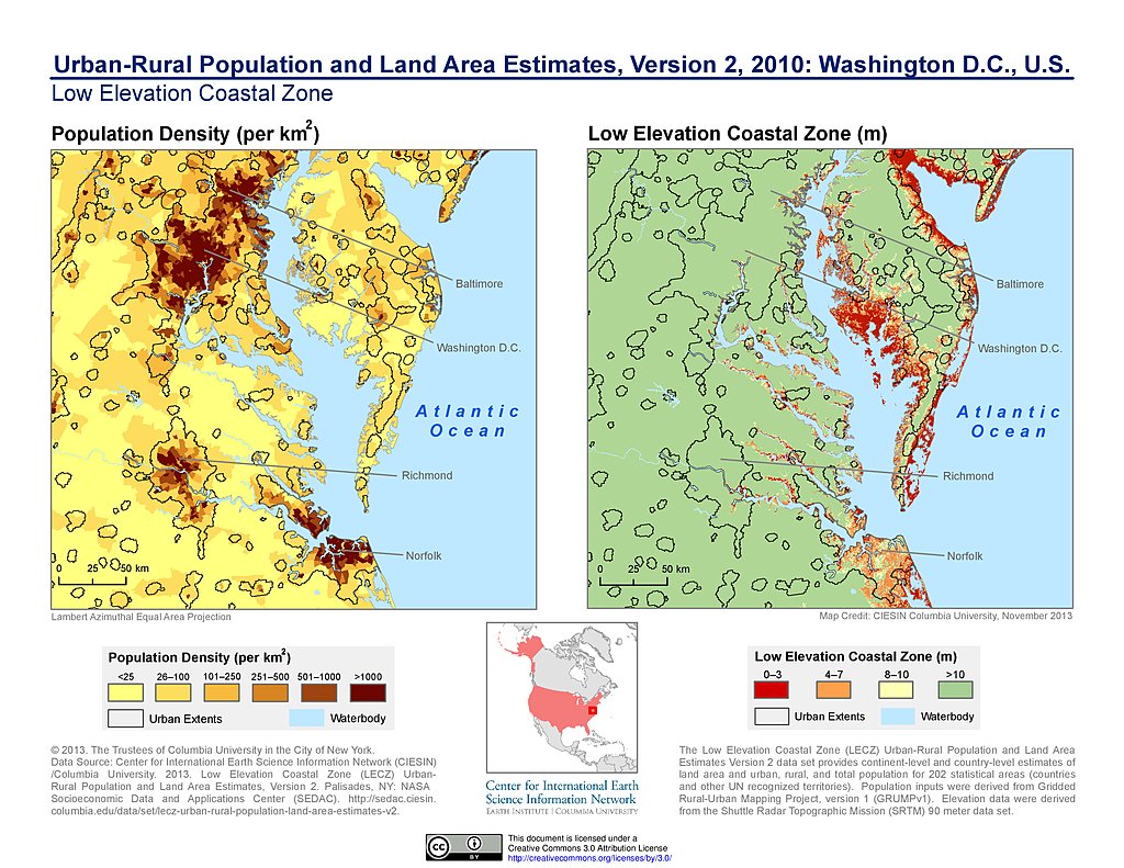
Population & Land Area Estimates (2010): Washington DC
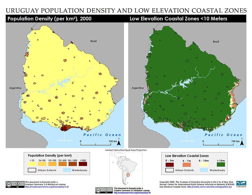
Population Density & LECZ: Uruguay
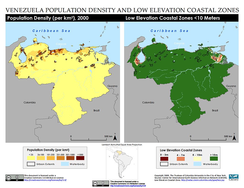
Population Density & LECZ: Venezuela
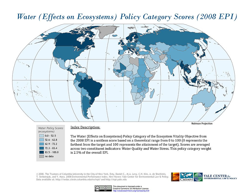
Water Effects on Ecosystems, EPI 2008
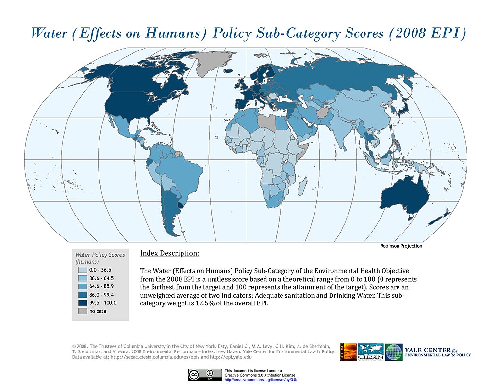
Water Effects on Humans, EPI 2008
Maps
»
Theme: Climate
Remove Facet
17 of 18
Prev
|
Next