Socioeconomic Data and Applications Center (
sedac
)
A Data Center in NASA's Earth Observing System Data and Information System (
EOSDIS
) — Hosted by
CIESIN
at
Columbia University
Search SEDAC
Data
Data Sets
Maps
Web Pages
search
Data
· Data Sets
· Data Collections
· Featured Data Uses
· Data Citations
· Citations Database
· Data Submission
Maps
· Map Gallery
· Map Viewer
· Map Services
· Mapping Tools
Themes
· Agriculture
· Climate
· Conservation
· Governance
· Hazards
· Health
· Infrastructure
· Land Use
· Marine and Coastal
· Population
· Poverty
· Remote Sensing
· Sustainability
· Urban
· Water
Resources
· Guides
· Multimedia
· Networks
· News
· Publications
· Related Sites
· Remote Sensing
· Tools
Social Media
· Twitter
· FaceBook
· YouTube
· Flickr
· Blog Posts
· Communities
About
· About SEDAC
· User Working Group
· Privacy
· User Registration
Help
Map Gallery
(139)
Follow Us:
Twitter
Follow Us on Facebook
YouTube
Flickr
| Share:
Twitter
Facebook
Search
All Fields:
search
Maps
»
Theme: Population
Remove Facet
»
Region: Global
Remove Facet
1 of 5
Prev
|
Next
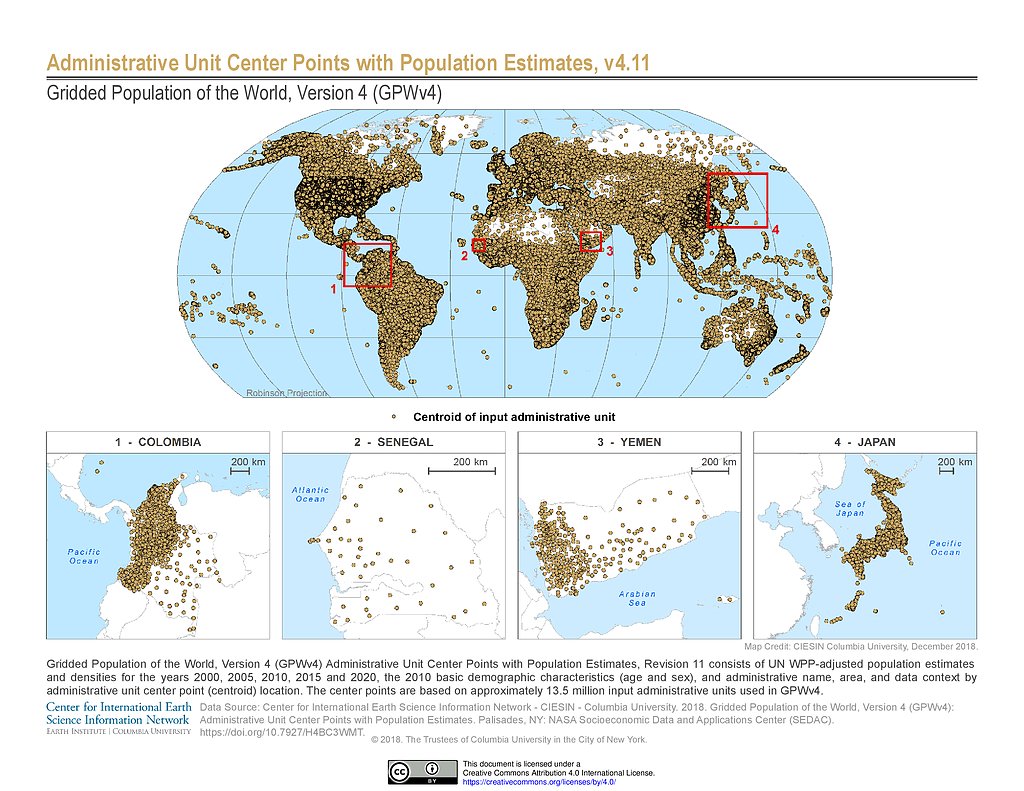
GPWv4 Rev11: Administrative Unit Center Points with Population Estimates
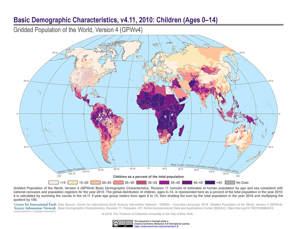
GPWv4 Rev11: Basic Demographic Characteristics (2010): Children
GPWv4 Rev11: Basic Demographic Characteristics (2010): Sex Ratio
GPWv4 Rev11: Basic Demographic Characteristics (2010): The Elderly
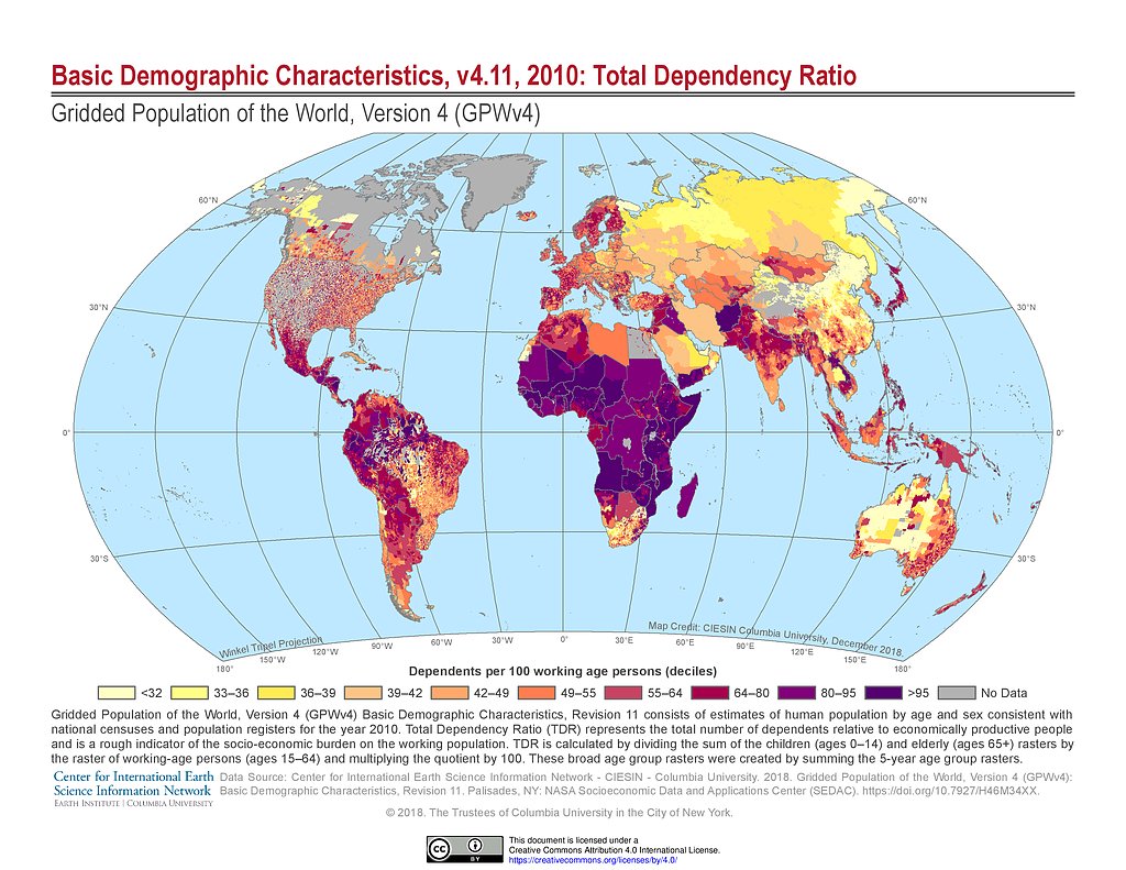
GPWv4 Rev11: Basic Demographic Characteristics (2010): Total Dependency Ratio
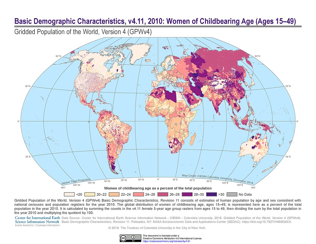
GPWv4 Rev11: Basic Demographic Characteristics (2010): Women of Childbearing Age
GPWv4 Rev11: Basic Demographic Characteristics (2010): Young and Aging Populations
Biomes
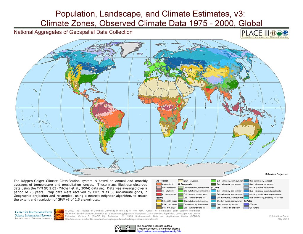
Observed Climate Data - Climate Zones (1976-2000)
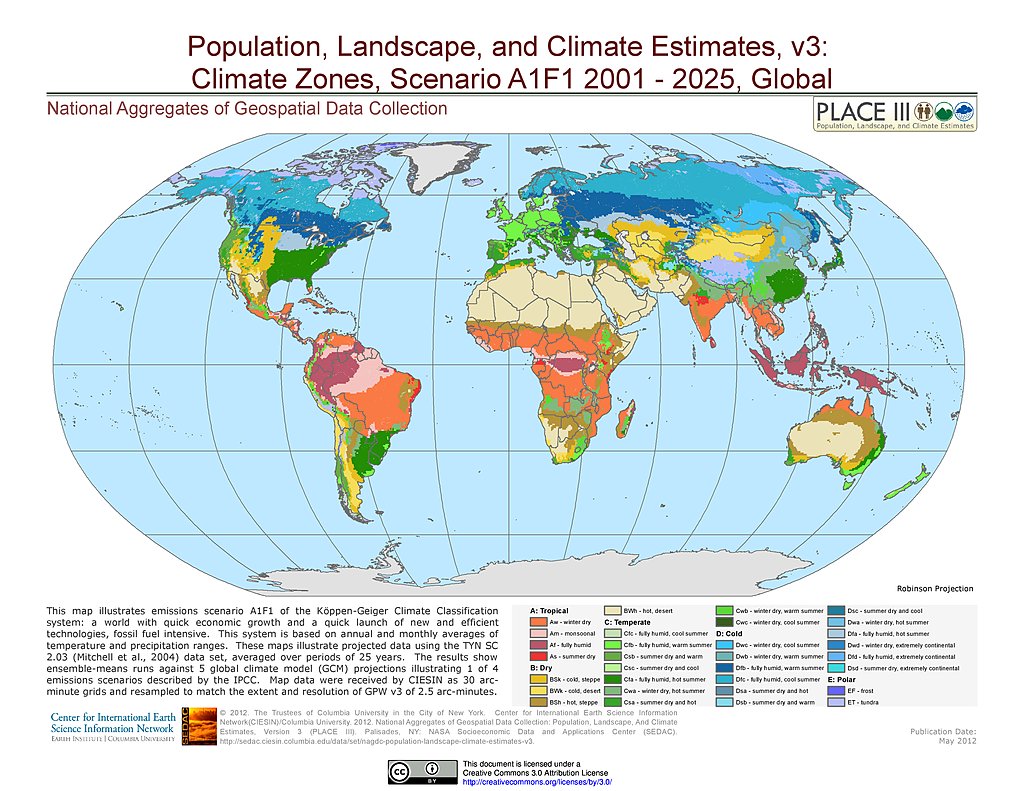
A1F1 - Climate Zones (2001-2025)
A2 - Climate Zones (2001-2025)
B1 - Climate Zones (2001-2025)
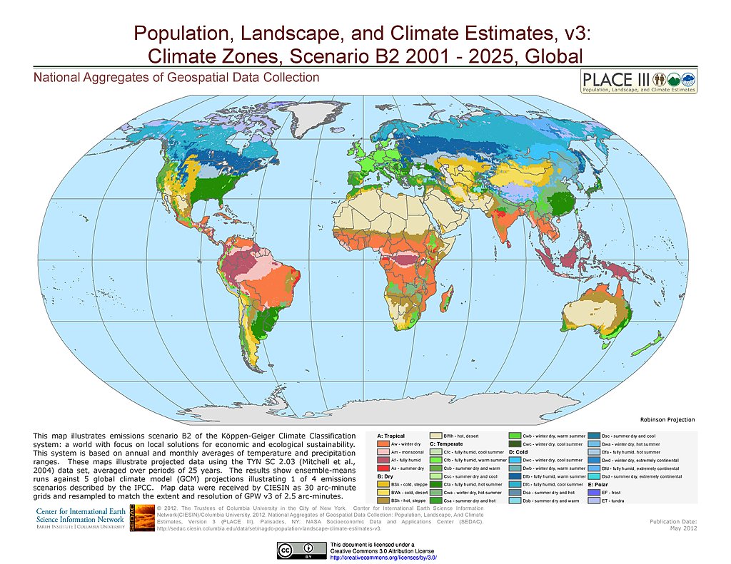
B2 - Climate Zones (2001-2025)
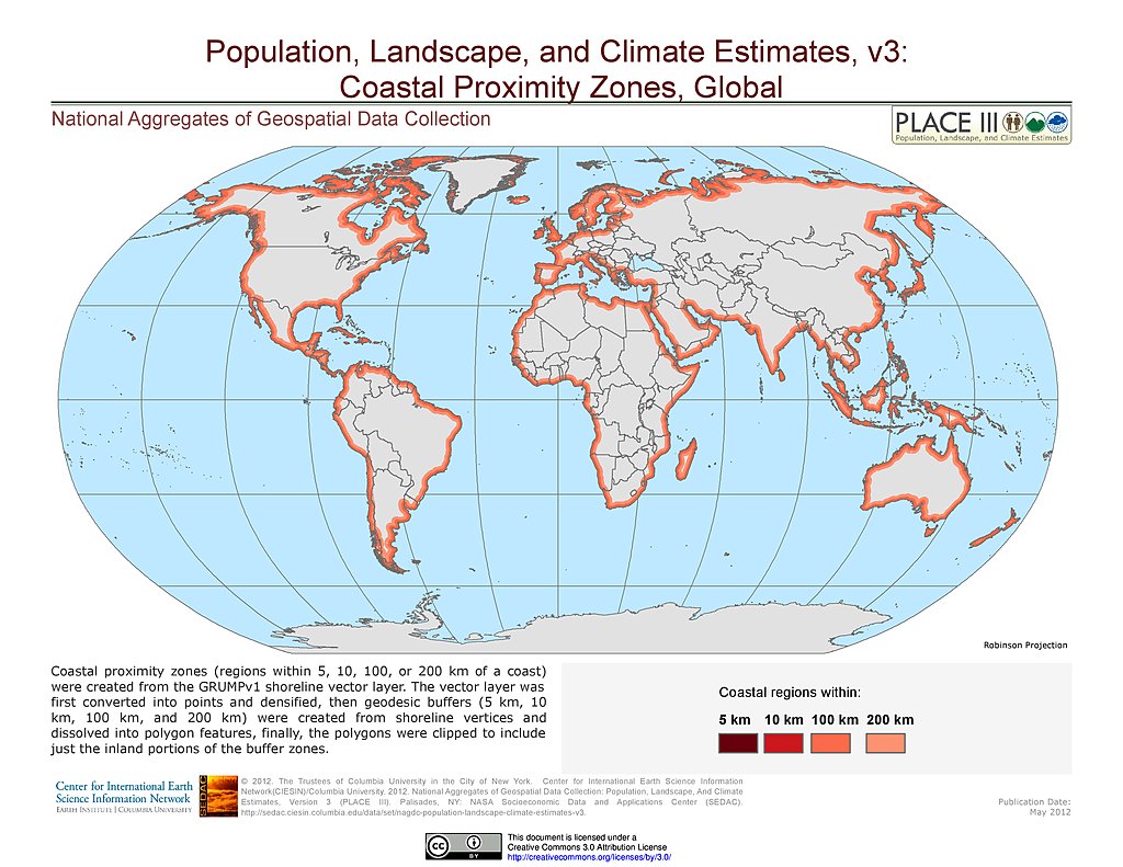
Coastal Proximity Zones
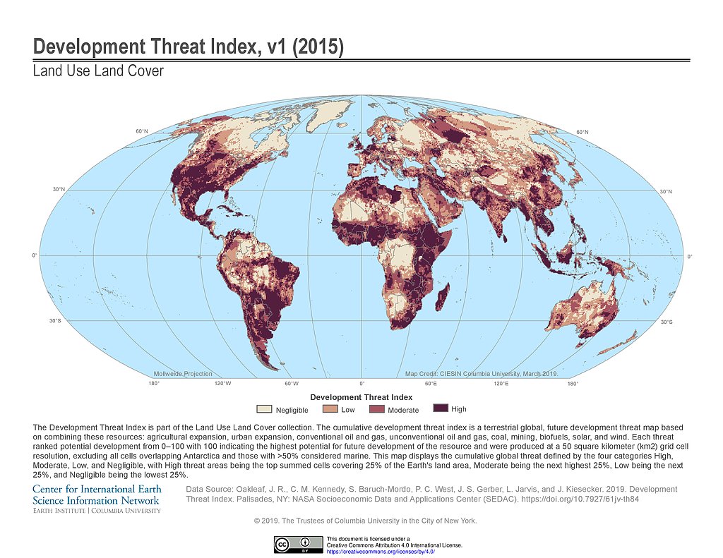
Development Threat Index (2015)
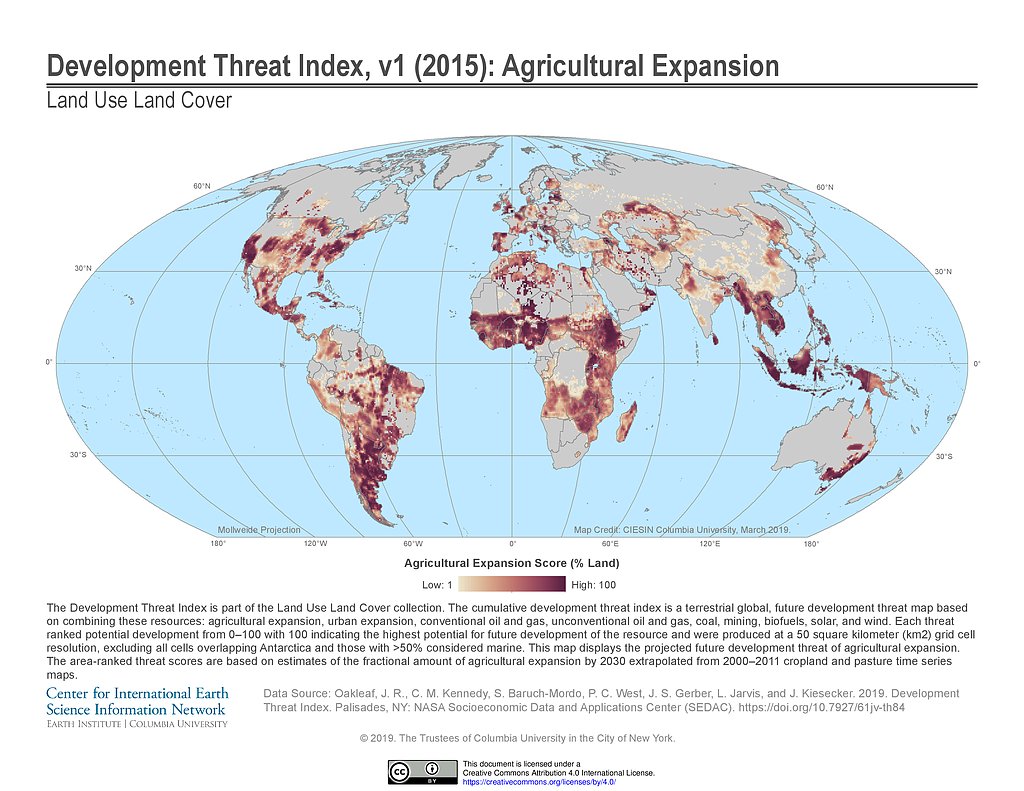
Development Threat Index (2015): Agricultural Expansion
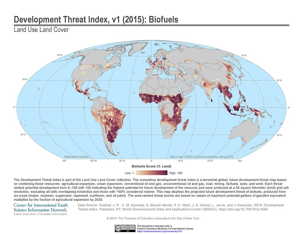
Development Threat Index (2015): Biofuels
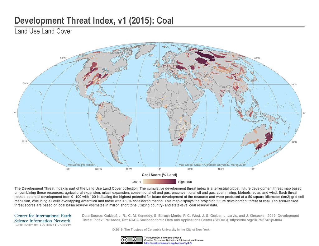
Development Threat Index (2015): Coal
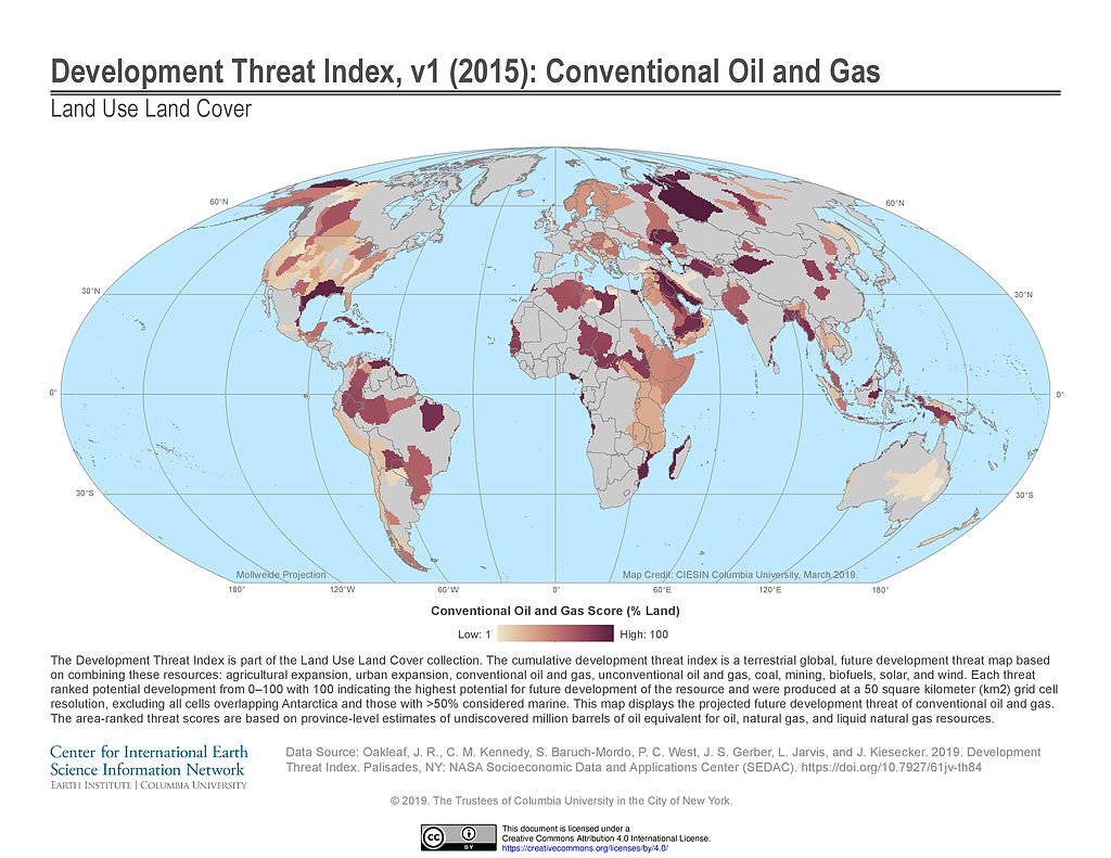
Development Threat Index (2015): Conventional Oil and Gas
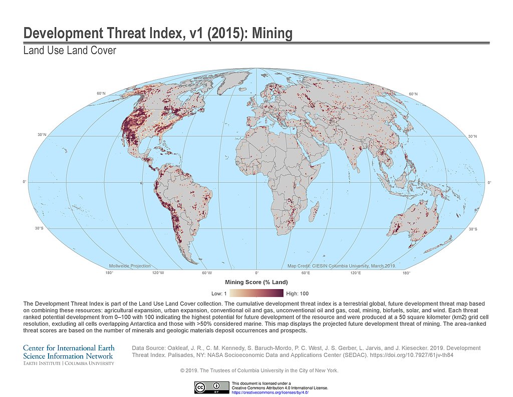
Development Threat Index (2015): Mining
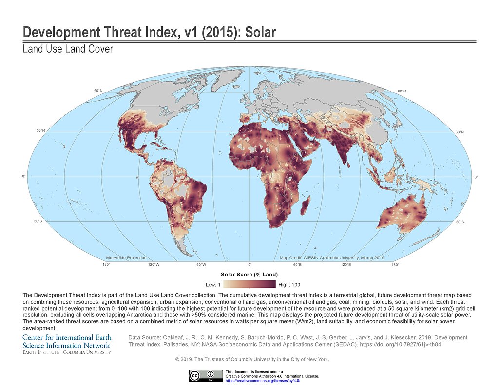
Development Threat Index (2015): Solar
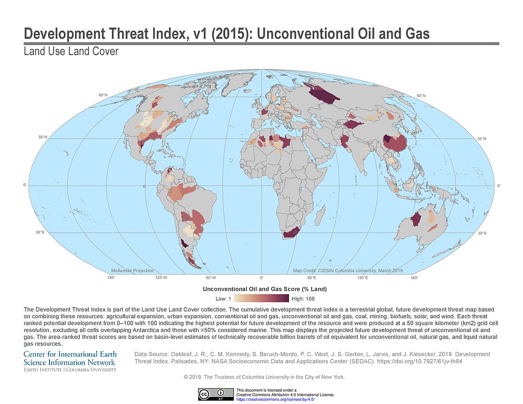
Development Threat Index (2015): Unconventional Oil and Gas
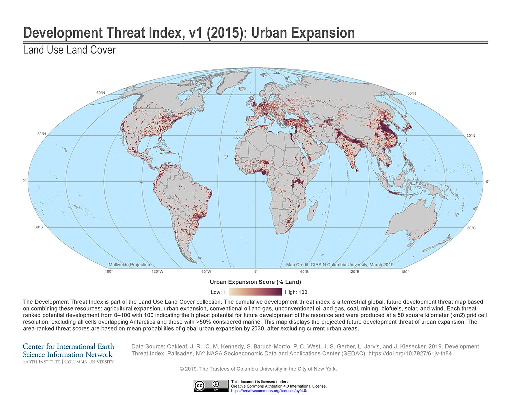
Development Threat Index (2015): Urban Expansion
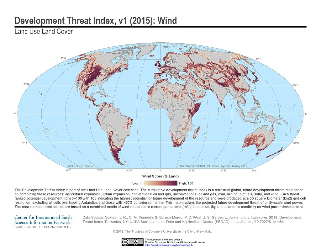
Development Threat Index (2015): Wind
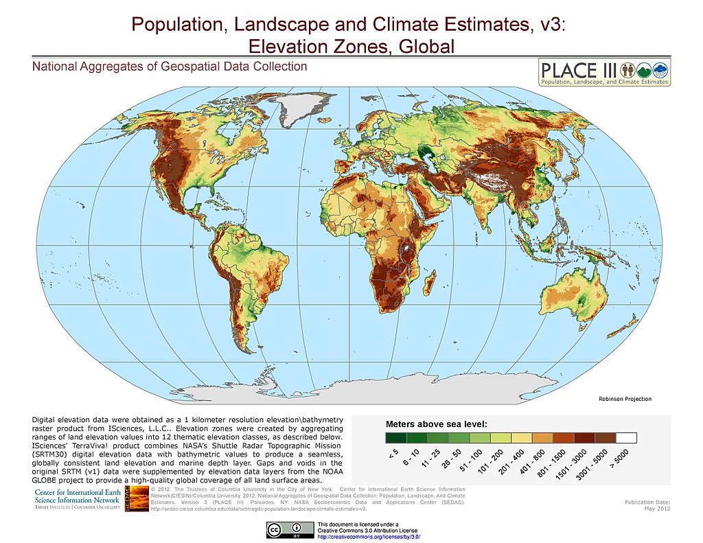
Elevation Zones
1-km Downscaled Total Population Base Year based on SSPs, v1.01 (2000)
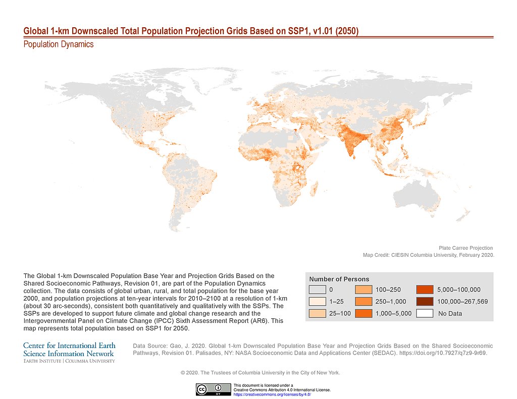
1-km Downscaled Total Population Projection based on SSP1, v1.01 (2050)
1-km Downscaled Total Population Projection based on SSP1, v1.01 (2100)
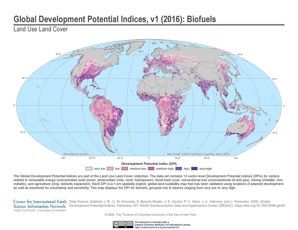
Development Potential Indices (2016): Biofuels
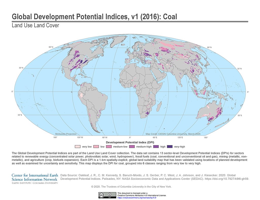
Development Potential Indices (2016): Coal
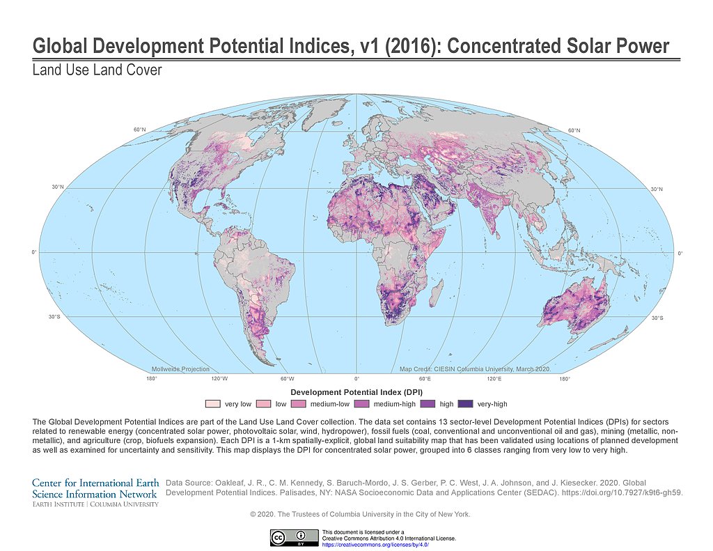
Development Potential Indices (2016): Concentrated Solar Power
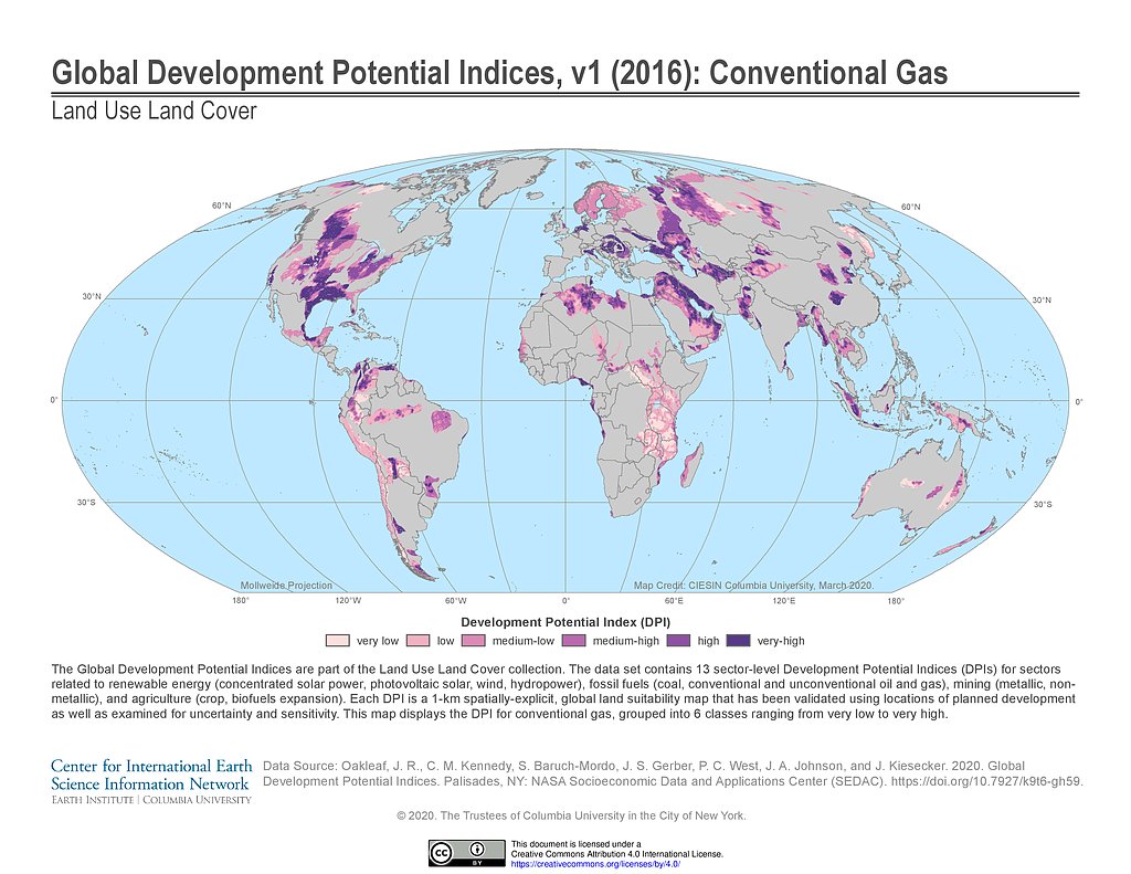
Development Potential Indices (2016): Conventional Gas
Maps
»
Theme: Population
Remove Facet
»
Region: Global
Remove Facet
1 of 5
Prev
|
Next