Socioeconomic Data and Applications Center (
sedac
)
A Data Center in NASA's Earth Observing System Data and Information System (
EOSDIS
) — Hosted by
CIESIN
at
Columbia University
Search SEDAC
Data
Data Sets
Maps
Web Pages
search
Data
· Data Sets
· Data Collections
· Featured Data Uses
· Data Citations
· Citations Database
· Data Submission
Maps
· Map Gallery
· Map Viewer
· Map Services
· Mapping Tools
Themes
· Agriculture
· Climate
· Conservation
· Governance
· Hazards
· Health
· Infrastructure
· Land Use
· Marine and Coastal
· Population
· Poverty
· Remote Sensing
· Sustainability
· Urban
· Water
Resources
· Guides
· Multimedia
· Networks
· News
· Publications
· Related Sites
· Remote Sensing
· Tools
Social Media
· Twitter
· FaceBook
· YouTube
· Flickr
· Blog Posts
· Communities
About
· About SEDAC
· User Working Group
· Privacy
· User Registration
Help
Map Gallery
(531)
Follow Us:
Twitter
Follow Us on Facebook
YouTube
Flickr
| Share:
Twitter
Facebook
Search
All Fields:
search
Theme
Agriculture
(13)
Climate
(49)
Conservation
(33)
Framework Data
(48)
Governance
(2)
Hazards
(7)
Health
(171)
Infrastructure
(9)
Land Use
(55)
Marine and Coastal
(17)
Population
(254)
Poverty
(170)
Remote Sensing
(48)
Sustainability
(213)
Urban
(181)
Water
(10)
Region
Africa
(43)
Asia
(395)
Europe
(13)
Global
(2)
North America
(48)
Oceania
(2)
South America
(28)
Location
Select a Location...
afghanistan
(6)
albania
(6)
armenia
(5)
azerbaijan
(5)
bahrain
(5)
bangladesh
(13)
bhutan
(5)
bolivia
(6)
brunei darussalam
(5)
bulgaria
(6)
cambodia
(15)
china
(28)
democratic people's republic of korea
(6)
ecuador
(8)
guatemala
(18)
honduras
(11)
hong kong special administrative region
(6)
india
(20)
indonesia
(11)
iran (islamic republic of)
(6)
iraq
(5)
israel
(6)
japan
(7)
jordan
(6)
kazakhstan
(5)
kenya
(5)
kuwait
(5)
kyrgyzstan
(5)
lao people's democratic republic
(5)
lebanon
(6)
macao special administrative region
(5)
madagascar
(7)
malawi
(9)
malaysia
(5)
maldives
(5)
mongolia
(5)
morocco
(1)
mozambique
(6)
myanmar
(5)
nepal
(6)
nicaragua
(3)
occupied palestinian territory
(5)
oman
(5)
pakistan
(4)
panama
(11)
paraguay
(13)
philippines
(5)
qatar
(5)
republic of korea
(5)
russian federation
(1)
saudi arabia
(5)
singapore
(6)
south africa
(7)
sri lanka
(5)
syrian arab republic
(6)
taiwan
(6)
tajikistan
(5)
thailand
(6)
timor-leste
(5)
turkey
(5)
turkmenistan
(5)
uganda
(5)
united arab emirates
(5)
united states of america
(4)
uzbekistan
(5)
viet nam
(17)
yemen
(5)
go
Maps
»
All Fields: Asia
Remove Facet
2 of 17
Prev
|
Next
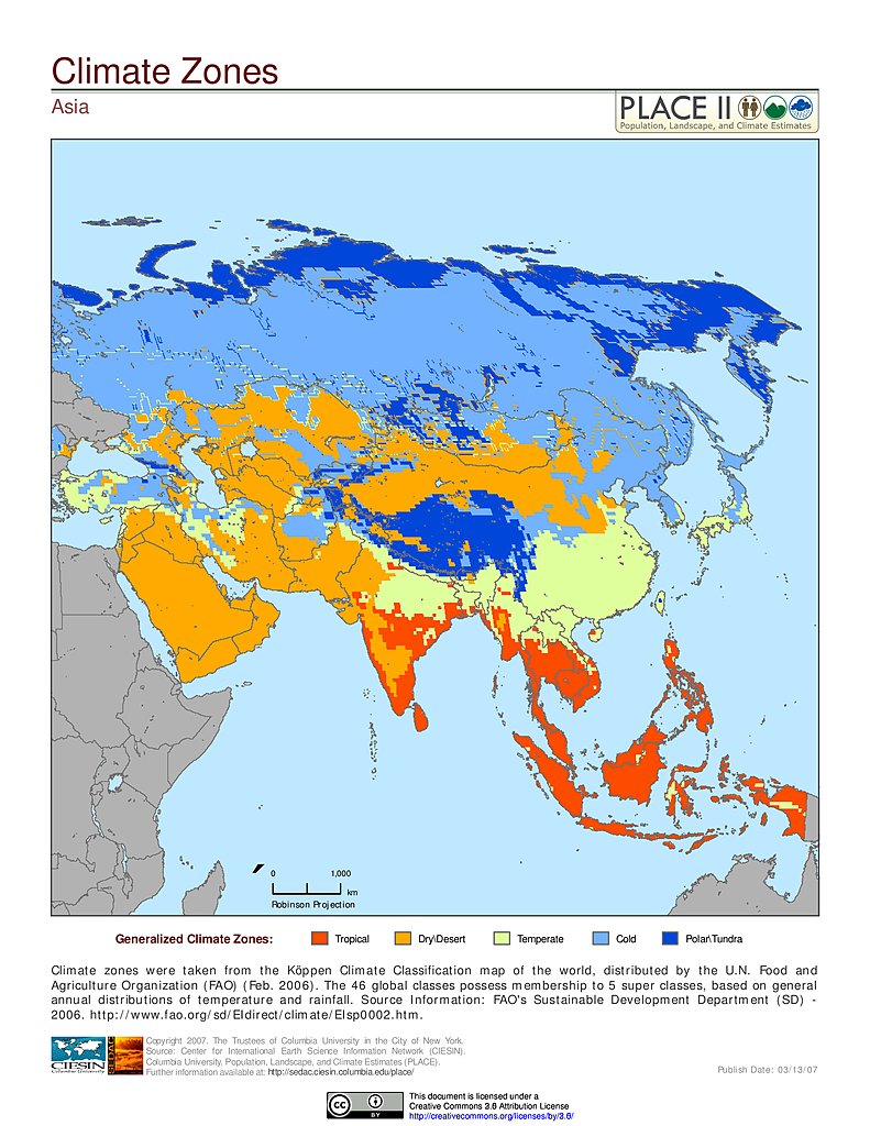
Climate Zones: Asia
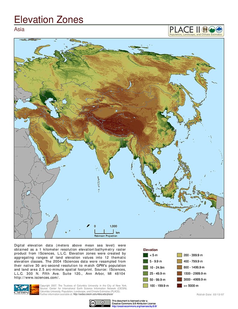
Elevation Zones: Asia
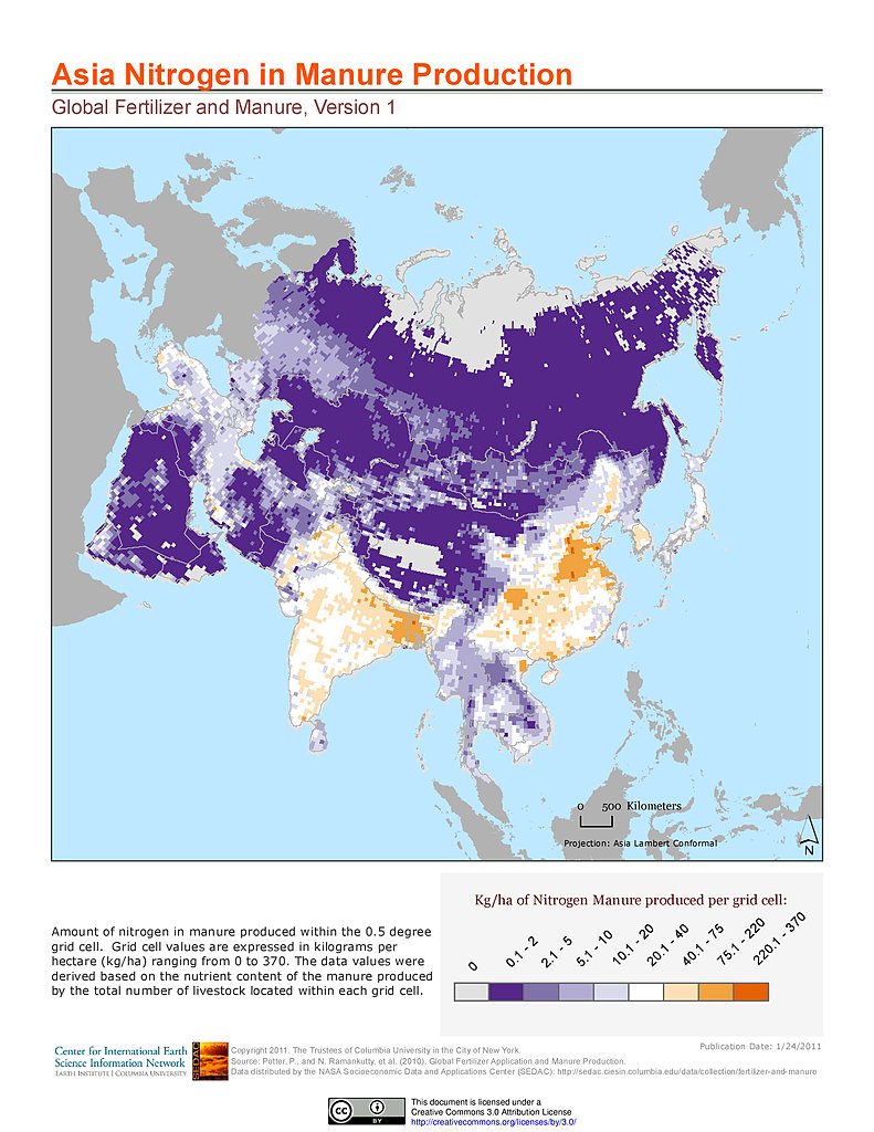
Nitrogen in Manure Production: Asia
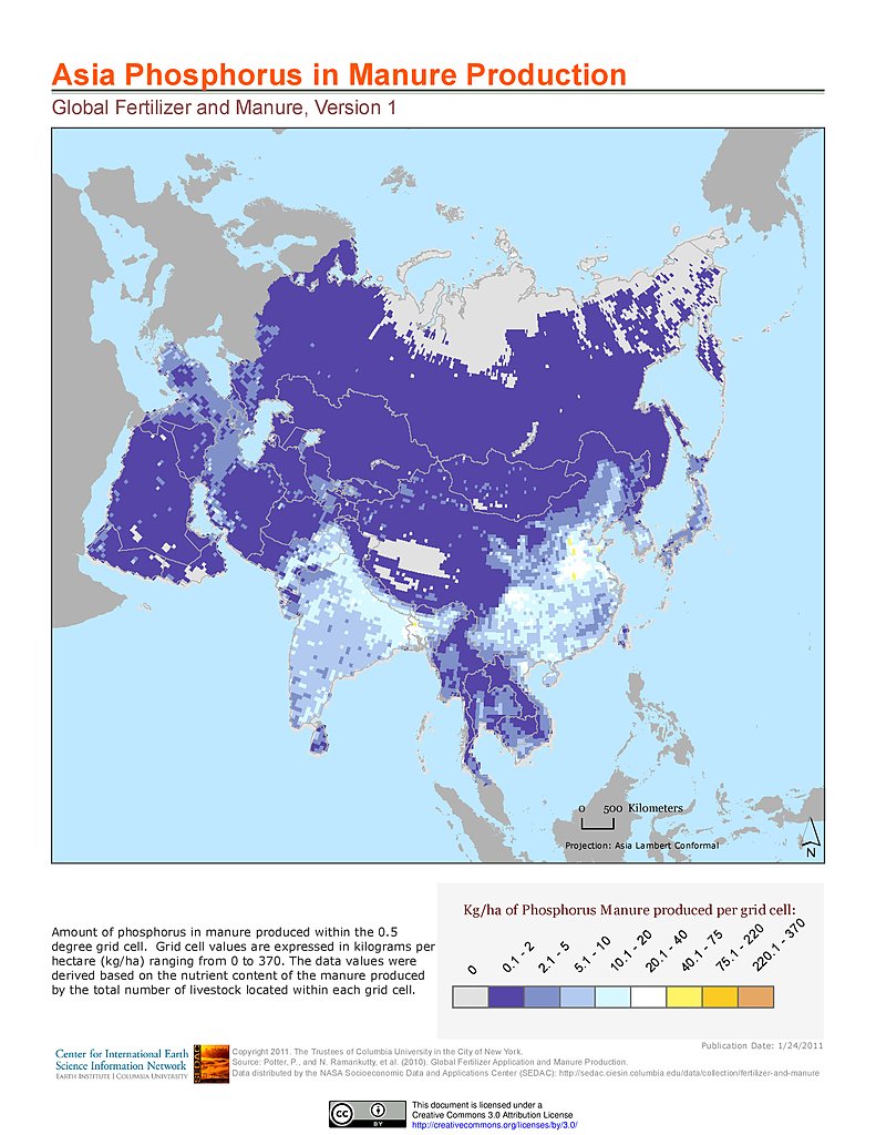
Phosphorus in Manure Production: Asia
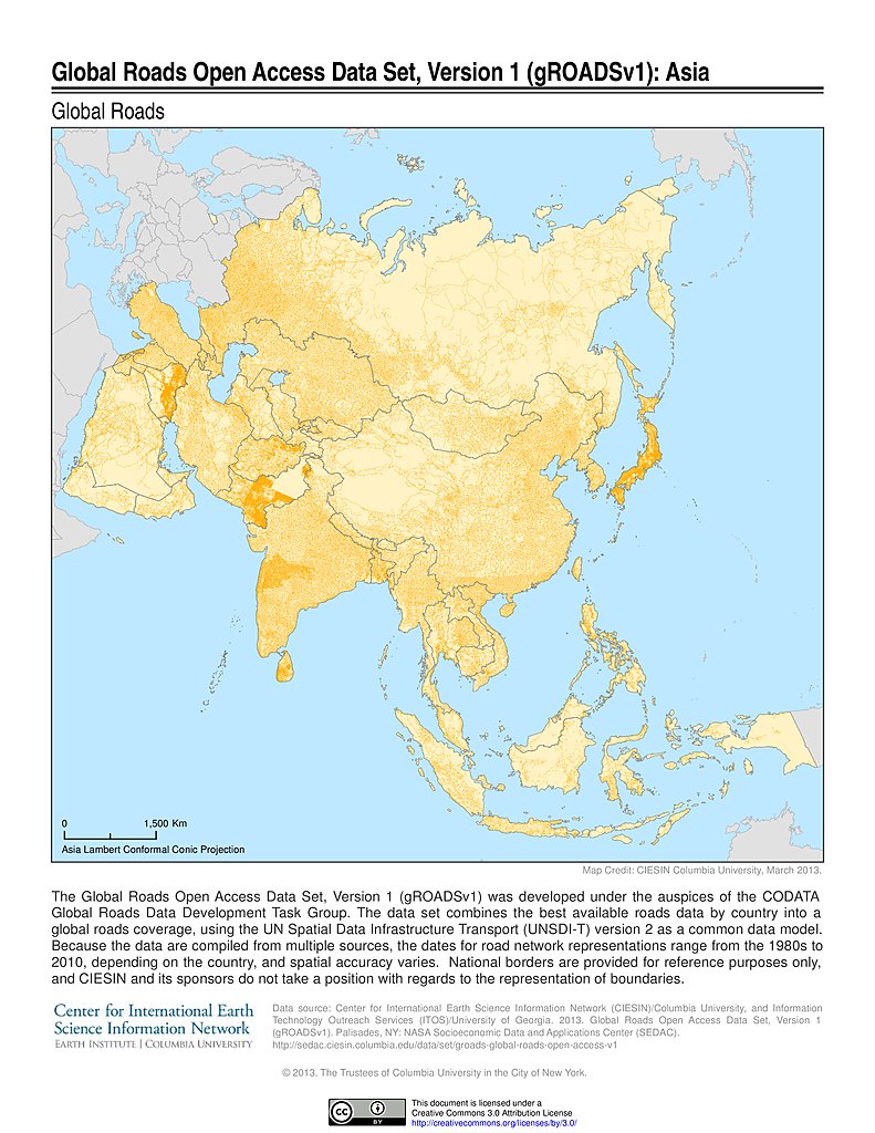
Global Roads Open Access Data Set, v1: Asia
Infant Mortality Rates: Asia
Infant Mortality Rates, Specific: Asia
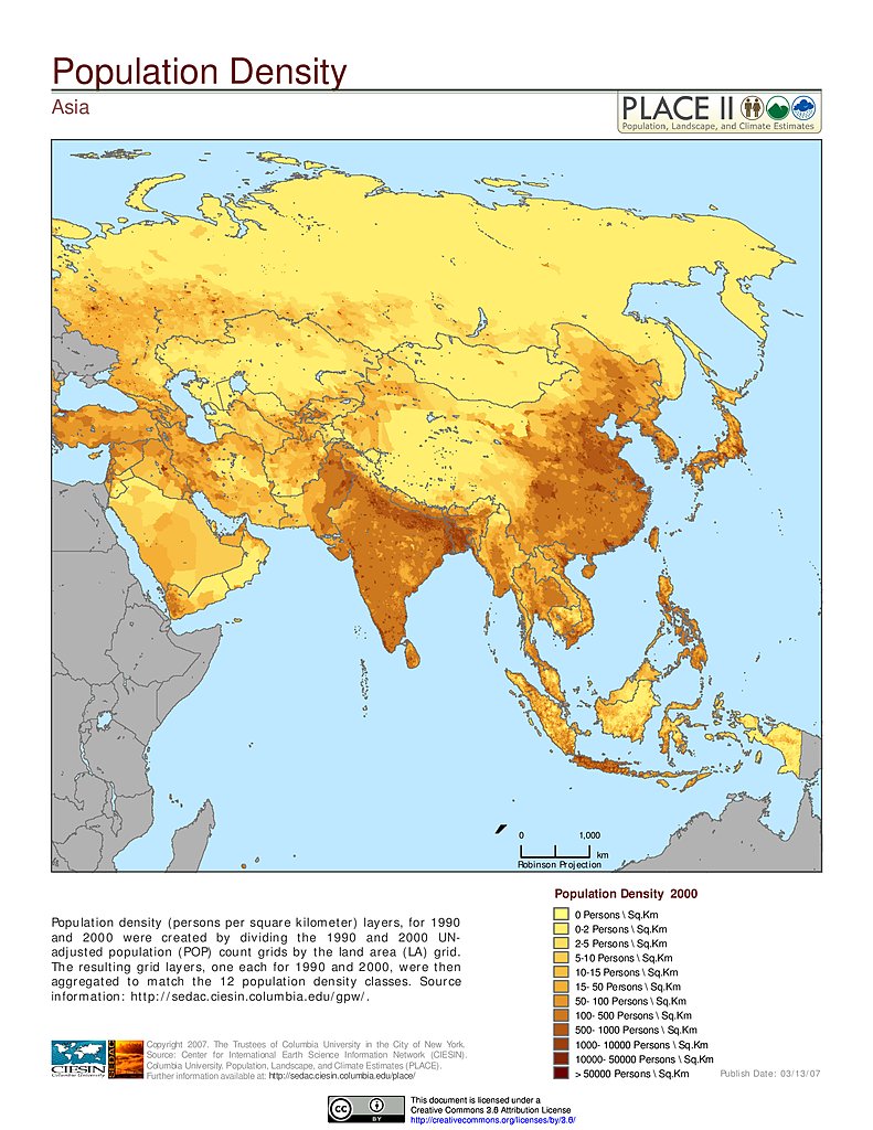
Population Density: Asia
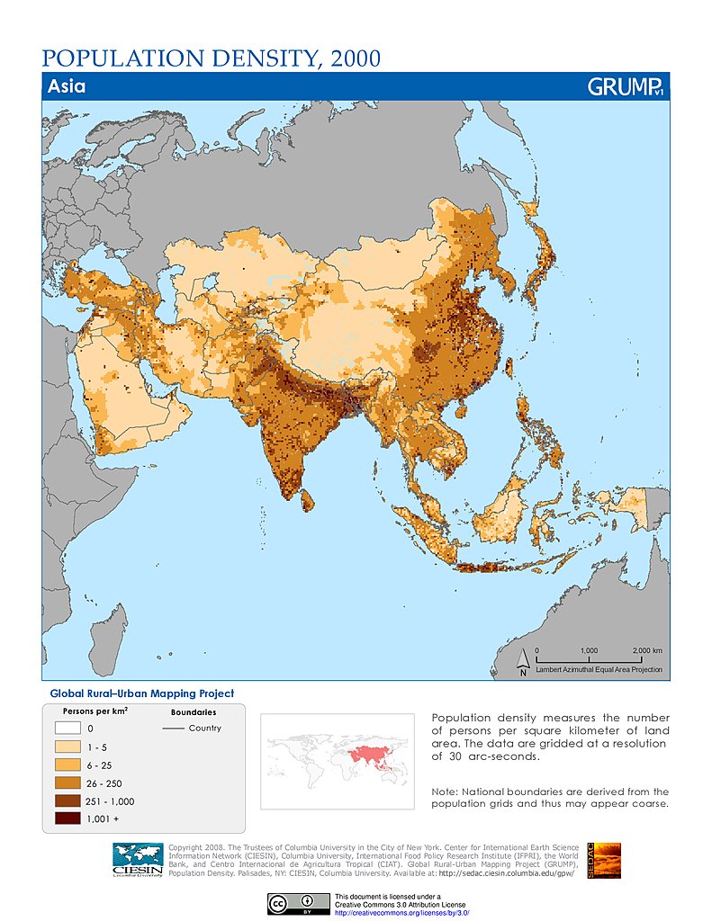
Population Density (2000): Asia
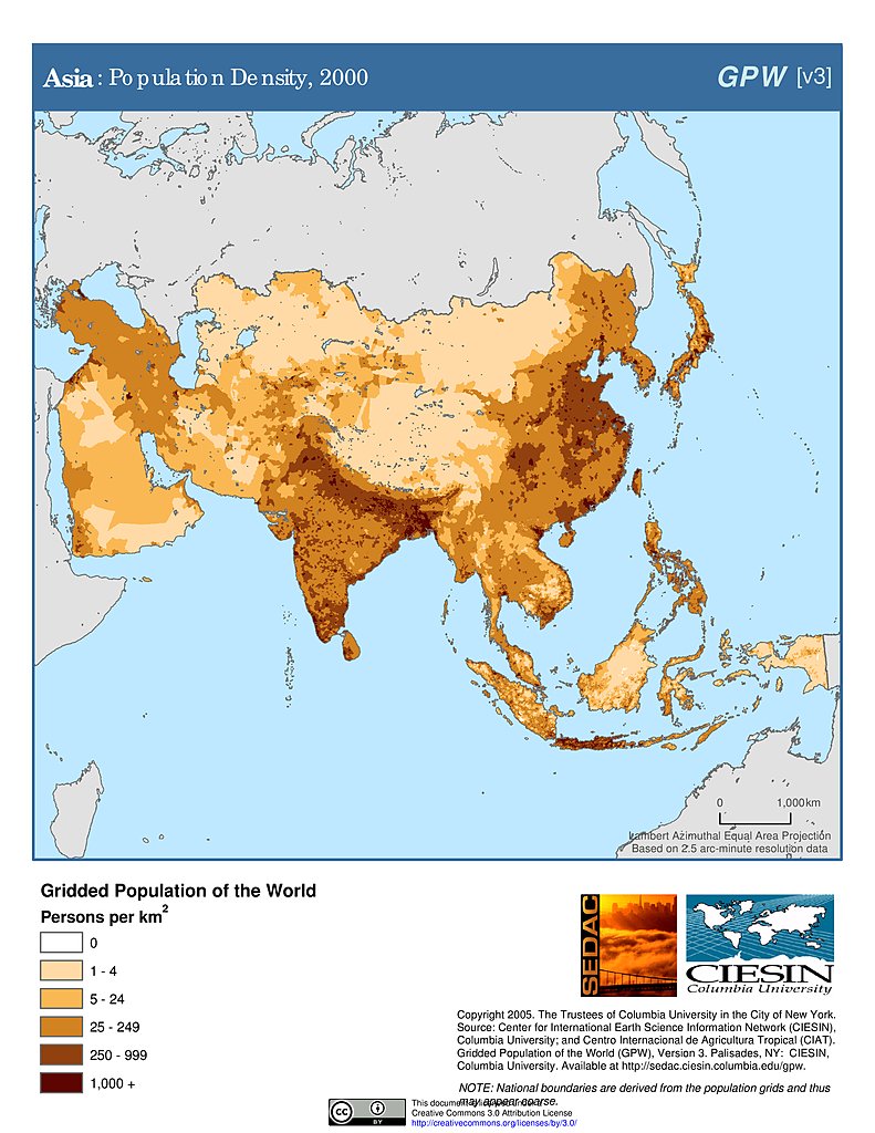
Population Density (2000): Asia
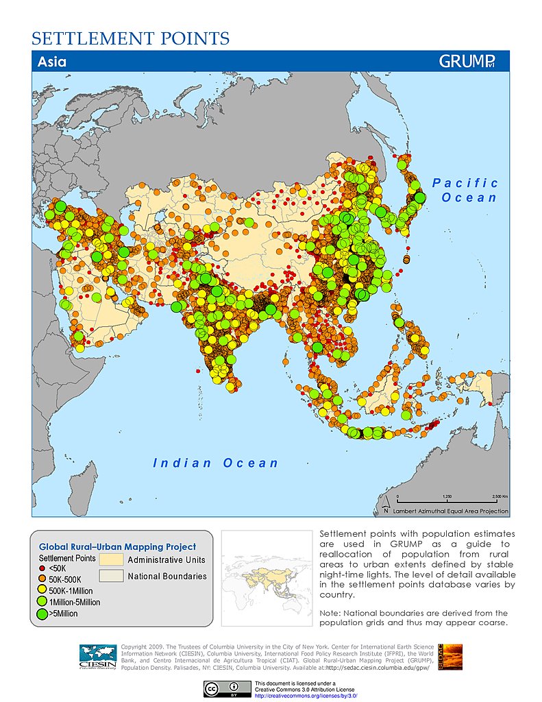
Settlement Points: Asia
Human Footprint Index, v2: Asia
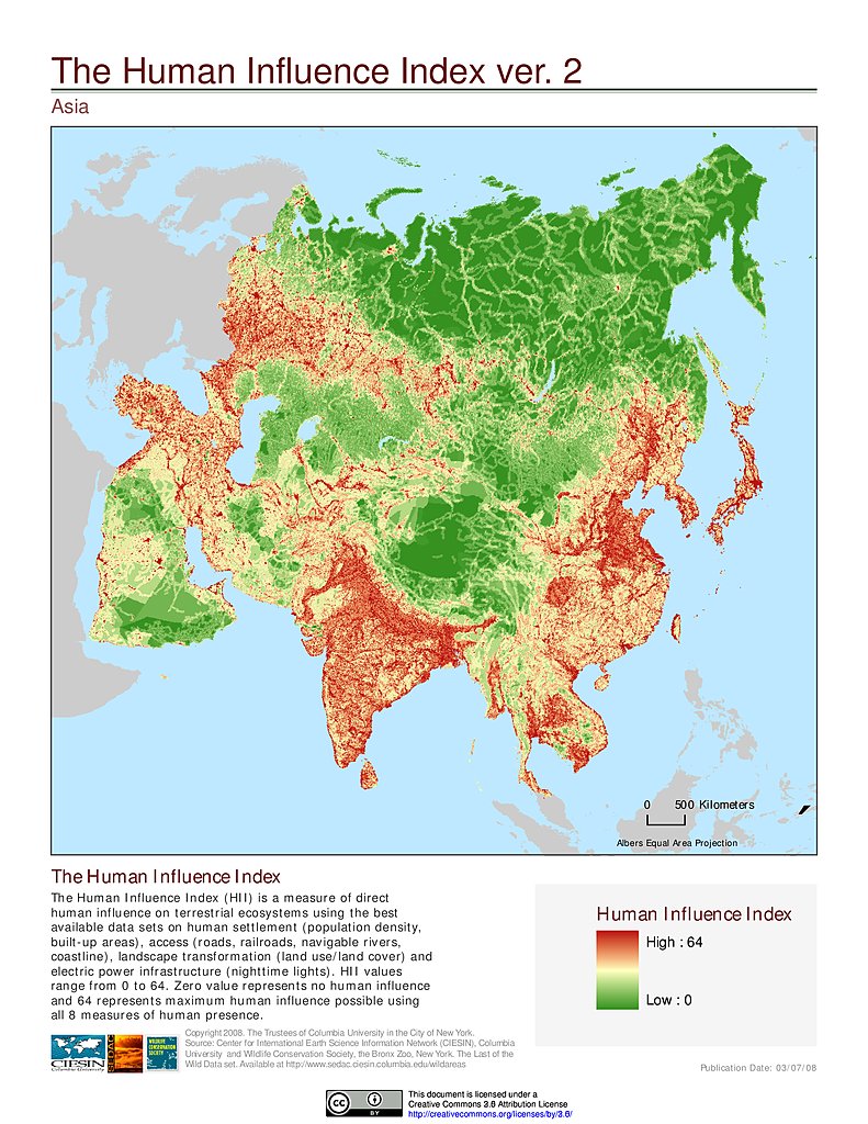
Human Influence Index, v2: Asia
Last of the Wild, v2: Asia
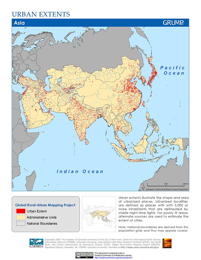
Urban Extents: Asia
Administrative Boundaries: Azerbaijan
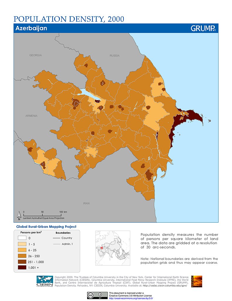
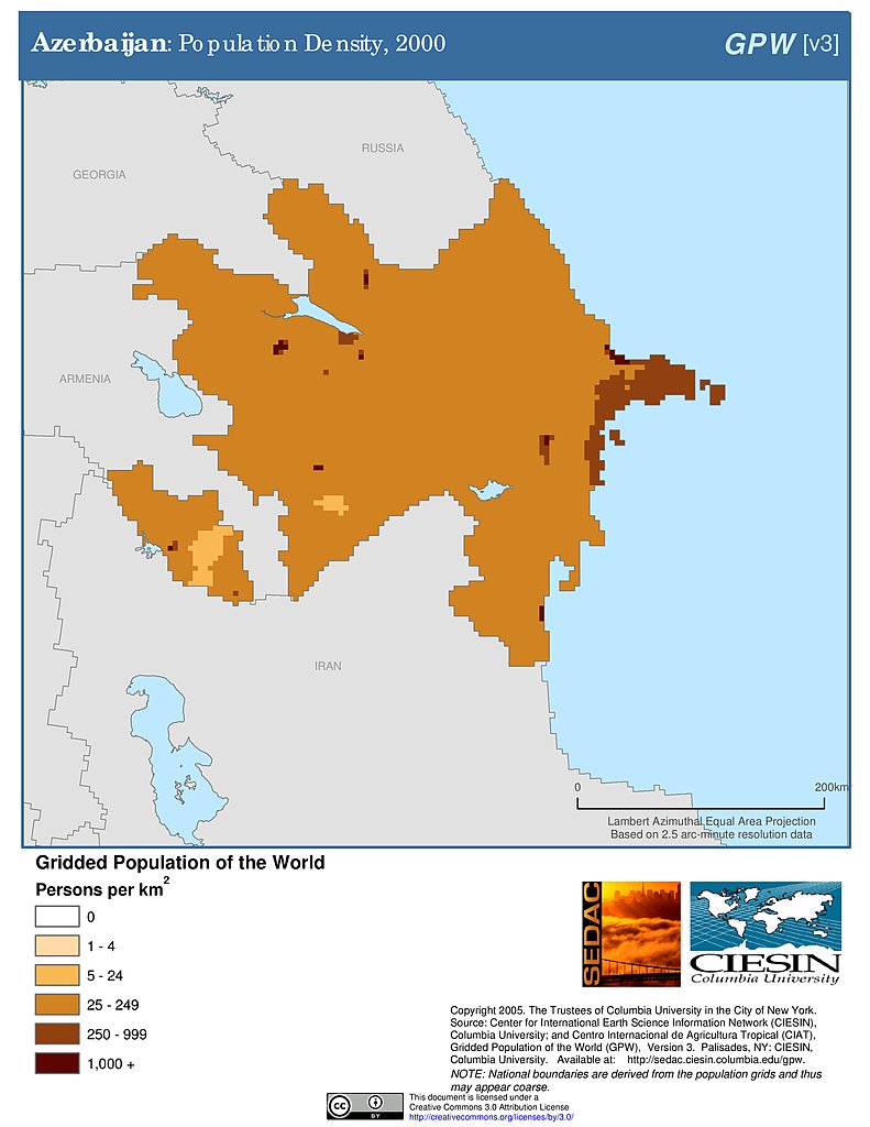
Population Density (2000): Azerbaijan
Population Density (2000): Azerbaijan
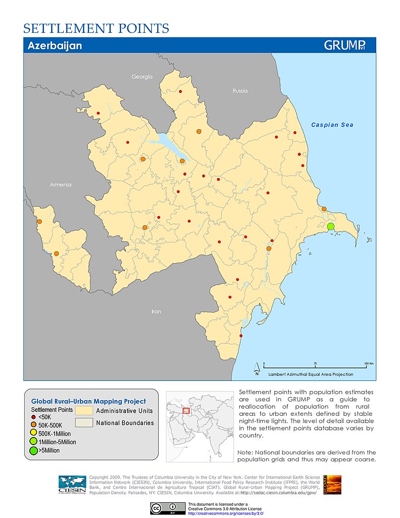
Settlement Points: Azerbaijan
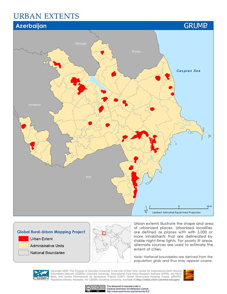
Urban Extents: Azerbaijan
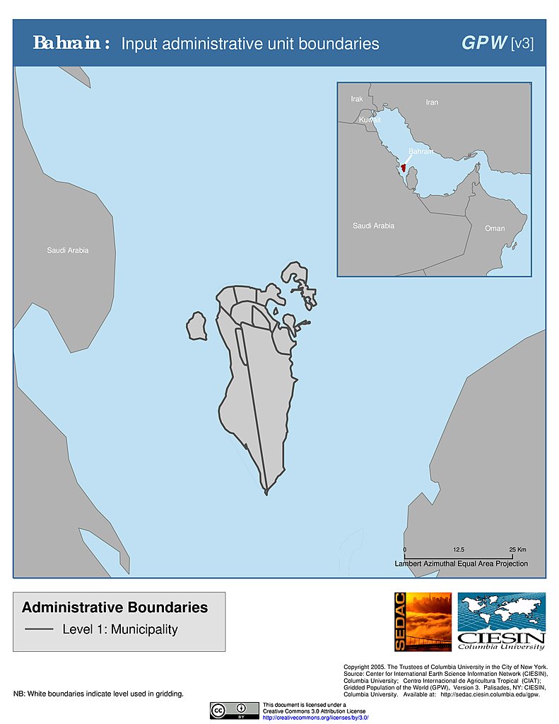
Administrative Boundaries: Bahrain
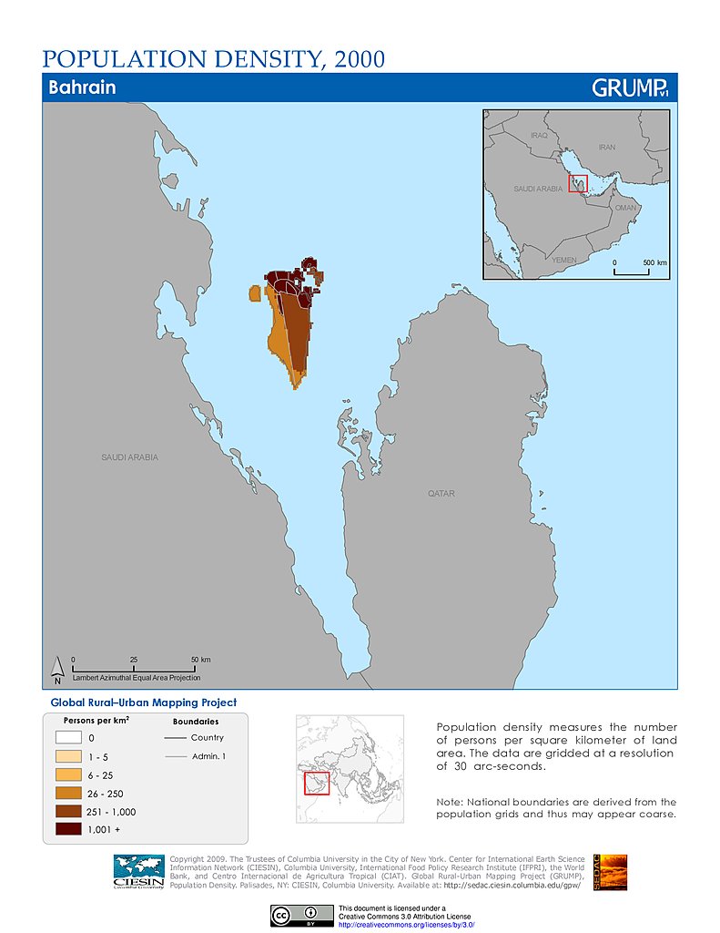
Population Density (2000): Bahrain
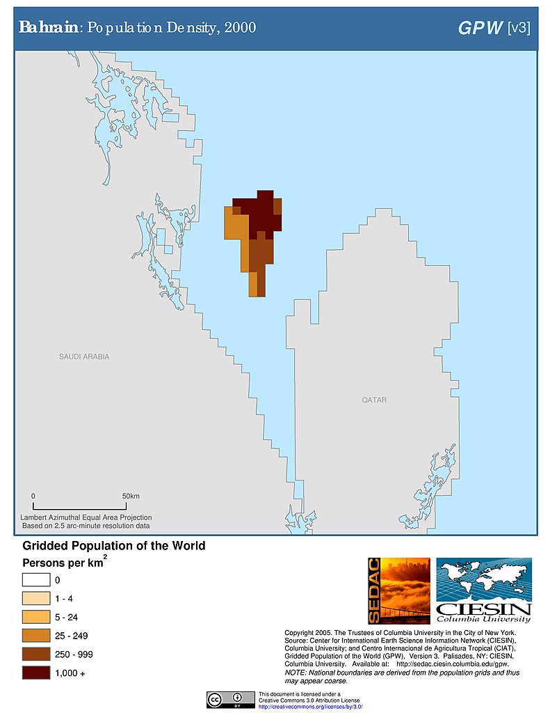
Population Density (2000): Bahrain
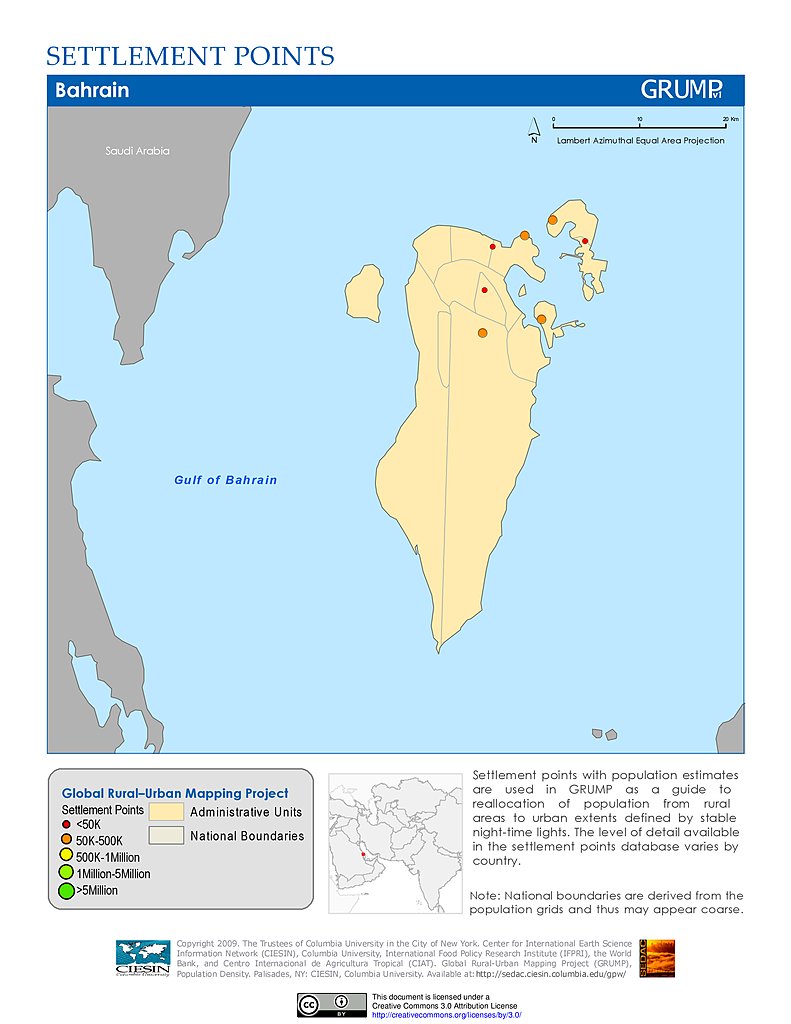
Settlement Points: Bahrain
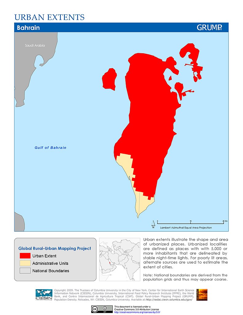
Urban Extents: Bahrain
Population Density & LECZ: Bangkok, Thailand
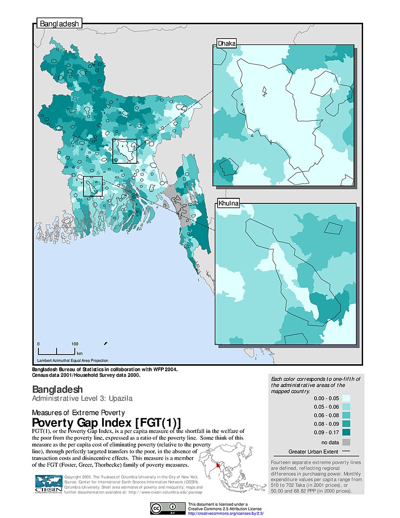
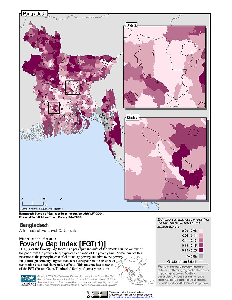
Extreme Poverty Gap Index, ADM3: Bangladesh
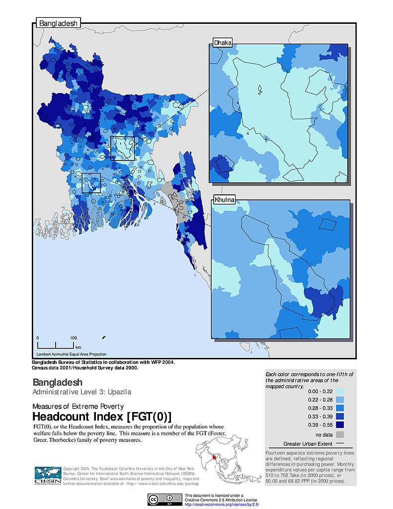
Extreme Poverty Headcount Index, ADM3: Bangladesh
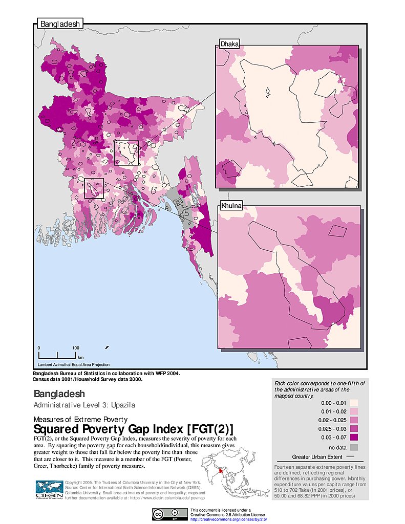
Extreme Squared Poverty Gap Index, ADM3: Bangladesh
Poverty Gap Index, ADM3: Bangladesh
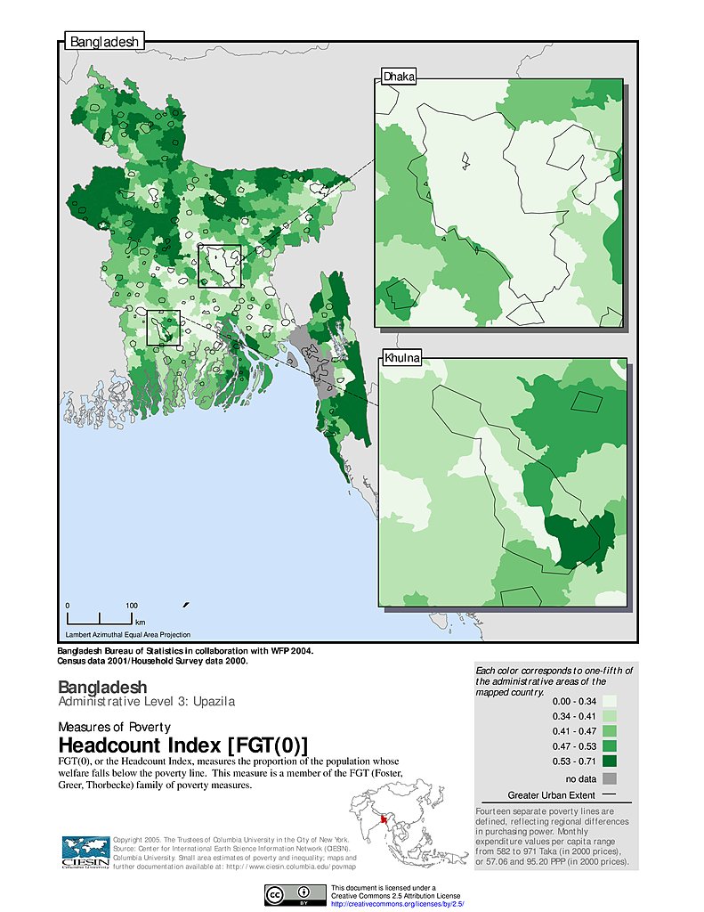
Poverty Headcount Index, ADM3: Bangladesh
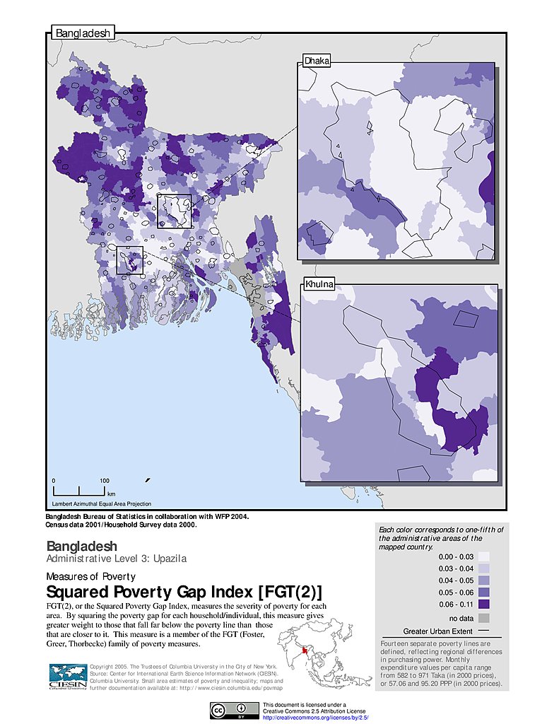
Squared Poverty Gap Index, ADM3: Bangladesh
Maps
»
All Fields: Asia
Remove Facet
2 of 17
Prev
|
Next