Socioeconomic Data and Applications Center (
sedac
)
A Data Center in NASA's Earth Observing System Data and Information System (
EOSDIS
) — Hosted by
CIESIN
at
Columbia University
Search SEDAC
Data
Data Sets
Maps
Web Pages
search
Data
· Data Sets
· Data Collections
· Featured Data Uses
· Data Citations
· Citations Database
· Data Submission
Maps
· Map Gallery
· Map Viewer
· Map Services
· Mapping Tools
Themes
· Agriculture
· Climate
· Conservation
· Governance
· Hazards
· Health
· Infrastructure
· Land Use
· Marine and Coastal
· Population
· Poverty
· Remote Sensing
· Sustainability
· Urban
· Water
Resources
· Guides
· Multimedia
· Networks
· News
· Publications
· Related Sites
· Remote Sensing
· Tools
Social Media
· Twitter
· FaceBook
· YouTube
· Flickr
· Blog Posts
· Communities
About
· About SEDAC
· User Working Group
· Privacy
· User Registration
Help
Map Gallery
(79)
Follow Us:
Twitter
Follow Us on Facebook
YouTube
Flickr
| Share:
Twitter
Facebook
Search
All Fields:
search
Maps
»
Region: Global
Remove Facet
»
Theme: Land Use
Remove Facet
2 of 3
Prev
|
Next
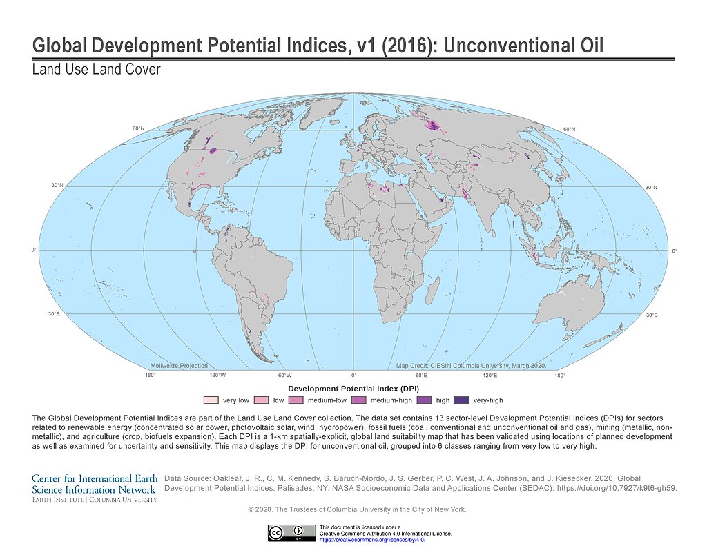
Development Potential Indices (2016): Unconventional Oil
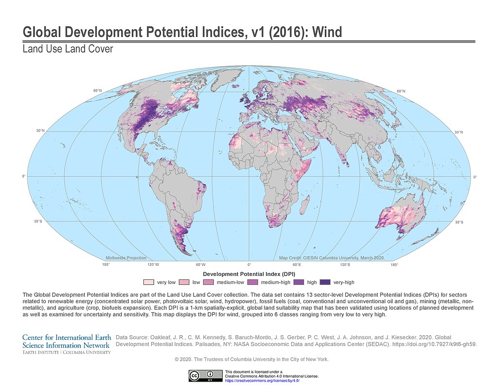
Development Potential Indices (2016): Wind
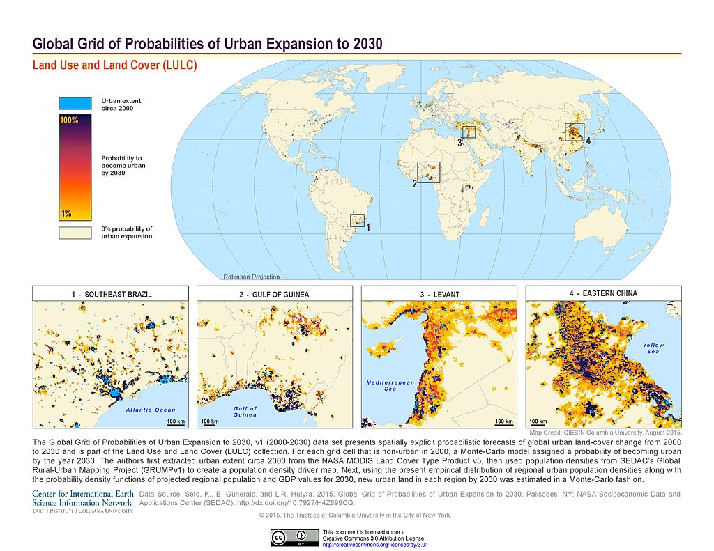
Probabilities of Urban Expansion (2000-2030)
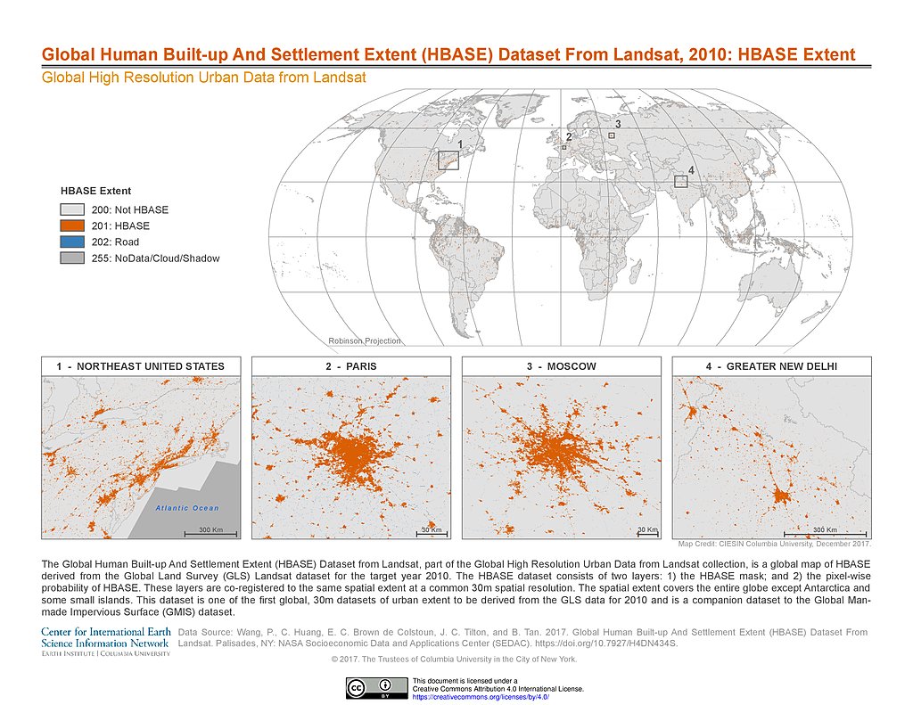
HBASE Extent, 2010
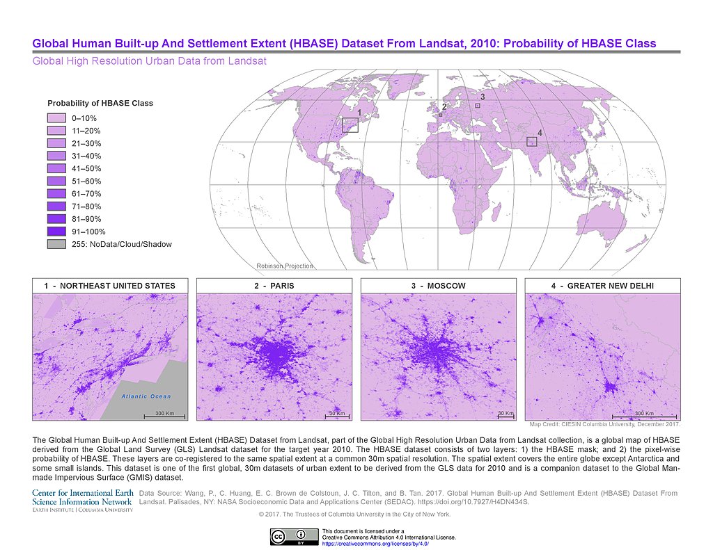
Probability of HBASE Class, 2010
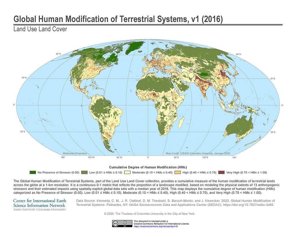
Human Modification of Terrestrial Systems (2016)
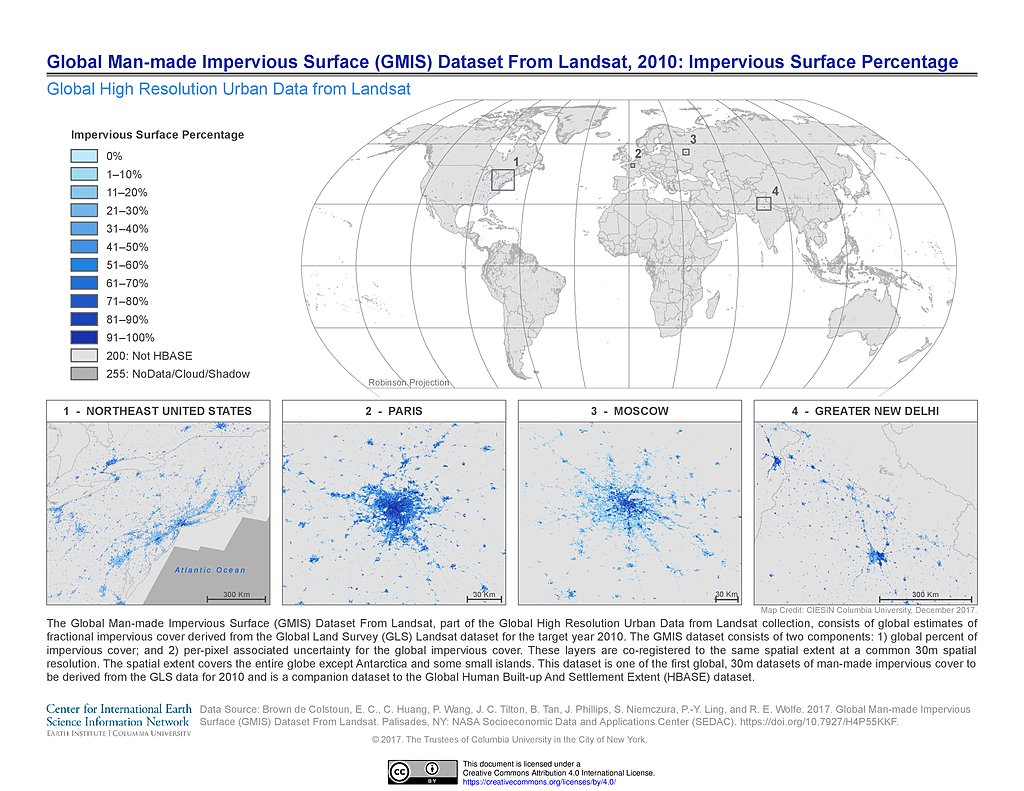
GMIS Impervious Surface Percentage, 2010
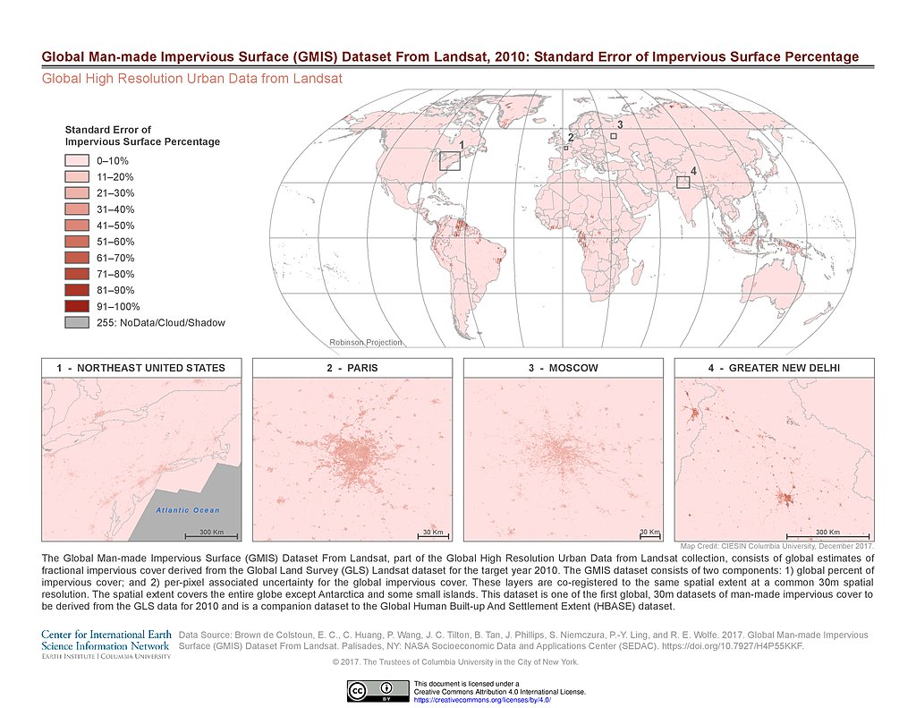
GMIS Standard Error Impervious Surface Percentage, 2010
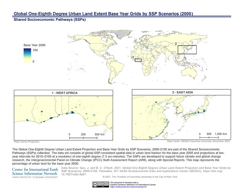
1/8th Degree Urban Land Extent Base Year (2000)
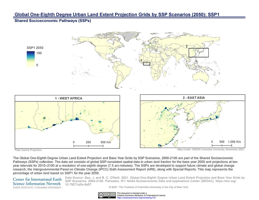
1/8th Degree Urban Land Extent Projection SSP1 (2050)
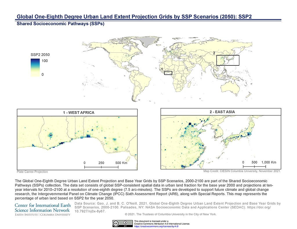
1/8th Degree Urban Land Extent Projection SSP2 (2050)
1/8th Degree Urban Land Extent Projection SSP3 (2050)
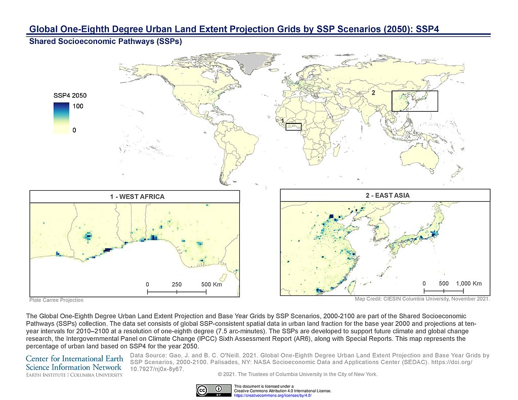
1/8th Degree Urban Land Extent Projection SSP4 (2050)
1/8th Degree Urban Land Extent Projection SSP5 (2050)
1/8th Degree Urban Land Extent Projection SSP1 (2100)
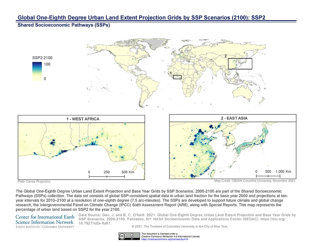
1/8th Degree Urban Land Extent Projection SSP2 (2100)
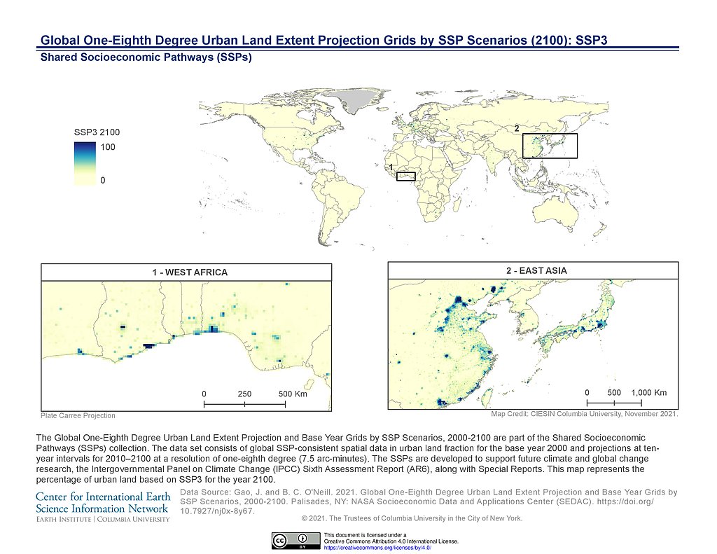
1/8th Degree Urban Land Extent Projection SSP3 (2100)
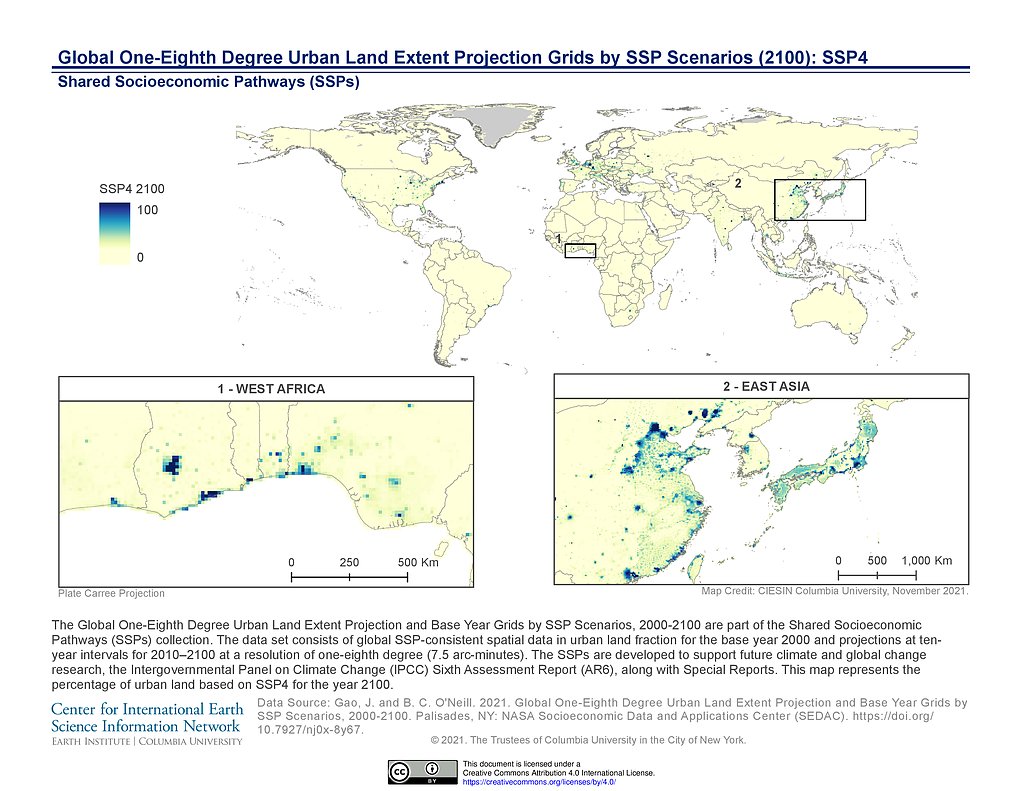
1/8th Degree Urban Land Extent Projection SSP4 (2100)
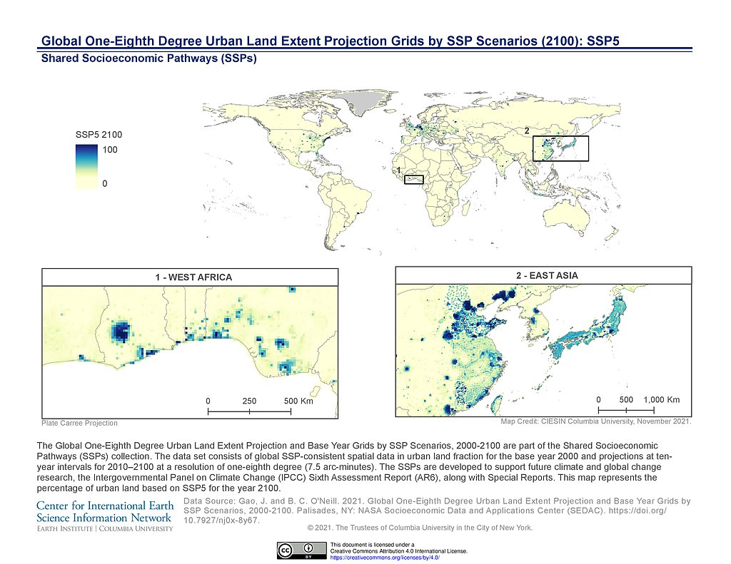
1/8th Degree Urban Land Extent Projection SSP5 (2100)
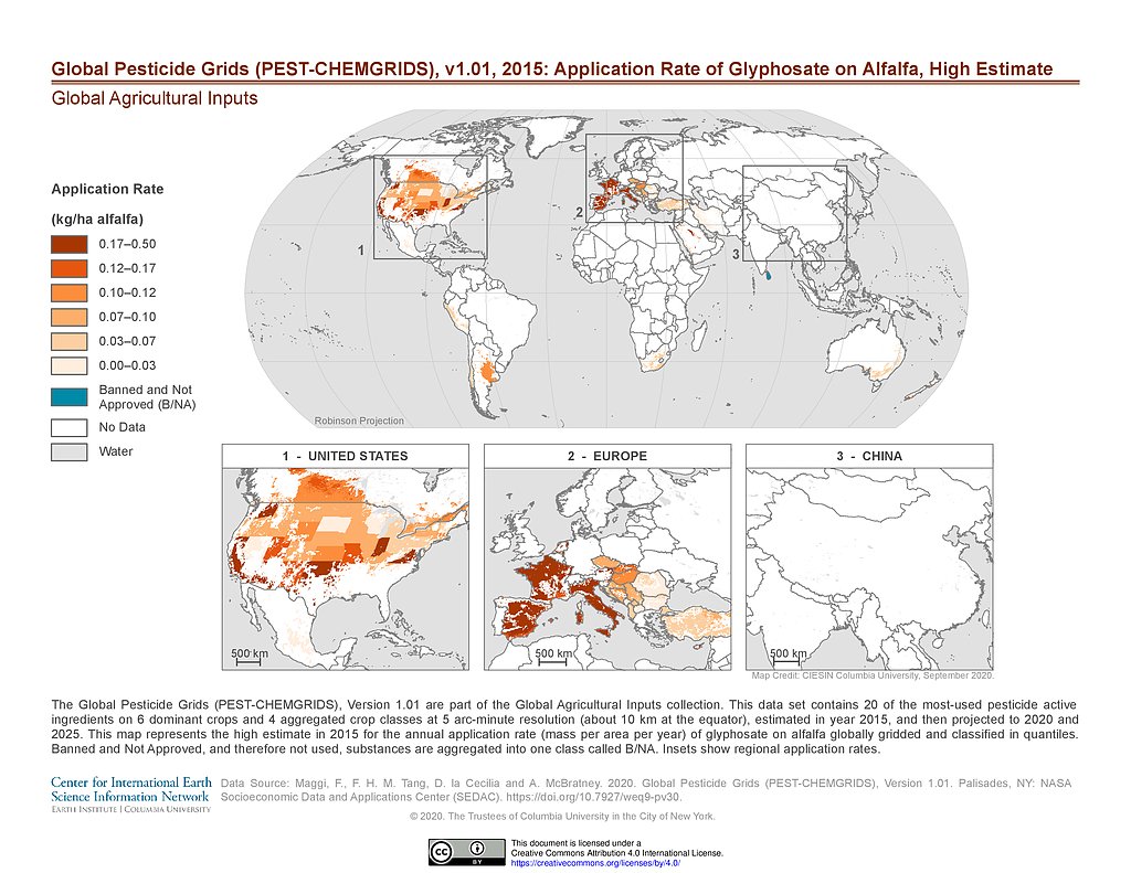
PEST-CHEMGRIDS v1.01 (2015): Glyphosate Application Rate on Alfalfa, High Estimate
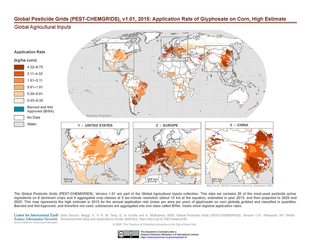
PEST-CHEMGRIDS v1.01 (2015): Glyphosate Application Rate on Corn, High Estimate
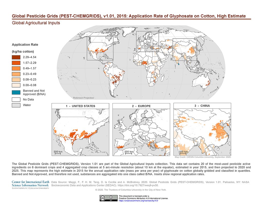
PEST-CHEMGRIDS v1.01 (2015): Glyphosate Application Rate on Cotton, High Estimate
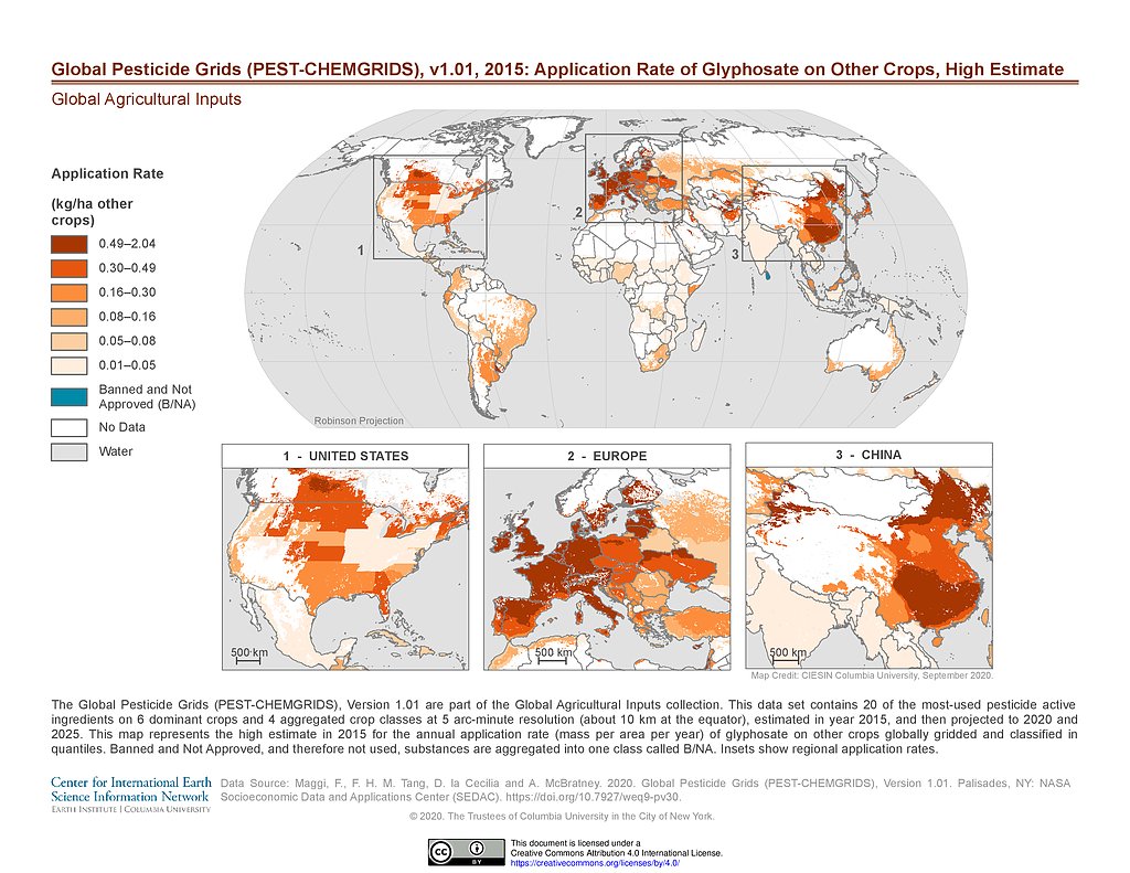
PEST-CHEMGRIDS v1.01 (2015): Glyphosate Application Rate on Other Crops, High Estimate
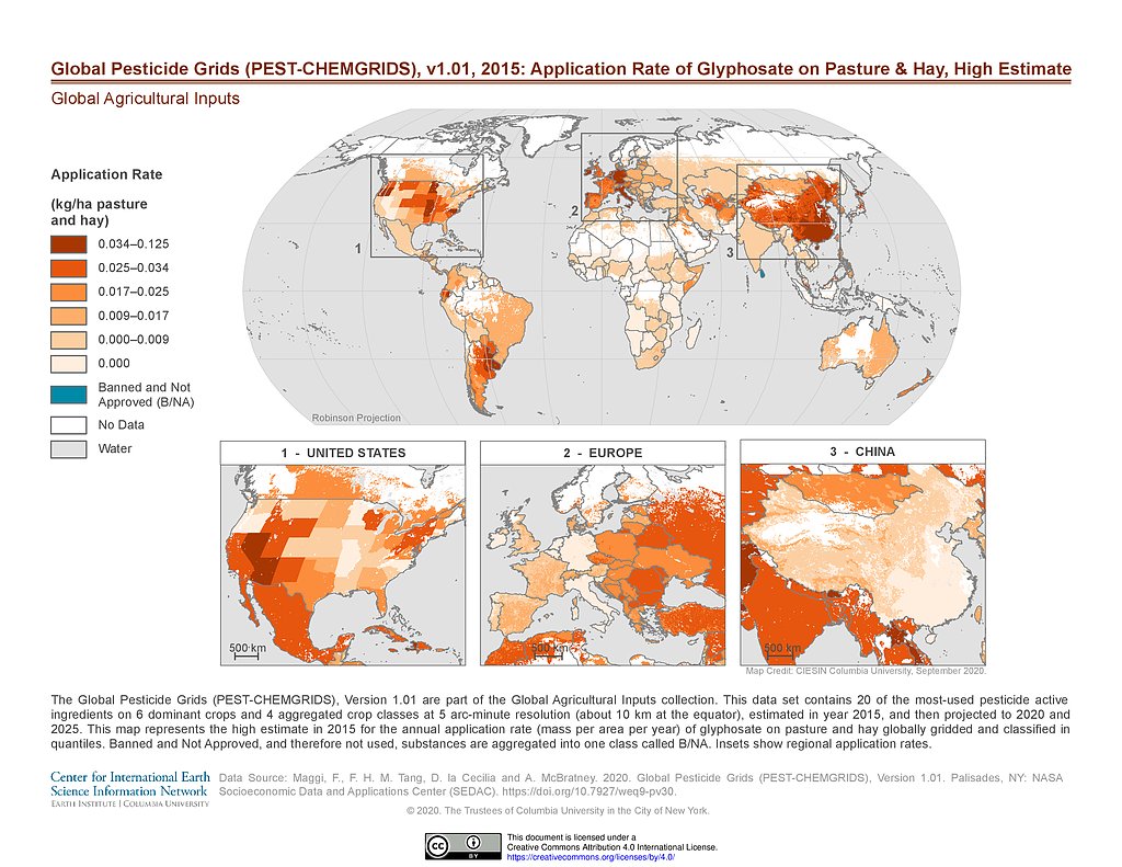
PEST-CHEMGRIDS v1.01 (2015): Glyphosate Application Rate on Pasture & Hay, High Estimate
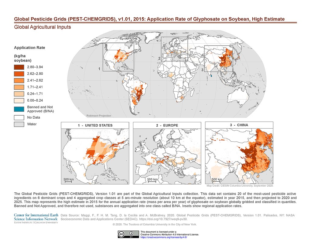
PEST-CHEMGRIDS v1.01 (2015): Glyphosate Application Rate on Soybean, High Estimate
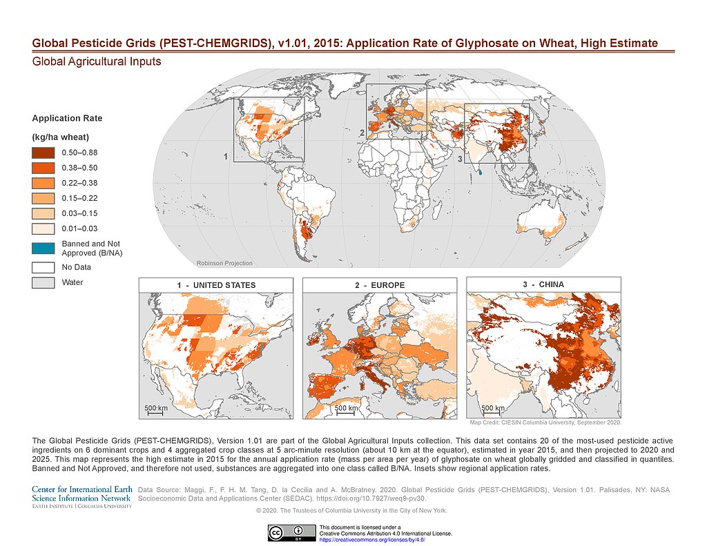
PEST-CHEMGRIDS v1.01 (2015): Glyphosate Application Rate on Wheat, High Estimate
PEST-CHEMGRIDS v1.01 (2015): Metam Application Rate on Vegetables & Fruits, High Estimate
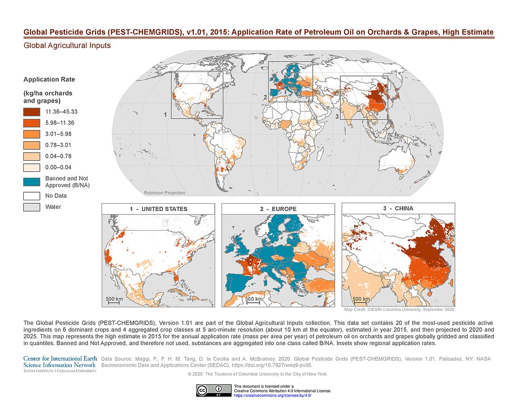
PEST-CHEMGRIDS v1.01 (2015): Petroleum Oil Application Rate on Orchards & Grapes, High Estimate
PEST-CHEMGRIDS v1.01 (2015): Propanil Application Rate on Rice, High Estimate
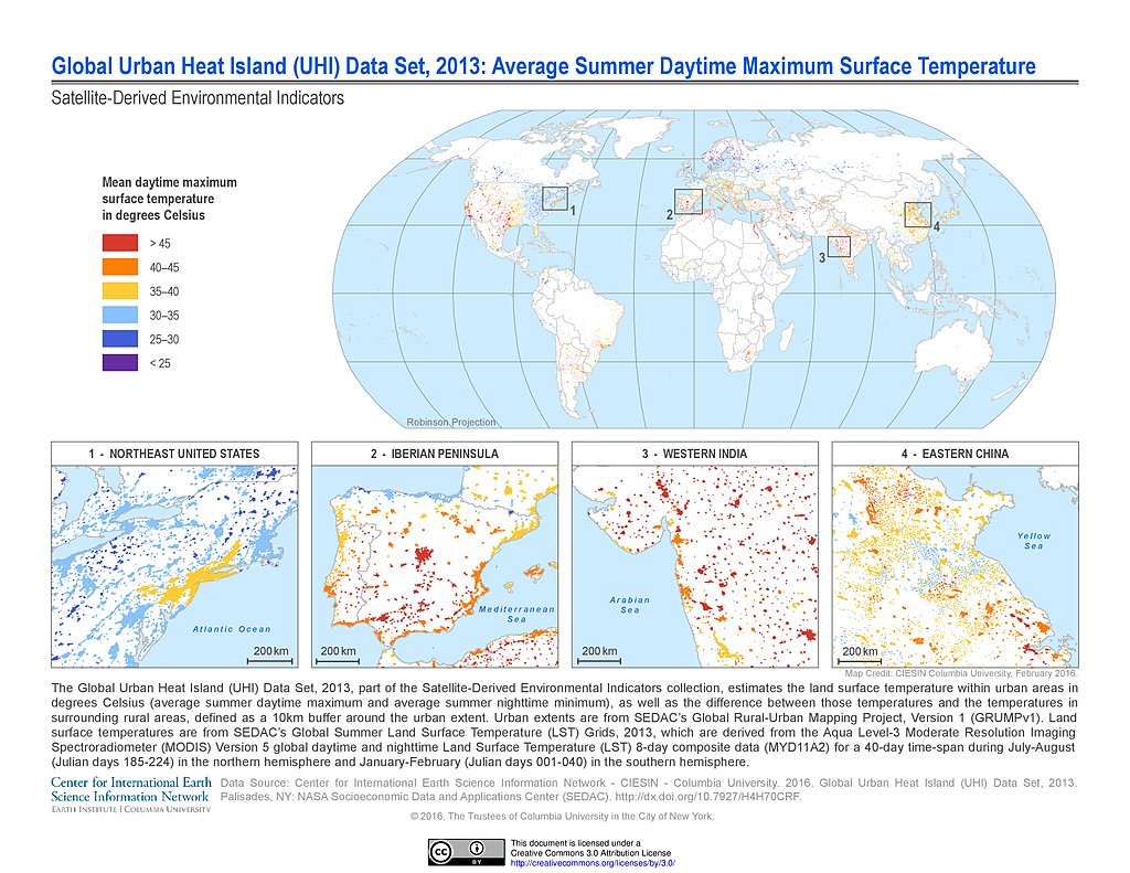
UHI Average Summer Daytime Maximum Surface Temperature (2013)
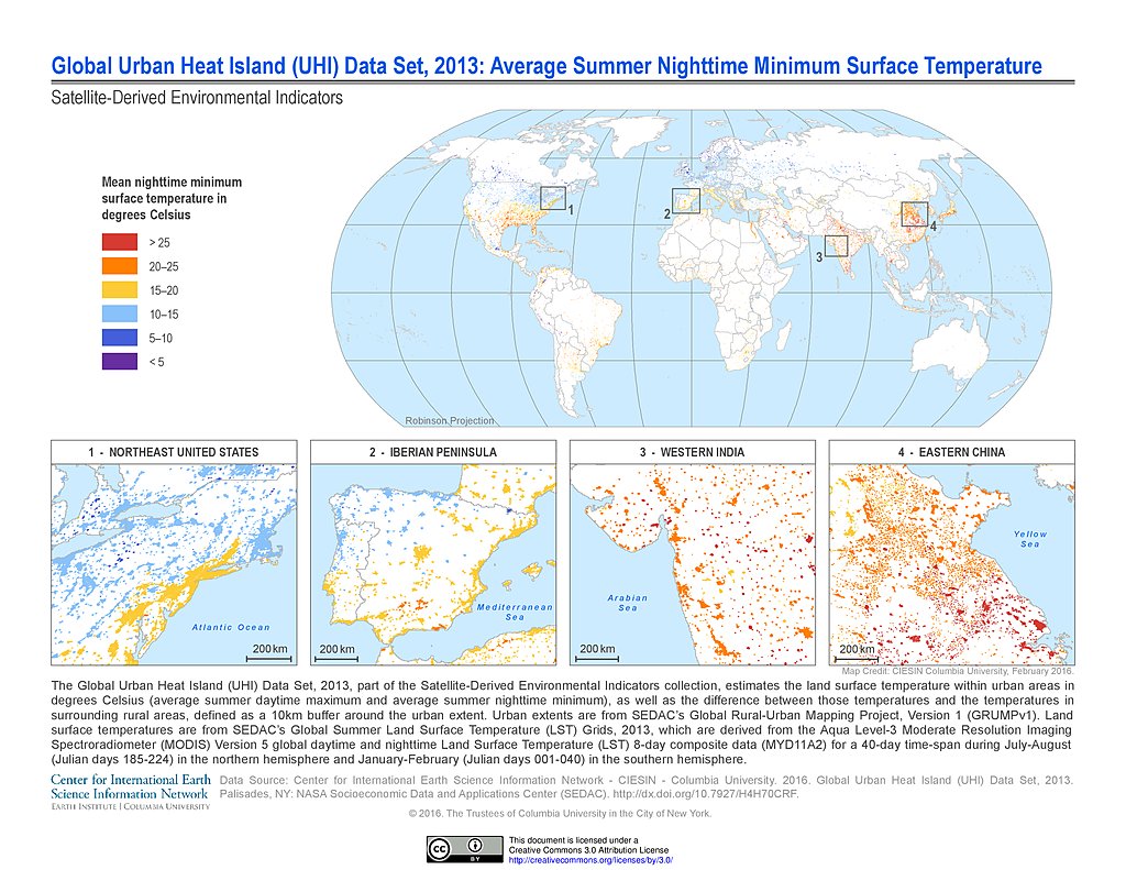
UHI Average Summer Nighttime Minimum Surface Temperature (2013)
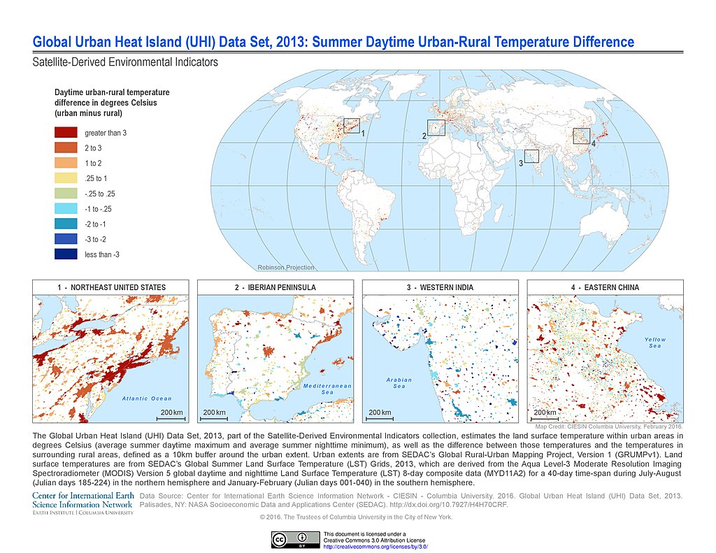
UHI Summer Daytime Urban-Rural Temperature Difference (2013)
Maps
»
Region: Global
Remove Facet
»
Theme: Land Use
Remove Facet
2 of 3
Prev
|
Next