Socioeconomic Data and Applications Center (
sedac
)
A Data Center in NASA's Earth Observing System Data and Information System (
EOSDIS
) — Hosted by
CIESIN
at
Columbia University
Search SEDAC
Data
Data Sets
Maps
Web Pages
search
Data
· Data Sets
· Data Collections
· Featured Data Uses
· Data Citations
· Citations Database
· Data Submission
Maps
· Map Gallery
· Map Viewer
· Map Services
· Mapping Tools
Themes
· Agriculture
· Climate
· Conservation
· Governance
· Hazards
· Health
· Infrastructure
· Land Use
· Marine and Coastal
· Population
· Poverty
· Remote Sensing
· Sustainability
· Urban
· Water
Resources
· Guides
· Multimedia
· Networks
· News
· Publications
· Related Sites
· Remote Sensing
· Tools
Social Media
· Twitter
· FaceBook
· YouTube
· Flickr
· Blog Posts
· Communities
About
· About SEDAC
· User Working Group
· Privacy
· User Registration
Help
Map Gallery
(175)
Follow Us:
Twitter
Follow Us on Facebook
YouTube
Flickr
| Share:
Twitter
Facebook
Search
All Fields:
search
Theme
Agriculture
(8)
Climate
(29)
Conservation
(30)
Framework Data
(14)
Hazards
(5)
Health
(34)
Infrastructure
(5)
Land Use
(35)
Marine and Coastal
(4)
Population
(86)
Poverty
(31)
Remote Sensing
(29)
Sustainability
(88)
Urban
(63)
Water
(4)
Location
Select a Location...
argentina
(6)
bolivia
(14)
brazil
(8)
chile
(7)
colombia
(6)
ecuador
(14)
falkland islands (malvinas)
(5)
french guiana
(3)
guyana
(5)
paraguay
(18)
peru
(7)
suriname
(5)
uruguay
(6)
venezuela (bolivarian republic of)
(7)
go
Maps
»
Region: south
Remove Facet
3 of 6
Prev
|
Next
Urban Extents: Falkland Islands
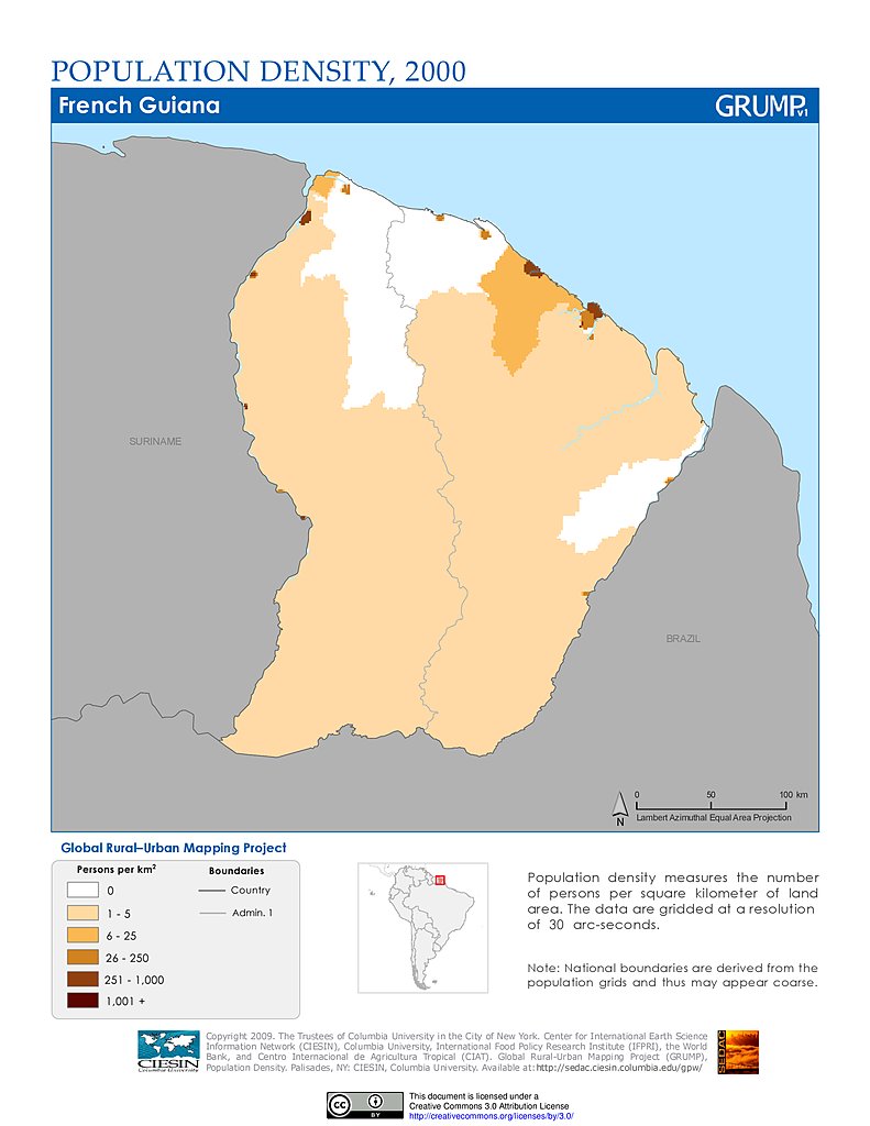
Population Density (2000): French Guiana
Settlement Points: French Guiana
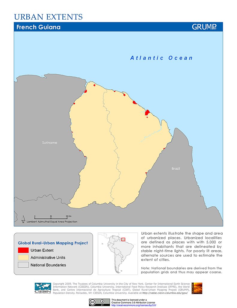
Urban Extents: French Guiana
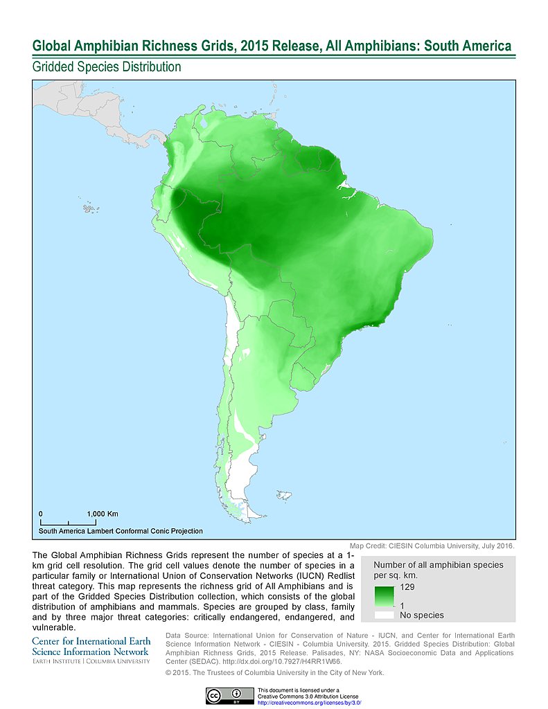
Amphibian Richness, 2015: South America
Amphibian Richness - All Threats, 2015: South America
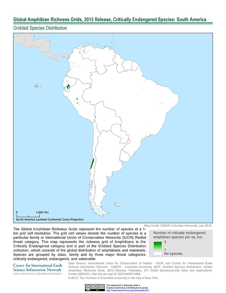
Amphibian Richness - Critically Endangered, 2015: South America
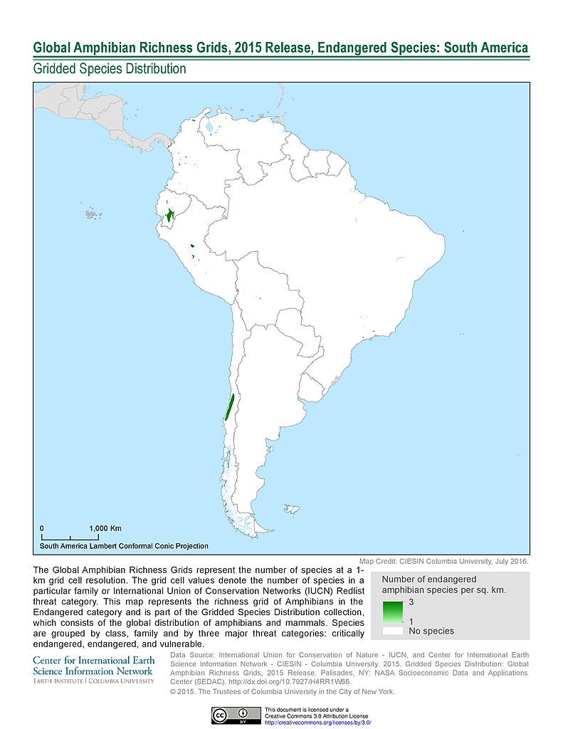
Amphibian Richness - Endangered, 2015: South America
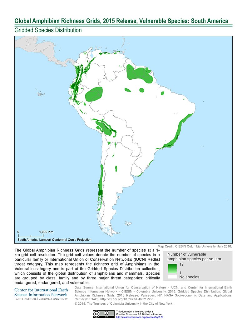
Amphibian Richness - Vulnerable, 2015: South America
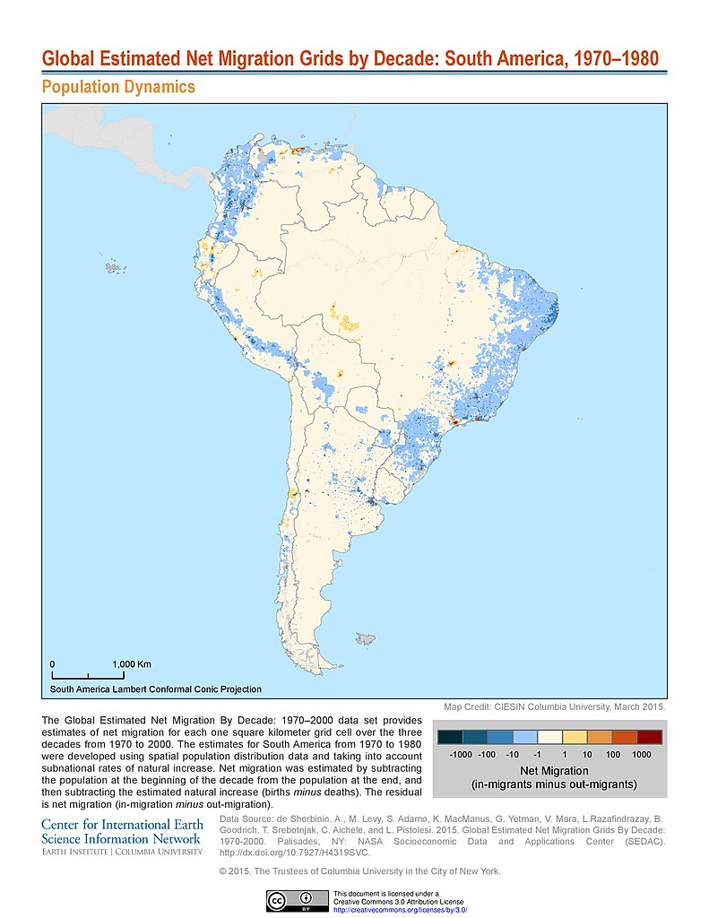
Net Migration (1970-1980): South America
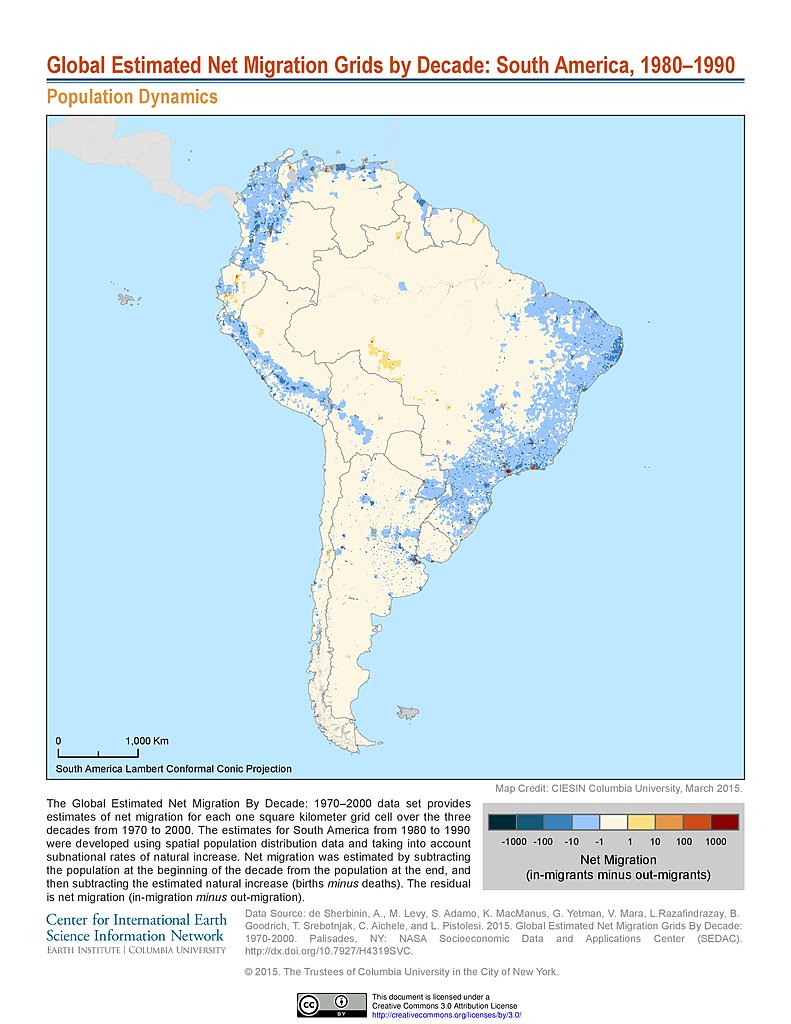
Net Migration (1980-1990): South America
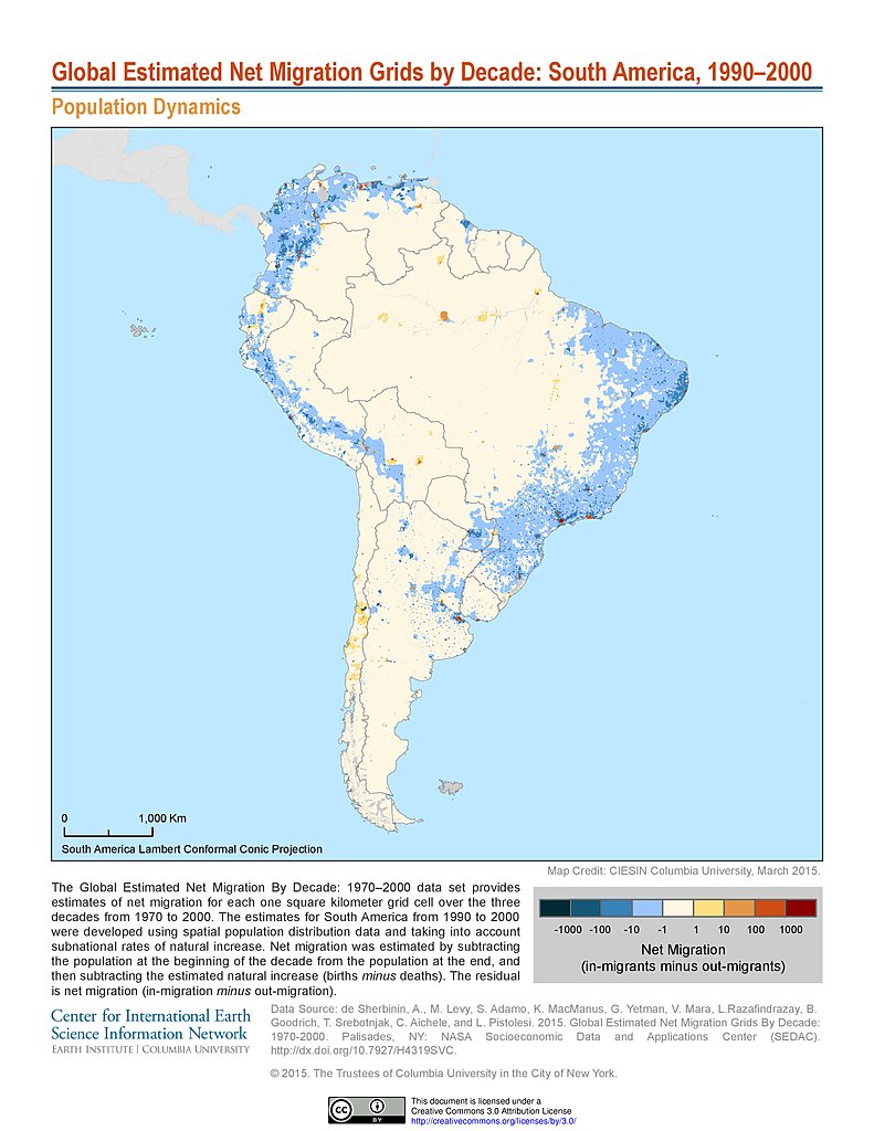
Net Migration (1990-2000): South America
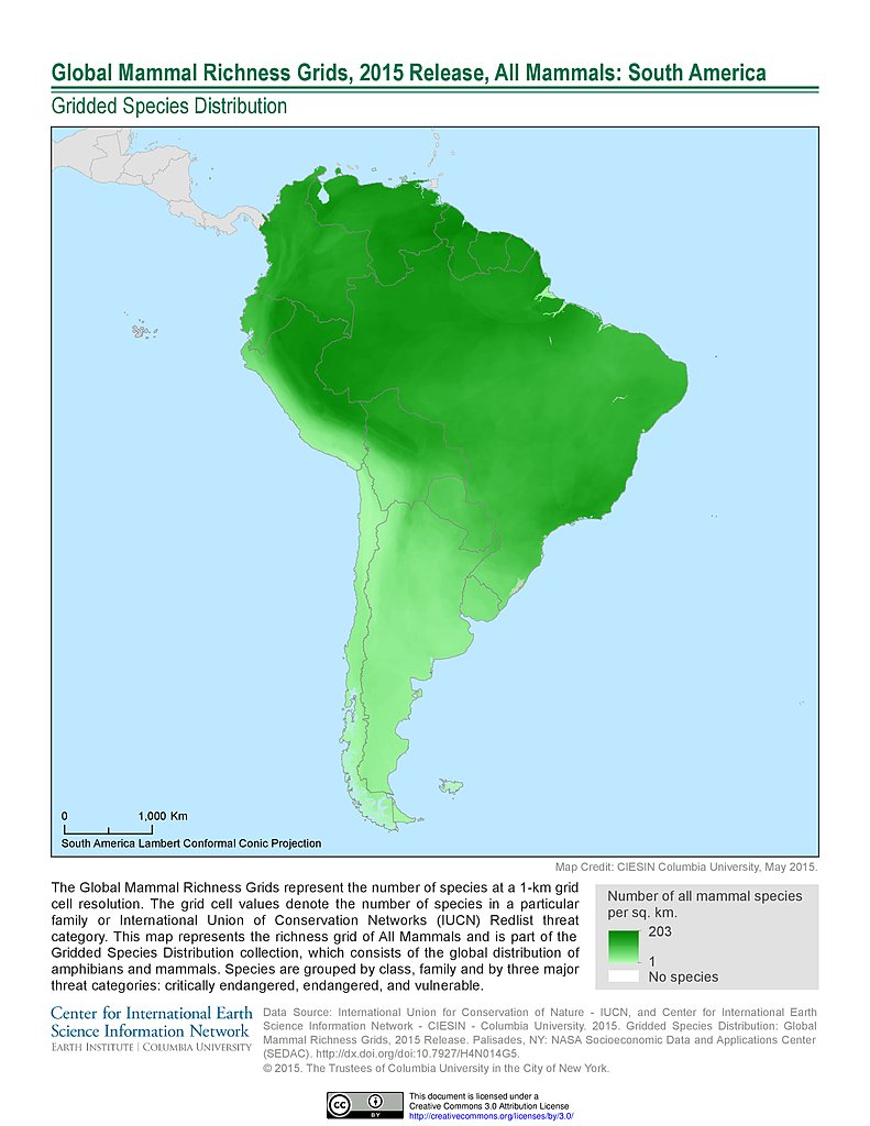
Mammal Richness, 2015: South America
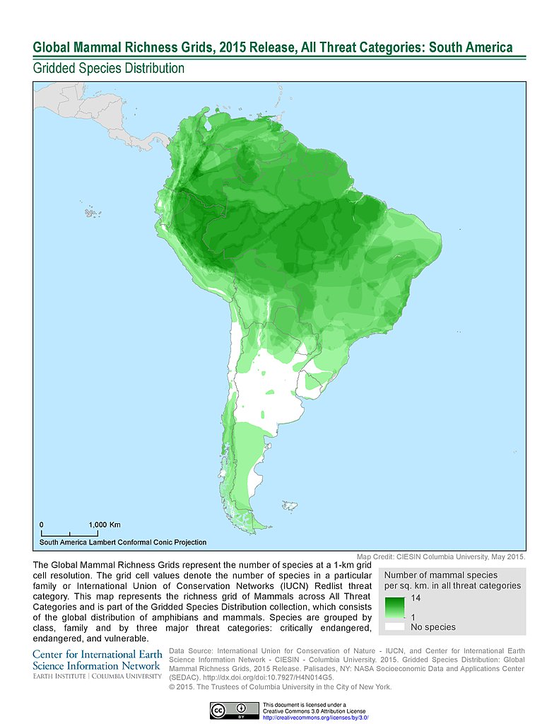
Mammal Richness - All Threats, 2015: South America
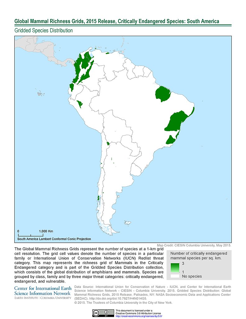
Mammal Richness - Critically Endangered, 2015: South America
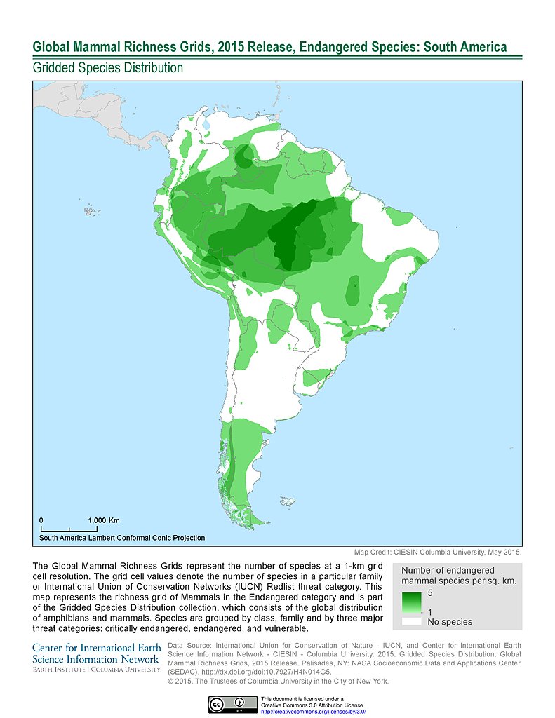
Mammal Richness - Endangered, 2015: South America
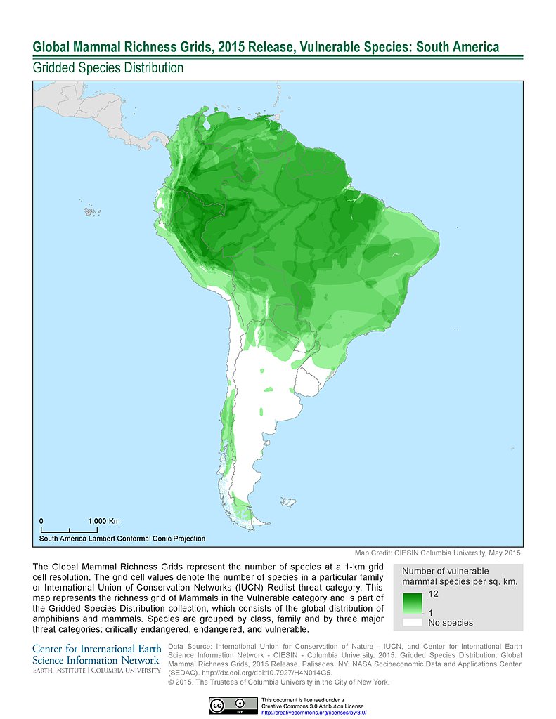
Mammal Richness - Vulnerable, 2015: South America
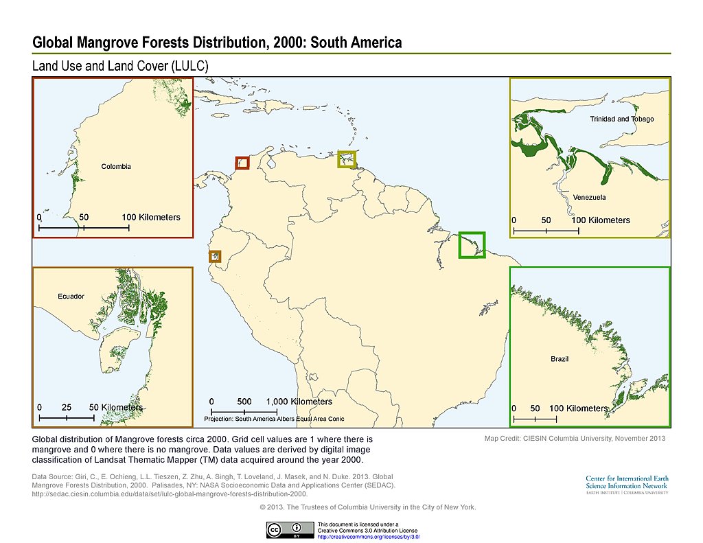
Mangrove Forests Distribution (2000): South America
GRDIv1: South America
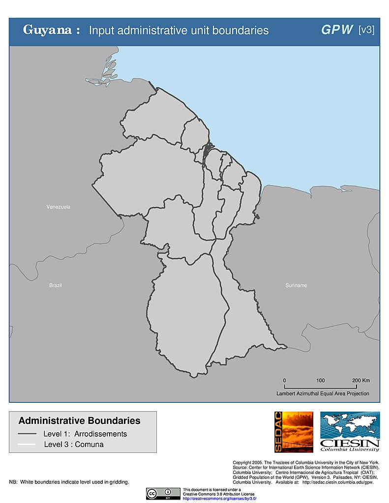
Administrative Boundaries: Guyana
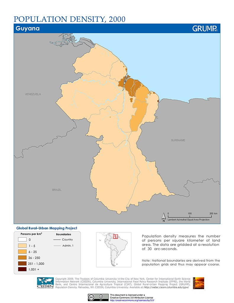
Population Density (2000): Guyana
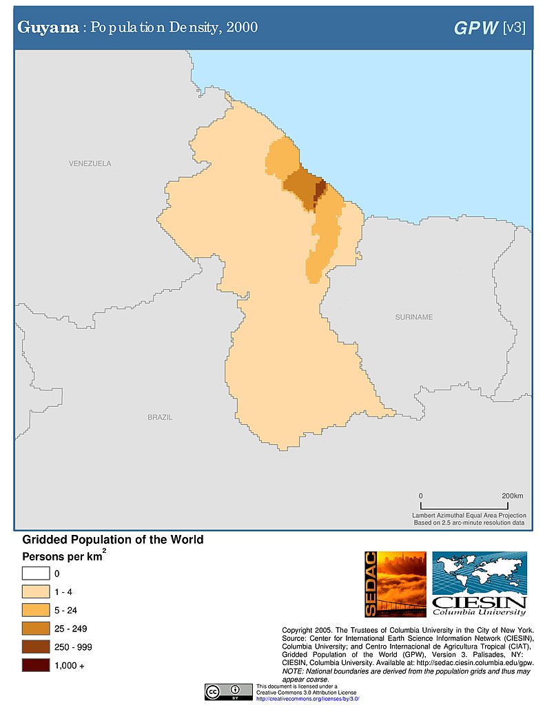
Population Density (2000): Guyana
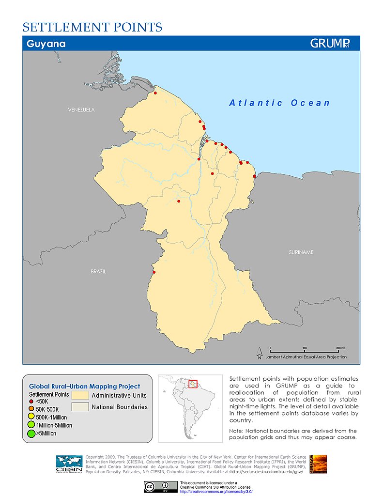
Settlement Points: Guyana
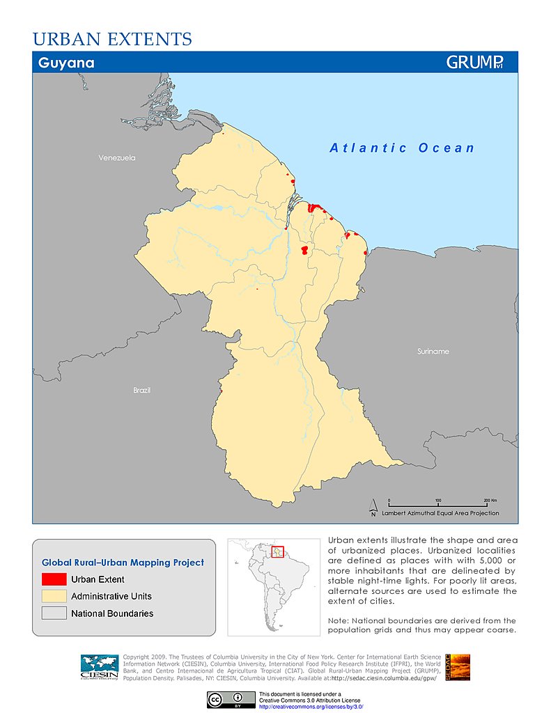
Urban Extents: Guyana
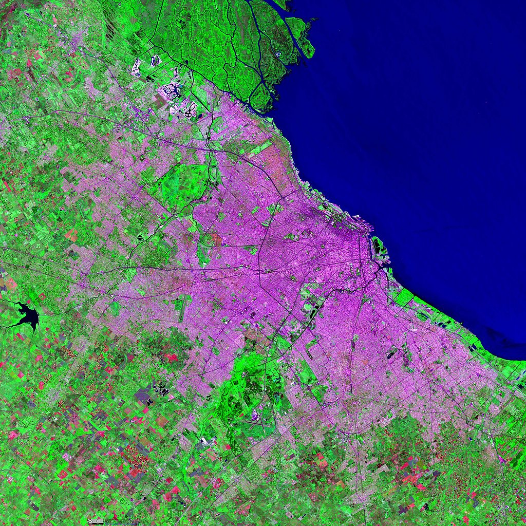
Landsat Image: Bogota, Colombia
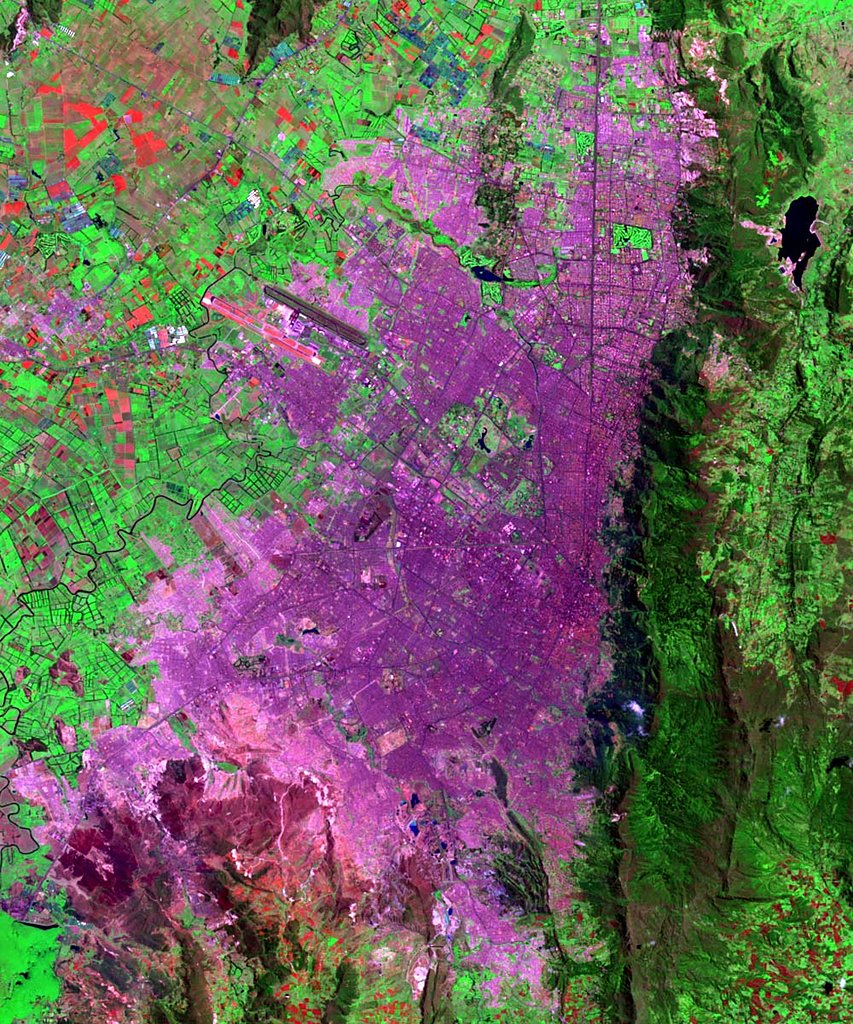
Landsat Image: Buenos Aires, Argentina
Landsat Image: Caracas, Venezuela
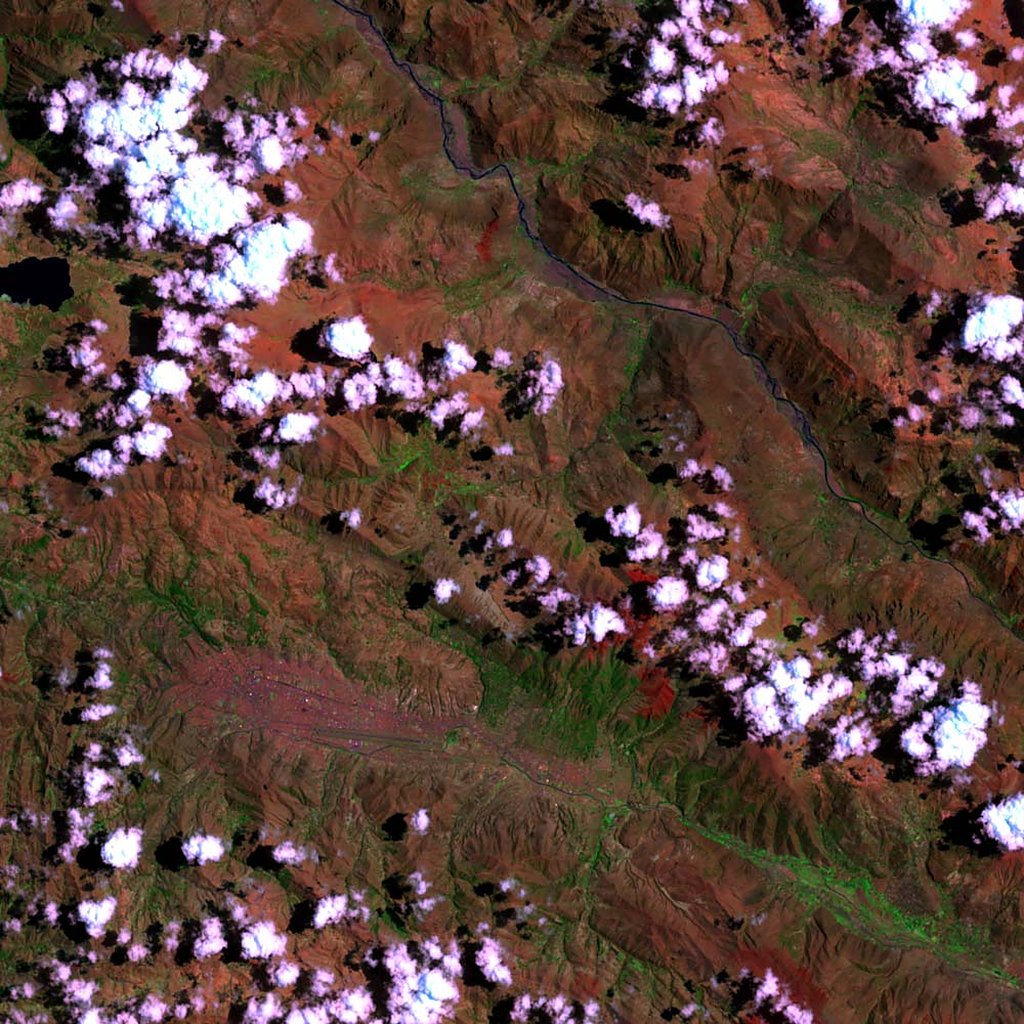
Landsat Image: Cuzco, Peru
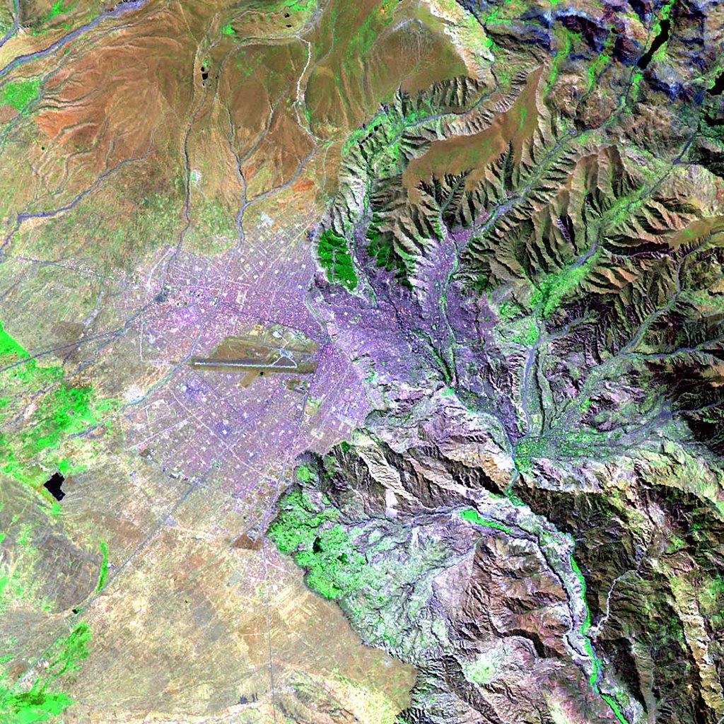
Landsat Image: La Paz, Bolivia
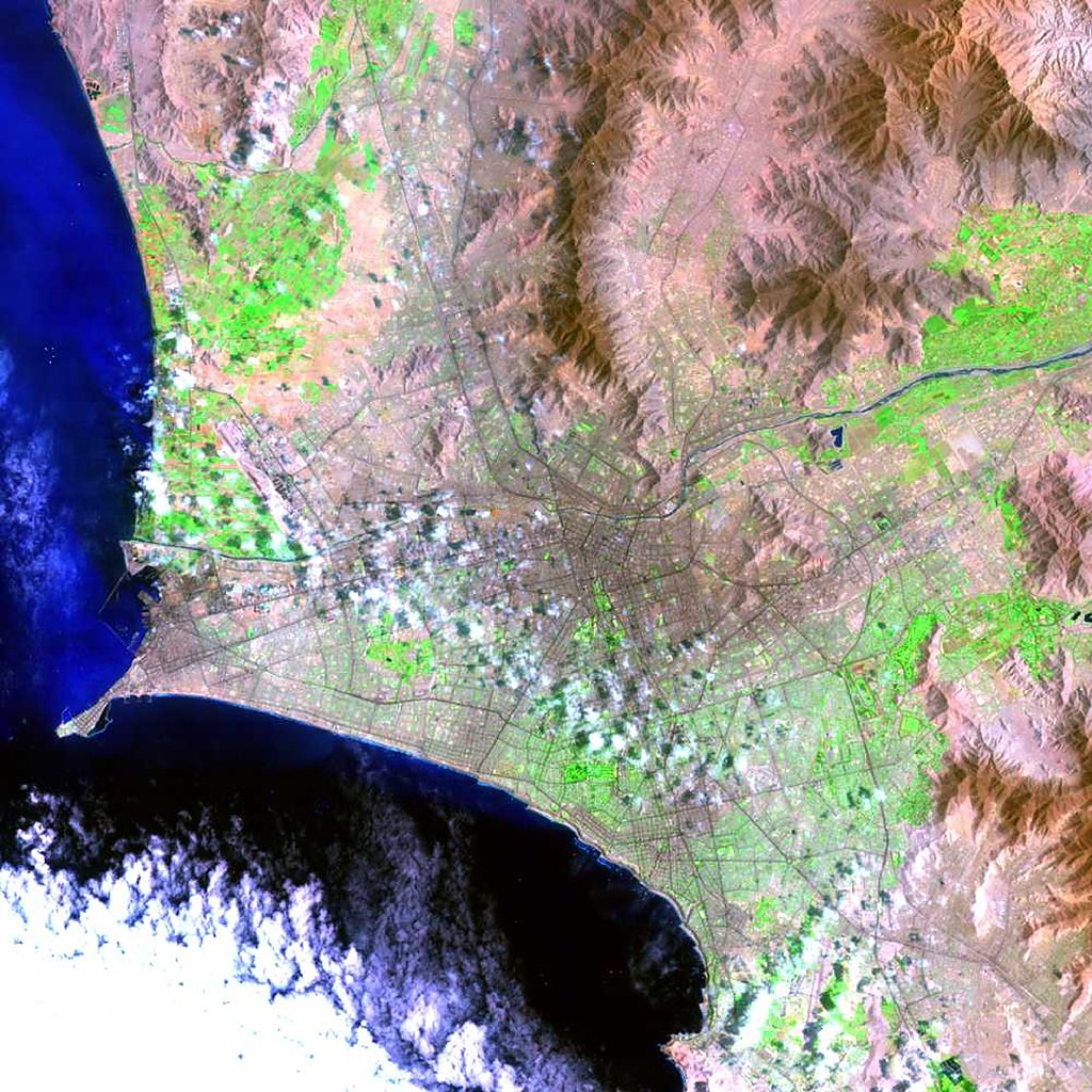
Landsat Image: Lima, Peru
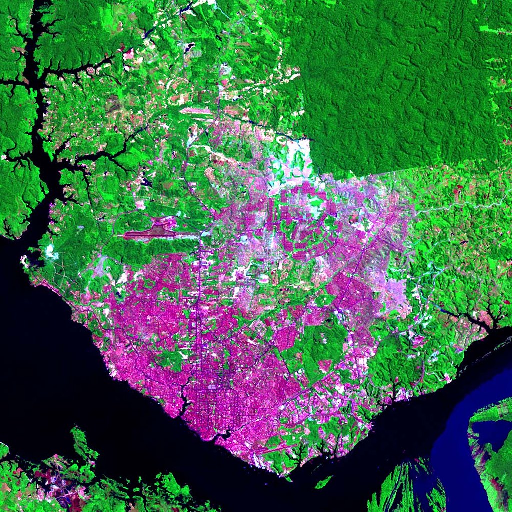
Landsat Image: Manaus, Brazil
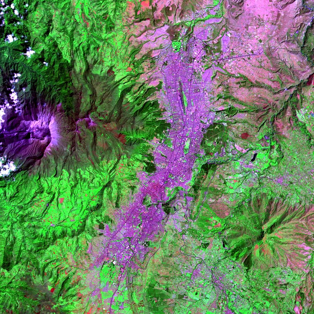
Landsat Image: Quito, Ecuador
Maps
»
Region: south
Remove Facet
3 of 6
Prev
|
Next