Socioeconomic Data and Applications Center (
sedac
)
A Data Center in NASA's Earth Observing System Data and Information System (
EOSDIS
) — Hosted by
CIESIN
at
Columbia University
Search SEDAC
Data
Data Sets
Maps
Web Pages
search
Data
· Data Sets
· Data Collections
· Featured Data Uses
· Data Citations
· Citations Database
· Data Submission
Maps
· Map Gallery
· Map Viewer
· Map Services
· Mapping Tools
Themes
· Agriculture
· Climate
· Conservation
· Governance
· Hazards
· Health
· Infrastructure
· Land Use
· Marine and Coastal
· Population
· Poverty
· Remote Sensing
· Sustainability
· Urban
· Water
Resources
· Guides
· Multimedia
· Networks
· News
· Publications
· Related Sites
· Remote Sensing
· Tools
Social Media
· Twitter
· FaceBook
· YouTube
· Flickr
· Blog Posts
· Communities
About
· About SEDAC
· User Working Group
· Privacy
· User Registration
Help
Map Gallery
(317)
Follow Us:
Twitter
Follow Us on Facebook
YouTube
Flickr
| Share:
Twitter
Facebook
Search
All Fields:
search
Region
Africa
(32)
Asia
(55)
Europe
(31)
Global
(86)
North America
(51)
Oceania
(27)
South America
(35)
Location
Select a Location...
afghanistan
(1)
argentina
(1)
australia
(4)
austria
(1)
bolivia
(2)
brazil
(3)
canada
(4)
chile
(1)
china
(5)
colombia
(1)
costa rica
(1)
democratic people's republic of korea
(1)
dominican republic
(1)
ecuador
(1)
egypt
(1)
el salvador
(1)
france
(1)
ghana
(1)
greece
(1)
guatemala
(1)
haiti
(1)
hong kong special administrative region
(1)
hungary
(1)
india
(10)
israel
(1)
italy
(1)
japan
(1)
jordan
(1)
lebanon
(1)
mali
(1)
mexico
(4)
nepal
(1)
nicaragua
(1)
nigeria
(1)
peru
(2)
philippines
(1)
portugal
(1)
russian federation
(1)
senegal
(1)
singapore
(1)
south africa
(1)
spain
(1)
syrian arab republic
(1)
taiwan
(1)
united kingdom of great britain and northern ireland
(1)
united republic of tanzania
(1)
united states of america
(14)
venezuela (bolivarian republic of)
(1)
viet nam
(1)
go
Maps
»
Theme: Land Use
Remove Facet
3 of 10
Prev
|
Next
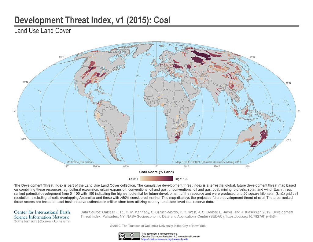
Development Threat Index (2015): Coal
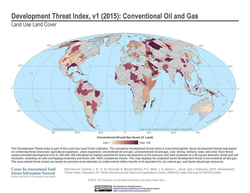
Development Threat Index (2015): Conventional Oil and Gas
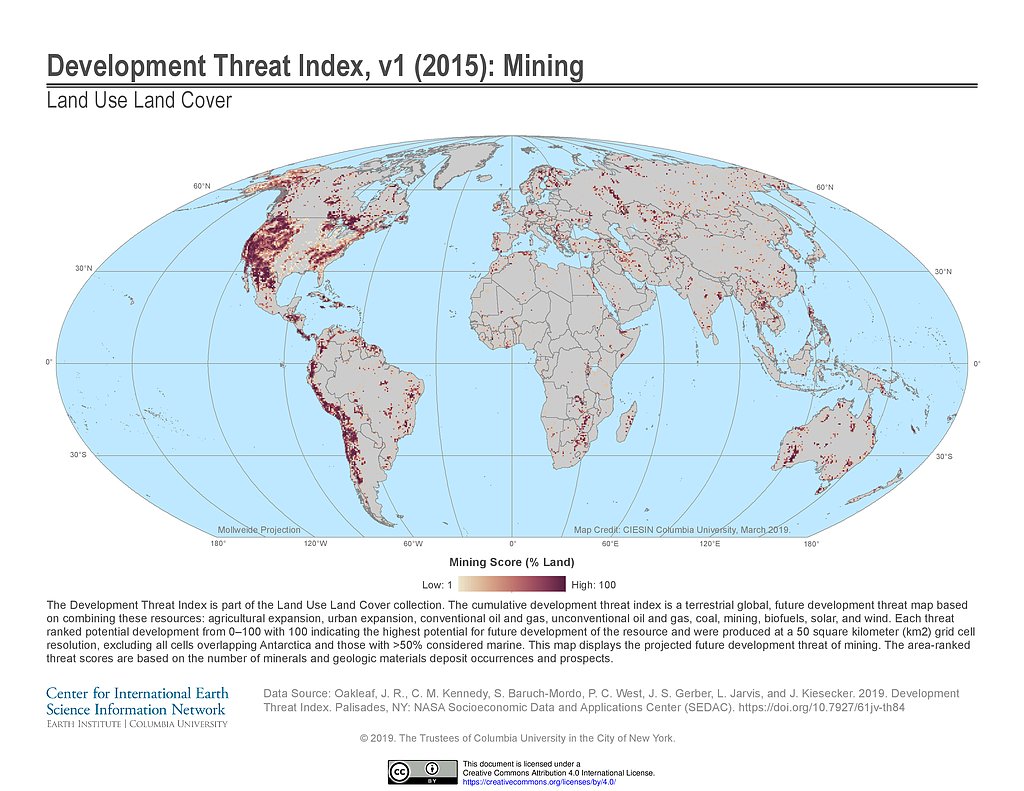
Development Threat Index (2015): Mining
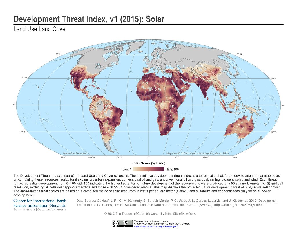
Development Threat Index (2015): Solar
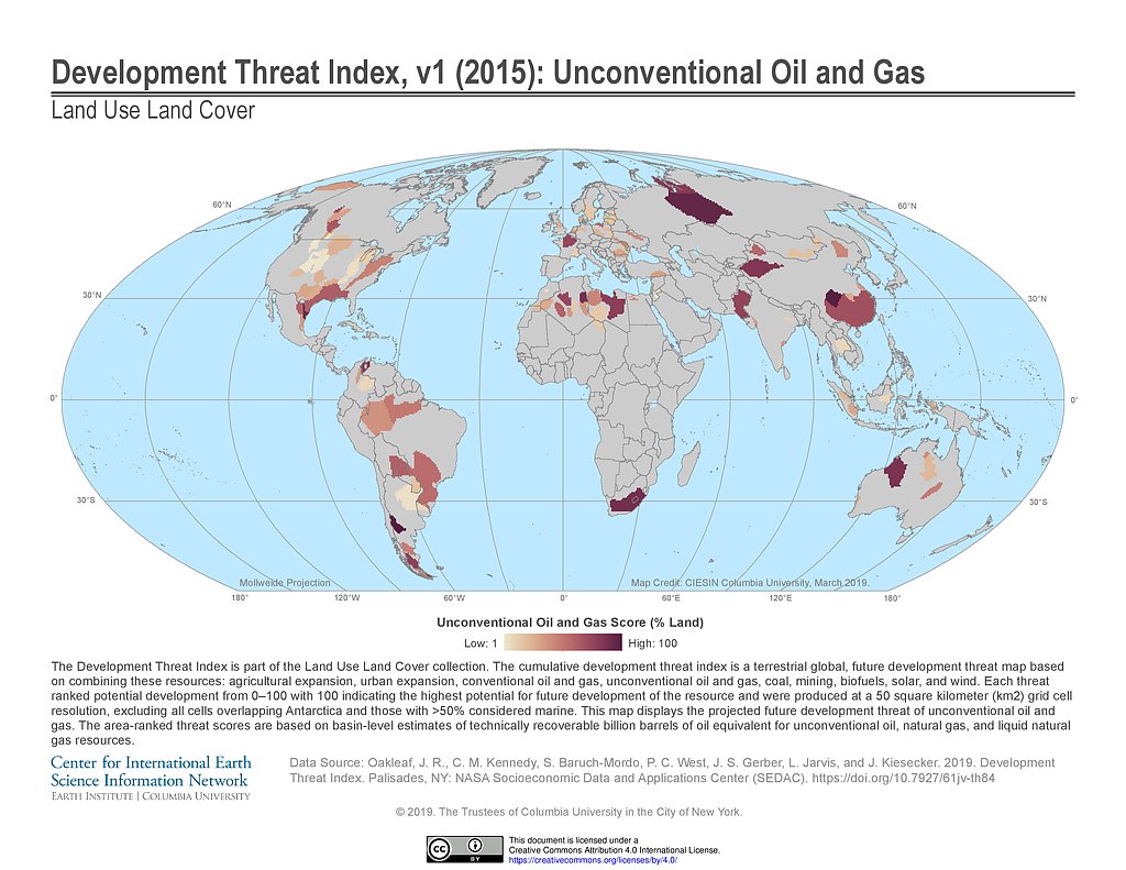
Development Threat Index (2015): Unconventional Oil and Gas
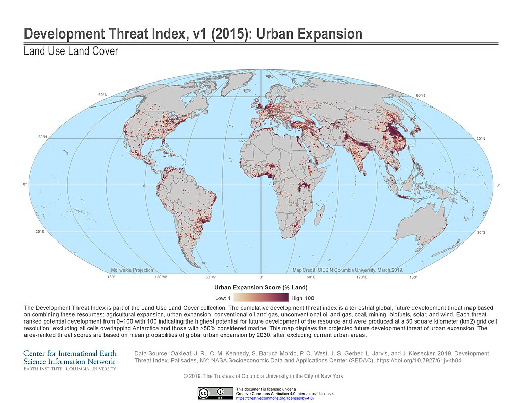
Development Threat Index (2015): Urban Expansion
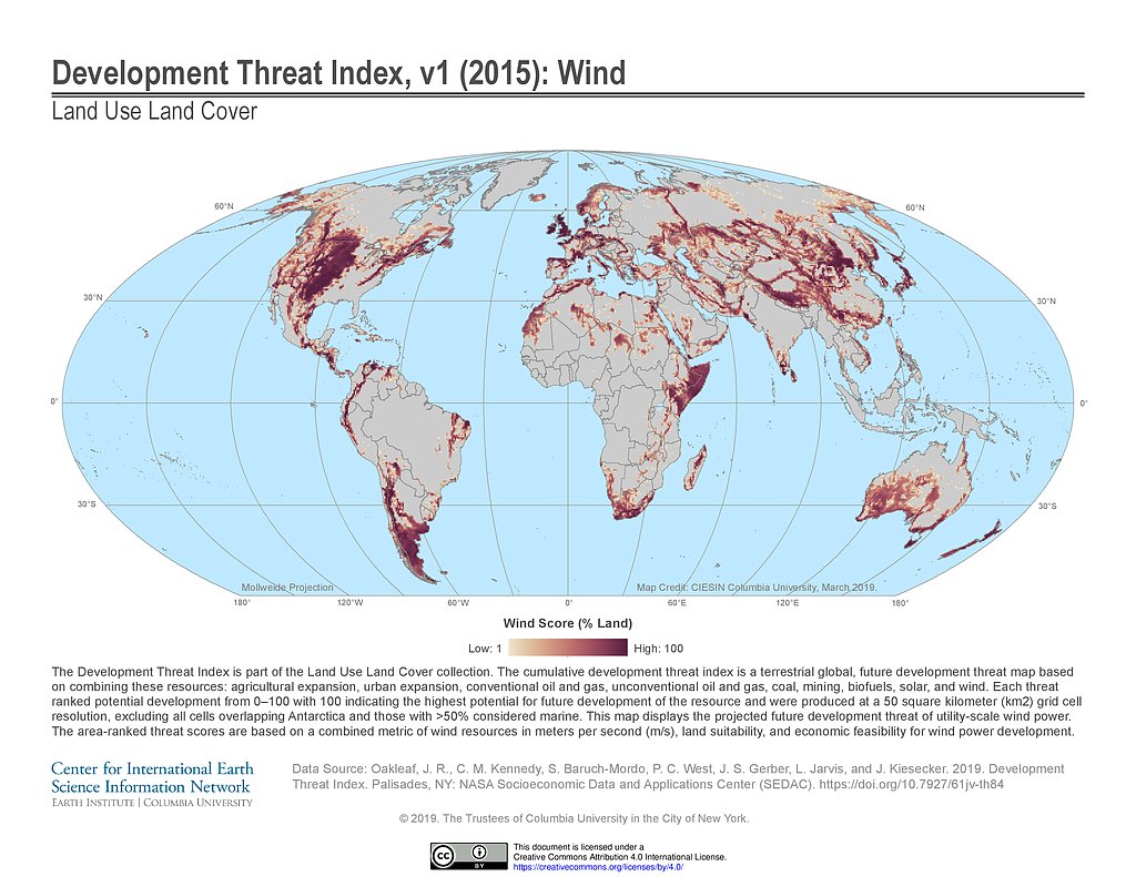
Development Threat Index (2015): Wind
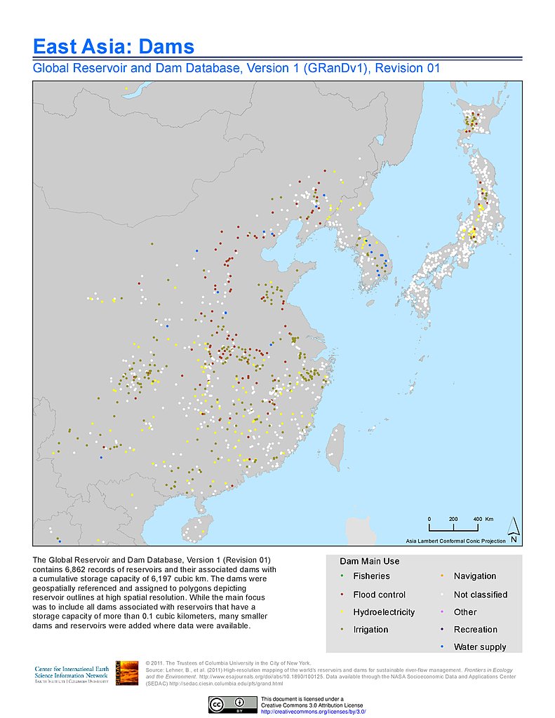
Dams, v1.01: East Asia
Reservoirs, v1.01: East Asia
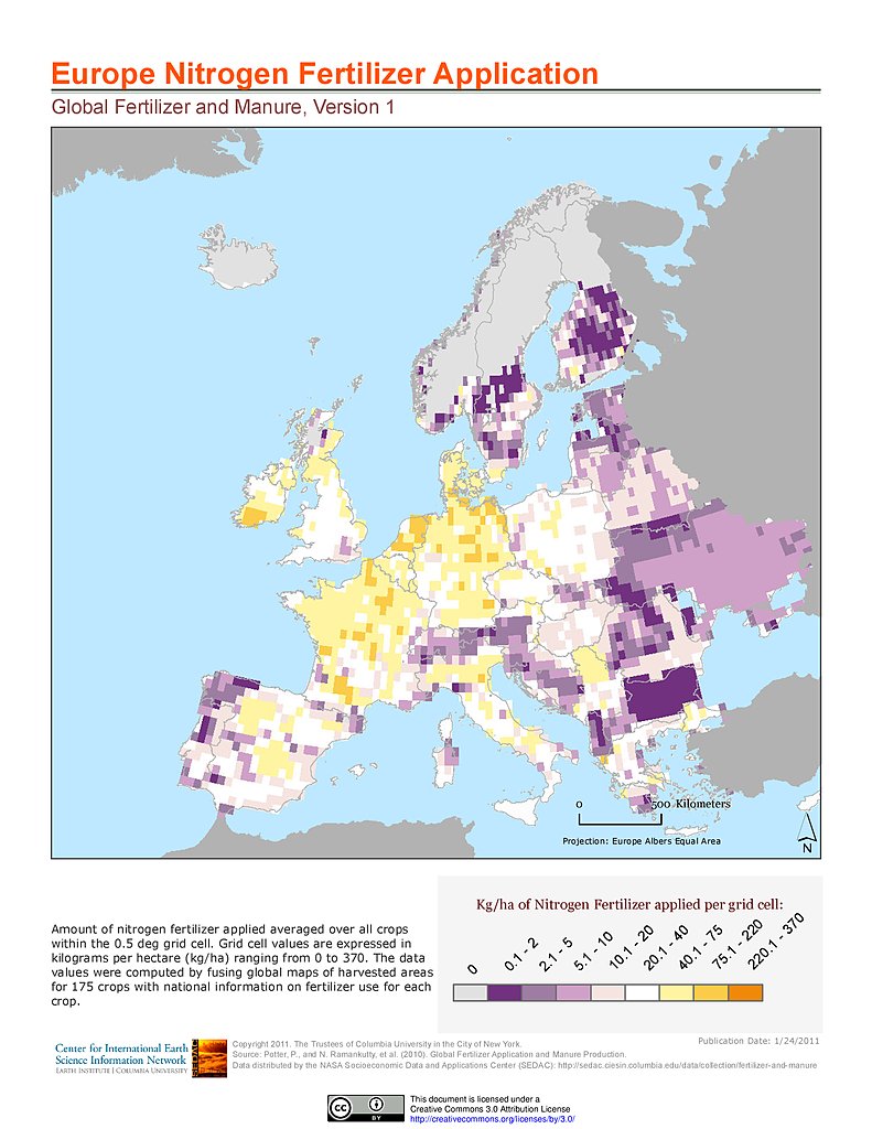
Nitrogen Fertilizer Application: Europe
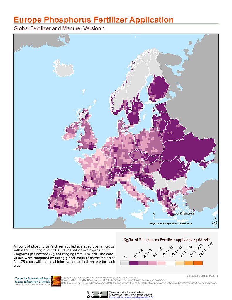
Phosphorus Fertilizer Application: Europe
Dams, v1.01: Europe
Reservoirs, v1.01: Europe
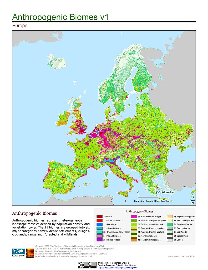
Anthropogenic Biomes, v1: Europe
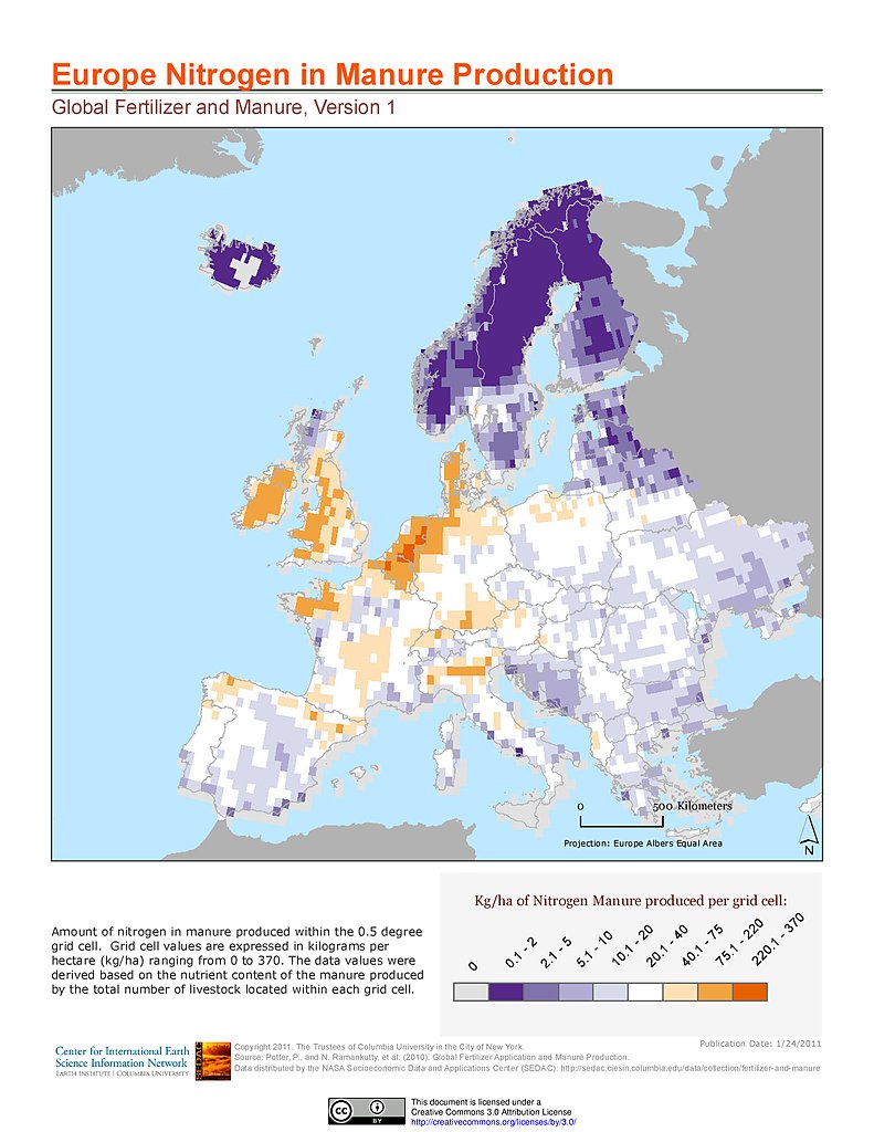
Nitrogen in Manure Production: Europe
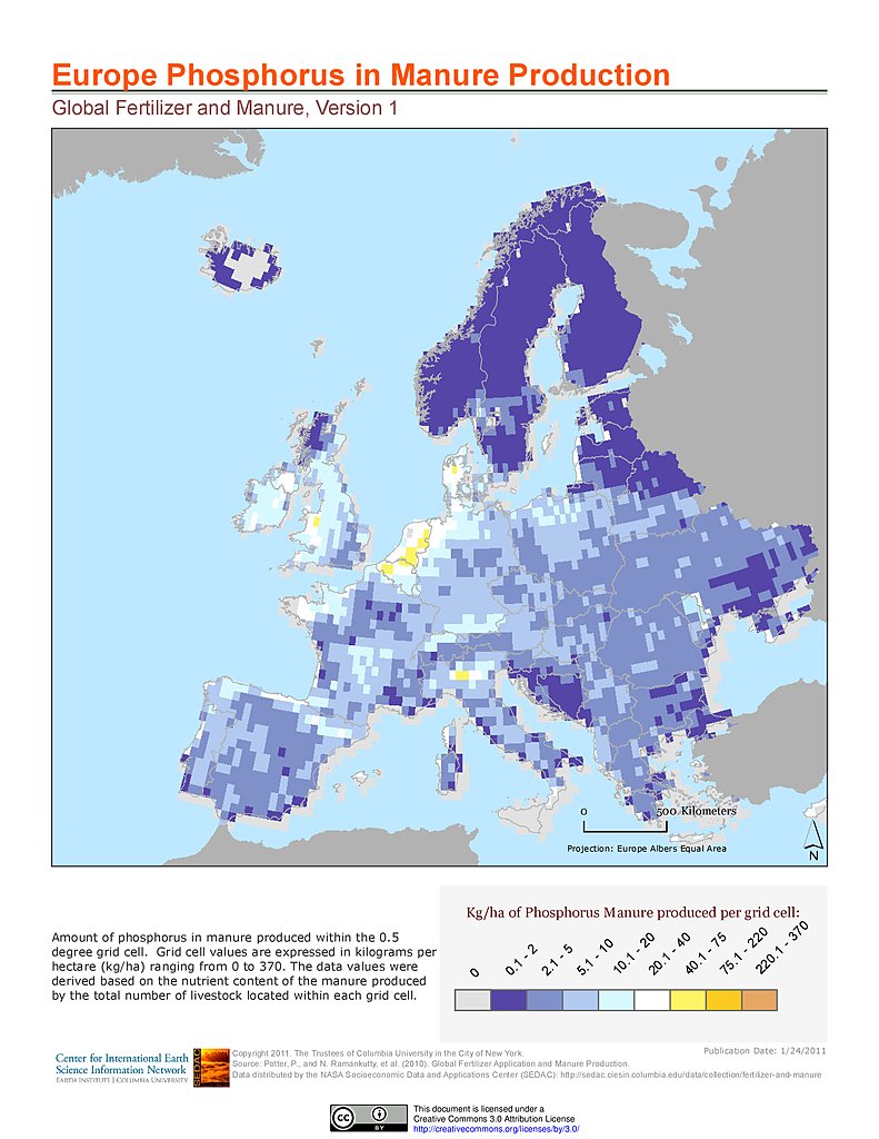
Phosphorus in Manure Production: Europe
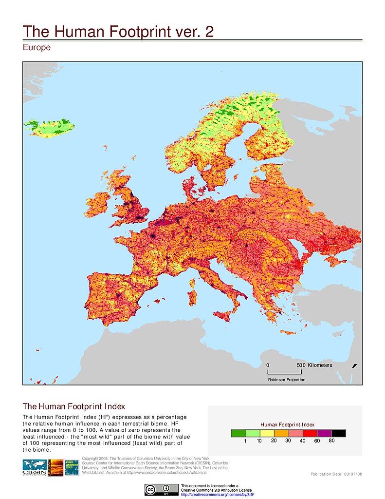
Human Footprint Index, v2: Europe
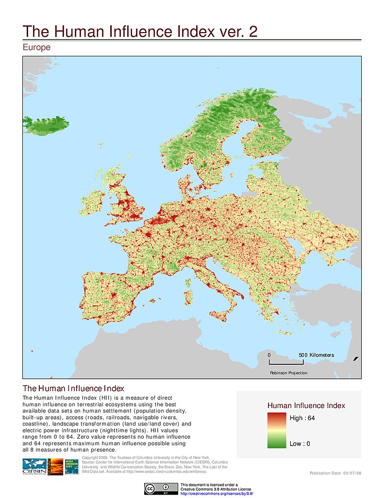
Human Influence Index, v2: Europe
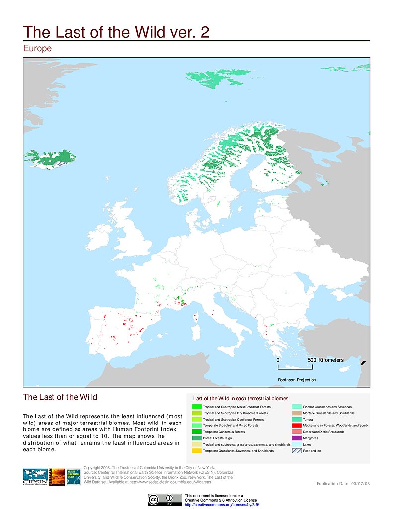
Last of the Wild, v2: Europe
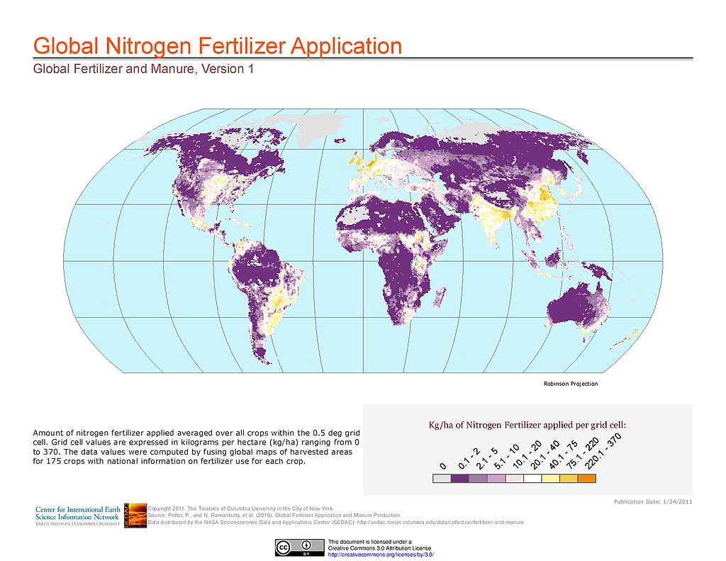
Nitrogen Fertilizer Application
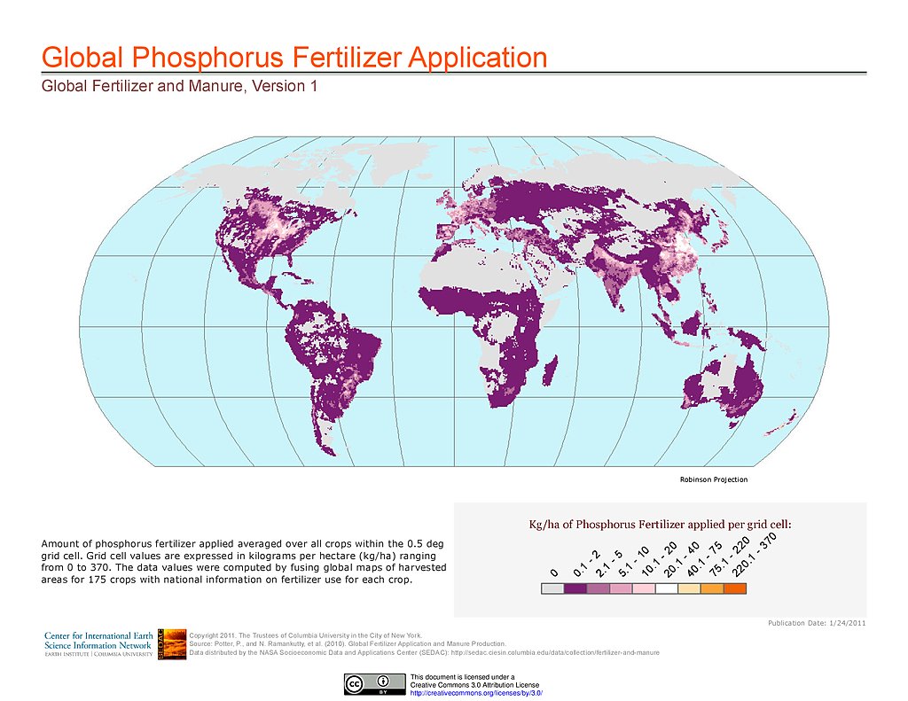
Phosphorus Fertilizer Application
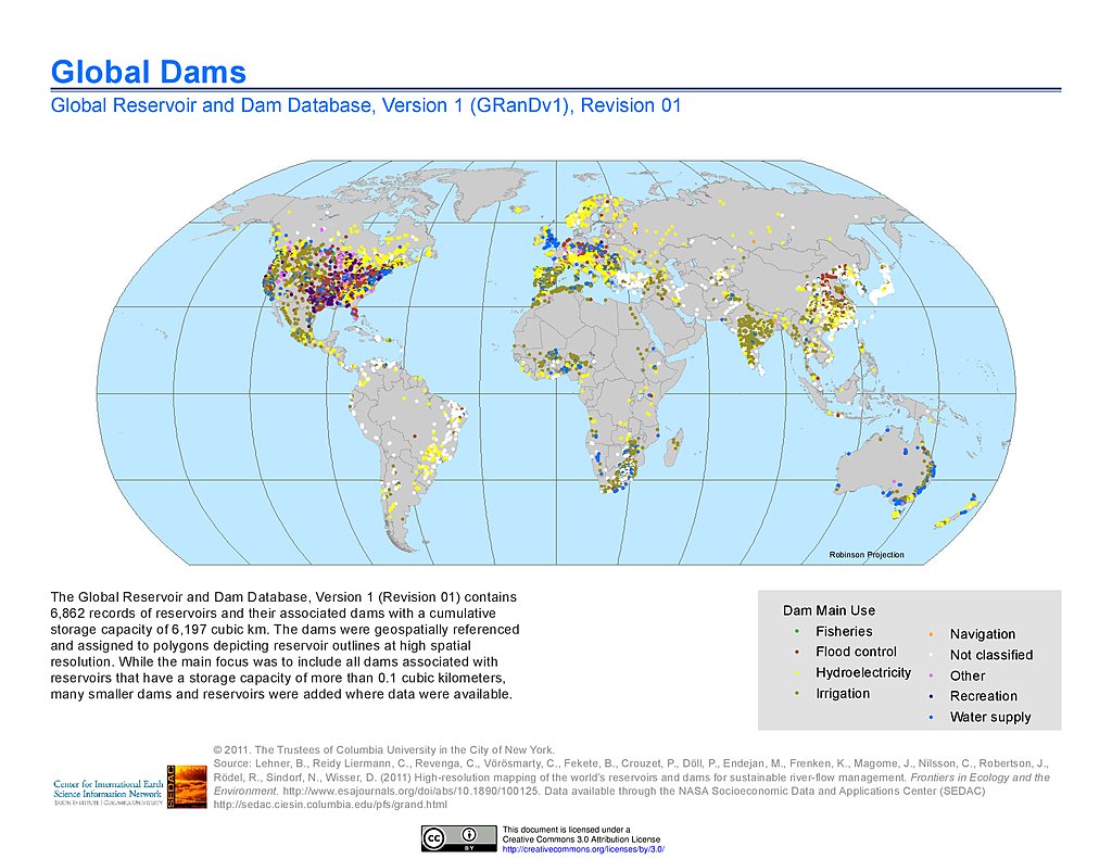
Dams, v1.01
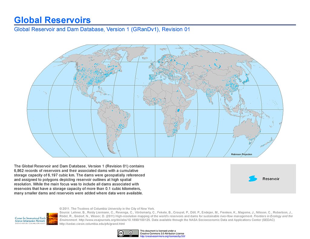
Reservoirs, v1.01
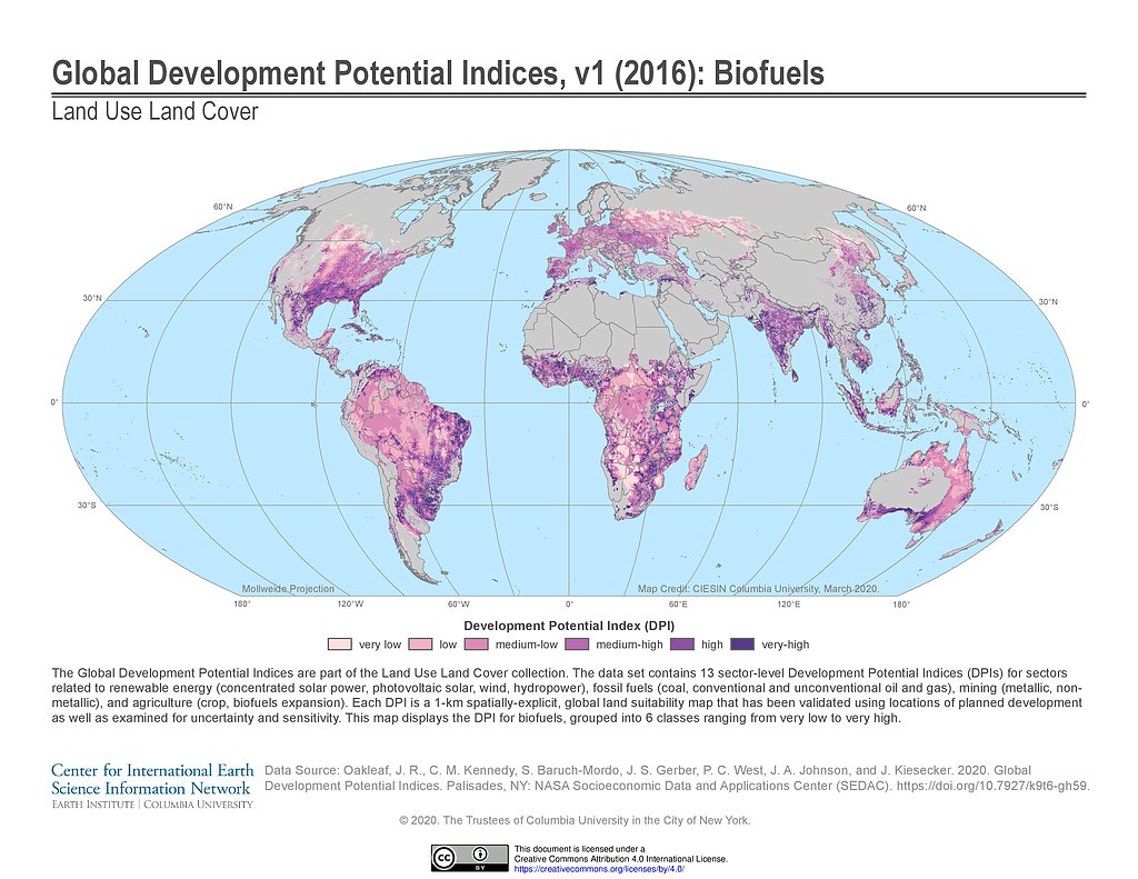
Development Potential Indices (2016): Biofuels
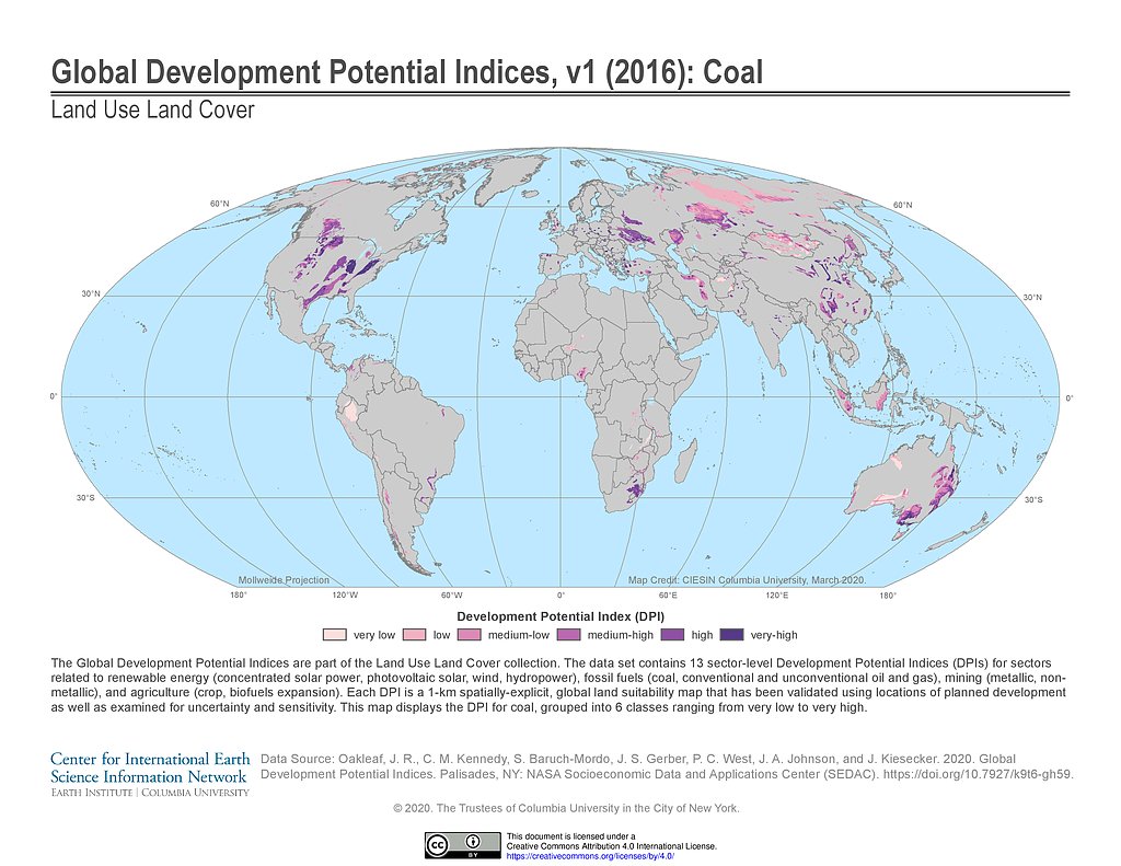
Development Potential Indices (2016): Coal
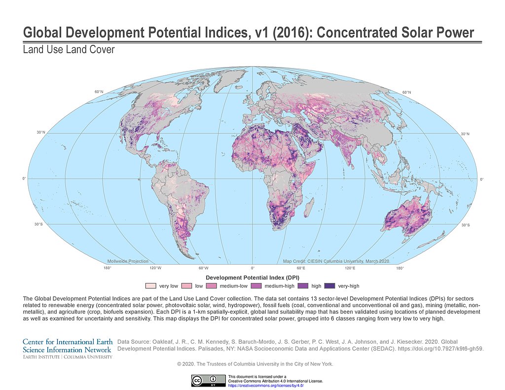
Development Potential Indices (2016): Concentrated Solar Power
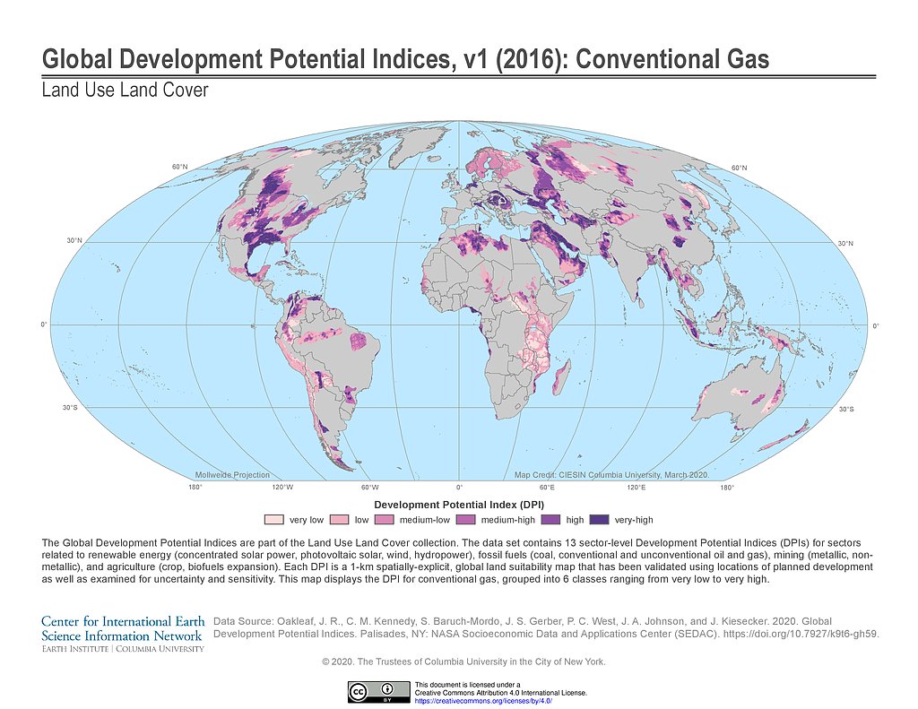
Development Potential Indices (2016): Conventional Gas
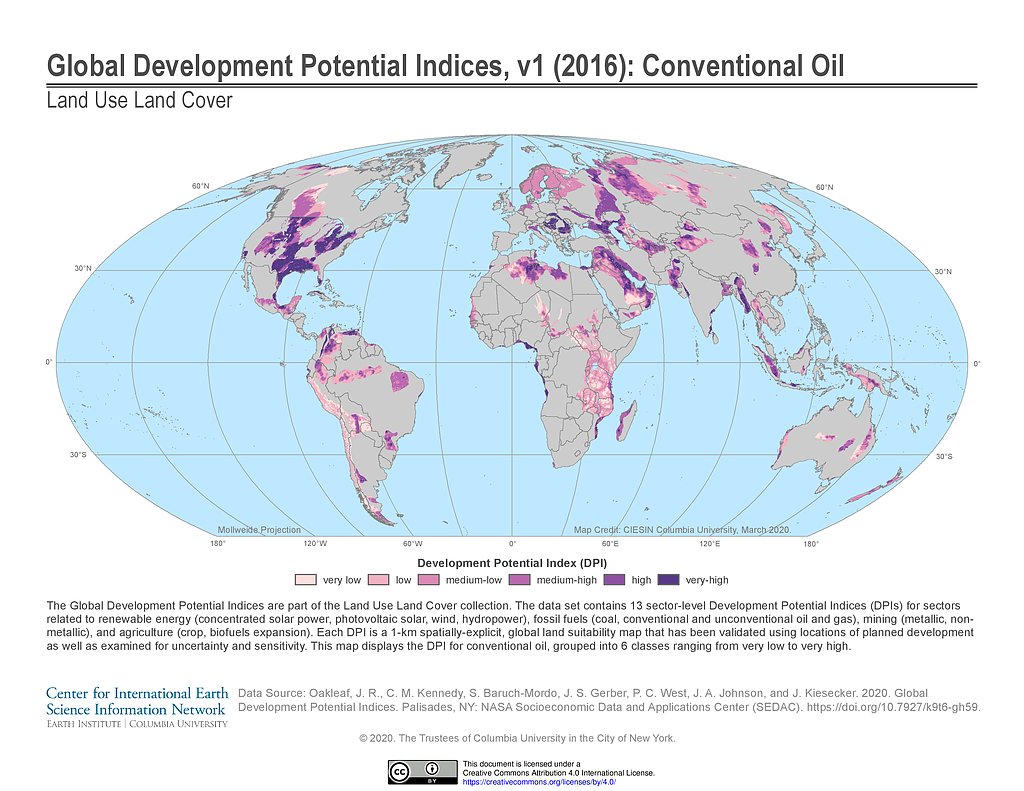
Development Potential Indices (2016): Conventional Oil
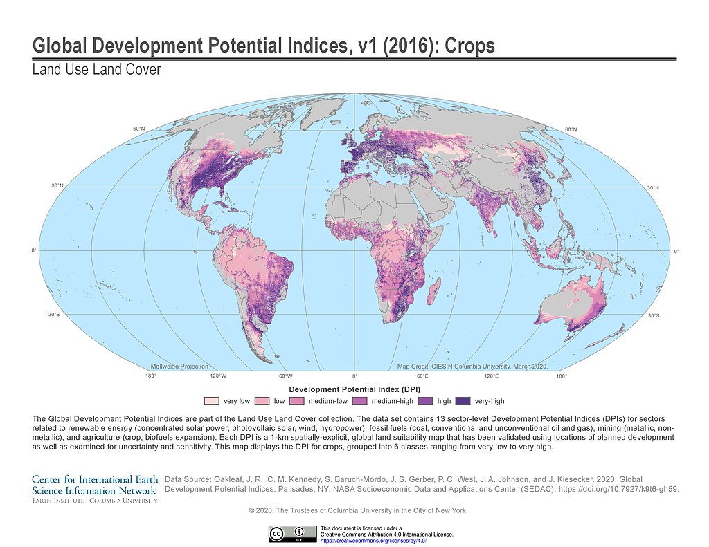
Development Potential Indices (2016): Crops
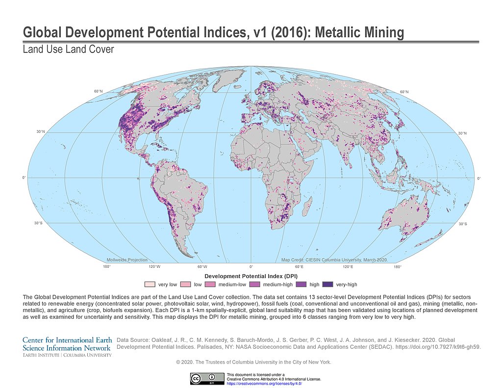
Development Potential Indices (2016): Metallic Mining
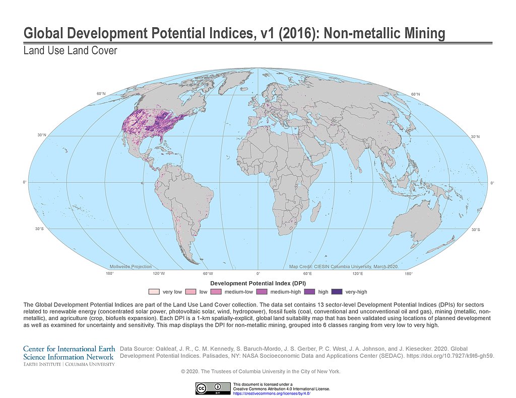
Development Potential Indices (2016): Non-metallic Mining
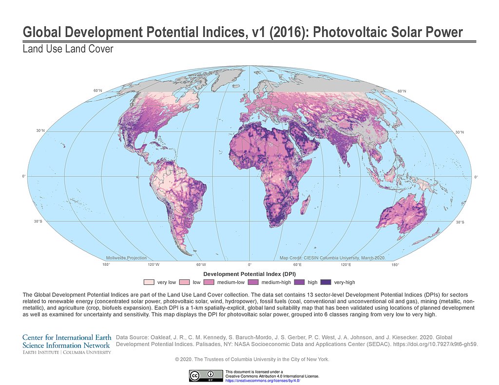
Development Potential Indices (2016): Photovoltaic Solar Power
Maps
»
Theme: Land Use
Remove Facet
3 of 10
Prev
|
Next