Socioeconomic Data and Applications Center (
sedac
)
A Data Center in NASA's Earth Observing System Data and Information System (
EOSDIS
) — Hosted by
CIESIN
at
Columbia University
Search SEDAC
Data
Data Sets
Maps
Web Pages
search
Data
· Data Sets
· Data Collections
· Featured Data Uses
· Data Citations
· Citations Database
· Data Submission
Maps
· Map Gallery
· Map Viewer
· Map Services
· Mapping Tools
Themes
· Agriculture
· Climate
· Conservation
· Governance
· Hazards
· Health
· Infrastructure
· Land Use
· Marine and Coastal
· Population
· Poverty
· Remote Sensing
· Sustainability
· Urban
· Water
Resources
· Guides
· Multimedia
· Networks
· News
· Publications
· Related Sites
· Remote Sensing
· Tools
Social Media
· Twitter
· FaceBook
· YouTube
· Flickr
· Blog Posts
· Communities
About
· About SEDAC
· User Working Group
· Privacy
· User Registration
Help
Map Gallery
(310)
Follow Us:
Twitter
Follow Us on Facebook
YouTube
Flickr
| Share:
Twitter
Facebook
Search
All Fields:
search
Region
Africa
(32)
Asia
(55)
Europe
(31)
Global
(79)
North America
(51)
Oceania
(27)
South America
(35)
Location
Select a Location...
afghanistan
(1)
argentina
(1)
australia
(4)
austria
(1)
bolivia
(2)
brazil
(3)
canada
(4)
chile
(1)
china
(5)
colombia
(1)
costa rica
(1)
democratic people's republic of korea
(1)
dominican republic
(1)
ecuador
(1)
egypt
(1)
el salvador
(1)
france
(1)
ghana
(1)
greece
(1)
guatemala
(1)
haiti
(1)
hong kong special administrative region
(1)
hungary
(1)
india
(10)
israel
(1)
italy
(1)
japan
(1)
jordan
(1)
lebanon
(1)
mali
(1)
mexico
(4)
nepal
(1)
nicaragua
(1)
nigeria
(1)
peru
(2)
philippines
(1)
portugal
(1)
russian federation
(1)
senegal
(1)
singapore
(1)
south africa
(1)
spain
(1)
syrian arab republic
(1)
taiwan
(1)
united kingdom of great britain and northern ireland
(1)
united republic of tanzania
(1)
united states of america
(14)
venezuela (bolivarian republic of)
(1)
viet nam
(1)
go
Maps
»
Theme: Land Use
Remove Facet
5 of 10
Prev
|
Next
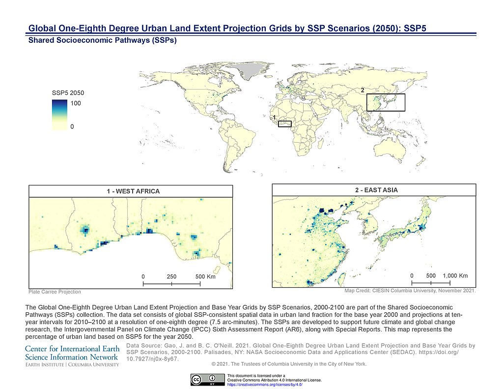
1/8th Degree Urban Land Extent Projection SSP5 (2050)
1/8th Degree Urban Land Extent Projection SSP1 (2100)
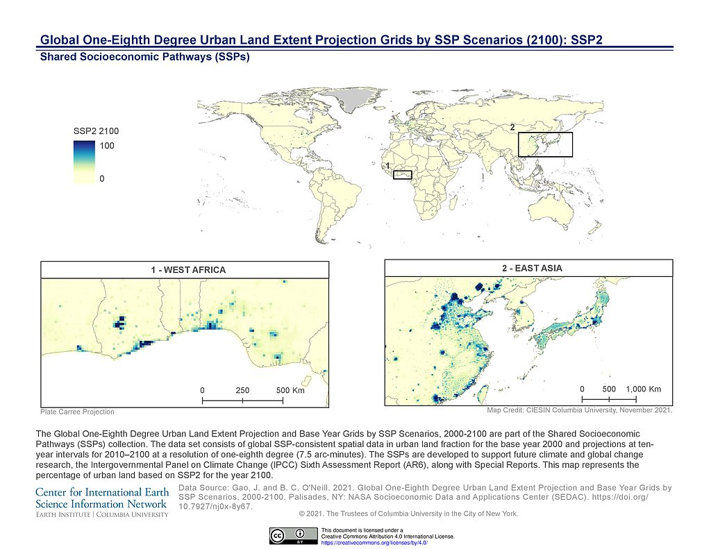
1/8th Degree Urban Land Extent Projection SSP2 (2100)
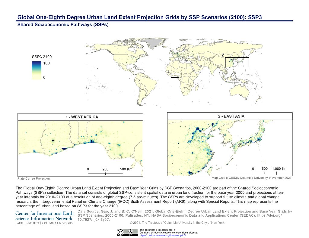
1/8th Degree Urban Land Extent Projection SSP3 (2100)
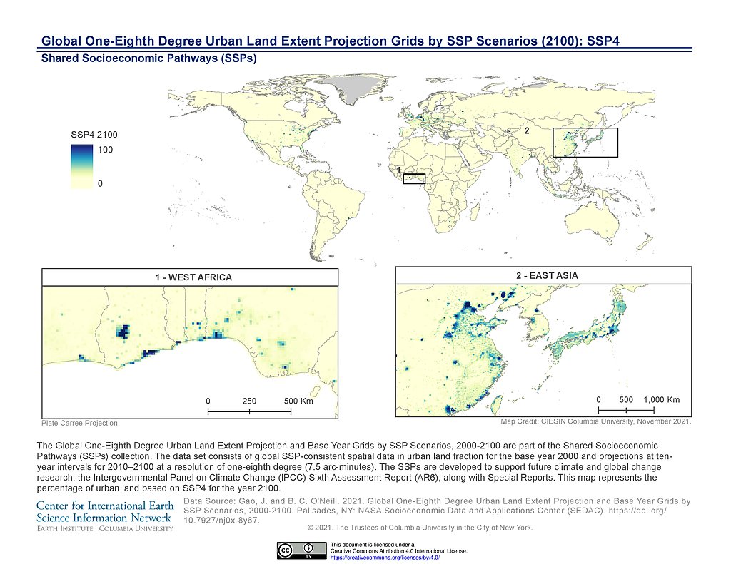
1/8th Degree Urban Land Extent Projection SSP4 (2100)
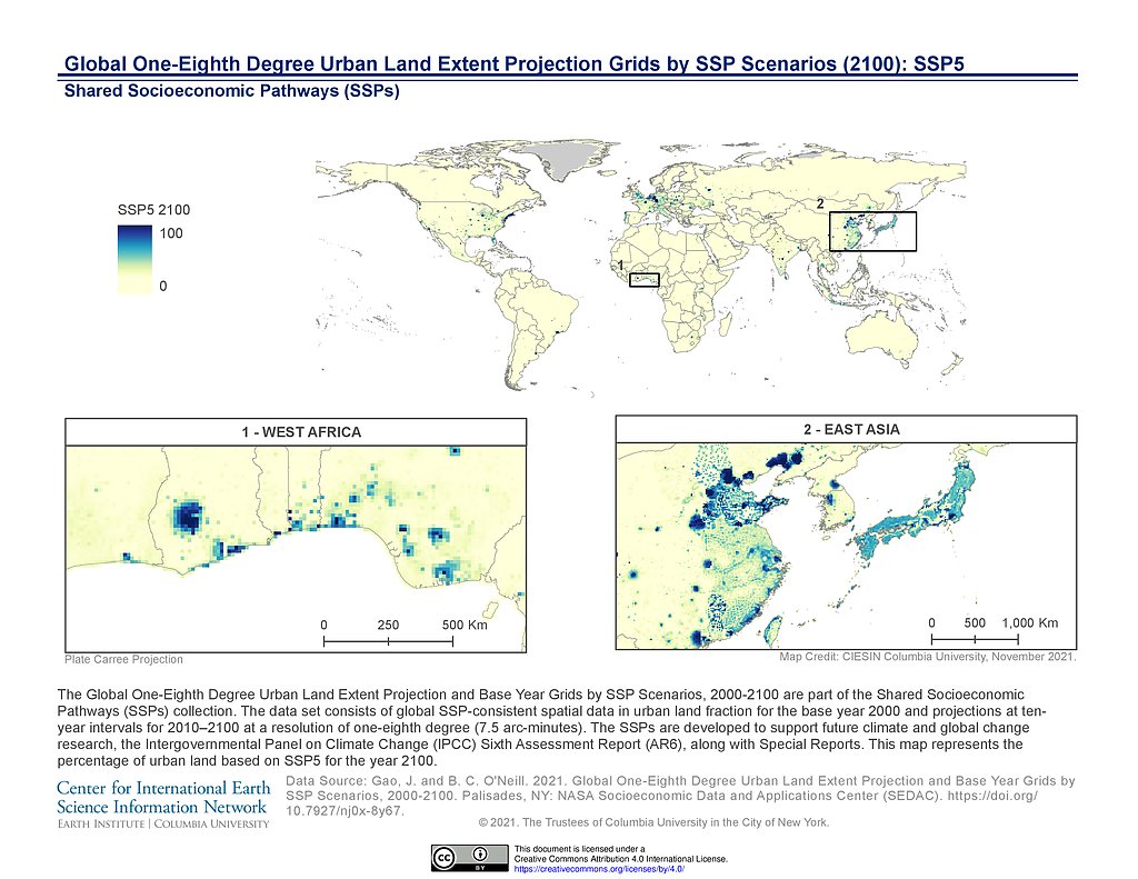
1/8th Degree Urban Land Extent Projection SSP5 (2100)
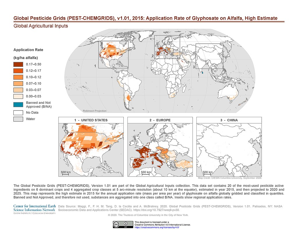
PEST-CHEMGRIDS v1.01 (2015): Glyphosate Application Rate on Alfalfa, High Estimate
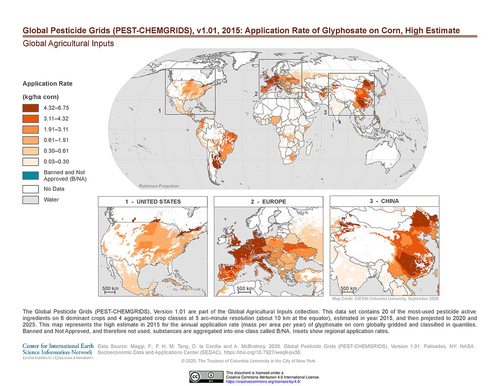
PEST-CHEMGRIDS v1.01 (2015): Glyphosate Application Rate on Corn, High Estimate
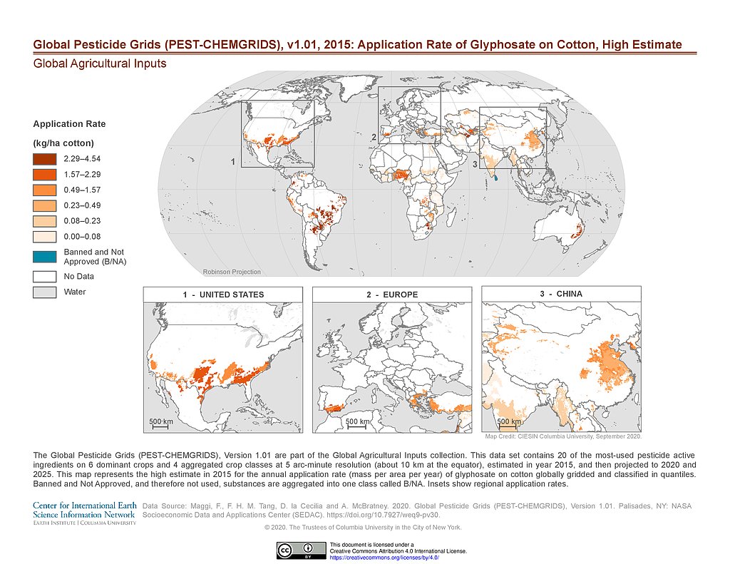
PEST-CHEMGRIDS v1.01 (2015): Glyphosate Application Rate on Cotton, High Estimate
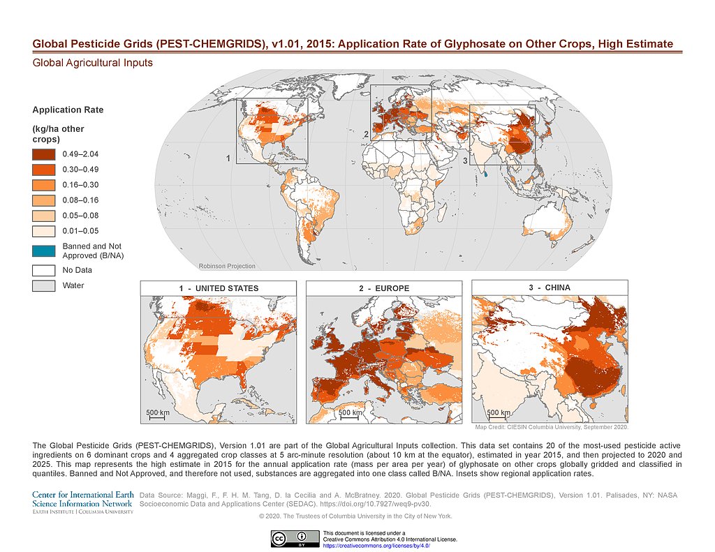
PEST-CHEMGRIDS v1.01 (2015): Glyphosate Application Rate on Other Crops, High Estimate
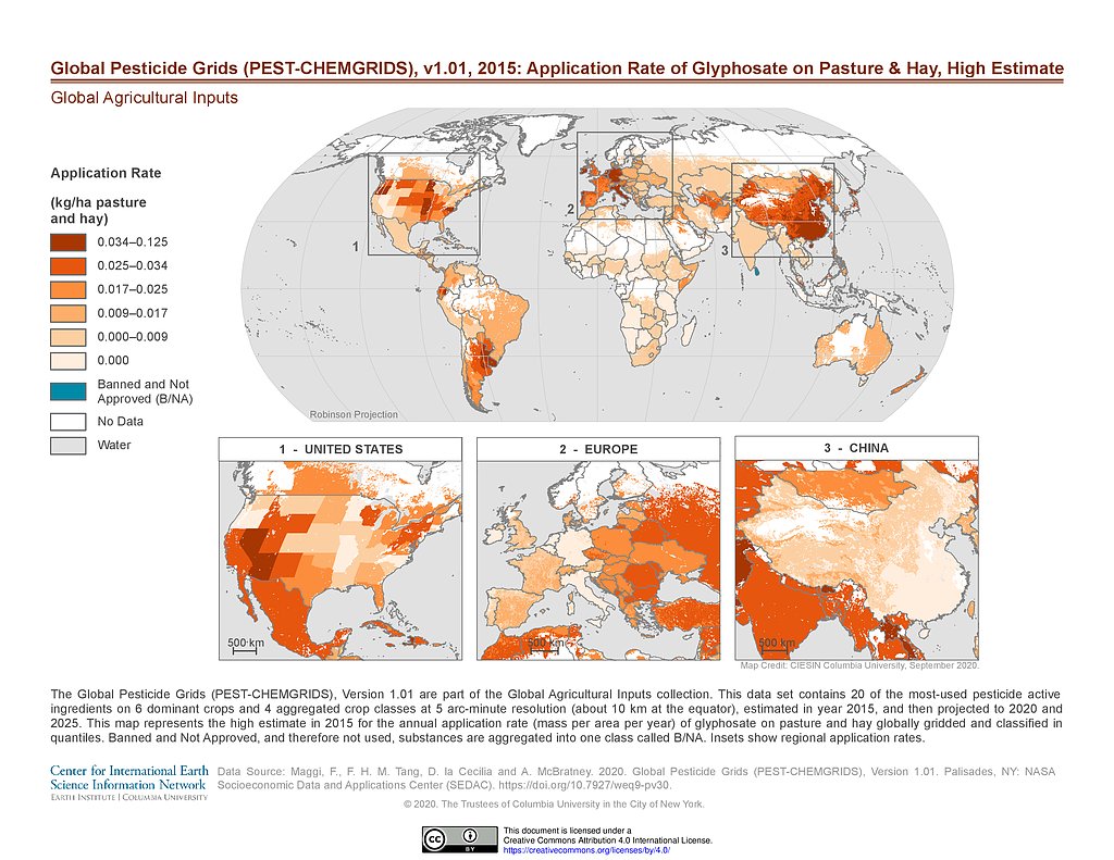
PEST-CHEMGRIDS v1.01 (2015): Glyphosate Application Rate on Pasture & Hay, High Estimate
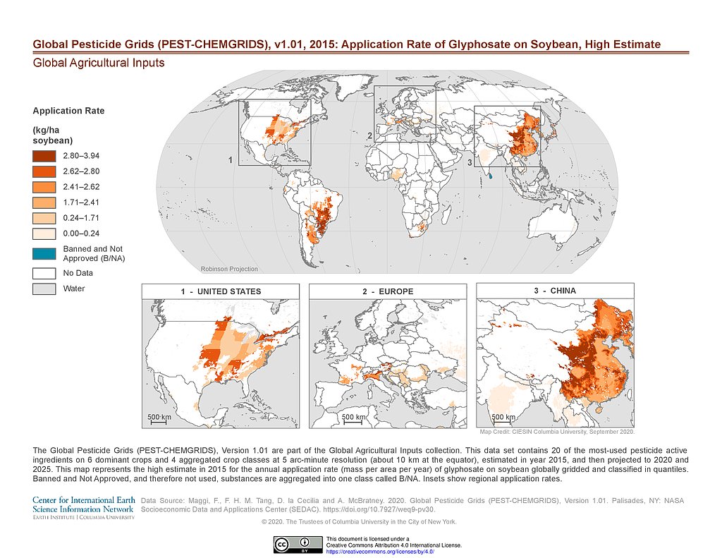
PEST-CHEMGRIDS v1.01 (2015): Glyphosate Application Rate on Soybean, High Estimate
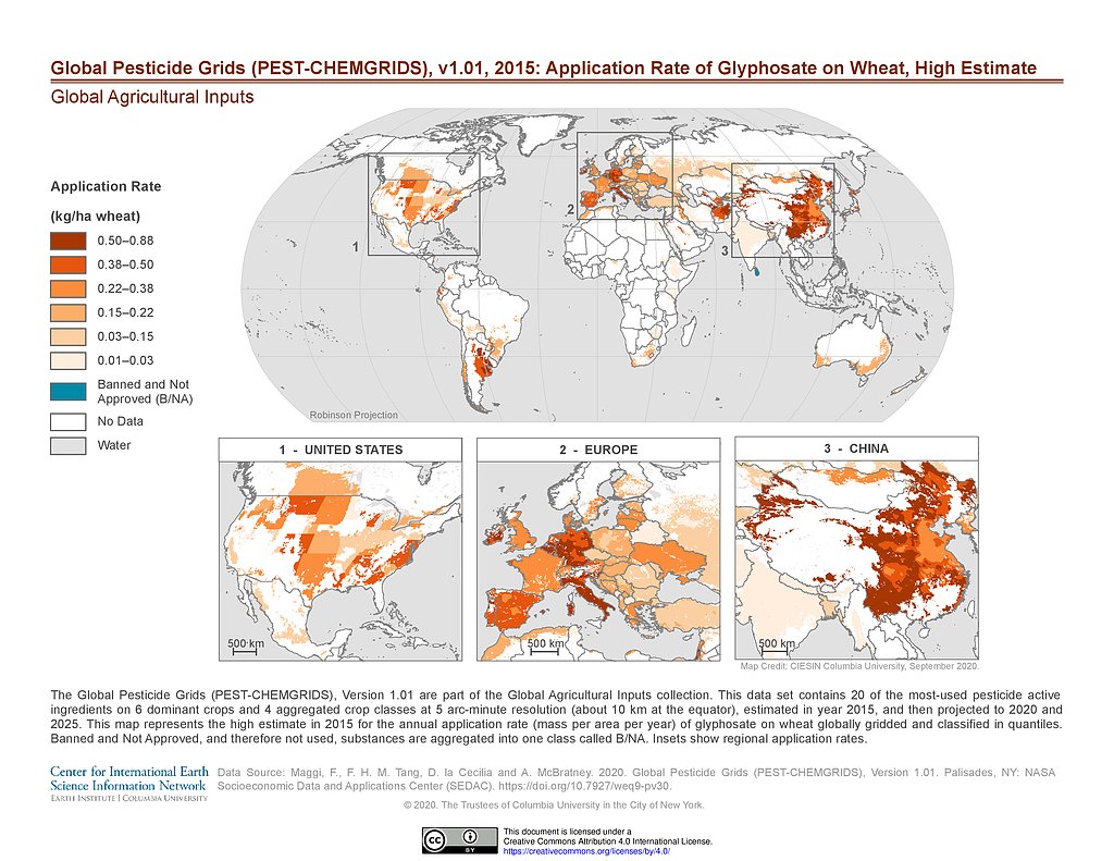
PEST-CHEMGRIDS v1.01 (2015): Glyphosate Application Rate on Wheat, High Estimate
PEST-CHEMGRIDS v1.01 (2015): Metam Application Rate on Vegetables & Fruits, High Estimate
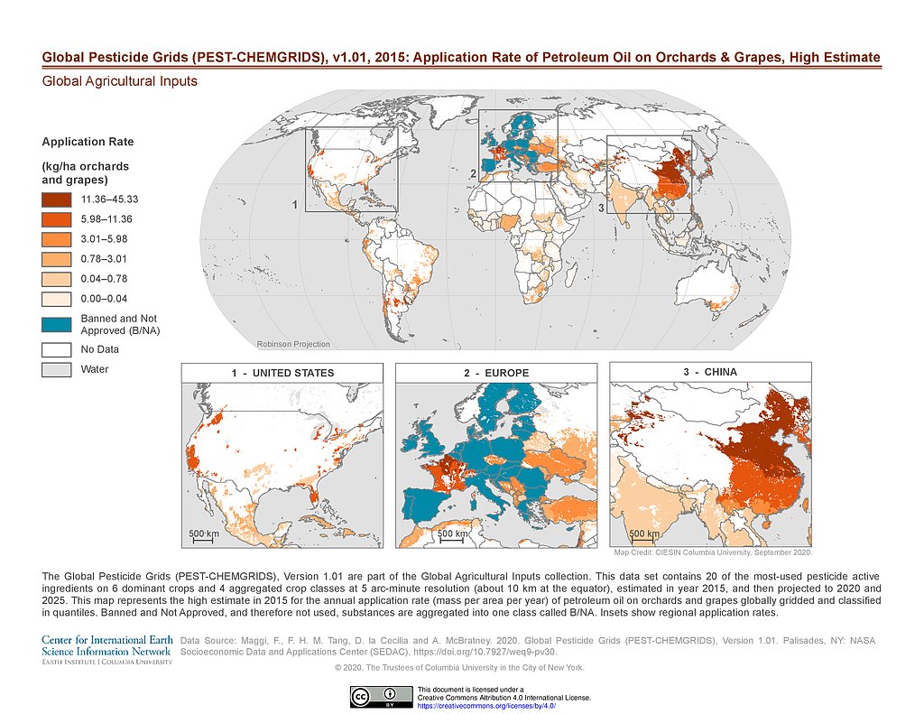
PEST-CHEMGRIDS v1.01 (2015): Petroleum Oil Application Rate on Orchards & Grapes, High Estimate
PEST-CHEMGRIDS v1.01 (2015): Propanil Application Rate on Rice, High Estimate
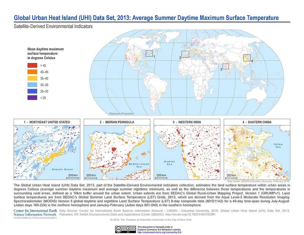
UHI Average Summer Daytime Maximum Surface Temperature (2013)
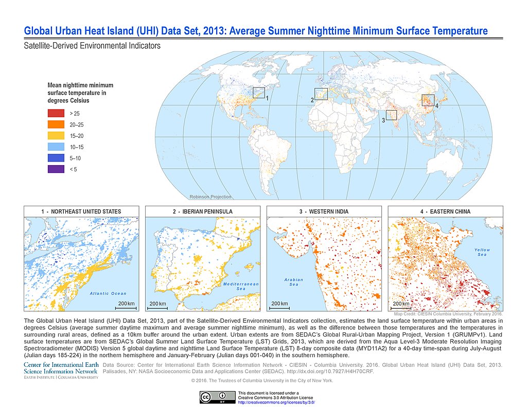
UHI Average Summer Nighttime Minimum Surface Temperature (2013)
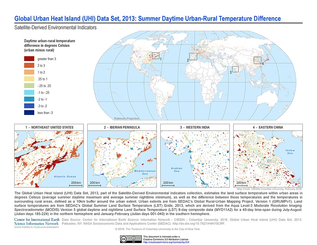
UHI Summer Daytime Urban-Rural Temperature Difference (2013)
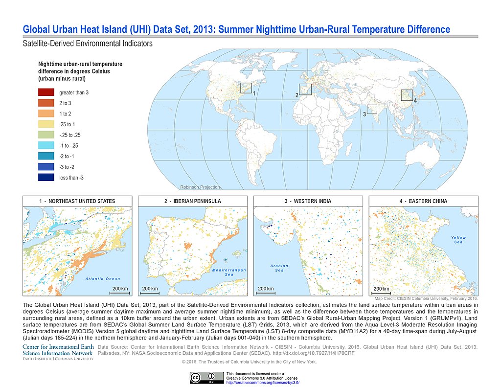
UHI Summer Nighttime Urban-Rural Temperature Difference (2013)
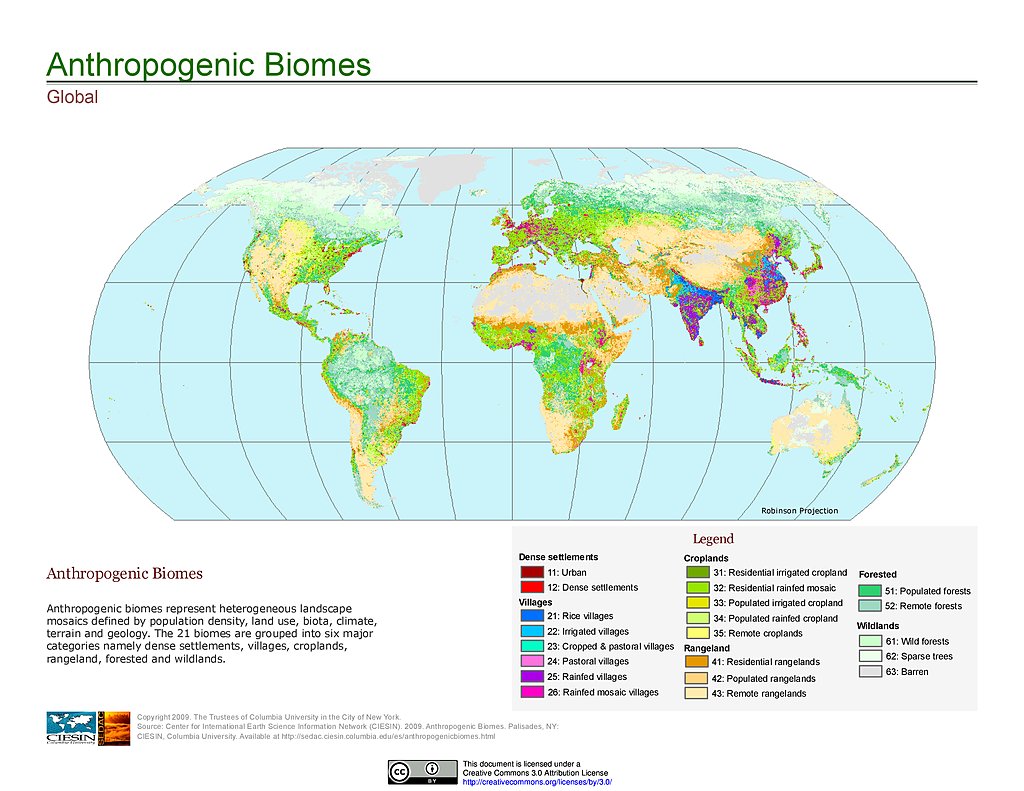
Anthropogenic Biomes, v1
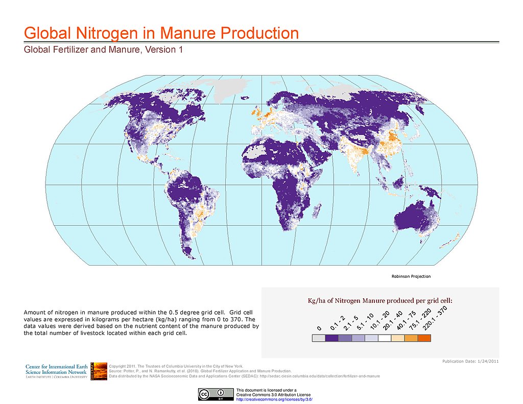
Nitrogen in Manure Production
Phosphorus in Manure Production
Last of the Wild, v2
Human Footprint Index, v2
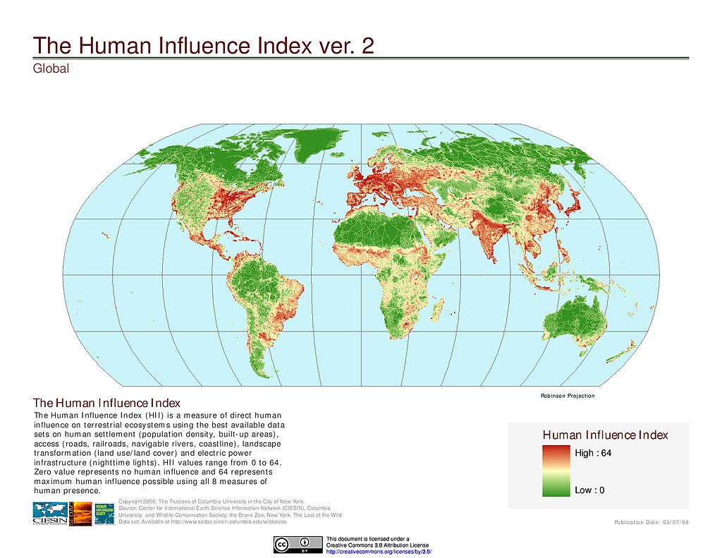
Human Influence Index, v2
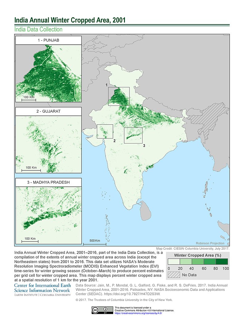
India Winter Cropped Area, 2001
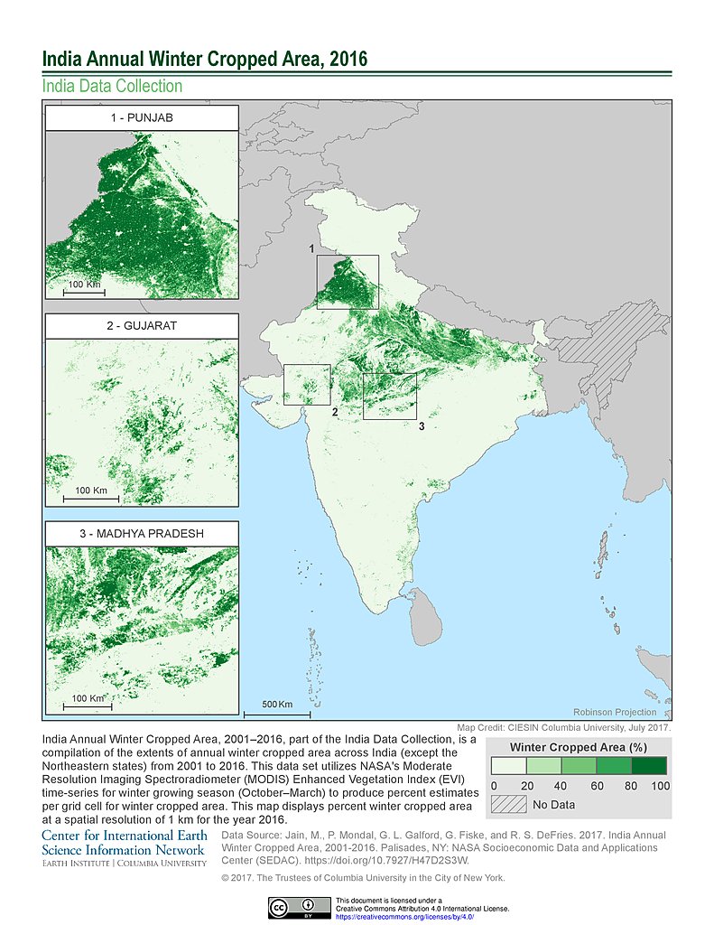
India Winter Cropped Area, 2016
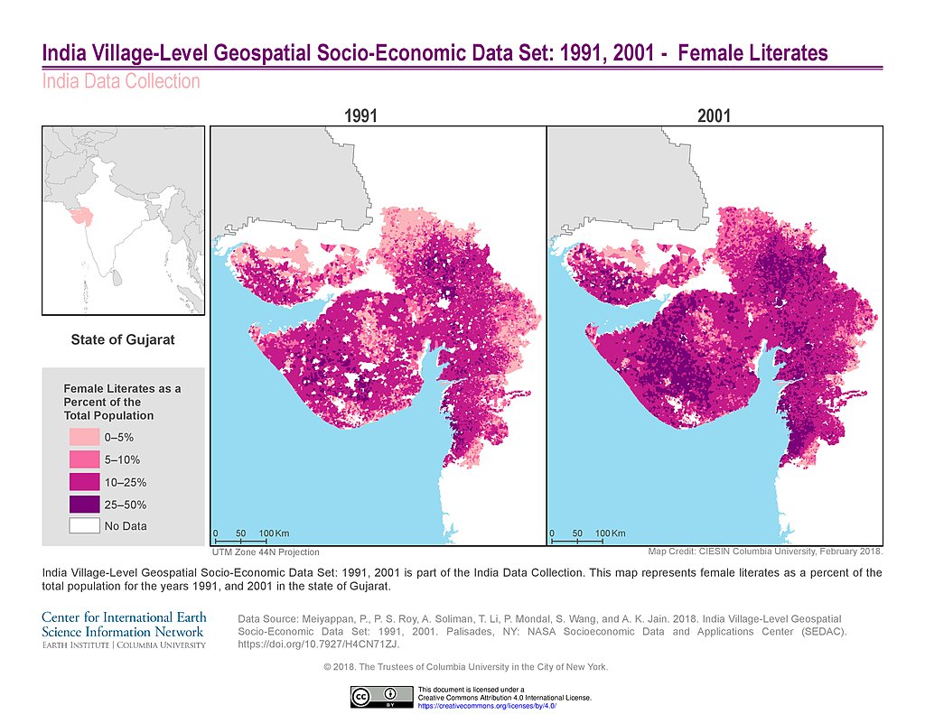
India Female Literates (1991, 2001): State of Gujarat
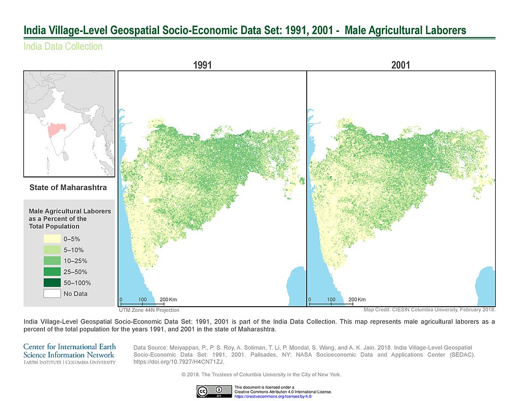
India Male Agricultural Laborers (1991, 2001): State of Maharashtra
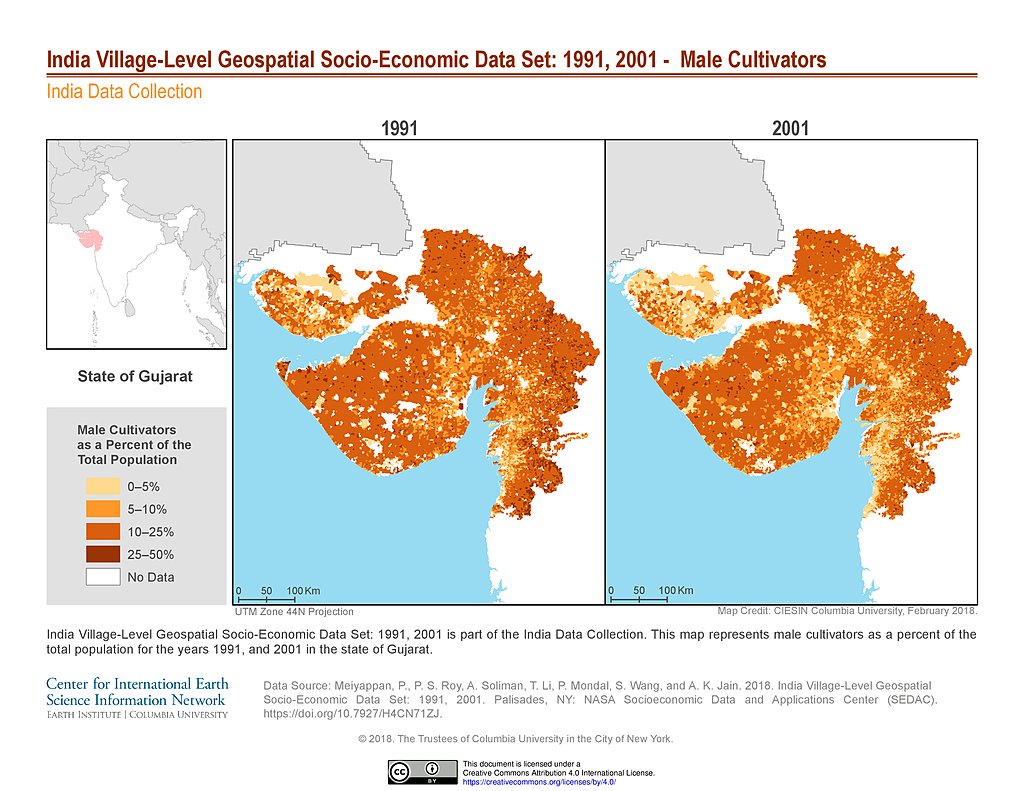
India Male Cultivators (1991, 2001): State of Gujarat
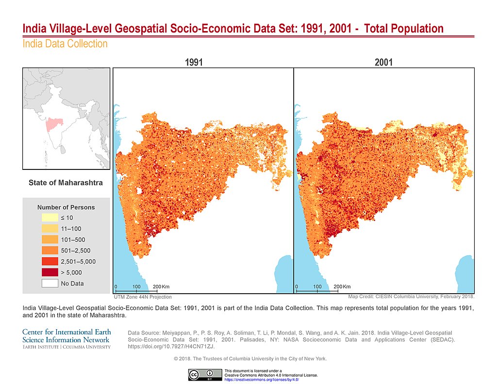
India Total Population (1991, 2001): State of Maharashtra
Maps
»
Theme: Land Use
Remove Facet
5 of 10
Prev
|
Next