Socioeconomic Data and Applications Center (
sedac
)
A Data Center in NASA's Earth Observing System Data and Information System (
EOSDIS
) — Hosted by
CIESIN
at
Columbia University
Search SEDAC
Data
Data Sets
Maps
Web Pages
search
Data
· Data Sets
· Data Collections
· Featured Data Uses
· Data Citations
· Citations Database
· Data Submission
Maps
· Map Gallery
· Map Viewer
· Map Services
· Mapping Tools
Themes
· Agriculture
· Climate
· Conservation
· Governance
· Hazards
· Health
· Infrastructure
· Land Use
· Marine and Coastal
· Population
· Poverty
· Remote Sensing
· Sustainability
· Urban
· Water
Resources
· Guides
· Multimedia
· Networks
· News
· Publications
· Related Sites
· Remote Sensing
· Tools
Social Media
· Twitter
· FaceBook
· YouTube
· Flickr
· Blog Posts
· Communities
About
· About SEDAC
· User Working Group
· Privacy
· User Registration
Help
Map Gallery
(462)
Follow Us:
Twitter
Follow Us on Facebook
YouTube
Flickr
| Share:
Twitter
Facebook
Search
All Fields:
search
Region
Africa
(53)
Asia
(45)
Europe
(19)
Global
(234)
North America
(67)
Oceania
(9)
South America
(34)
Location
Select a Location...
abu dhabi
(1)
albania
(6)
australia
(1)
bangladesh
(6)
bolivia
(6)
bulgaria
(6)
cambodia
(10)
chile
(1)
china
(5)
ecuador
(8)
guatemala
(18)
honduras
(11)
india
(1)
indonesia
(5)
kenya
(5)
madagascar
(7)
malawi
(9)
morocco
(1)
mozambique
(6)
nicaragua
(3)
panama
(11)
paraguay
(13)
south africa
(7)
uganda
(5)
united states of america
(13)
viet nam
(9)
go
Maps
»
Theme: Health
Remove Facet
6 of 15
Prev
|
Next
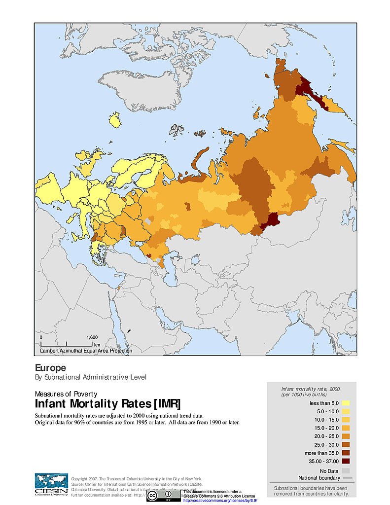
Infant Mortality Rates: Europe
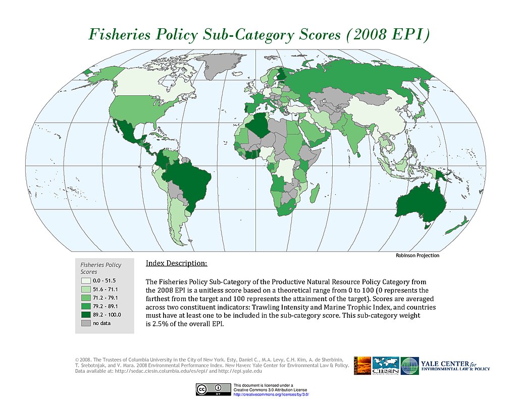
Fisheries, EPI 2008
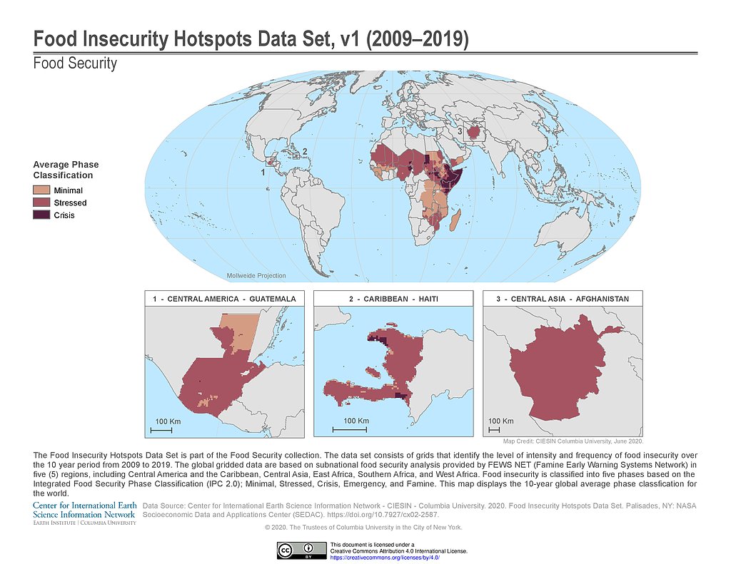
Food Insecurity Hotspots (2009-2019)
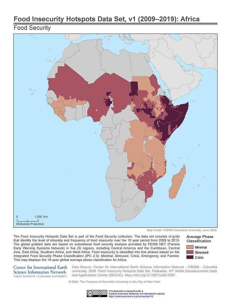
Food Insecurity Hotspots (2009-2019): Africa
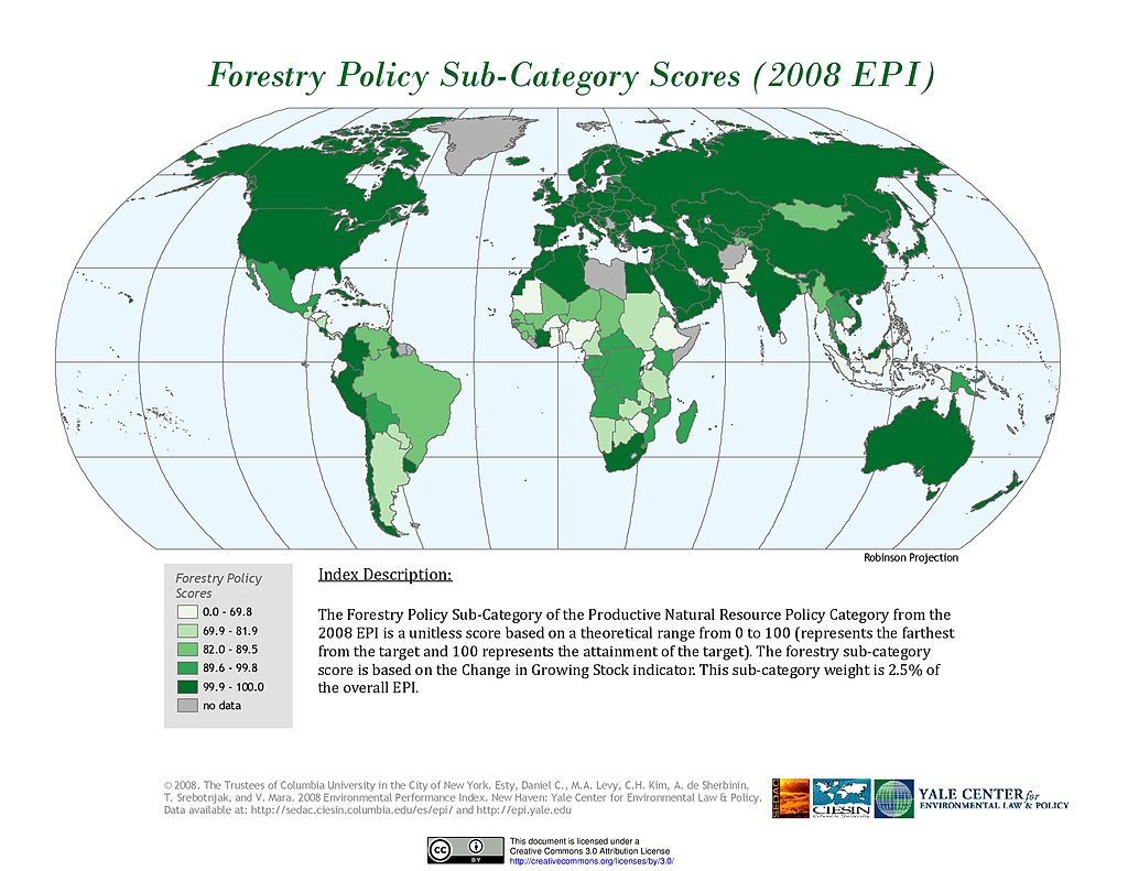
Forestry, EPI 2008
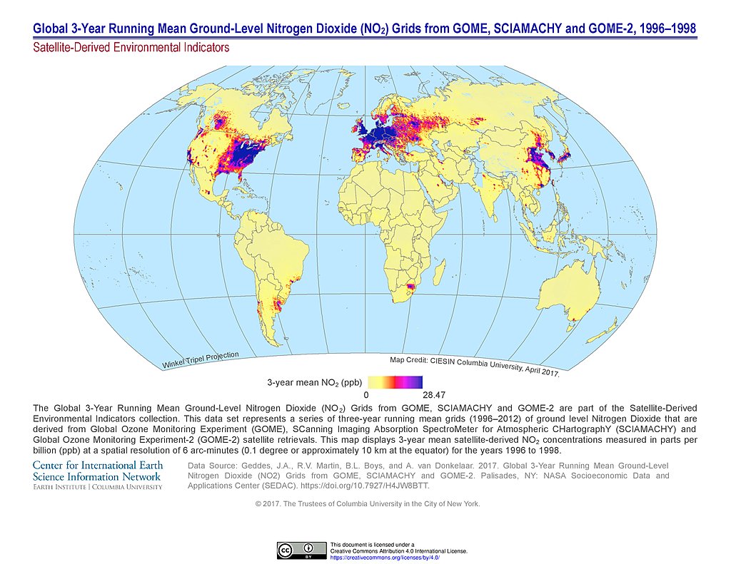
NO2 Grids (1996-1998)
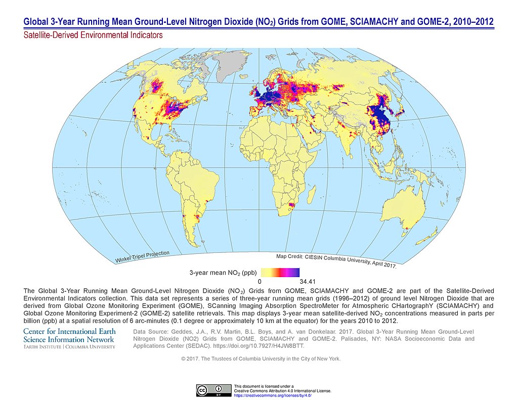
NO2 Grids (2010-2012)
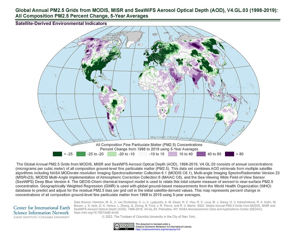
PM 2.5 Grids V4.GL.03 (1998-2019): % Change
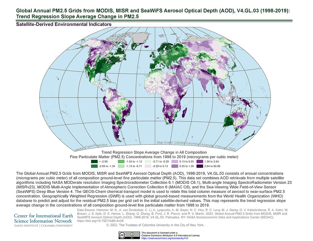
PM 2.5 Grids V4.GL.03 (1998-2019): Trend Avg Change
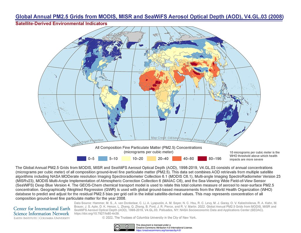
PM 2.5 Grids V4.GL.03 (2008)
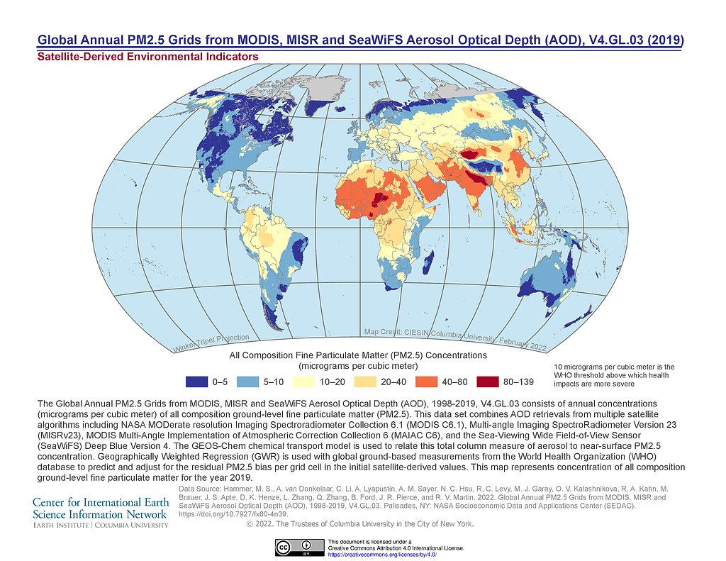
PM 2.5 Grids V4.GL.03 (2019)
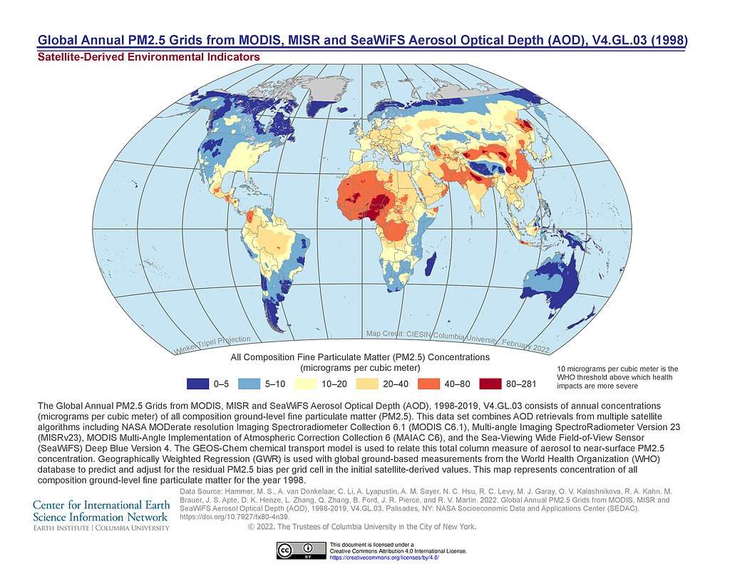
PM 2.5 Grids V4.GL.03 (1998)
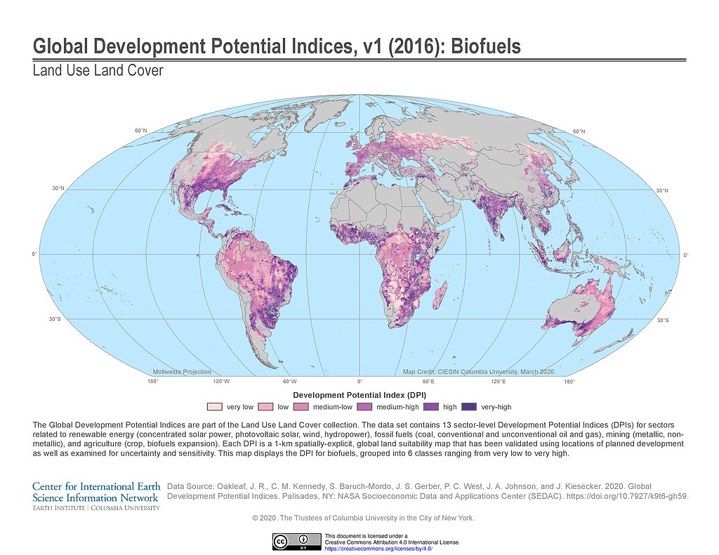
Development Potential Indices (2016): Biofuels
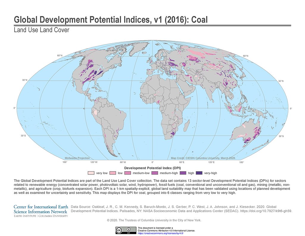
Development Potential Indices (2016): Coal
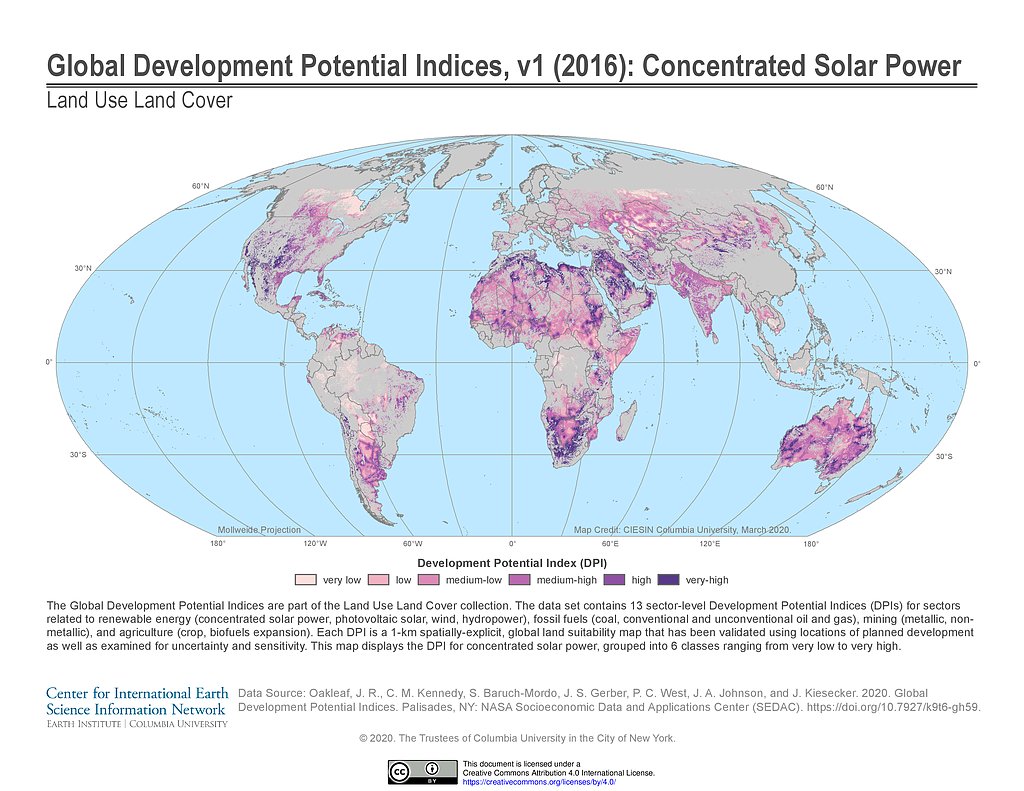
Development Potential Indices (2016): Concentrated Solar Power
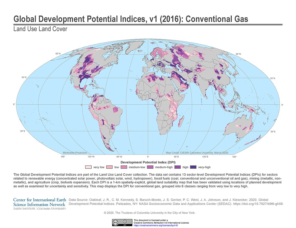
Development Potential Indices (2016): Conventional Gas
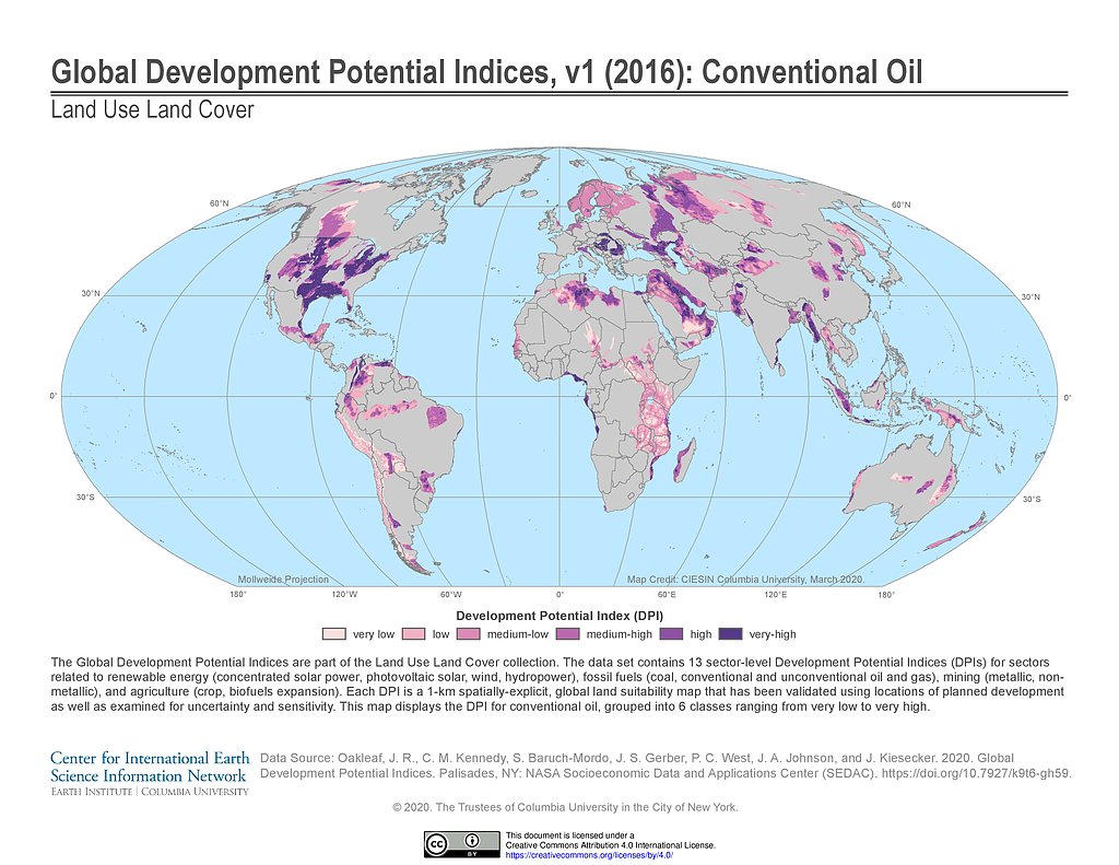
Development Potential Indices (2016): Conventional Oil
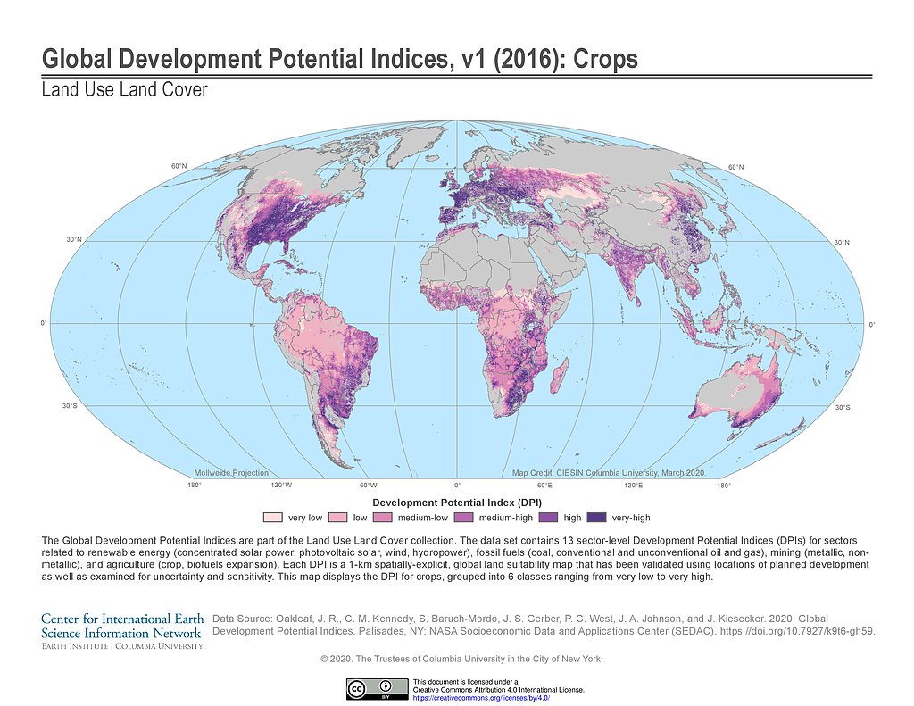
Development Potential Indices (2016): Crops
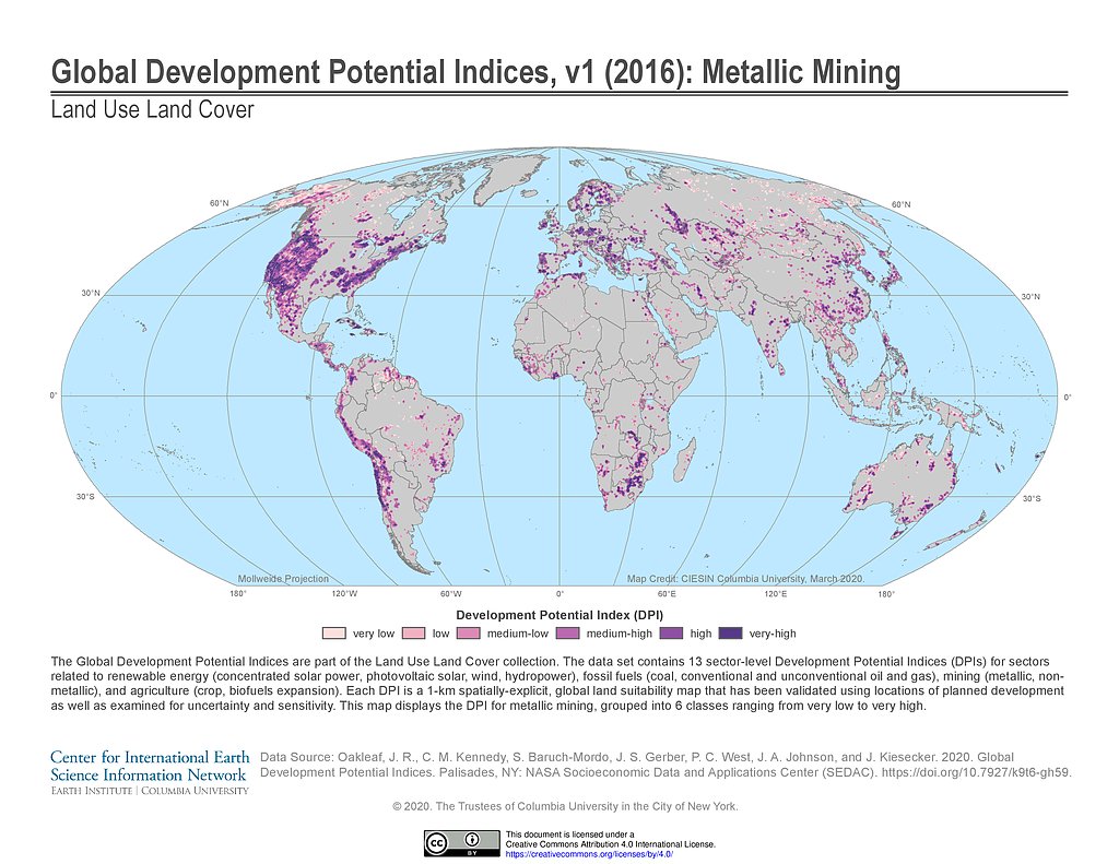
Development Potential Indices (2016): Metallic Mining
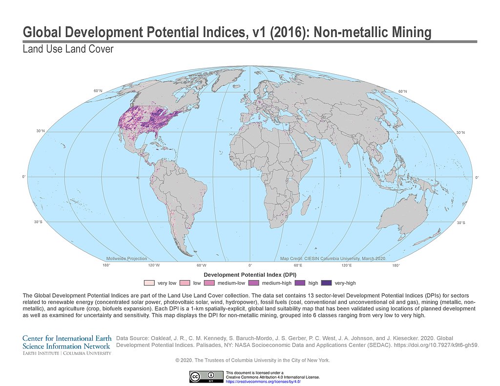
Development Potential Indices (2016): Non-metallic Mining
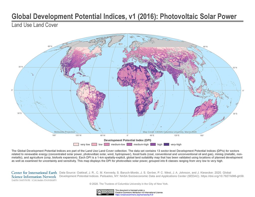
Development Potential Indices (2016): Photovoltaic Solar Power
Development Potential Indices (2016): Unconventional Gas
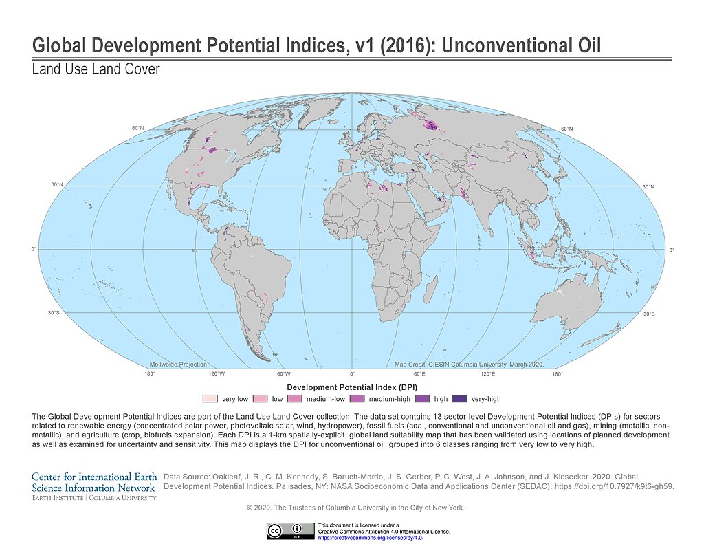
Development Potential Indices (2016): Unconventional Oil
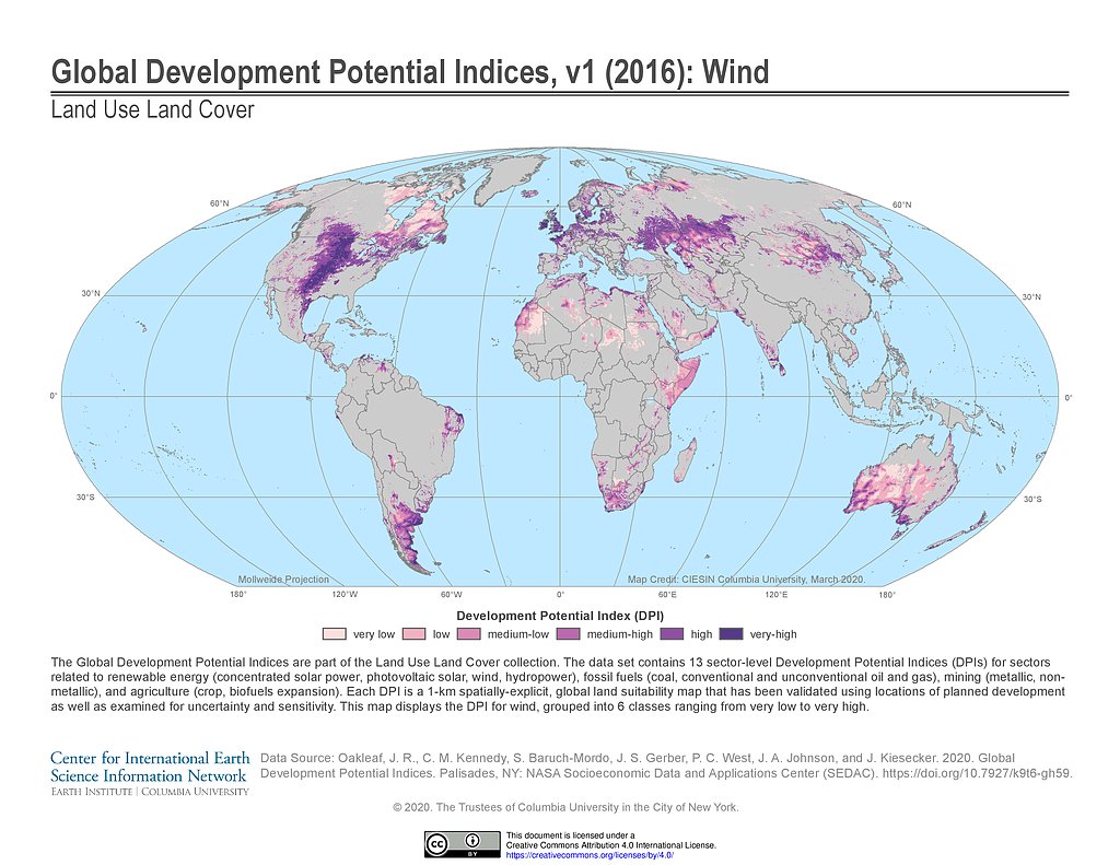
Development Potential Indices (2016): Wind
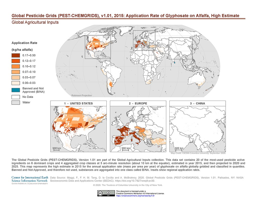
PEST-CHEMGRIDS v1.01 (2015): Glyphosate Application Rate on Alfalfa, High Estimate
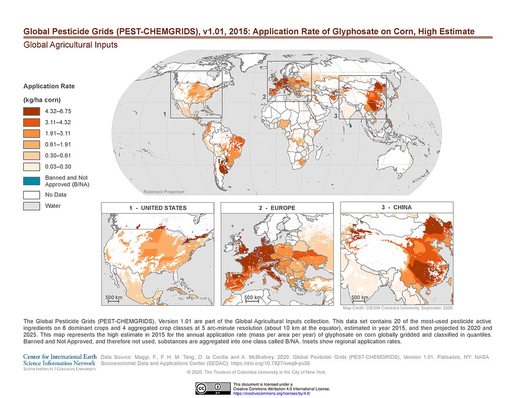
PEST-CHEMGRIDS v1.01 (2015): Glyphosate Application Rate on Corn, High Estimate
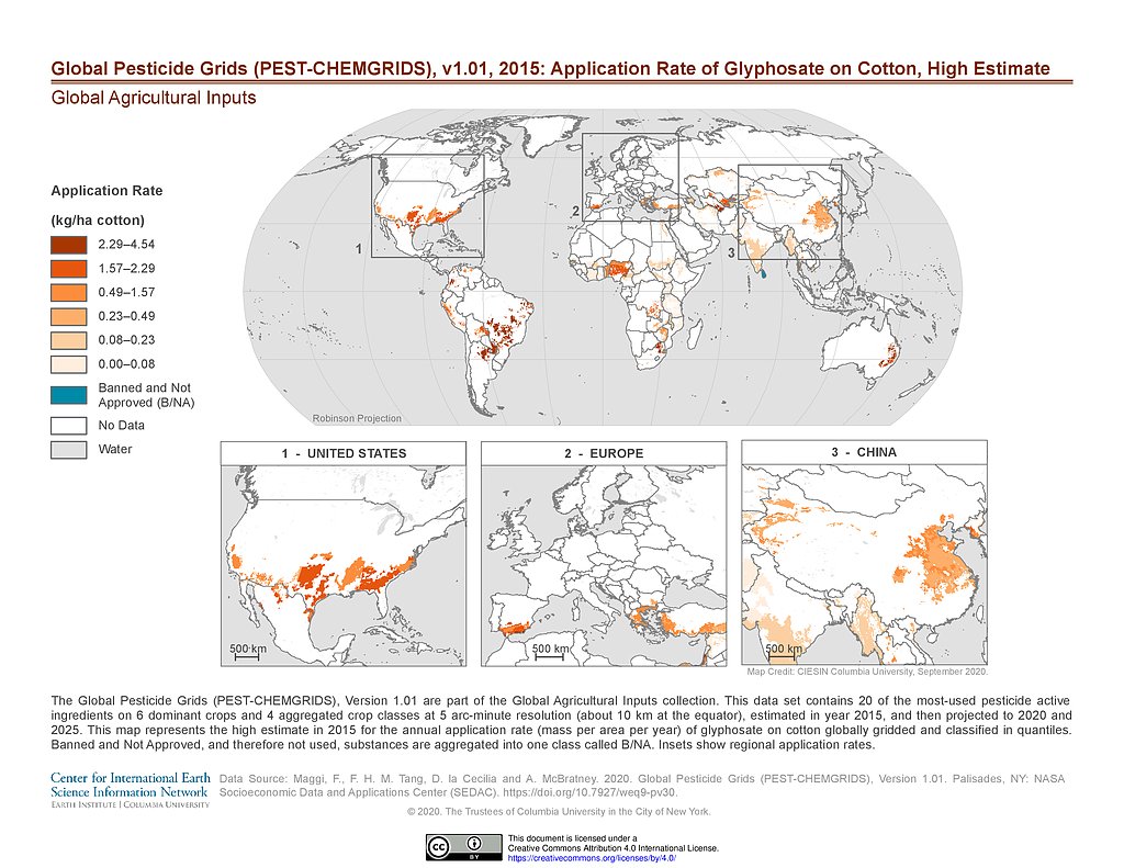
PEST-CHEMGRIDS v1.01 (2015): Glyphosate Application Rate on Cotton, High Estimate
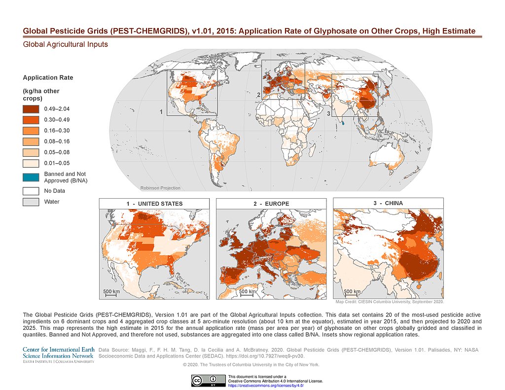
PEST-CHEMGRIDS v1.01 (2015): Glyphosate Application Rate on Other Crops, High Estimate
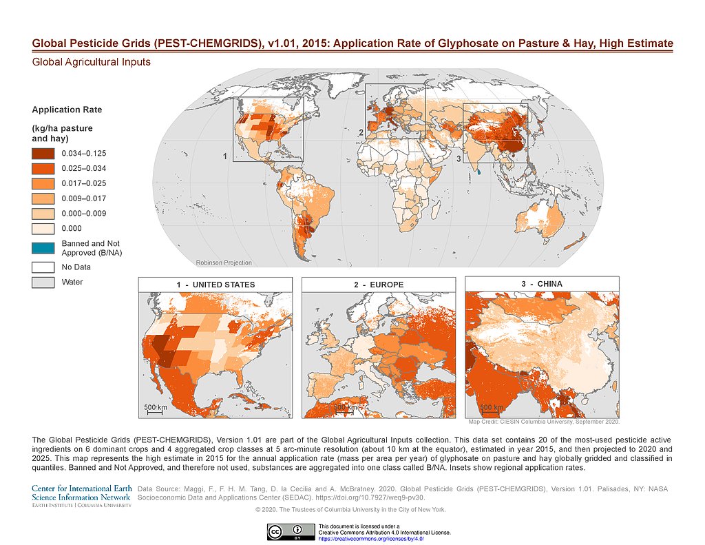
PEST-CHEMGRIDS v1.01 (2015): Glyphosate Application Rate on Pasture & Hay, High Estimate
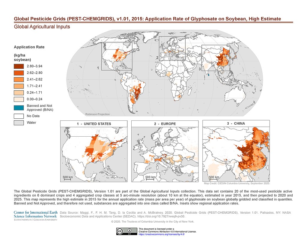
PEST-CHEMGRIDS v1.01 (2015): Glyphosate Application Rate on Soybean, High Estimate
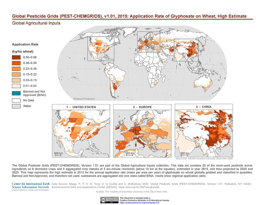
PEST-CHEMGRIDS v1.01 (2015): Glyphosate Application Rate on Wheat, High Estimate
PEST-CHEMGRIDS v1.01 (2015): Metam Application Rate on Vegetables & Fruits, High Estimate
Maps
»
Theme: Health
Remove Facet
6 of 15
Prev
|
Next