Socioeconomic Data and Applications Center (
sedac
)
A Data Center in NASA's Earth Observing System Data and Information System (
EOSDIS
) — Hosted by
CIESIN
at
Columbia University
Search SEDAC
Data
Data Sets
Maps
Web Pages
search
Data
· Data Sets
· Data Collections
· Featured Data Uses
· Data Citations
· Citations Database
· Data Submission
Maps
· Map Gallery
· Map Viewer
· Map Services
· Mapping Tools
Themes
· Agriculture
· Climate
· Conservation
· Governance
· Hazards
· Health
· Infrastructure
· Land Use
· Marine and Coastal
· Population
· Poverty
· Remote Sensing
· Sustainability
· Urban
· Water
Resources
· Guides
· Multimedia
· Networks
· News
· Publications
· Related Sites
· Remote Sensing
· Tools
Social Media
· Twitter
· FaceBook
· YouTube
· Flickr
· Blog Posts
· Communities
About
· About SEDAC
· User Working Group
· Privacy
· User Registration
Help
Map Gallery
(252)
Follow Us:
Twitter
Follow Us on Facebook
YouTube
Flickr
| Share:
Twitter
Facebook
Search
All Fields:
search
Location
Select a Location...
anguilla
(4)
antigua and barbuda
(4)
aruba
(4)
bahamas
(4)
barbados
(4)
belize
(5)
bermuda
(4)
british virgin islands
(4)
canada
(4)
cape verde
(4)
cayman islands
(4)
costa rica
(4)
cuba
(4)
dominica
(4)
dominican republic
(4)
el salvador
(4)
greenland
(4)
grenada
(4)
guatemala
(4)
haiti
(4)
honduras
(4)
jamaica
(4)
martinique
(4)
mexico
(4)
montserrat
(4)
netherlands antilles
(4)
nicaragua
(4)
panama
(4)
puerto rico
(4)
saint kitts and nevis
(4)
saint lucia
(4)
saint pierre and miquelon
(4)
saint vincent and the grenadines
(4)
turks and caicos islands
(3)
united states of america
(86)
united states virgin islands
(4)
go
Maps
»
Region: North America
Remove Facet
»
Theme: Population
Remove Facet
7 of 8
Prev
|
Next
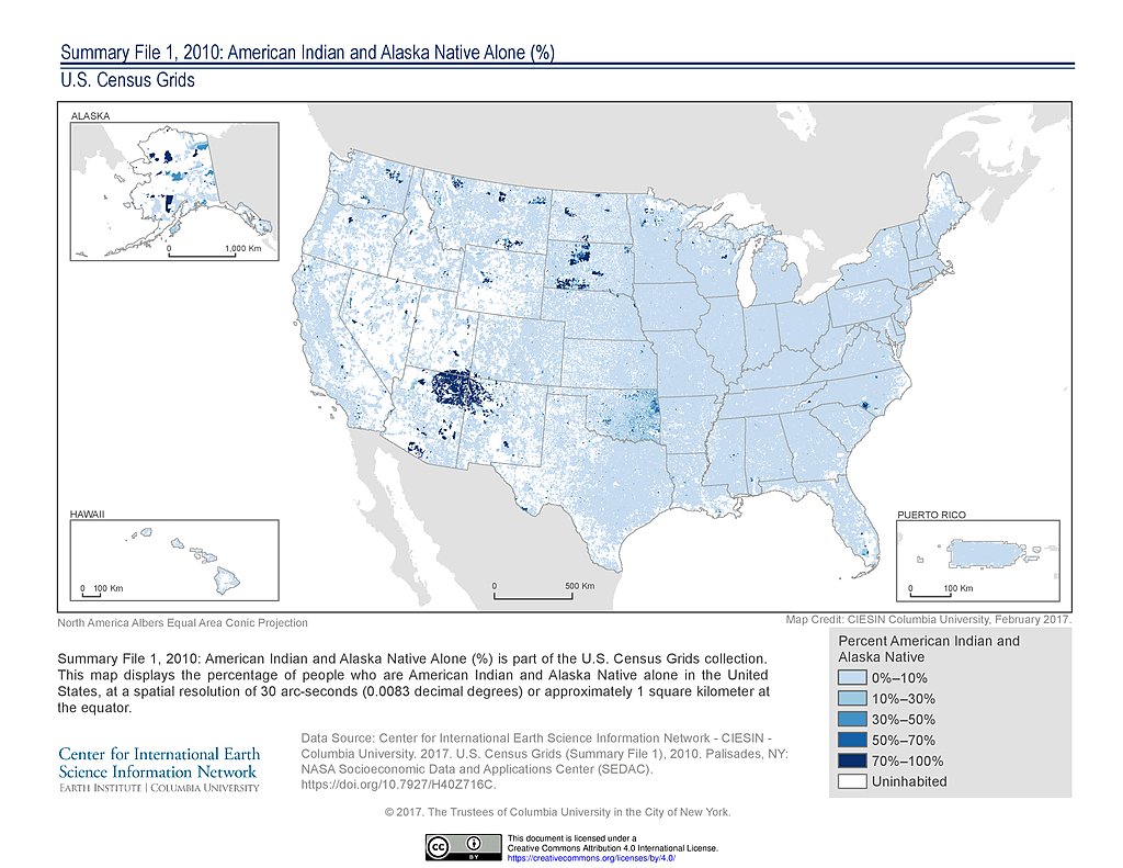
SF1 2010, American Indian and Alaska Native Alone (%): USA
SF1 2010, Asian Alone (%): USA
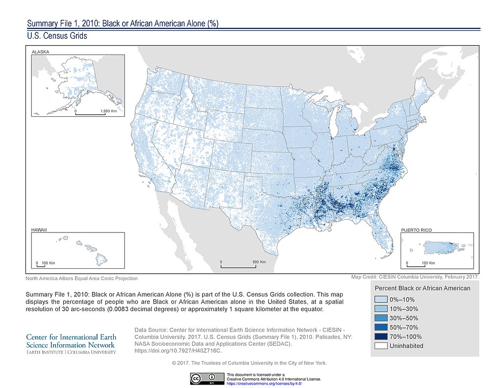
SF1 2010, Black or African American Alone (%): USA
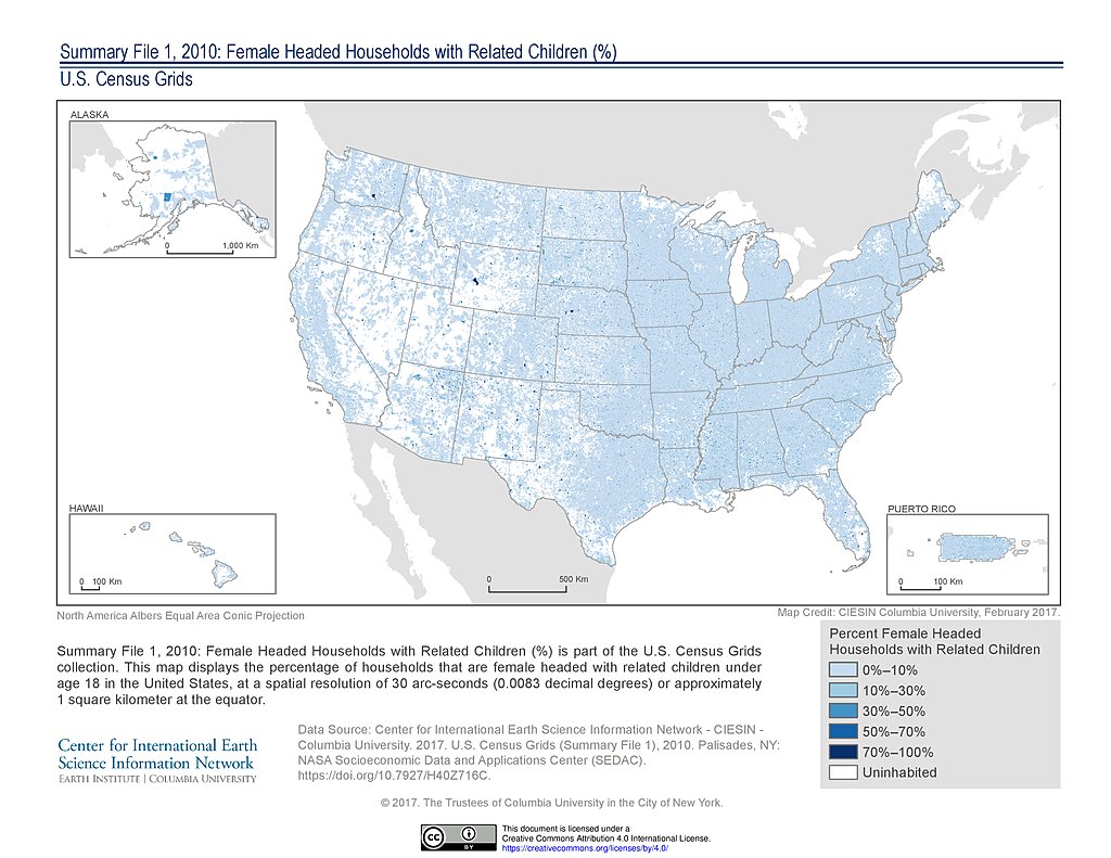
SF1 2010, Female Headed Households with Related Children (%): USA
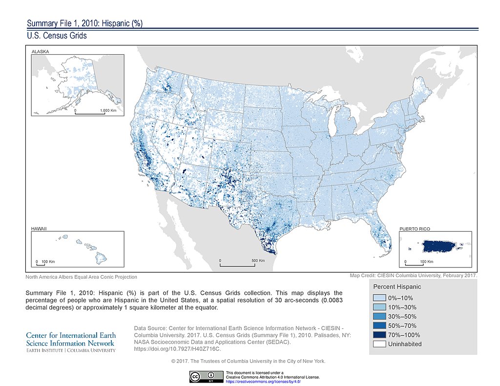
SF1 2010, Hispanic (%): USA
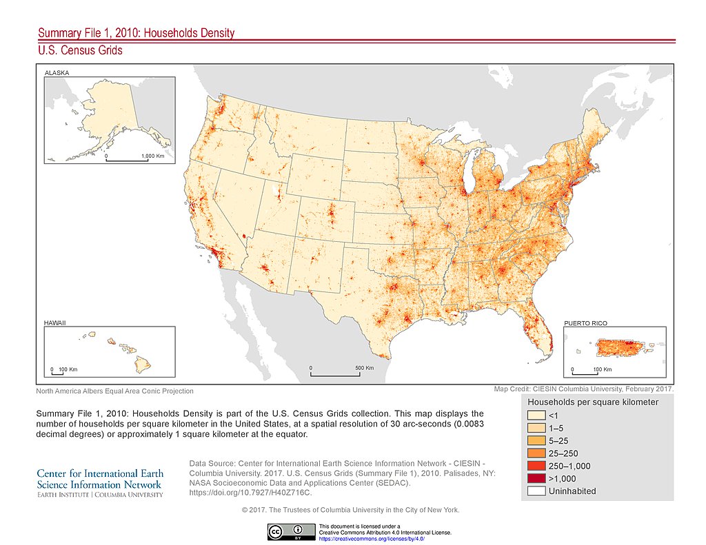
SF1 2010, Households Density: USA
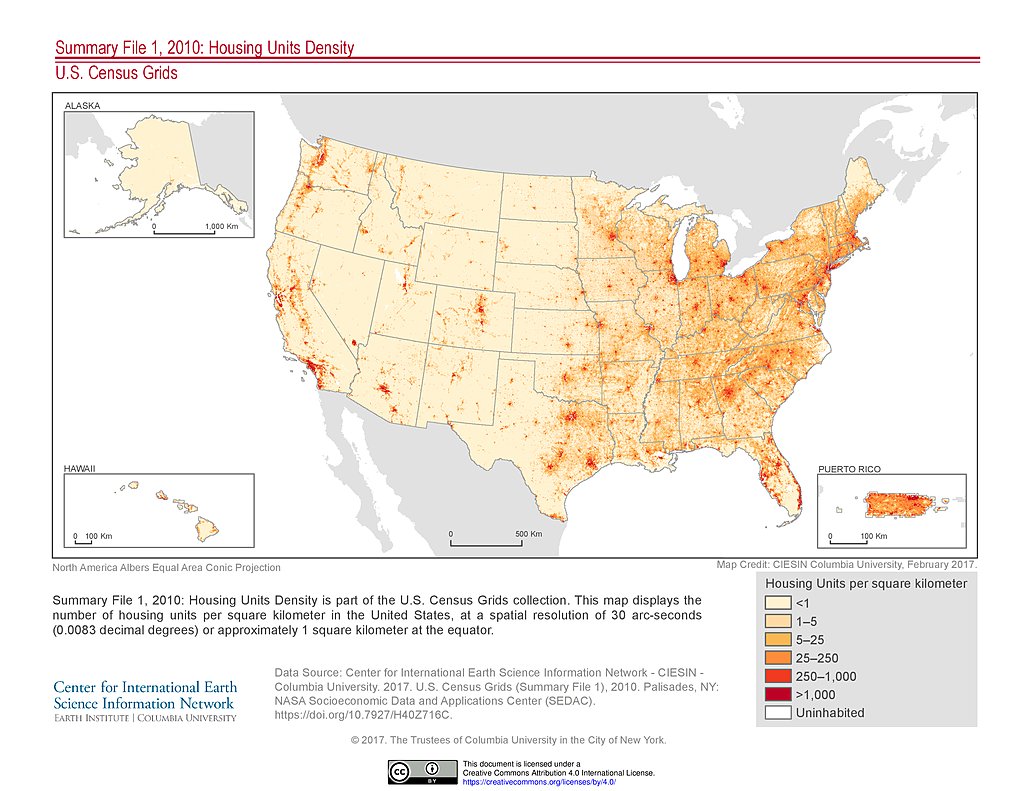
SF1 2010, Housing Units Density: USA
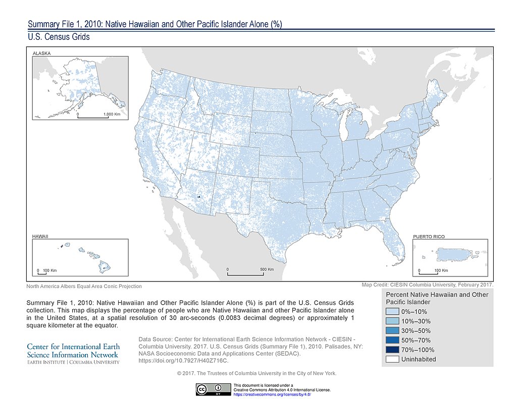
SF1 2010, Native Hawaiian and Other Pacific Islander Alone (%): USA
SF1 2010, Non-Hispanic (%): USA
SF1 2010, Non-Hispanic Black (%): USA
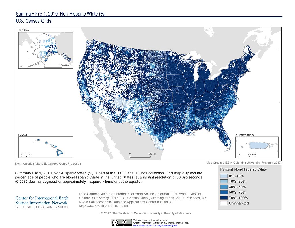
SF1 2010, Non-Hispanic White (%): USA
SF1 2010, Occupied Housing Units (%): USA
SF1 2010, One-Person Housing Units (%): USA
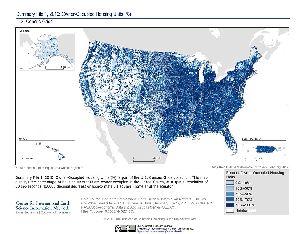
SF1 2010, Owner-Occupied Housing Units (%): USA
SF1 2010, Population Age 25 and Older (%): USA
SF1 2010, Population Age 25 to 64 (%): USA
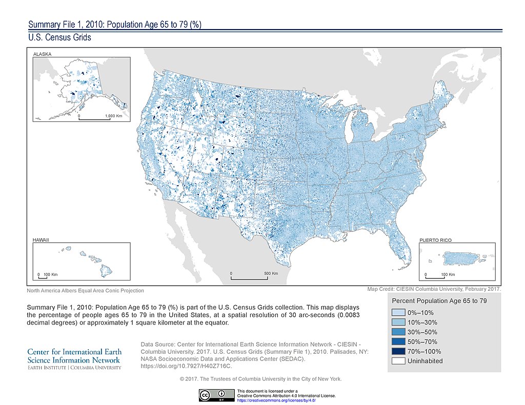
SF1 2010, Population Age 65 to 79 (%): USA
SF1 2010, Population Age 80 and Older (%): USA
SF1 2010, Population Ages 1 to 4 (%): USA
SF1 2010, Population Ages 18 to 24 (%): USA
SF1 2010, Population Ages 5 to 17 (%): USA
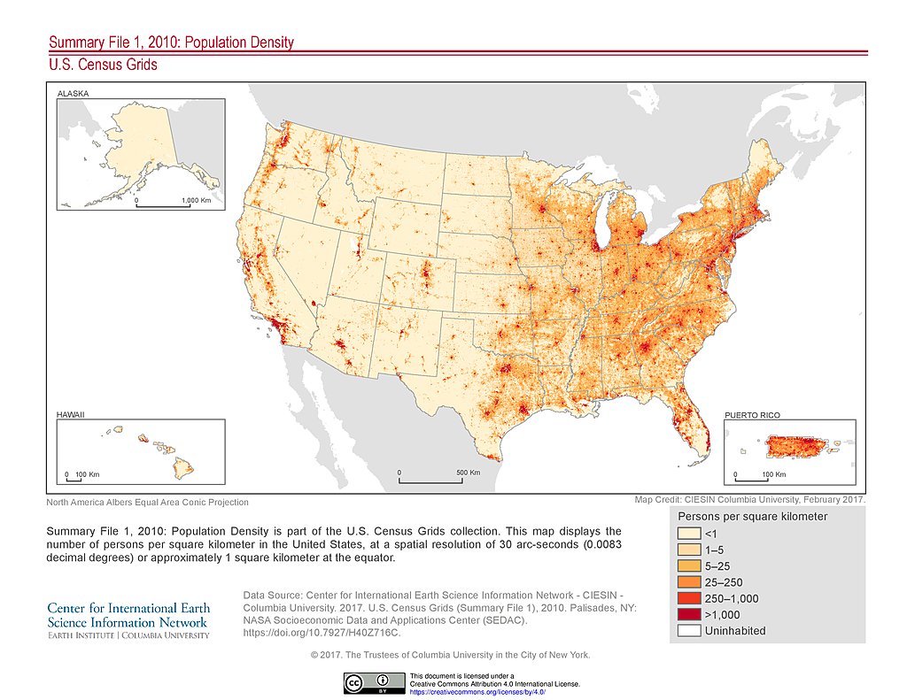
SF1 2010, Population Density: USA
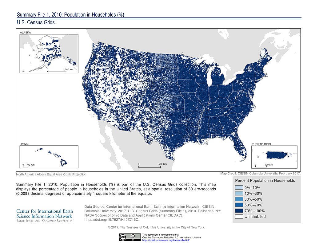
SF1 2010, Population in Households (%): USA
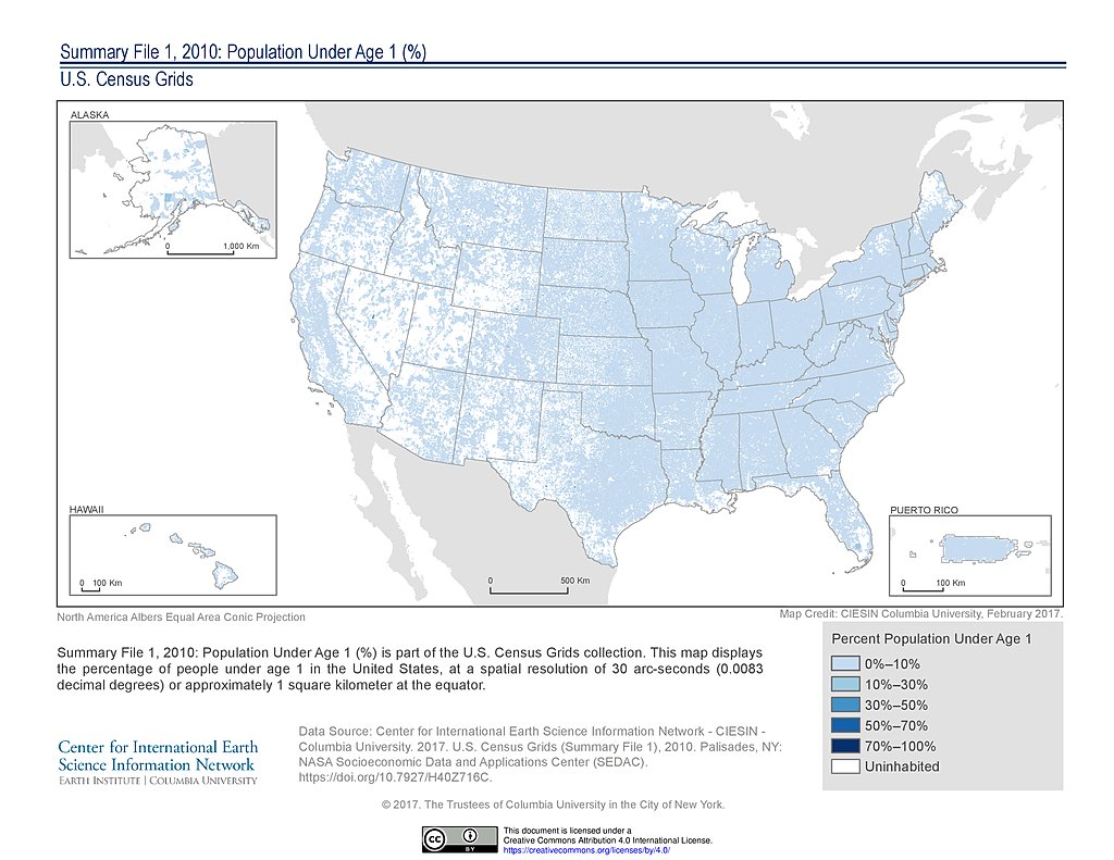
SF1 2010, Population Under Age 1 (%): USA
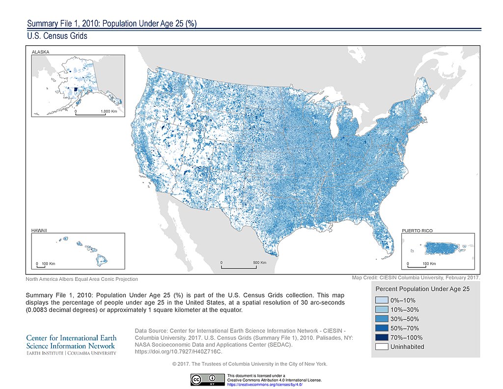
SF1 2010, Population Under Age 25 (%): USA
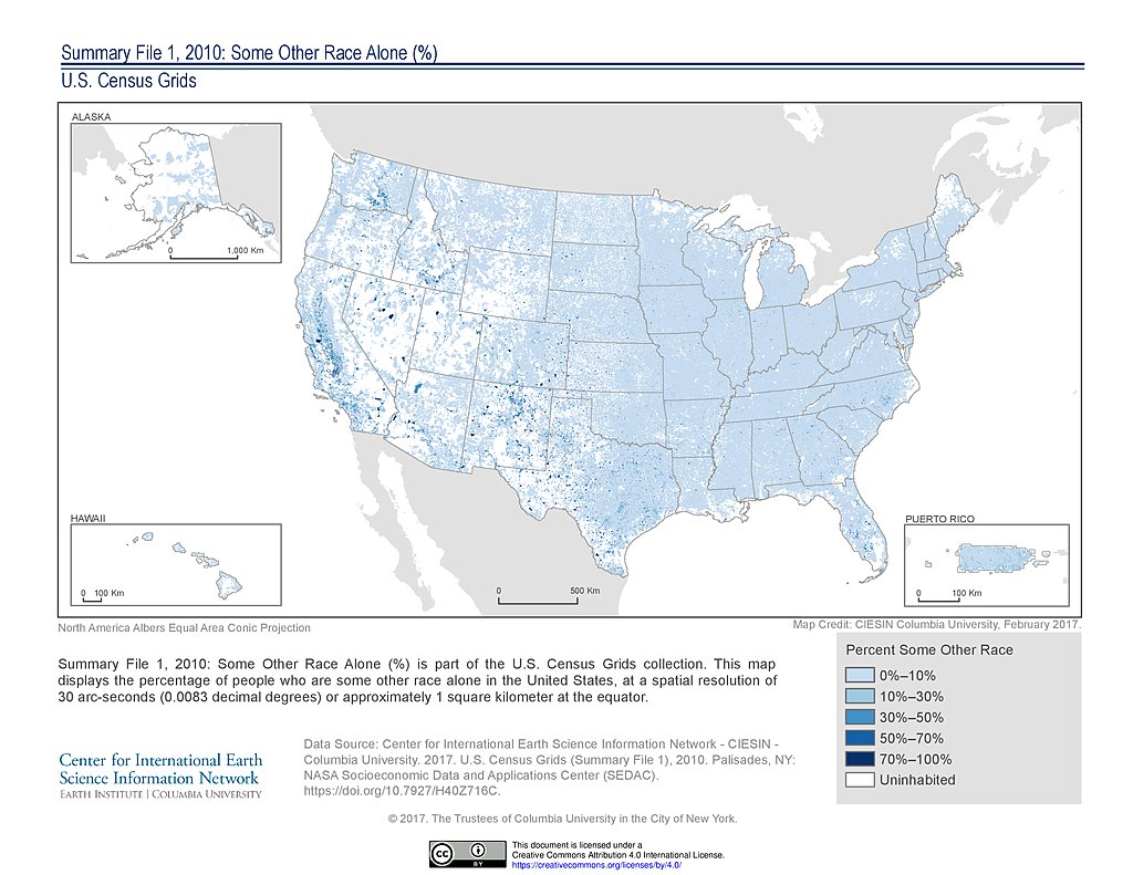
SF1 2010, Some Other Race Alone (%): USA
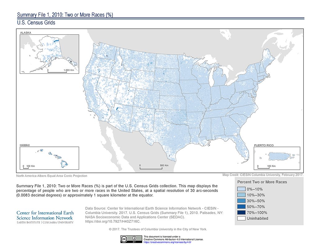
SF1 2010, Two or More Races (%): USA
SF1 2010, Vacant Housing Units (%): USA
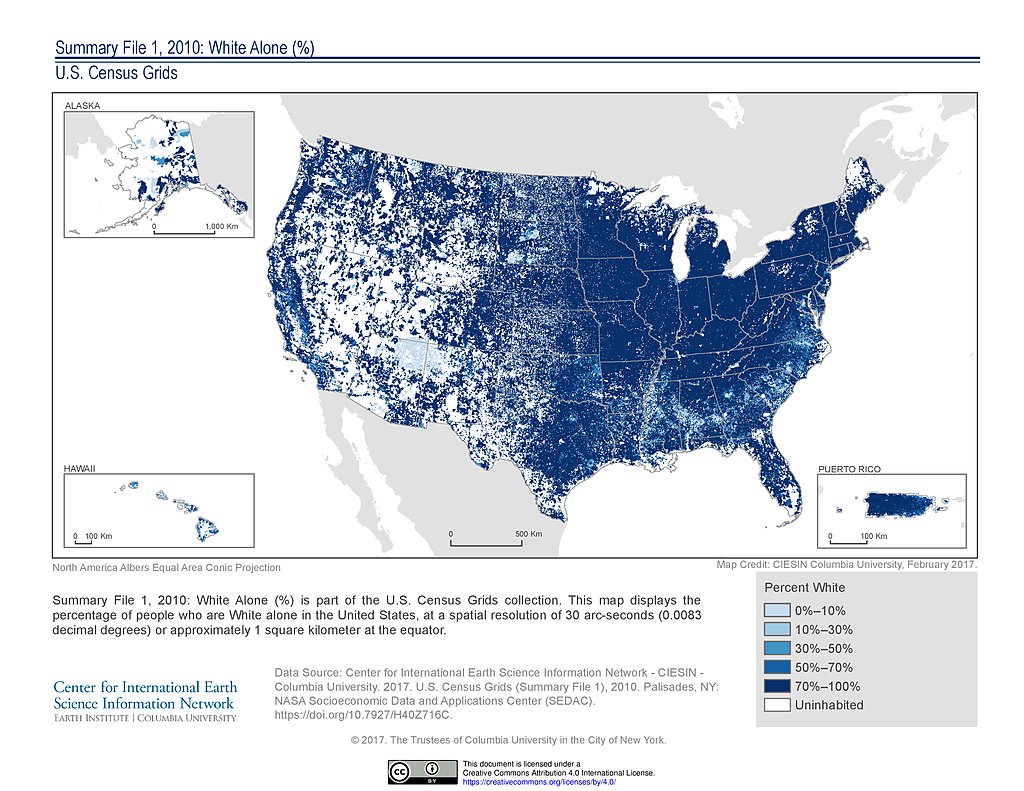
SF1 2010, White Alone (%): USA
SF1 2010, Women of Childbearing Age (%): USA
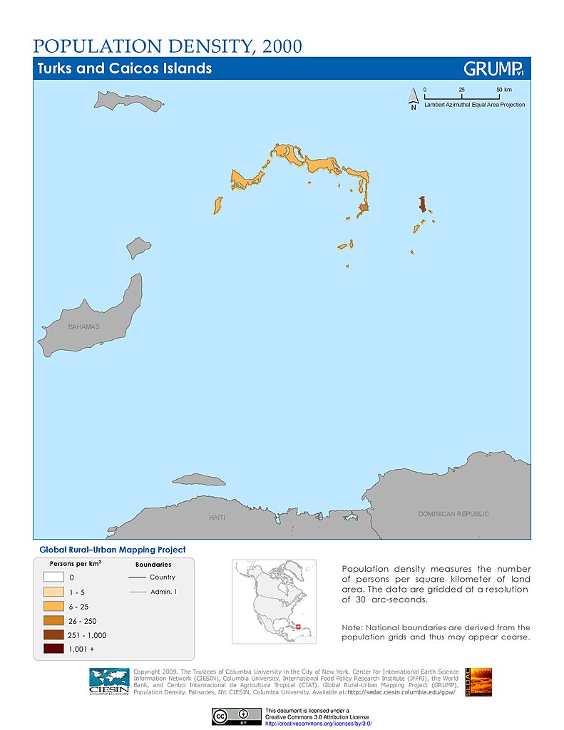
Population Density (2000): Turks & Caicos Islands
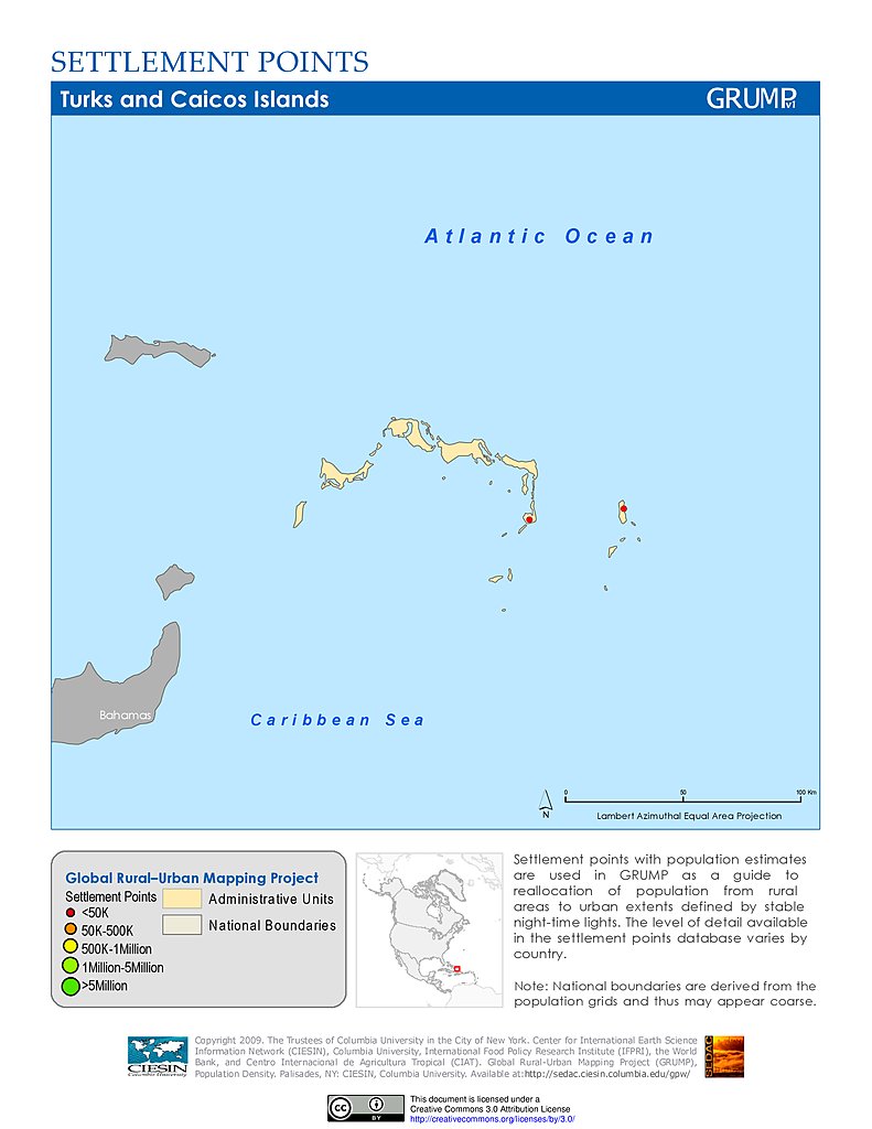
Settlement Points: Turks & Caicos Islands
Maps
»
Region: North America
Remove Facet
»
Theme: Population
Remove Facet
7 of 8
Prev
|
Next