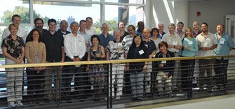
CIESIN hosted the annual meeting of the NASA User Services Working Group (USWG) at the Lamont and Morningside Heights campuses on September 21–23. The USWG coordinates the user support and outreach activities of the twelve Earth Science Data Centers in the NASA Earth Observing System Data and Information System (EOSDIS). CIESIN director Robert Chen, who serves as manager of the NASA Socioeconomic Data and Application Center (SEDAC), welcomed the group and provided an overview of CIESIN and the Earth Institute. Joe Schumacher, who has just begun a term as vice chair of the USWG, gave an update on recent SEDAC activities. The USWG helps to ensure that EOSDIS data and services are responsive to the needs of the Earth science and applications community and as accessible and user friendly as possible.
Resources »  News
News
| 35 of 36 |
Workshop on Communicating Digital Soil Information Convenes at Lamont
September 23, 2010CIESIN and the Tropical Agriculture and Rural Environment Program program, of the Earth Institute of Columbia University, co-hosted a workshop September 21 and 22 at Lamont Campus in Palisades, New York, to explore new opportunities for improving the collection and distribution of digital soil information. The workshop, “Making Soil Information Widely Available: From the Satellite to the Mobile Phone,” brought together 25 scientists and information technologists from the Africa Soil Information Service (AfSIS), GlobalSoilMap.Net, the Earth Institute, Google, NASA, and others. The group identified strategies to integrate new NASA Earth observing missions, cloud computing, and crowd sourcing to improve the effectiveness of planned soil information services. Such services will support plans to increase crop yields in Africa and to dramatically increase the quality of global soil maps.
SEDAC Terra Viva Helps Launch World Bank Competition to Develop Software and Visualization Tools
September 17, 2010CIESIN senior research associate Alex de Sherbinin demonstrated the visualization tool, TerraViva! SEDAC Viewer, at an event sponsored by the World Bank in Washington, D.C., September 9 to launch their Apps for Development Competition. The competition is open to software developers and development practitioners to develop useful software tools and data visualizations that use World Bank data. The demonstration focused on using TerraViva! to access World Bank development indicator data and other spatial and statistical databases, including key data sets the World Bank has made free as part of its new Open Data Initiative. A presentation on SEDAC data and TerraViva! was also given by de Sherbinin to a group of 20 staff from the World Bank Development Data Group and other selected divisions. TerraViva! SEDAC Viewer is a standalone software application, developed under the auspices of the NASA Socioeconomic Data and Applications Center (SEDAC) operated by CIESIN, that enables the viewing of a wide range of socioeconomic and environmental variables and layers, including satellite-based data.
NASA Requests Participation in User Satisfaction Survey
August 25, 2010NASA conducts an annual survey of users of the Earth Observing System Data and Information System (EOSDIS) data center users. SEDAC encourages all of its users to participate. Your comments will enable us to improve our services.
Within the coming week SEDAC registered users will receive an email invitation from Claes Fornell International (CFI) Group on behalf of NASA to participate in a Web-based survey about the quality and utility of SEDAC products and services, and the ease of access to SEDAC resources. It takes approximately 10 minutes to complete this anonymous questionnaire and optional comment fields are provided to address user concerns.
If you would like to take the survey and did not receive an invitation from CFI Group, please contact CFI Group at nasasurvey@cfigroup.com. You will need to provide your e-mail address and specify that you are a SEDAC data user. Please do not forward the invitation to others but refer them to the above email address.
Please participate! Your feedback affects our future performance, helps to identify science needs, and helps to justify NASA's continuing investment in EOSDIS data systems. SEDAC is one of twelve NASA EOSDIS data centers evaluated by this survey.
CIESIN Outreach Efforts in Pennsylvania
August 13, 2010CIESIN led outreach activities at two venues in Pennsylvania recently, with an emphasis on the capabilities of TerraViva! SEDAC Viewer, a map viewer and standalone software application that lets users visualize hundreds of socioeconomic and environmental variables and layers, including a range of satellite-based data. In Pittsburgh, CIESIN geographic information specialist Malanding Jaiteh presented TerraViva! at the annual meeting of the Ecological Society of America (ESA) held July 31–August 6. The presentation was part of a workshop on NASA Tools for Remote Sensing in Ecology Research. At Dickinson College in Carlisle August 11–12, senior research associate Alex de Sherbinin led the second half of a NASA Global Climate Change Education workshop structured around the use of SEDAC data products to enhance understanding of climate change impacts, vulnerability, and adaptation. Hands-on training with TerraViva! was also provided. Twenty professors from Dickinson College and area community colleges participated in the workshop, representing disciplines from the humanities to the Earth sciences.
International Group of Experts Examines Data Needs of IPCC Fifth Assessment
August 6, 2010
|
|
Participants in the 16th TGICA meeting in Boulder, Colorado, August 4-6. |
The Intergovernmental Panel on Climate Change (IPCC) is undertaking its fifth assessment of the science, impacts, and policy implications of climate change. In support of this process, the IPCC Task Group on Data and Scenario Support for Impact and Climate Analysis (TGICA) held its 16th meeting August 4–6 in Boulder, Colorado, hosted by the University Corporation for Atmospheric Research. CIESIN director Robert Chen participated in the meeting in his capacity as an ex officio member of the TGICA and co-manager of the IPCC Data Distribution Centre (DDC). Information scientist Xiaoshi Xing also attended as an observer. Issues addressed at the meeting included how best to meet the needs of the international assessment community for new socioeconomic scenarios, how to improve guidance materials provided by the TGICA, and how best to update and improve the DDC itself.
Established in 1996, the TGICA facilitates the distribution and application of climate change-related data and scenarios in support of the IPCC assessment process. The TGICA serves as the oversight body for the DDC, which is jointly operated by the British Atmospheric Data Center (BADC) in the United Kingdom, the World Data Center Climate (WDCC) in Germany, and CIESIN.
Ideas for Software Reuse and Data Stewardship Shared at Informatics Workshop
August 5, 2010CIESIN senior digital archivist Robert Downs participated in the 2010 Earth and Space Science Informatics (ESSI) Workshop held at George Mason University in Fairfax, Virginia, August 2-4. He made two presentations; the first, “Tools for Reusing Earth Science Software,” was co-authored with Neal Most and James Marshall, both of INNOVIM and the NASA Goddard Space Flight Center, and with Chris Mattmann of the NASA Jet Propulsion Laboratory. Later in the week he gave a presentation, “Sustainable Governance for Long-Term Stewardship of Earth Science Data,” which was co-authored with CIESIN director Robert Chen.
Use of Remote Sensing in Social Sciences the Focus of Mexico City Workshop
July 5, 2010CIESIN associate research scientist Susana Adamo led a five-day workshop on the use of remote sensing in social science research, held at the Colegio de México (COLMEX), Mexico City, June 28–July 2. Participants included academics, researchers, and public officials. The workshop was part of the Summer Workshops on Research Methods on Population and Territory offered by the Centro de Estudios Demográfia, Urbanos y Ambientales (CEDUA), a center at COLMEX dedicated to demographic, urban, and environmental studies, and was held under the auspices of the NASA Socioeconomic Data and Applications Center (SEDAC) operated by CIESIN, for which Adamo is a project scientist. The workshop was coordinated by Landy Sánchez Peña, assistant professor at CEDUA and general coordinator of the Summer Workshops, and workshop materials were prepared by CIESIN geographic information specialist Malanding Jaiteh. Topics included an introduction to remote sensing; application areas within the social sciences; image interpretation and classification methods; use of Google Earth imagery; and use of remote sensing data in GIS and statistical packages. One session involved exploring global data sets using TerraViva! SEDAC Viewer, a map viewer and standalone software application developed by SEDAC that lets users visualize and integrate socioeconomic data with other data layers, including satellite-based data. In addition, Jose Luis Ornelas of the Instituto Nacional de Estadística y Geografía (INEGI) gave a talk on remote sensing resources there, and Marcia Castro of the Harvard School of Public Health discussed the use of remotely sensed imagery in population studies.
New Data Resource on Populations Near Superfund Sites Released
June 18, 2010A Superfund site is an uncontrolled or abandoned place where hazardous waste could potentially expose nearby people and ecosystems to harmful contaminants. The U.S. Environmental Protection Agency (EPA) maintains a National Priorities List (NPL) for the United States and its territories that identifies more than 1,600 sites as posing the most serious threats and the most likely to require long-term cleanup. Until now, information about the precise location and boundaries of these sites has been difficult to access and to link with data on nearby residents.
Utilizing the US Census Grids database developed by the NASA Socioeconomic Data and Applications Center (SEDAC), CIESIN, with funding from the National Institute of Environmental Health Sciences (NIEHS), has prepared a new data resource on populations in proximity to more than 1,500 Superfund NPL sites. The resource offers an improved data set of NPL site boundaries in geographic information system (GIS) format, based on data for 1996 from the Agency for Toxic Substances and Disease Registry (ATSDR) and for 2008 from the U.S. EPA Comprehensive Environmental Response, Compensation, and Liability Information System (CERCLIS). Estimated total populations for the year 2000 residing within one and four miles of each site, and associated demographic characteristics based on the year 2000 census, are provided in spreadsheet format. These data are expected to be of value to researchers and decision makers concerned with the assessment, remediation, and community outreach related to Superfund NPL sites.
Socioeconomic Data Needs Examined at SEDAC User Working Group Meeting
June 17, 2010The User Working Group (UWG) of SEDAC, the NASA Socioeconomic Data and Applications Center operated by CIESIN, met June 15-16 at the Lamont Campus in Palisades and at Columbia University’s Morningside Campus. The UWG is tasked with guiding SEDAC on user needs and overall strategies regarding socioeconomic data and services complementary to remote sensing data. Leading experts from the social, natural, health, and information sciences make up the group, with representation from the academic, governmental, and nongovernmental sectors. The new UWG chair is Molly Macauley, an economist who serves as a research director and senior fellow at Resources for the Future. She replaces the outgoing chair, Harlan Onsrud of the University of Maine, who will remain a member of the group until the end of the year.
The UWG meeting reviewed SEDAC’s plans to improve its data resources in support of operational disaster mitigation, response, recovery, and reconstruction activities, drawing on lessons from the Haiti earthquake and other major disasters of the past decade. UWG members also discussed how SEDAC could better assist the research and applications communities concerned with climate change impacts, vulnerability, adaptation, and mitigation. Invited guests included award-winning journalist and the New York Times Dot Earth blogger Andrew Revkin, who spoke about communicating science in the post-media world as well as his frequent use of SEDAC’s data. Eric Sanderson, senior conservation ecologist at the Wildlife Conservation Society, reflected on his collaboration with CIESIN in the development of the Human Footprint and Last of the Wild datasets available from SEDAC, in the context of his recent book, Mannahatta, a natural history of the island of Manhattan.
New Digital Commons for Polar Data Launched at Oslo Meeting
June 8, 2010

|
|
The logo of the Polar Information Commons (PIC), an initiative launched in Oslo June 8. The PIC is envisoned by the scientific and data community as an open, virtual repository for vital scientific polar data and information. |
In response to the pressing need to preserve polar data and ensure their long-term accessibility, an international team of scientists and data managers has established the Polar Information Commons (PIC), an information resource about the Earth’s polar regions that will be managed by the polar science and data community and freely accessible to all. The launch of the PIC is being celebrated in Oslo June 8 at the International Polar Year (IPY) Oslo Science Conference, a gathering of several thousand scientists involved in the IPY 2007–08.
CIESIN director Robert Chen is chairing the launch event in his capacity as secretary general of CODATA, the Committee on Data for Science and Technology of the International Council for Science (ICSU), and as lead of the ICSU grant that supported planning of the PIC. The PIC aims to provide a long-term open access framework for polar science data through the IPY and other programs. It includes a method for “badging” data as part of the PIC and a set of community “norms” to encourage appropriate use and acknowledgement of PIC data. A key element of the PIC is the PIC cloud, a repository developed by the Tasmanian Partnership for Advanced Computing (TPAC) and the Australian Antarctic Division (AAD) in collaboration with the Australian Research Collaboration Service (ARCS) and the Australian National Data Service (ANDS).
Other PIC partners include the International Arctic Science Council (IASC), the Scientific Committee on Antarctic Research (SCAR), the International Union of Geodesy and Geophysics (IUGG), the World Meteorological Organization (WMO), the IPY International Program Office (IPY IPO), the ICSU World Data System Scientific Committee (WDS-SC), Science Commons, the Association of Polar Early Career Scientists (APECS), and the Royal Netherlands Academy of Sciences.
Third Annual Summer Institute Offers Focused Training for Health-Care Decision Makers
June 1, 2010The Summer Institute for Climate Information on Public Health, now in its third year, provides hands-on training for health-care decision makers from developing countries around the world. Held at Columbia’s Lamont Campus in Palisades, New York, the two week session this year ran from May 17 to May 28. It was organized by the International Research Institute for Climate and Society (IRI) in partnership with CIESIN and the Columbia University Mailman School of Public Health. Summer Institute is also conducted under the auspices of the Group on Earth Observations (GEO).
This year’s group of students numbered 13 professionals from 10 countries. They attended lectures and participated in interactive exercises, with an emphasis on tools that facilitate the integration of climate, public health, and population data. CIESIN’s associate director of geospatial applications, Mark Becker, addressed the spatial components of attendees’ work by teaching the use of Global Positioning System (GPS), Geographic Information Systems (GIS), and Google Maps for Public Health.
NASA Earth Science Data Centers Address Emerging Technology and Data Issues
May 7, 2010Managers and staff from more than a dozen NASA-supported Earth Science Data Centers gathered in Virginia Beach, Virginia May 4–6 to discuss opportunities for infusing new technologies and standards and for promoting coordination and collaboration both between NASA centers and with external groups. CIESIN director Robert Chen, associate director for Information Technology Sri Vinay, and senior staff associate Alex de Sherbinin participated in the meeting, representing the NASA Socioeconomic Data and Applications Center (SEDAC) operated by CIESIN. Alex de Sherbinin introduced the workshop’s keynote speaker, Rob Covey of National Geographic, who described how the organization has developed and implemented a coherent Web presence for a diverse set of National Geographic units and partners including its magazine, television channel, and online resources. In addition, de Sherbinin presented a poster paper co-authored with Chen and CIESIN senior digital archivist Robert Downs on SEDAC’s implementation of a digital asset management system to support long-term data stewardship. Vinay gave a presentation on SEDAC’s ongoing Web site redesign process and the Web development framework technologies that were evaluated. Chen serves as SEDAC’s manager, de Sherbinin as its deputy manager, and Vinay as its systems engineer.
The NASA Earth Observing System Data and Information System (EOSDIS), a world leader in the provision of Earth observations and environmental data for research, education, and decision making, supports a range of discipline-focused data centers around the United States, including SEDAC. SEDAC provides data that complements remote sensing data primarily addressing human-environment interactions.
Upcoming PERN Cyberseminar Will Discuss Remote Sensing Data Needs
April 23, 2010The Population-Environment Research Network (PERN) will hold a cyberseminar from May 10 to 21, “What Are the Remote Sensing Data Needs of the Population-Environment Research Community?” The goal of this online seminar is to identify the past use of remote sensing data products in population-environment research, to explore challenges of integrating remote sensing data, and to begin to think about the specifications of future remote sensing data products that would meet the needs of the research community. Another goal is to consider a process for greater social science input into the design of future satellite sensors.
The cyberseminar is co-sponsored by the NASA Socioeconomic Data and Applications Center (SEDAC) operated by CIESIN, which supports the PERN Web site, and by the Group on Earth Observations (GEO). SEDAC has been tasked by NASA and its User Working Group to think specifically about how to increase the input of social scientists in designing future missions, and GEO has expressed a similar interest in engaging the social sciences as it builds a Global Earth Observation System of Systems (GEOSS) to address nine societal benefit areas.
Some New Themes Addressed at the 2010 AAG Annual Meeting
April 21, 2010Climate change, innovation in geographic information science (GIS), and the intersection of geography and human rights were some of the conference themes explored by CIESIN participants of the 2010 Annual Meeting of the American Association of Geographers (AAG) held in Washington, D.C., April 14−18. Deputy director Marc Levy presented a paper, “Population Change in Latin America and the Caribbean, 1990-2000: A Spatial Time Series,” which he co-authored with CIESIN colleagues Maria Muñiz, Susana Adamo, Gregory Yetman, Maria Elisa Lukang, Tricia Chai-Onn, and Sandra Baptista, and with colleagues from University of Puerto Rico, Rio Piedras, T. Mitchell Aide and María José Andrade Núñez. At the session, Greening the City: Environment, Economy, and Urbanization, Baptista presented her paper “Adapting to Urban Climate Risk in Coastal Brazil.” A paper co-authored by CIESIN director Robert Chen with Mark Parsons of the National Snow and Ice Data Center (NSIDC) at the University of Colorado, “Creating an Information Commons for the Earth’s Polar Regions,” was presented by Parsons at the session, Geographic Information Ethics and GIScience. Senior information specialist Joe Schumacher staffed the NASA Earth Sciences, Data, and Services exhibit booth on behalf of the NASA Socioeconomic Data and Applications Center (SEDAC) operated by CIESIN.
Search Tool Supports Global Service for Environmental Law Information
April 9, 2010The largest, most comprehensive global information service on environmental law, ECOLEX, combines the environmental law information holdings of the Food and Agriculture Organization (FAO), the International Union for Conservation of Nature (IUCN), and the United Nations Environmental Programme (UNEP) into an accessible and easy-to-use online service. CIESIN is supporting ECOLEX through a search service that enables users to easily search for and obtain Conference of Party (COP) decisions for ten major treaties. The tool was initially developed as part of the Environmental Treaty and Resource Indicators (ENTRI) service of the NASA Socioeconomic Data and Applications Center (SEDAC). The COP decision search tool indexes thousands of decision documents using a Google Search Appliance and has recently been updated with new COP decisions as of April 2, 2010.
Global Data Set Explores Indicators of Coastal Water Quality
March 31, 2010

|
Over the past few decades coastal waters throughout the world have received an increased influx of nutrients from land-based sources. The resulting change in water quality has many possible implications for coastal and marine ecosystems. In extreme cases eutrophication results, where excess nutrients in the water stimulate excessive plant growth. This can lead to hypoxia—oxygen-depleted “dead zones”—and harmful algal blooms.
Coastal water quality over time may be assessed by measuring chlorophyll concentrations as an indicator of algae biomass. A new global data set, Indicators of Coastal Water Quality, aims to identify near-coastal areas that have improving, declining, and stable chlorophyll concentrations in order to help identify areas that may need management intervention. The data set uses chlorophyll-a concentrations derived from NASA’s sea-viewing wide field-of-view sensor (SeaWiFS) to analyze trends over a ten year period (1998–2007). This data set is a result of a pilot effort, and the methodology will be further refined as part of a NASA Decisions feasibility project.
Implementing Data Sharing Addressed at Italy Workshop
March 12, 2010Linking Earth observations and other spatial data from many different systems is a goal of the Group on Earth Observations (GEO), an intergovernmental initiative aimed at developing the Global Earth Observing System of Systems (GEOSS). CIESIN associate director for Information Technology, Sri Vinay, is representing CIESIN at an international workshop in Frascati, Italy on March 10-12, helping to kick off the third phase of the GEOSS Architecture Implementation Pilot (AIP-3). CIESIN plans to contribute to AIP-3 by enhancing a new Population Estimation Service. The service, which was developed as part of the NASA Socioeconomic Data and Applications Center (SEDAC), supports spatial queries about population distribution using open interoperability standards. CIESIN is also working to develop user interfaces that recognize open access licenses such as those developed by Creative Commons. Vinay is co-leading a session on data sharing approaches at the workshop and is helping to develop specific scenarios of interoperable data services in several different application areas, which will be demonstrated at the next GEO Ministerial meeting in Beijing in November 2010.
Director's Annual Message: Focus on Environmental Sustainability and Disasters
March 8, 2010
|
In just a bit more than five years, the world has experienced an unprecedented string of “megadisasters.” These events were the result not only of the awesome power of earthquakes and cyclones but were also due to the high exposure and extreme vulnerability of populations around the world to a range of hazards. At the end of 2004, the South Asian tsunami shocked the world with its sudden devastation of many densely settled and poorly protected coastal areas. In 2005 and 2008, we witnessed the suffering of hundreds of thousands affected by major earthquakes in Pakistan and China, compounded by poorly constructed schools, dams, and other structures. Hurricane Katrina in 2005 gave us an object lesson about the potential for disaster even in a highly developed country, if governments and citizens fail to prepare for hazards and fail to respond effectively to them. Then Cyclone Nargis in 2008 provided an even more devastating example of the vulnerability of disenfranchised populations worsened by a rogue government. And now we have begun the year 2010 with damaging earthquakes in both Haiti and Chile—the first inflicting much more death and destruction than it should have and leaving a massive and continuing humanitarian crisis in its wake.
These disasters underscore the important roles population location and physical and social vulnerability play in amplifying the risks of natural hazards around the world. We know that population has been growing much faster in coastal areas than elsewhere, often accompanied by accelerated stress on coastal ecosystems and marine resources. Rapid urbanization is occurring in many areas prone to earthquakes, landslides, and/or floods with little or no attention to building codes, protective works, land degradation, or land use restrictions. Poverty continues to force millions to live in substandard housing in environmentally marginal areas with few resources to draw upon when drought, floods, and other hazards strike. Full story
Population Estimation Service and New Mapping Tools Added to GPW Web Site
February 12, 2010The Web site for CIESIN’s flagship data product—Gridded Population of the World (GPW), now in its third version—has been enhanced with three new services and tools: the Population Estimation Service, a Web-based service for estimating population totals and related statistics within a user-defined region; and two mapping tools.
Because the Population Estimate Service is accessible through three standard protocols (the Open Geospatial Consortium (OGC) Web processing service (WPS) standard, a representational state transfer (REST) interface, and a simple object access protocol (SOAP) interface), it can accommodate a wide variety of map clients and tools and users can quickly obtain population estimates for specific areas without having to download and analyze large amounts of spatial data. Users submit polygons that define an area, then the service returns measures of population, land area, quality measures, and basic parametric statistics. These estimates are based on the gridded population data for 2005 from the GPW v3 data set developed by the NASA Socioeconomic Data and Applications Center (SEDAC) operated by CIESIN.
One of the new mapping tools also released, based on the technology used by Google Maps, demonstrates the Population Estimation Service. It lets users select an area of interest by drawing a polygon on the map and submit the request to the service, and it displays the results. The other tool is a basic mapper that provides previews of the GPW v3 data sets with an overlay of national boundaries, and lets users pan and zoom to an area of interest before downloading the data sets. For more complex visualization and overlay of other data sets, the stand-alone SEDAC Map Client is recommended.
| 35 of 36 |