Data Sets » Theme: ClimateRemove Facet » All Fields: floodRemove Facet
1 of 1
Prev | Next

U.S. Climate Risk Projections by County, v1 (2040 – 2049)

Climate Risk and Vulnerability

To provide a U.S. county-level multi-hazard climate risk projection for 2040-2049 for climate, socioeconomic, environmental, and other related research.

Groundswell Africa Spatial Population and Migration Projections at One-Eighth Degree According to SSPs and RCPs, v1 (2010 – 2050)

Climate Migration

To provide a data set that allows users to understand how climate change impacts on water availability, crop productivity, and pasturelands (where no cropping occurs), coupled with sea-level rise, storm surge and flooding, may affect the future population distribution and climate-related internal migration in West Africa and the Lake Victoria Basin.

Groundswell Spatial Population and Migration Projections at One-Eighth Degree According to SSPs and RCPs, v1 (2010 – 2050)

Climate Migration

To provide a data set that allows users to understand how slow-onset climate change impacts on water availability and crop productivity, coupled with sea-level rise and storm surge, may affect the future population distribution and climate-related internal migration in low to middle income countries.

Altimeter Corrected Elevations (ACE2), v2 (1994 – 2005)

Digital Elevation Data Collection

To provide satellite altimeter corrected digital elevation data for environmental, socioeconomic, climate and other related research, such as flood risk assessment, land deformations, landslide modelling, urban planning, and sea level rise impacts.

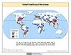
Global Flood Hazard Frequency and Distribution, v1 (1985 – 2003)

Natural Disaster Hotspots

To provide a means of assessing the relative distribution and frequency of global flood hazard.

Global Flood Total Economic Loss Risk Deciles, v1 (2000)

Natural Disaster Hotspots

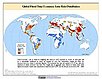
To provide a spatial surface of the total economic impacts of global flood hazard.

Global Flood Proportional Economic Loss Risk Deciles, v1 (2000)

Natural Disaster Hotspots

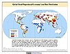
To provide a spatial surface of the proportional economic impacts of global flood hazard.

Global Flood Mortality Risks and Distribution, v1 (2000)

Natural Disaster Hotspots

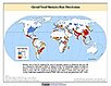
To provide a means of assessing global flood mortality risks and distribution.

Data Sets » Theme: ClimateRemove Facet » All Fields: floodRemove Facet
1 of 1
Prev | Next