Data Sets » Theme: ConservationRemove Facet » All Fields: lightsRemove Facet
1 of 1
Prev | Next

Subset of Global Mammal and Amphibian Richness Grids, 2015 Release (2013)

West Africa Coastal Vulnerability Mapping

To provide areas of higher richness of threatened species which may be at risk from climate stressors in the coastal zone of West Africa.

Mangrove Forests Distribution Polygon, v1 (2000)

West Africa Coastal Vulnerability Mapping

To provide mangrove forests in the coastal zone of West Africa that may be exposed to the threats of sea level rise and storm surge.

Deforestation, v1 (2000 – 2012)

West Africa Coastal Vulnerability Mapping

To provide areas of forest cover loss in the coastal zone of West Africa.

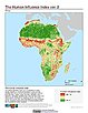
Global Human Influence Index (Geographic), v2 (1995 – 2004)

Last of the Wild, v2

To provide an updated map of anthropogenic impacts on the environment in geographic projection which can be used in wildlife conservation planning, natural resource management, and research on human-environment interactions.

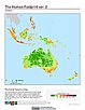
Global Human Footprint (IGHP), v2 (1995 – 2004)

Last of the Wild, v2

To provide an updated map of anthropogenic impacts on the environment in Interrupted Goode Homolosine Projection which can be used in wildlife conservation planning, natural resource management, and research on human-environment interactions.

Global Human Influence Index (IGHP), v2 (1995 – 2004)

Last of the Wild, v2

To provide an updated map of anthropogenic impacts on the environment in the Interrupted Goode Homolosine Projection which can be used in wildlife conservation planning, natural resource management, and research on human-environment interactions.

Global Human Footprint (Geographic), v2 (1995 – 2004)

Last of the Wild, v2

To provide an updated map of anthropogenic impacts on the environment in geographic projection which can be used in wildlife conservation planning, natural resource management, and research on human-environment interactions.

Global Human Footprint (Geographic), v1 (1992 – 1995)

Last of the Wild, v1

To provide a map of anthropogenic impacts on the environment in geographic projection which can be used in modeling efforts, wildlife conservation planning, natural resource management, policy-making, biodiversity studies and human-environment interactions.

Global Human Footprint (IGHP), v1 (1992 – 1995)

Last of the Wild, v1

To provide a map of anthropogenic impacts on the environment in the Interrupted Goode Homosoline Projection which can be used in wildlife conservation planning, natural resource management, and research on human-environment interactions.

Data Sets » Theme: ConservationRemove Facet » All Fields: lightsRemove Facet
1 of 1
Prev | Next