Data Sets » Theme: Remote SensingRemove Facet » All Fields: lightsRemove Facet
1 of 1
Prev | Next

SDG Indicator 7.1.1: Access to Electricity, 2023 Release (2020 – 2022)

Sustainable Development Goal Indicators (SDGI)

To provide national and subnational estimates of SDG indicator 7.1.1, the proportion of the population with access to electricity, produced using global open data.

Global Database of Light-based Geospatial Income Inequality (LGII) Measures, v1 (1992 – 2013)

Spatial Economic Data

To provide a database of inequality measures using satellite and population data at a global scale.

VIIRS Plus DMSP Change in Lights (VIIRS+DMSP dLIGHT), v1 (1992, 2002, 2013)

Satellite-Derived Environmental Indicators

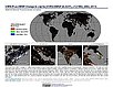
To visualize changes in brightness and extent of global nighttime lights networks over two decades with improved radiometric accuracy and finer spatial resolution.

Urban Extents from VIIRS and MODIS for the Continental U.S. Using Machine Learning Methods, v1 (2015)

Urban Spatial Data

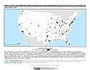
To provide representations of urban areas in the Continental U.S. in the year 2015 to support sustainable urban development planning in accordance with the growth of urban areas.

Subset of High and Low Resolution Altimeter Corrected Elevations 2 (ACE2), v1 (1994 – 2005)

West Africa Coastal Vulnerability Mapping

To provide high and low resolution elevation in forested ecosystems in the coastal zone of West Africa.

Subset of DMSP-OLS Nighttime Lights for Economic Activity, v1 (2010)

West Africa Coastal Vulnerability Mapping

To provide a measure of economic activity in the coastal zone of West Africa based on nighttime lights.

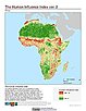
Global Human Influence Index (Geographic), v2 (1995 – 2004)

Last of the Wild, v2

To provide an updated map of anthropogenic impacts on the environment in geographic projection which can be used in wildlife conservation planning, natural resource management, and research on human-environment interactions.

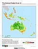
Global Human Footprint (IGHP), v2 (1995 – 2004)

Last of the Wild, v2

To provide an updated map of anthropogenic impacts on the environment in Interrupted Goode Homolosine Projection which can be used in wildlife conservation planning, natural resource management, and research on human-environment interactions.

Global Human Influence Index (IGHP), v2 (1995 – 2004)

Last of the Wild, v2

To provide an updated map of anthropogenic impacts on the environment in the Interrupted Goode Homolosine Projection which can be used in wildlife conservation planning, natural resource management, and research on human-environment interactions.

Global Human Footprint (Geographic), v2 (1995 – 2004)

Last of the Wild, v2

To provide an updated map of anthropogenic impacts on the environment in geographic projection which can be used in wildlife conservation planning, natural resource management, and research on human-environment interactions.

Global Human Footprint (Geographic), v1 (1992 – 1995)

Last of the Wild, v1

To provide a map of anthropogenic impacts on the environment in geographic projection which can be used in modeling efforts, wildlife conservation planning, natural resource management, policy-making, biodiversity studies and human-environment interactions.

Global Human Footprint (IGHP), v1 (1992 – 1995)

Last of the Wild, v1

To provide a map of anthropogenic impacts on the environment in the Interrupted Goode Homosoline Projection which can be used in wildlife conservation planning, natural resource management, and research on human-environment interactions.

Data Sets » Theme: Remote SensingRemove Facet » All Fields: lightsRemove Facet
1 of 1
Prev | Next