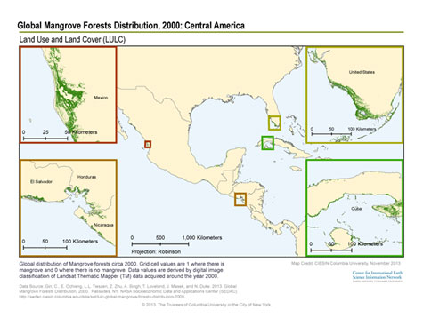
|
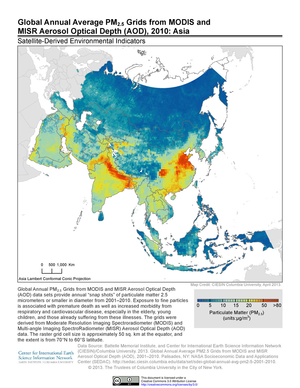
A new data release offers insights into the extent of global human exposure to fine particulate matter (PM2.5) over more than a decade. The new data set replaces an earlier one released by the NASA Socioeconomic Data and Applications Center operated by CIESIN and features improved accuracy, a longer time span, and higher spatial resolution than the previous version.
Satellite-derived estimates of PM2.5 provide one of the few ways of assessing changes in exposure to air pollution around the world over the long term. The data set consists of a series of global grids representing three-year running averages, from 1998-2012, derived from measurements of Aerosol Optical Depth (AOD) from three different NASA instruments: MODIS (Moderate Resolution Imaging Spectroradiometer), MISR (Multi-angle Imaging SpectroRadiometer), and SeaWIFS (Sea-Viewing Wide Field-of-View Sensor). The grids were developed by Aaron van Donkelaar and colleagues at Dalhousie University in Canada.
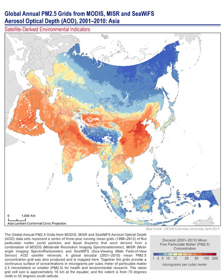
These global grids of estimated PM2.5 surface concentrations, expressed in micrograms per cubic meter (μg/m3), are useful for health and environmental research and have already served as a valuable input to the World Health Organization (WHO) global burden of disease study. Fine-particulate matter represents one of the most serious types of air pollutants and is of particular concern in many parts of Asia. For example, the estimated proportion of the people in East Asia living above the WHO Interim Target-1 of 35 μg/m3 increased from 51% in 1998–2000 to 70% in 2010–2012.
The raster grids have a grid cell resolution of 6 arc-minutes (0.1 degree, or approximately 10 km at the equator) and cover the global land surface from 70 degrees north to 55 degrees south. More details can be found in the van Donkelaar et al. 2015 article, “Use of Satellite Observations for Long-Term Exposure Assessment of Global Concentrations of Fine Particulate Matter,” in the journal Environmental Health Perspectives.