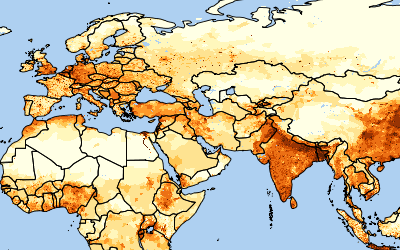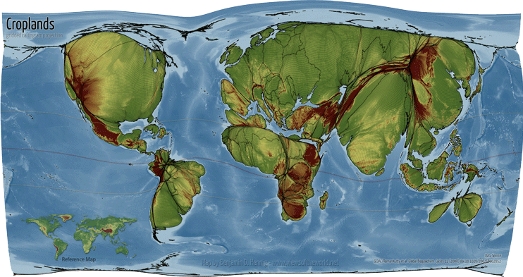
The SEDAC Global Agricultural Cropland and Pasture data sets are presented in Food: An Atlas, which uses maps to explore global food distribution and production. The cropland and pasture data, originally developed by Ramankutty et al (2008), are transformed into cartograms, in which the land area of countries is replaced by extent of crops and pastures, by Benjamin Hennig to better visualize the magnitude of agricultural areas around the world.