NASA Website Socioeconomic Data and Applications Center (sedac)
A Data Center in NASA's Earth Observing System Data and Information System (EOSDIS) — Hosted by CIESIN at Columbia University
Data
  • Data Sets
  • Maps
  • Web Pages
  • home
  • Data
    • · Data Sets
    • · Data Collections
    • · Featured Data Uses
    • · Data Citations
    • · Citations Database
    • · Data Submission
  • Maps
    • · Map Gallery
    • · Map Viewer
    • · Map Services
    • · Mapping Tools
  • Themes
    • · Agriculture
    • · Climate
    • · Conservation
    • · Governance
    • · Hazards
    • · Health
    • · Infrastructure
    • · Land Use
    • · Marine and Coastal
    • · Population
    • · Poverty
    • · Remote Sensing
    • · Sustainability
    • · Urban
    • · Water
  • Resources
    • · Guides
    • · Multimedia
    • · Networks
    • · News
    • · Publications
    • · Related Sites
    • · Remote Sensing
    • · Tools
  • Social Media
    • · Twitter
    • · FaceBook
    • · YouTube
    • · Flickr
    • · Blog Posts
    • · Communities
  • About
    • · About SEDAC
    • · User Working Group
    • · Privacy
    • · User Registration
  • Help
 

Water Resources and Consumption

Follow Us: Twitter Follow Us on Facebook YouTube Flickr   |   Share: Twitter Facebook
  • Theme Home
  • Data Sets
  • Map Gallery
  • Map Services
  • Featured Data Uses
  • Resources
    • Guides
    • Networks
    • Publications
    • Related Sites

Transboundary River Basins: Status and Trends

United Nations Environment Programme – April 14, 2016
Victoria Falls River Basin

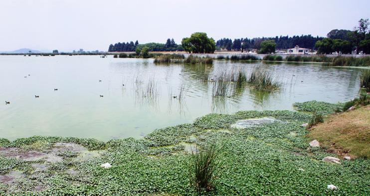
For a new report assessing the environmental and socioeconomic conditions in 286 of the world’s transboundary river basins, SEDAC data were used in the calculation of several indicators: economic dependence on water resources, societal wellbeing levels, and the risk of climate-related hazards. The report is an outcome of the Transboundary Waters Assessment Programme, coordinated by the UNEP-DHI (Danish Hydrological Institute) Center on Waste and Environment in execution with international partners, for the Global Environmental Facility, with the aim of creating a baseline assessment of all transboundary water resources on Earth.

Closed Season

Sensing Our Planet – July 3, 2018
Algae in a groundwater-fed lagoon

Using data from the NASA Gravity Recovery and Climate Experiment (GRACE) satellite instrument and the Advanced Land Observing Satellite Phased Array type L-Band Synthetic Aperture Radar (ALOS PALSAR) to study land subsidence, and SEDAC’s Gridded Population of the World (GPW), v3 to examine the distribution of people, investigators assessed the loss of groundwater storage in one of Mexico's most important watersheds.

Home | Data | Data Uses | Data Citations | Maps | Map Services

News | Tools | Guides | Publications | Blog Posts

About | Help | Privacy | User Registration

Copyright © 1997–2021. The Trustees of Columbia University in the City of New York.

WDS ICSU