Data Sets » Theme: PovertyRemove Facet
2 of 2
Prev | Next

Small Area Estimates of Poverty and Inequality, v1 (1990 – 2002)

Poverty Mapping

To provide high spatial resolution subnational estimates of poverty and inequality for use by a wide user community for interdisciplinary studies of poverty, inequality and the environment.

Global Subnational Prevalence of Child Malnutrition, v1 (1990 – 2002)

Poverty Mapping

To provide a global subnational map of the prevalence of underweight children that can be used by a wide user community in interdisciplinary studies of health, poverty and the environment.

Poverty and Food Security Case Studies, v1 (1998 – 2002)

Poverty Mapping

To provide high spatial resolution subnational estimates of poverty and food security for use by a wide community for interdisciplinary studies of poverty, food security and the environment.

Global Subnational Infant Mortality Rates, v1 (2000)

Poverty Mapping

To provide a global subnational map of infant mortality rate estimates that can be used by a wide user community in interdisciplinary studies of health, poverty and the environment.

Global 15 x 15 Minute Grids of the Downscaled GDP Based on the SRES B2 Scenario, v1 (1990, 2025)

Socioeconomic Downscaled Projections

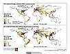
To provide gridded GDP data on country-level downscaled projections based on the SRES B2 marker scenario.

Country-Level GDP and Downscaled Projections Based on the SRES A1, A2, B1, and B2 Marker Scenarios, v1 (1990 – 2100)

Socioeconomic Downscaled Projections

To provide data on country-level GDP per capita and downscaled projections based on the SRES A1, A2, B1, B2 marker scenarios.

Data Sets » Theme: PovertyRemove Facet
2 of 2
Prev | Next