Data Sets (148)
| 7 of 8 |
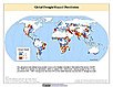
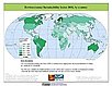
Global Drought Hazard Frequency and Distribution, v1 (
|
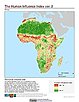
Global Human Influence Index (Geographic), v2 (
|
|
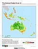
Global Human Footprint (IGHP), v2 (
|
Global Human Influence Index (IGHP), v2 (
|
|
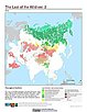
Last of the Wild (Geographic), v2 (
|
Global Human Footprint (Geographic), v2 (
|
|
Last of the Wild (IGHP), v2 (
|
MA Ecosystems, v1 (2000)Millennium Ecosystem Assessment (MA)To preserve access to the original ecosystems data used by the Millennium Ecosystem Assessment (MA) and other related research. |
|
MA Biodiversity, v1 (
|
Global Mangrove Forests Distribution, v1 (2000)Land Use and Land Cover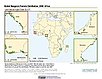
To provide data that can be used in global mangrove forest distribution modeling, land cover change analysis, global carbon accounting studies and to assist with policy-making in regards to human-environment interactions and future adaptive strategies. |
|
Environmental Sustainability Index, 2005 Release (
|
Global Patterns of HANPP, v1 (1995)Human Appropriation of Net Primary Productivity (HANPP)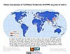
To assist in understanding human impacts on the environment, and especially impacts on biodiversity and ecosystem services. |
|
Global Patterns in Net Primary Productivity, v1 (1995)Human Appropriation of Net Primary Productivity (HANPP)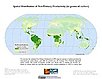
To be utilized in conjunction with a data set of human appropriation of net primary productivity (HANPP) in order to understand global energy flows and localized impacts on the environment. |
HANPP as a Percentage of Net Primary Productivity, v1 (1995)Human Appropriation of Net Primary Productivity (HANPP)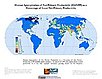
To identify spatial variations in the amount of NPP consumption relative to local production in a way that highlight humanity's growing impact on the biosphere. |
|
HANPP by Country and Product, v1 (1995)Human Appropriation of Net Primary Productivity (HANPP)To provide tabular data on human appropriation of net primary productivity by country. |
Global Human Footprint (Geographic), v1 (
|
|
Top One Percent Wild Areas (IGHP), v1 (
|
Global Human Footprint (IGHP), v1 (
|
|
Last of the Wild (IGHP), v1 (
|
Top One Percent Wild Areas (Geographic), v1 (
|
| 7 of 8 |