Data Sets (16)
|
1 of 1
Prev
|
Next
|
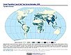
Urban-Rural Population and Land Area Estimates, v3 (1990, 2000, 2015)Low Elevation Coastal Zone (LECZ)
To provide estimates of urban and rural populations and land areas for the years 1990, 2000, 2015 for 234 countries and statistical areas with contiguous coastal elevations of less than or equal to 5m above sea level, 5-10m above sea level, and national totals using multiple updated data sources for comparative analysis. |
||
Global Urban Heat Island (UHI) Data Set, v1 (2013)Satellite-Derived Environmental Indicators
To provide a global data set of average summer daytime maximum/nighttime minimum land surface temperatures (LSTs) for urban extents, as well as the LST difference between the urban area and the buffer. |
||
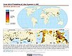
Sea Level Rise Impacts on Ramsar Wetlands of International Importance, v1 (
|
||
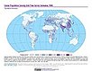
Urban-Rural Population and Land Area Estimates, v2 (1990, 2000, 2010, 2100)Low Elevation Coastal Zone (LECZ)
To provide estimates of urban and rural populations and land areas for the years 1990, 2000, and 2010; and projections to the year 2100 for 202 countries with contiguous coastal elevations in the following categories: less than or equal to 1m, 3m, 5m, 7m, 9m, 10m, 12m, or 20m; as well as national totals. |
Population Count Grid, v1 (1990, 1995, 2000)Global Rural-Urban Mapping Project (GRUMP), v1To provide a time series of raster population data for ntegration with other data sets. |
|
Urban Extents Grid, v1 (1995)Global Rural-Urban Mapping Project (GRUMP), v1
To provide a raster representation of urban areas (or urban mask) for use with GRUMP population grids or other data sets. |
Land and Geographic Unit Area Grids, v1 (2000)Global Rural-Urban Mapping Project (GRUMP), v1To provide land area data for use with GRUMPv1 population and urban data as well as a quantitative measure of resolution of the input spatial units for GRUMPv1. |
|
Population Density Grid, v1 (1990, 1995, 2000)Global Rural-Urban Mapping Project (GRUMP), v1
To provide a time series of raster population density data for data integration. |
Settlement Points, v1 (1990, 1995, 2000)Global Rural-Urban Mapping Project (GRUMP), v1
To provide populated place (point) data with consistent population estimates. |
|
Urban-Rural Population Estimates, v1 (1990, 1995, 2000)Low Elevation Coastal Zone (LECZ)
To provide estimates of urban and rural populations and land areas in the low elevation coastal zone. |
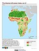
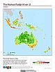
Global Human Influence Index (Geographic), v2 (
|
|
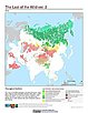
Last of the Wild (Geographic), v2 (
|
Global Human Footprint (Geographic), v2 (
|
|
1 of 1
Prev
|
Next
|